Ticker for March 28, 2016
MESONET TICKER ... MESONET TICKER ... MESONET TICKER ... MESONET TICKER ...
March 28, 2016 March 28, 2016 March 28, 2016 March 28, 2016
Snow vs. Fire...who would win?
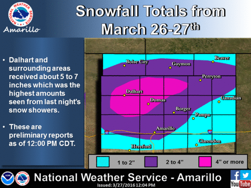
Yes, for those of you that ignore the NW part of the state (shame on you, it's the
best part!), they did receive a very nice Easter Sunday snow up that way. Now it
wasn't anything compared to the then record-setting 26 inches that fell in late
March 2009, but a good 2-4 inches.
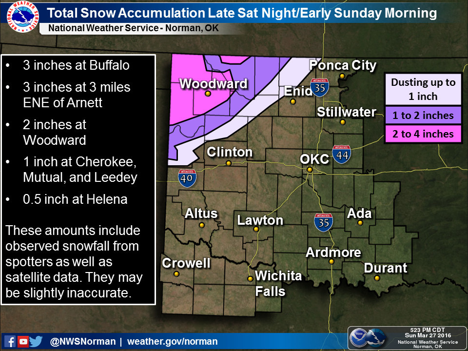
Laverne led the state (at least with the official COOP reports in thus far) at
6 inches. Now I'll let that slide seeing how Laverne was always Buffalo's arch-
nemesis, but Buffalo undoubtedly had an unreported 7 inches (not really, looks
like 3 inches estimated...DOH!). Slapout received about 5 inches and Arnett had
3 inches.
So a decent snow late in the season, and this is difficult for me to say, but
it has its benefits.
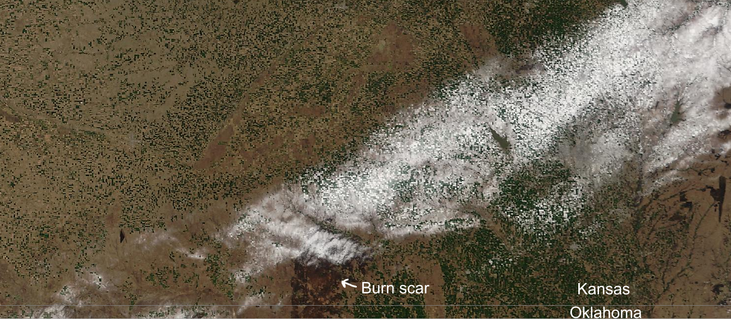
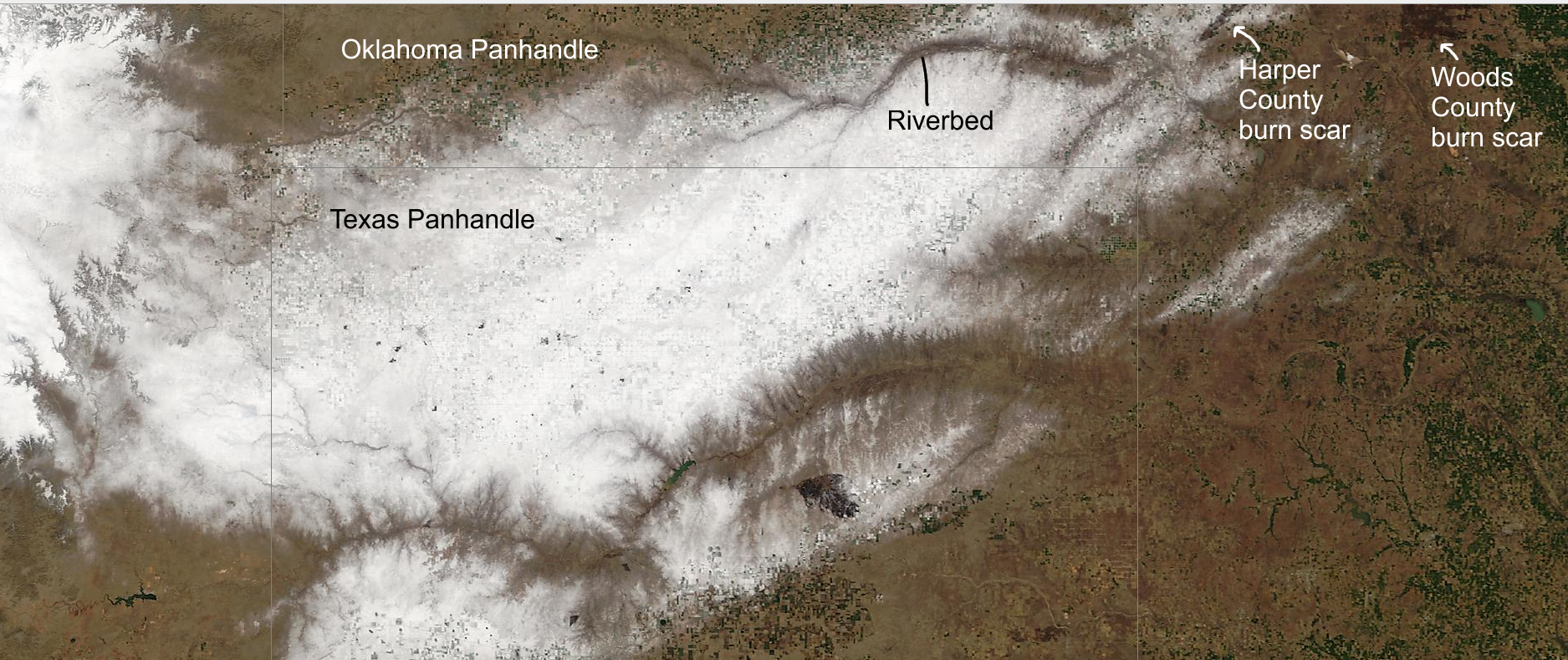
1) It fell on the Anderson Creek fire, which has now burned close to 400,000
acres. That's almost 650 square miles of land in Oklahoma and Kansas that has
burned. Here you can see the snowfall on the MODIS satellite images (with
labels for landmarks). You can tell it was snow and not clouds due to the
contours of the rivers and lakes appearing so distinctly. However, you can also
see most of that snow is now gone from the fire area.
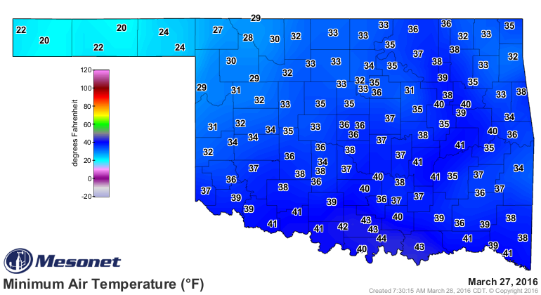
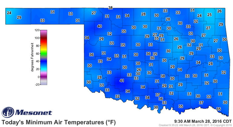
2) It probably helped the wheat crop up across that area by insulating it from
some rather frigid temperatures Sunday morning (but not so much this morning).
This was nothing compared to the freeze of last week, however, but potentially
damaging nevertheless.
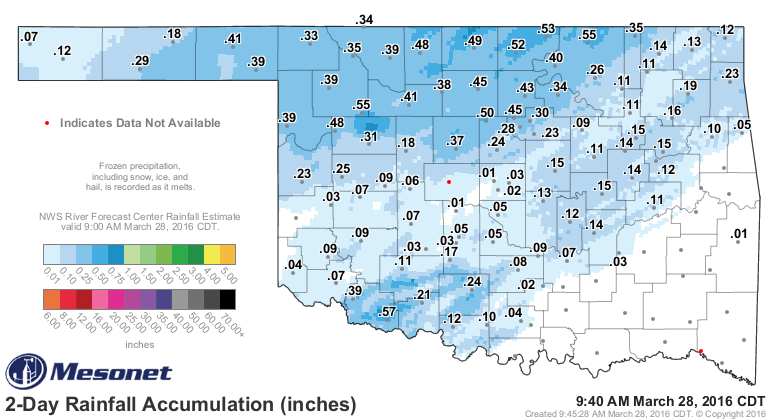
3) It did provide some much needed moisture, and while it was snowing up in the
NW, showers and storms were bringing more moisture to other parts of the state.
It wasn't enough to curtain the drought in that area, but every little bit
helps.
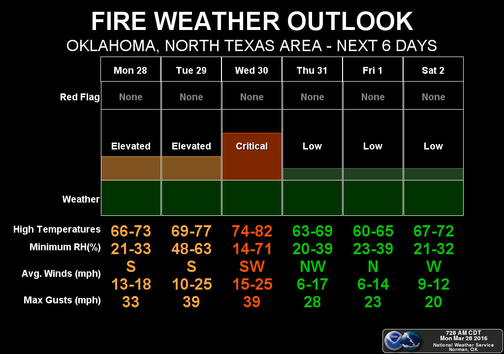
We now turn our attention to the coming week where two big problems loom:
1) Continued fire danger, including exacerbating the conditions of the still
uncontained Anderson Creek fire up in Woods County (and adjacent KS counties).
The fire danger will be bad the next two days, but critical on Wednesday with
the approach of a storm system that will bring those strong winds and a
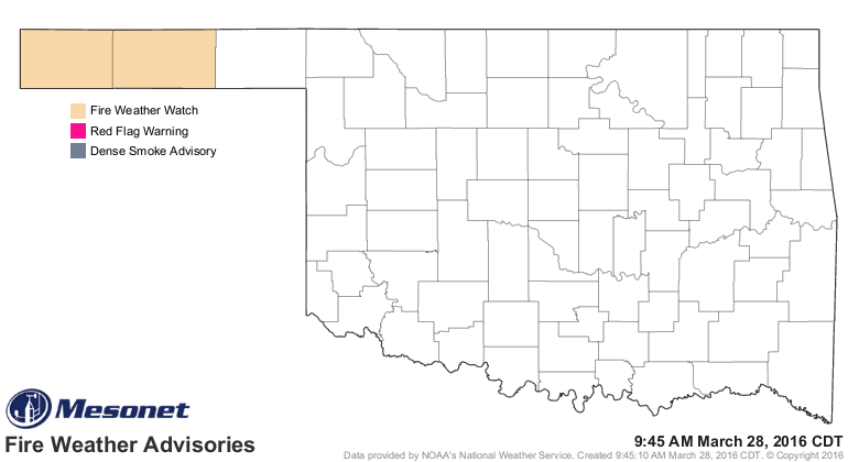
dryline to aid in fire ignition and spread. Watch for the fire advisories in
the western Panhandle to spread east over the next few days.
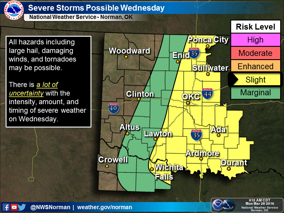
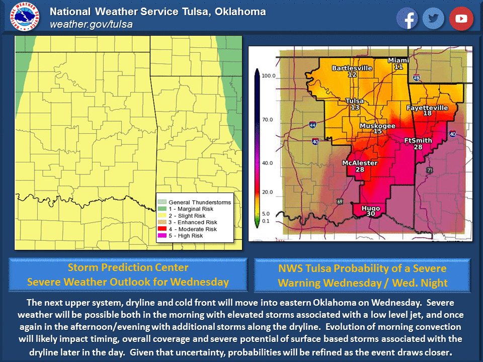
2) The same storm system that is bringing increased fire danger on Wednesday will
also bring increased severe weather chances. The Storm Prediction Center has
Wednesday labeled as "slight risk" for the eastern half of the state already,
but that could certainly change as we get closer. All modes of severe weather
could be possible at this point, but there will still be a lot of fine tuning
of that forecast and associated risks.

Lots of excitement as usual. Ready for some boring!
Gary McManus
State Climatologist
Oklahoma Mesonet
Oklahoma Climatological Survey
(405) 325-2253
gmcmanus@mesonet.org
March 28 in Mesonet History
| Record | Value | Station | Year |
|---|---|---|---|
| Maximum Temperature | 90°F | TIPT | 2022 |
| Minimum Temperature | 11°F | BOIS | 2009 |
| Maximum Rainfall | 4.20″ | ACME | 2017 |
Mesonet records begin in 1994.
Search by Date
If you're a bit off, don't worry, because just like horseshoes, “almost” counts on the Ticker website!