Ticker for February 12, 2021
MESONET TICKER ... MESONET TICKER ... MESONET TICKER ... MESONET TICKER ...
February 12, 2021 February 12, 2021 February 12, 2021 February 12, 2021
How much chill could a wind cill chill
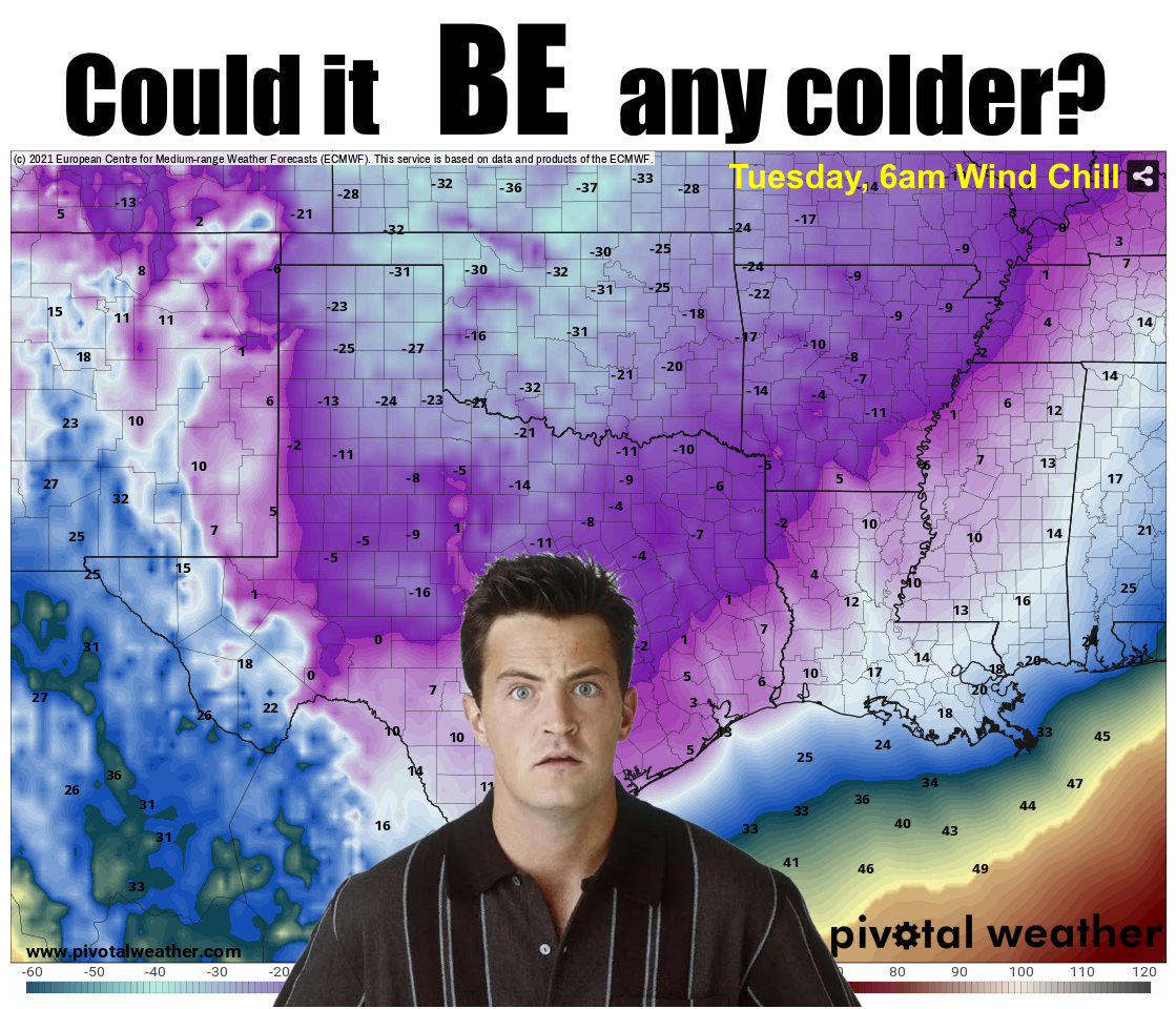
Snow? Are you kidding me, snow? Playoffs? Forget about the snow for a bit...we
all get it, okay? It's going to snow. But what about the temperatures that are
arriving soon? The lows in the negative single digits and possible negative
teens? Are you ready for that?
Snow? Heck, the wind chill will probably kill ya! (Butch and Sundance, again).
Oh, it's cold enough for me RIGHT NOW!
But that really cold air...you know, the air that keeps you up at night thinking
about, is still poised to our north. We got another dose of it overnight, which
is why we won't see too much upward pressure on the temperature. The real cold is
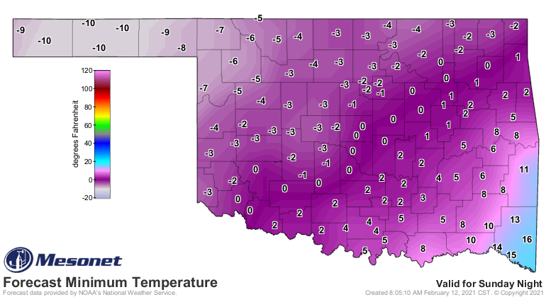
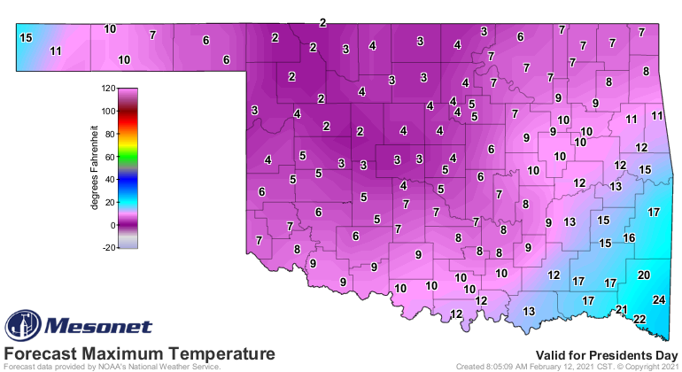
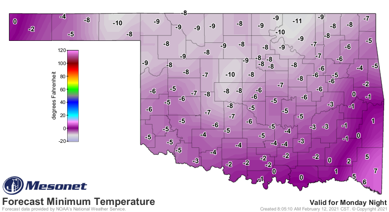
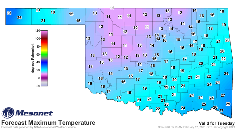
yet to come, however, as we can see in the forecast temps for Monday and Tuesday.
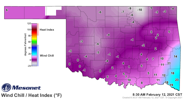
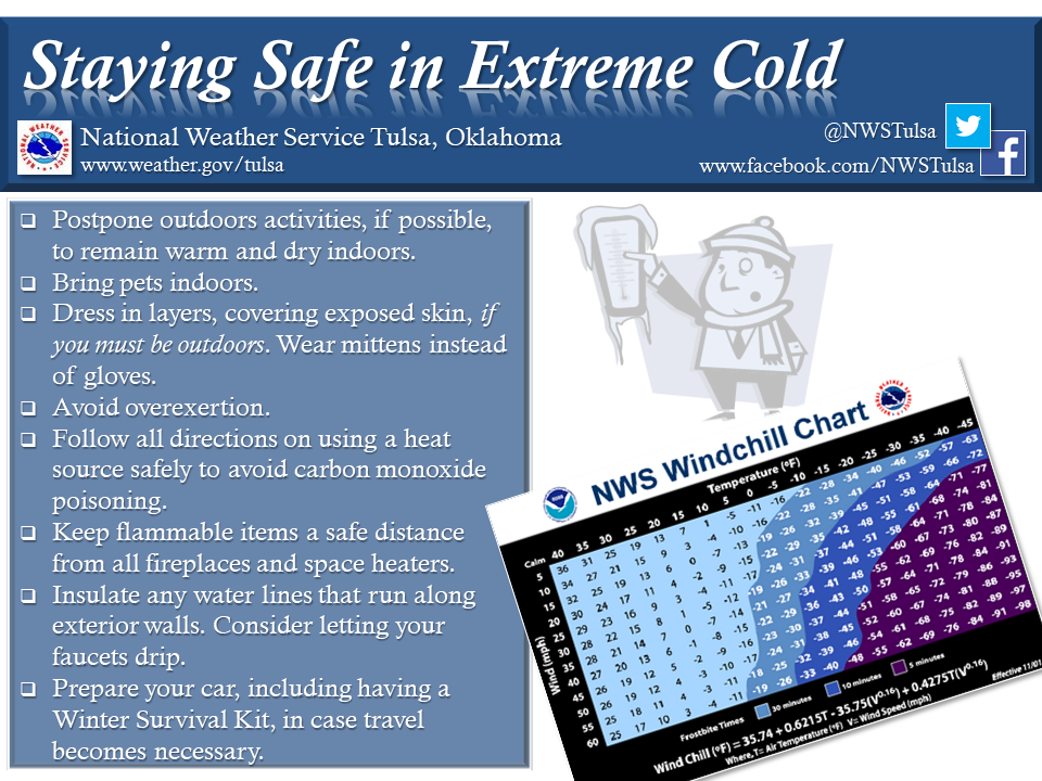
Remember, these are ACTUAL air temperatures. Add wind, get death.
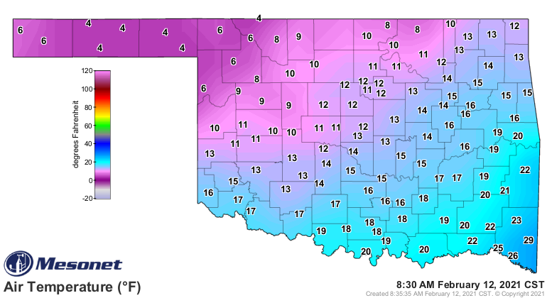
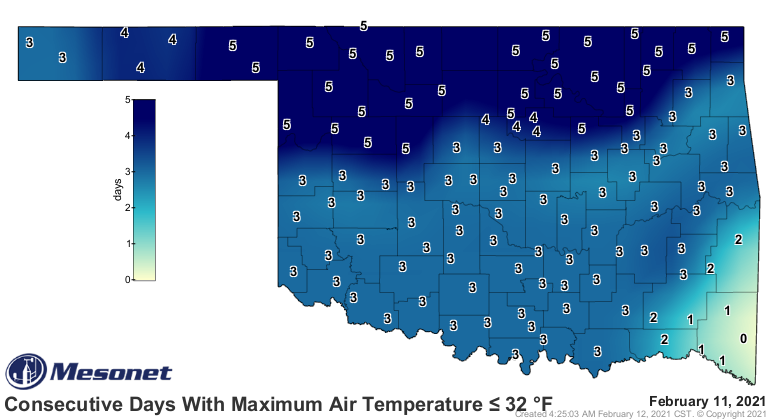
We're already up to 6 days below freezing across northern OK, and 4 over almost
all the rest of the state (just add a day to this map). Don't brag, Broken Bow.
Yours is coming.
We continue to zoom up the record books with each frigid day. Yesterday's
statewide average temperature of 18.6F is tied for the 241st coldest day on
record (remember, Dec. 22, 1989's 1.9 degrees is the mark to shoot for). Our
3-day value from Dec. 9-11 is now tied for the 193rd coldest 3-day period on
record for the state. All those marks will continue to zoom up the books as we
encounter the REALLY cold air yet to come.
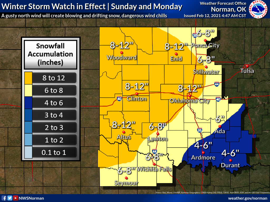
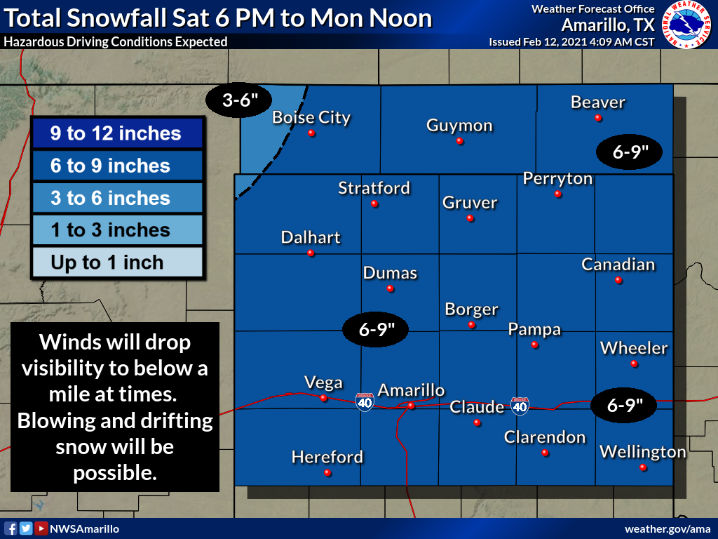
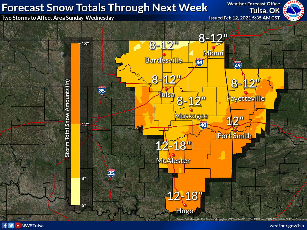
Oh yeah, for snow, we are looking at periodic snow over the weekend, but that
really ramps up Sunday into Monday. Then another storm hits Wednesday. That last
one could bring historic snows to SE OK. Here are some thoughts from our NWS
friends, for varying time periods. Remember, we're still a day or two away from
the event this weekend, so amounts could and probably will change...and shift
location as well.
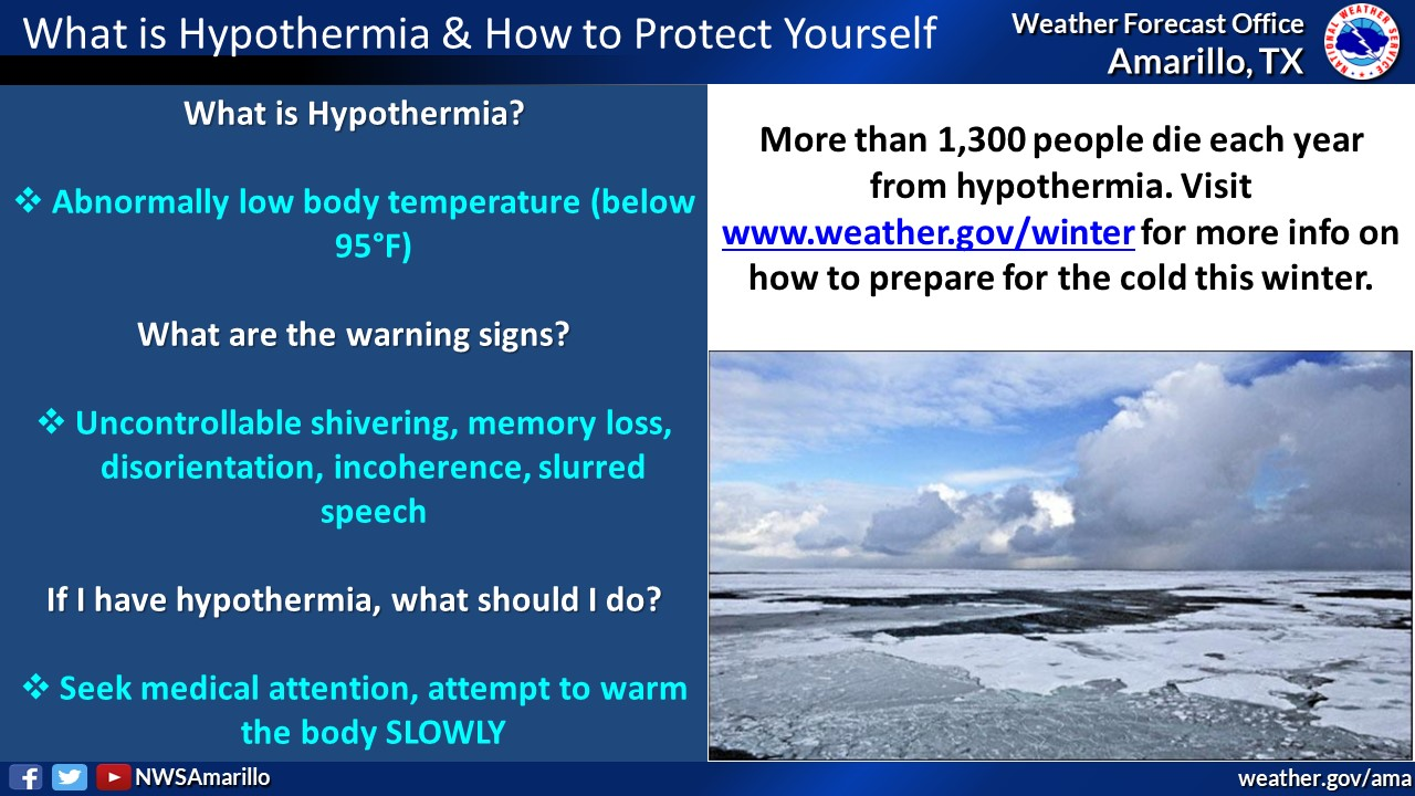
In all seriousness, this is a very dangerous storm due to the frigid weather
that will be in place. Deadly cold. And if you should venture out and get stuck,
it will put your life in jeopardy. So stay weather aware. Prepare now for
the possibility of being home bound for several days if not more. Be sure and
drip your faucets, because this is not a time to have your pipes freeze up and
be without water for an extended period of time.
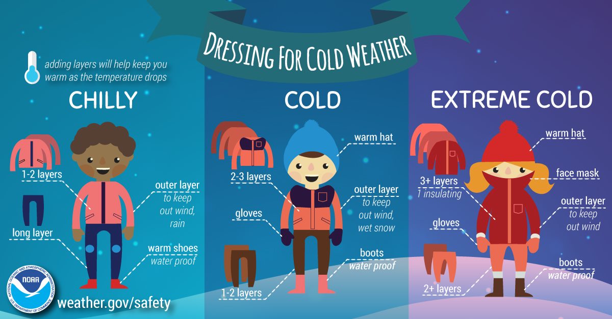
Here are some helpful hints from our NWS partners.
Gary McManus
State Climatologist
Oklahoma Mesonet
Oklahoma Climatological Survey
(405) 325-2253
gmcmanus@mesonet.org
February 12 in Mesonet History
| Record | Value | Station | Year |
|---|---|---|---|
| Maximum Temperature | 76°F | CAMA | 2023 |
| Minimum Temperature | -1°F | CAMA | 2018 |
| Maximum Rainfall | 1.81″ | BROK | 2020 |
Mesonet records begin in 1994.
Search by Date
If you're a bit off, don't worry, because just like horseshoes, “almost” counts on the Ticker website!