Ticker for February 9, 2018
MESONET TICKER ... MESONET TICKER ... MESONET TICKER ... MESONET TICKER ...
February 9, 2018 February 9, 2018 February 9, 2018 February 9, 2018
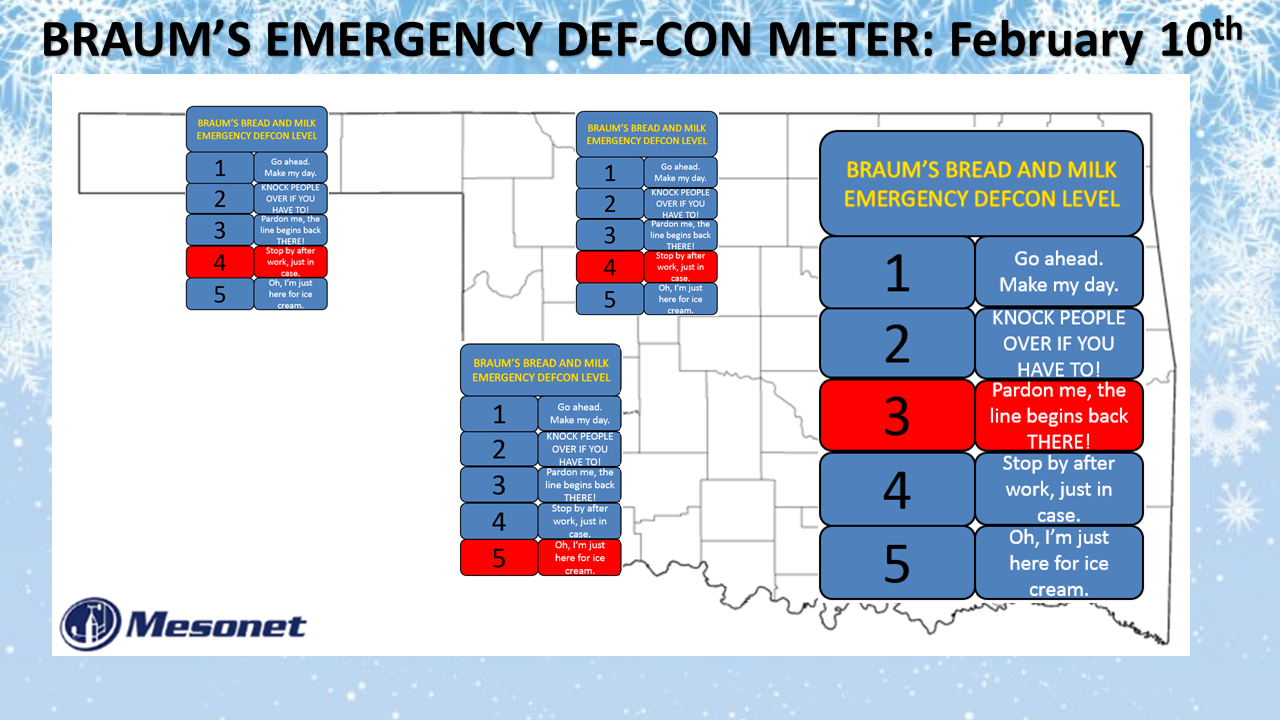
It's Braum's time!
Freezing drizzle. The mere mention of it strikes fear into our hearts. Normally
we issue these EMERGENCY BRAUM'S DEF-CON METERs for major winter storms, but the
fact we may have freezing drizzle/freezing rain AND that I'm worried we're going
to run out of chances to issue one of these as the winter dies down, prompts me
to go ahead and send one out. As we saw last week just to the SE of OKC, a little
bit of ice goes a long way as traffic accidents started to multiply, as did the
unfortunately traffic fatalities. Here's the setup. A cold front, plunging south
today will eventually stall somewhere near I-44 later on and then push on through
overnight into tomorrow. It's nose is already poking into far NW OK.
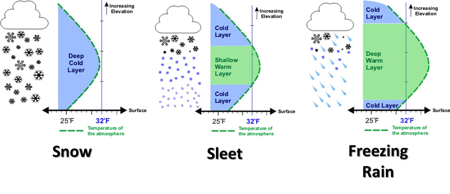
Warmer, moist air from the south will ride up and over this cold air and start
to precipitate out (meteorologists, please ignore that crass description of
"isentropic lift"). As it falls through the cold air as rain, it will supercool
and start to freeze on elevated surfaces. Eventually, it will start to get the
bridges and overpasses, as well as the regular road surfaces. In other words,
the third scenario on this graphic (although #s 1 and 2 will also be possible).
There's still lots of uncertainty in this forecast, even this close to the
event. How much will the air mass dry out behind the front? Where exactly will
those heavier bands of freezing drizzle/rain set up? Last week there were
patchy areas of heavier freezing rain that made life miserable for travelers.
They would be moving along nicely on dry road surfaces, hit one of those
small footprints of ice and the slipping and sliding was on! A terrible
situation. That's what we want to avoid late tonight and through tomorrow.
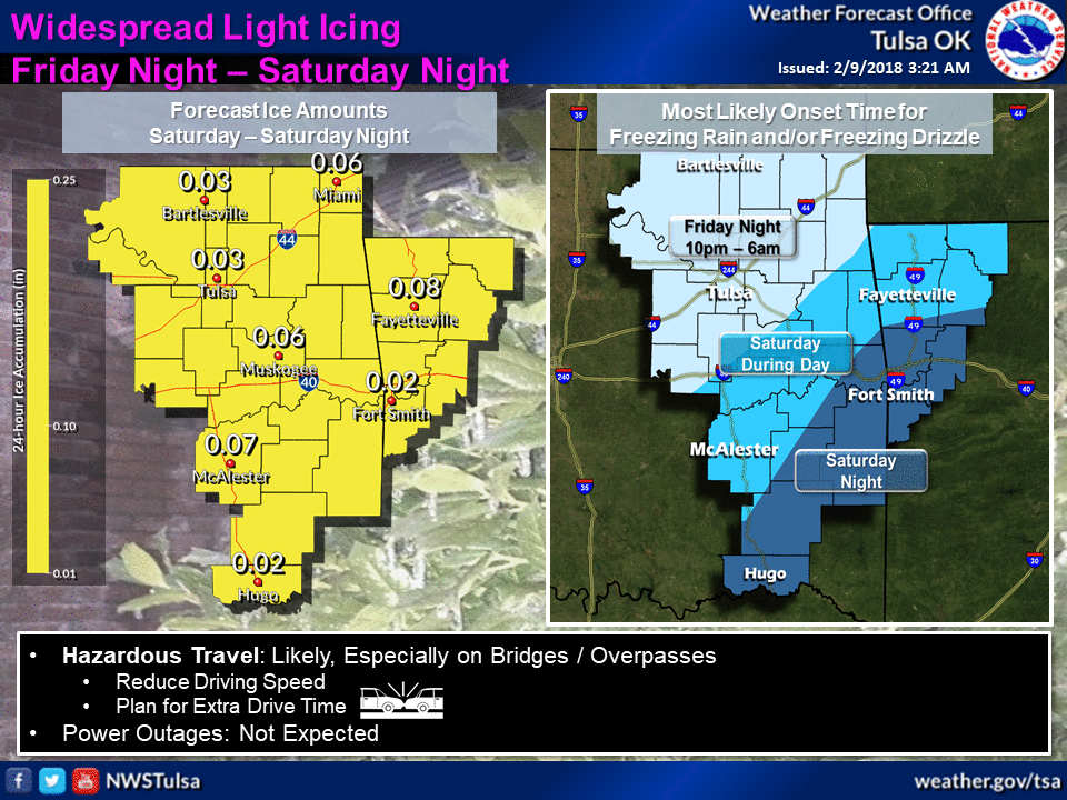
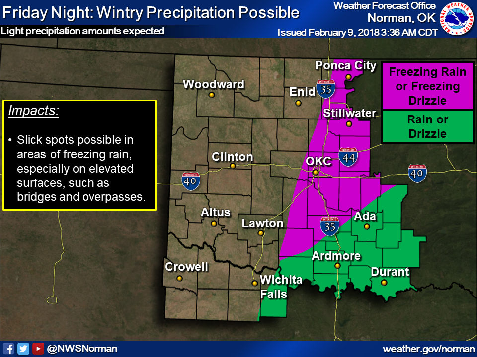
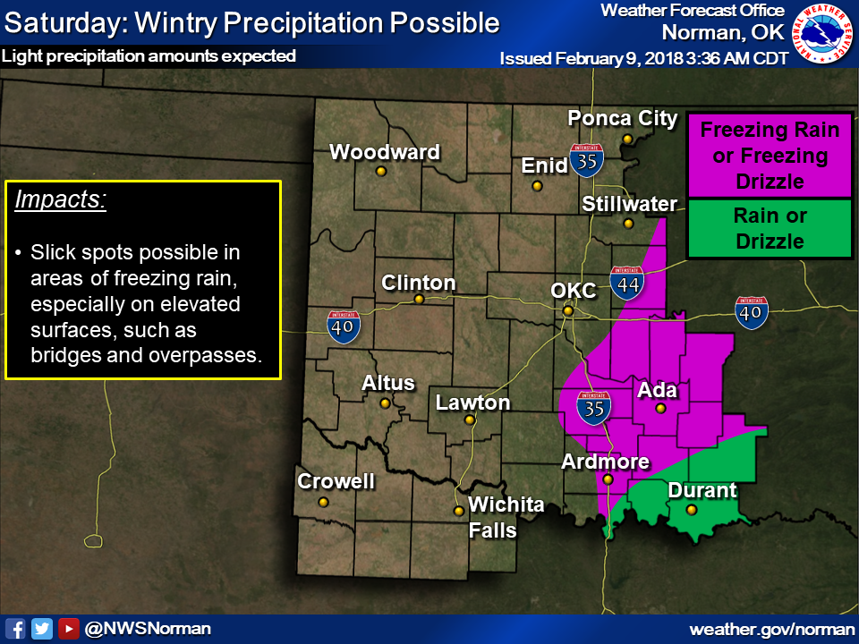
For some clarification, here are the latest graphics from our local NWS
offices explaining the situation.
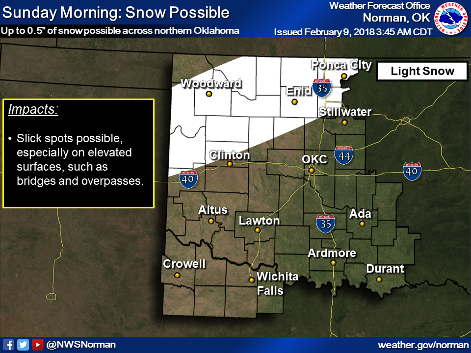
So we've thrown in a DEF-CON Level 4 for NW OK in case of snow, which could
cause a bit of slick travel. We've gone ahead and gone to DEF-CON Level 3 for
much of central and eastern OK because even though the amounts are expected to
be light, we don't want folks hitting those slick spots and crashing into
each other. In fact, we hope this whole forecast is a bust, but the
potential is there for some folks to completely miss out OR get it a bit worse
than expected.
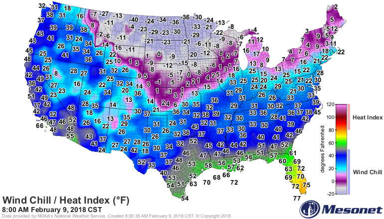
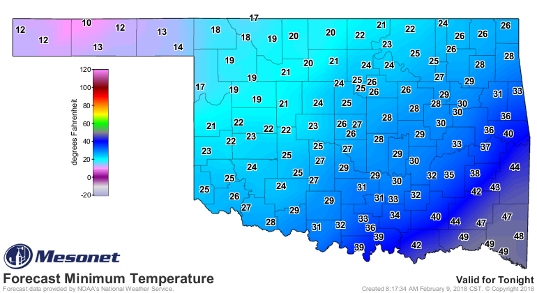
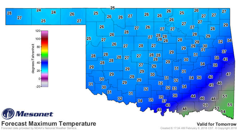
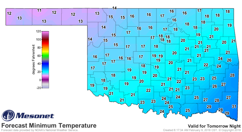
For the folks down across SW OK, looks like you're going to remain cold and dry.
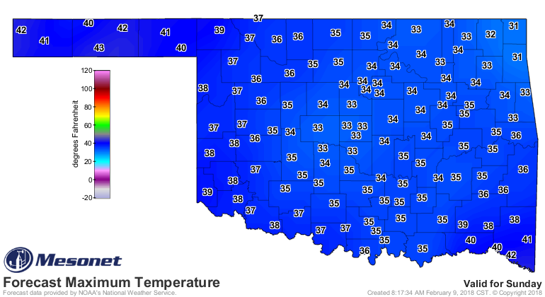
What else is new, right? These are the temperatures we're looking at for
tomorrow into Sunday.
Keep in mind that the cold front could slow down or speed up today, and its
position will determine the delighfulness of your day, or the misery. Ahem!
We're looking at you, Buffalo, where your misery is already locked in.

So there's a bit of goofiness in these here BRAUM'S EMERGENCY DEF-CON meters,
but they do serve a purpose. We try to highlight dangerous travel conditions
in an effective-but-humorous way. We hope we've at least given you pause on
trying to get out and about tomorrow if things get precarious. You'll know
if they do because we're positive you'll be tuned into your favorite NWS/Media
source for the latest weather information.
Just go to Braum's, buy some bread, milk and ice cream, go home and crank up
the heat to 85. INSTANT SUMMER!
Gary McManus
State Climatologist
Oklahoma Mesonet
Oklahoma Climatological Survey
(405) 325-2253
gmcmanus@mesonet.org
February 9 in Mesonet History
| Record | Value | Station | Year |
|---|---|---|---|
| Maximum Temperature | 82°F | GRA2 | 2000 |
| Minimum Temperature | -18°F | MEDF | 2011 |
| Maximum Rainfall | 1.02″ | VINI | 2001 |
Mesonet records begin in 1994.
Search by Date
If you're a bit off, don't worry, because just like horseshoes, “almost” counts on the Ticker website!