MESONET TICKER ... MESONET TICKER ... MESONET TICKER ... MESONET TICKER ...
January 11, 2024 January 11, 2024 January 11, 2024 January 11, 2024
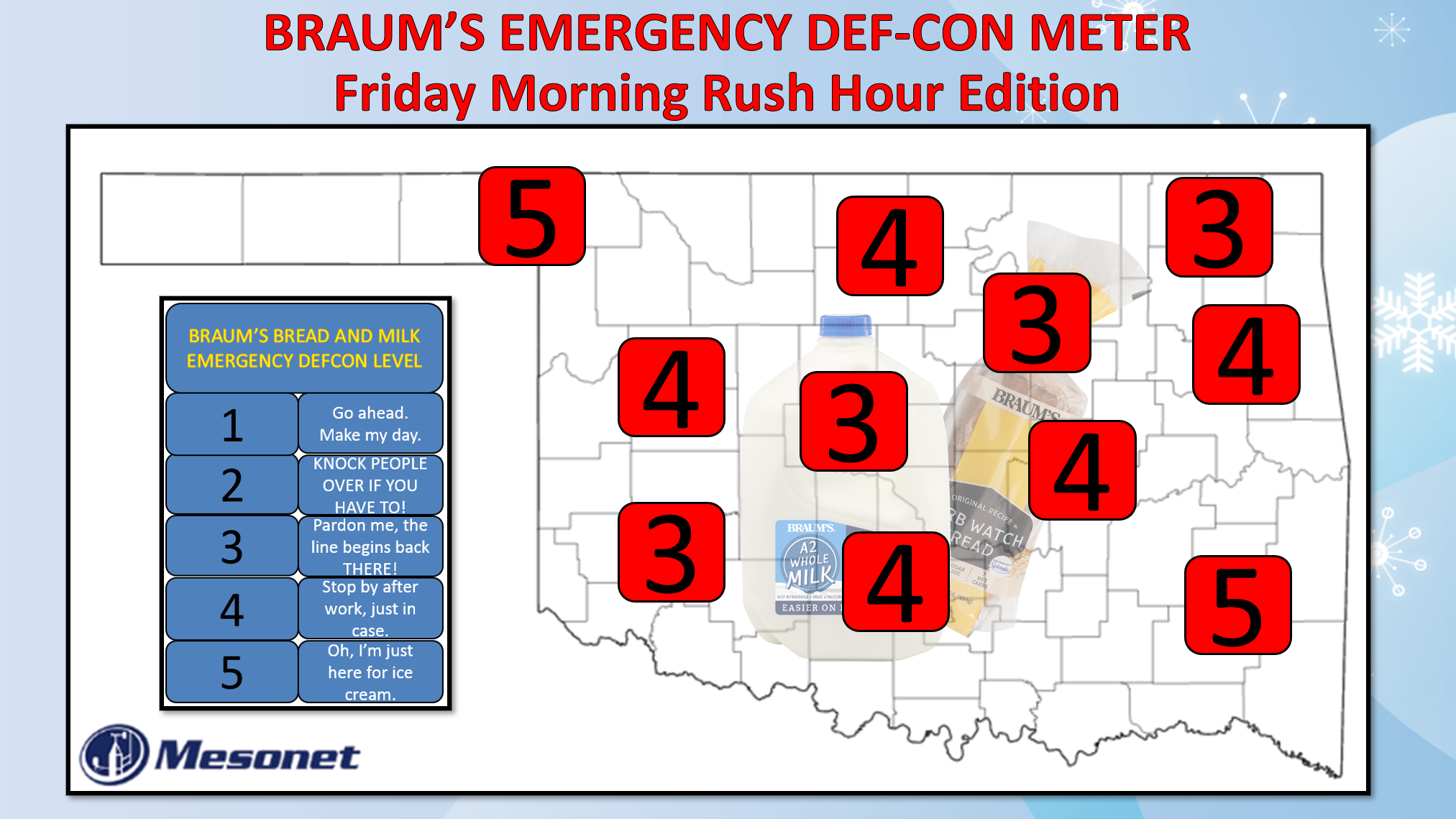
Snow-lite
https://ticker.mesonet.org/archive/20240111/Jan12-Braums-DEFCON.png
Remember when Mercutio got stabbed by Tybalt under Romeo's arm when Romeo tried
to stop them from fighting? Everybody thought Mercutio was joking as he lay
dying, but Benvolio, gentle soul that he was, sensed something was wrong and
said "bruh, you're really hurt?"
Mercutio replies with "Ay, ay, a scratch, a scratch; marry, 'tis enough." Romeo
then steps in with a non-helpful "Courage, man; the hurt cannot be much."
Yeah, that was well before Monty Python took credit for the "flesh wound" bit.
Anyway, Mercutio struggles back with "No, 'tis not so deep as a well, nor so wide
as a church-door; but 'tis enough,'twill serve: ask for me to-morrow, and you
shall find me a grave man."
Yeah, forgive me from going all Shakespeare on you, but I do love me some Mercutio.
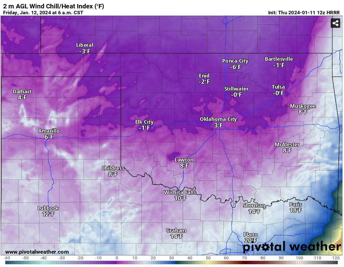
But why tho? Well, I thought it was an apt comparison between our snow situation
overnight what with the first Arctic front coming in late tonight that will kick
in in (I said "in" twice...I like "in") the morning with temperatures down into
the teens and wind chills near or below zero. Add just a bit of snow, and
possibly a bit of rain before that, and you have the makings of a mess in the
morning as folks get out and about to do their bidness. Or go to school. Or go
to Braum's to get some emergency bread and milk. I'm basing the Braum's DEF-CON
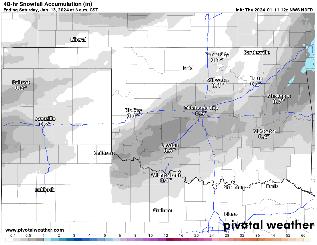
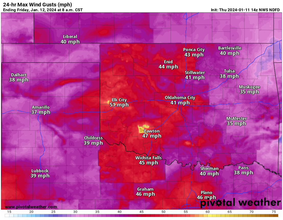
Meter on the NWS forecasts for snowfall and wind, and a look at some High-Res
model output for temps and wind chills.
https://ticker.mesonet.org/archive/20240111/48hour-snow-forecast.png
https://ticker.mesonet.org/archive/20240111/6am-wind.chills.png
https://ticker.mesonet.org/archive/20240111/6am-temps.png
https://ticker.mesonet.org/archive/20240111/max-wind-gusts-overnight.png
Now you don't want to get out driving in that POSSIBLE mess (things could
change between now and then...stay tuned), end up in a ditch, then have to
journey out into 35-50 mph wind gusts with wind chills around zero and end up
as worm's meat (Mercutio's words, not mine), do ya?
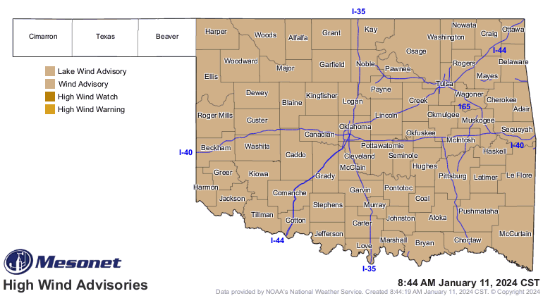
We already have a wind advisory out for 9pm tonight to 9am tomorrow.
https://ticker.mesonet.org/archive/20240111/latest.oklahoma.winds.gif
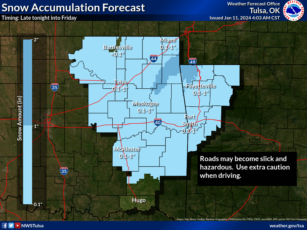
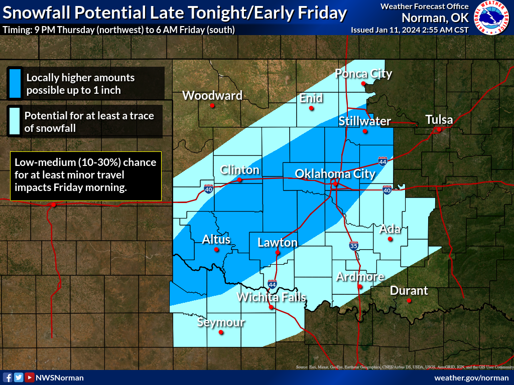
Here's what our local NWS offices have to say about tomorrow's snow.
https://ticker.mesonet.org/archive/20240111/nws-tulsa-snow.png
https://ticker.mesonet.org/archive/20240111/nws-norman-snow.png
NWS Tulsa: "Rain is expect to transition to snow late tonight into Friday
across eastern Oklahoma and western Arkansas behind a strong cold front. Most
areas are forecast to see a dusting to around 1 inch of snow while portions of
northeast Oklahoma into northwest Arkansas could see over an inch of snow.
Roads could become slick and hazardous. Use extra caution when driving."
So, not much snow, but dangerous conditions nonetheless with possible slick
roadways, blowing snow with very low visibility, and wind chills down close
to zero.
Ay, ay, a scratch, a scratch; marry, 'tis enough.
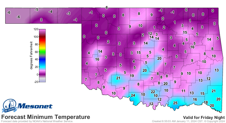
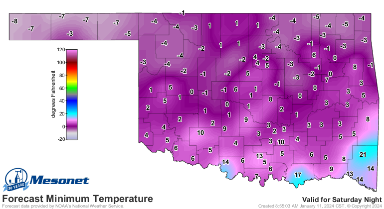
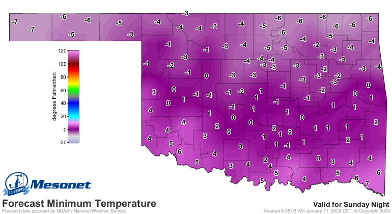
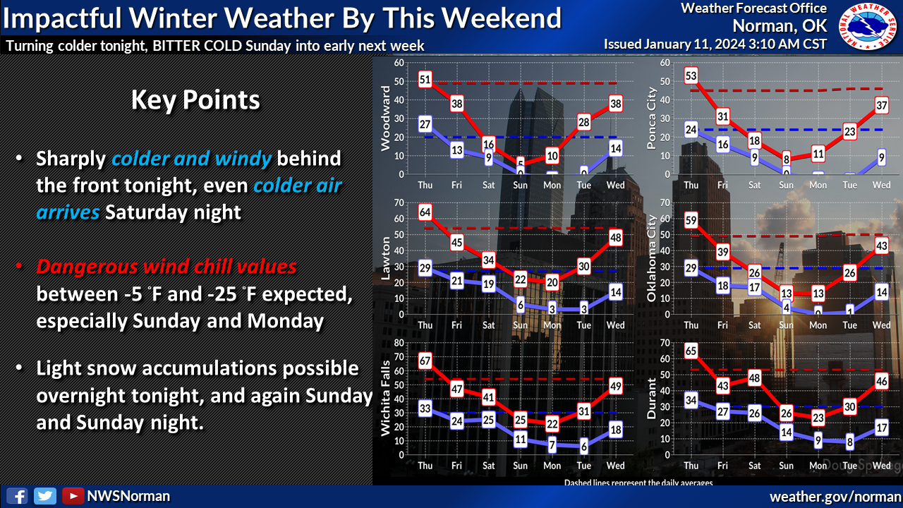
Now onwards past tomorrow morning, we will see a bit of a warm-up Friday
afternoon above freezing for some of us, then another shot of Arctic air
Saturday into Sunday that will give us some of the coldest air we've seen over
the last 3 years, at least since Feb. 2021's nonsense.
https://ticker.mesonet.org/archive/20240111/saturday-lows.png
https://ticker.mesonet.org/archive/20240111/sunday-lows.png
https://ticker.mesonet.org/archive/20240111/monday-lows.png
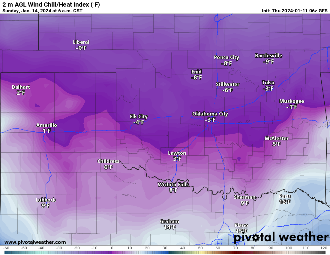
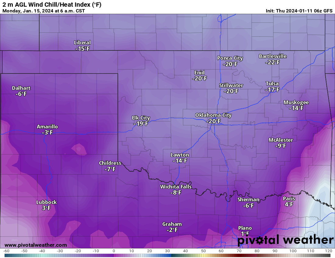
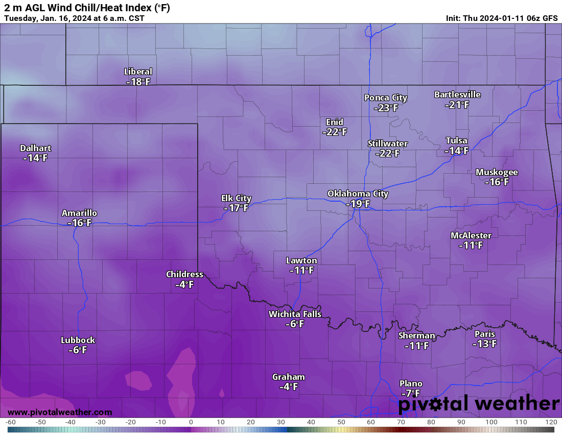
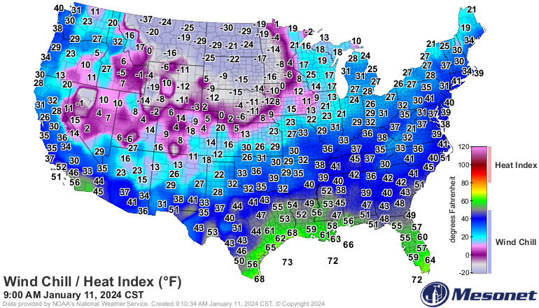
Sticking with the lows there, but add in the winds and we'll see wind chills
down into the minus single-digits to minus 20s Sunday through Tuesday.
https://ticker.mesonet.org/archive/20240111/sunday-morning-wind.chills.png
https://ticker.mesonet.org/archive/20240111/monday-morning-wind.chills.png
https://ticker.mesonet.org/archive/20240111/tuesday-morning-wind.chills.png
And confidence is increasing that we'll see something of a heavy snow event
Sunday into Monday where some folks could get more than a half a foot of snow.
No, nobody is getting two feet of snow.
https://ticker.mesonet.org/archive/20240111/two-feet-snow.png
Anyway, more on that tomorrow when the forecasts sync a bit better (and don't
call me more on!). It does look like we'll start to snap out of it on Wednesday
as the dome of cold air is dragged to the north and east of us.
https://ticker.mesonet.org/archive/20240111/nws-norman-7day-temps.png
Oh yeah, it's still coming all right.
https://ticker.mesonet.org/archive/20240111/latest.tapp.png
Gary McManus
State Climatologist
Oklahoma Mesonet
Oklahoma Climatological Survey
gmcmanus@mesonet.org
==================================================
The OCS/Mesonet Ticker
https://ticker.mesonet.org/
To subscribe or unsubscribe from the Ticker
or for questions about the Ticker or its content
Phone or Email the Ticker Manager at OCS
Phone: 405-325-2253 Email: ticker@mesonet.org
---------------------------------------------------
-C- Copyright 2024 Oklahoma Climatological Survey
===================================================
|


 Tweet
Tweet