MESONET TICKER ... MESONET TICKER ... MESONET TICKER ... MESONET TICKER ...
January 5, 2015 January 5, 2015 January 5, 2015 January 5, 2015
Chill and Chill Again
Okay, I did blatantly steal that title from the wondrous 1981 martial arts movie
of similar name (hey, he's not one of the best, he's THE best!),
http://ticker.mesonet.org/archive/20150105/again.jpg
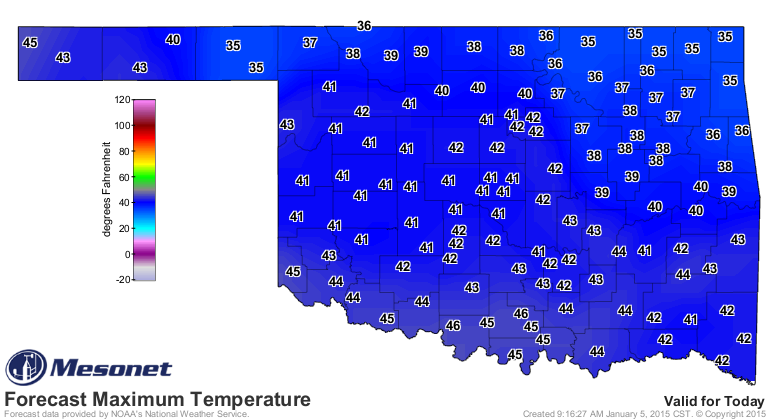
but having just come out of the deep chill, a look at the forecast warns us to
not get used to the 40s we'll see over the next couple of days. Better ignore
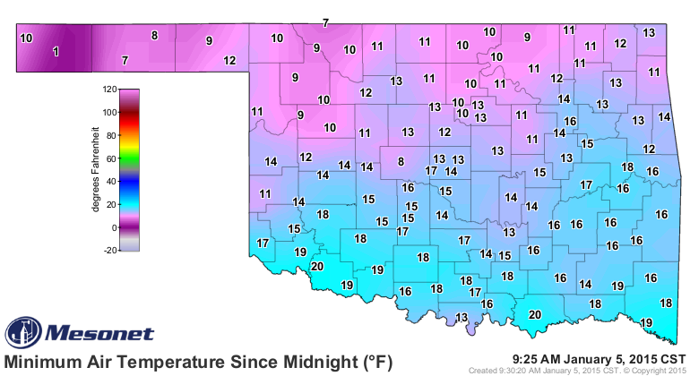
today's low temperatures too (at least until we reach those 40s).
http://ticker.mesonet.org/archive/20150105/todays-lows.png
http://ticker.mesonet.org/archive/20150105/todays-highs.png
http://ticker.mesonet.org/archive/20150105/tuesday-highs.png
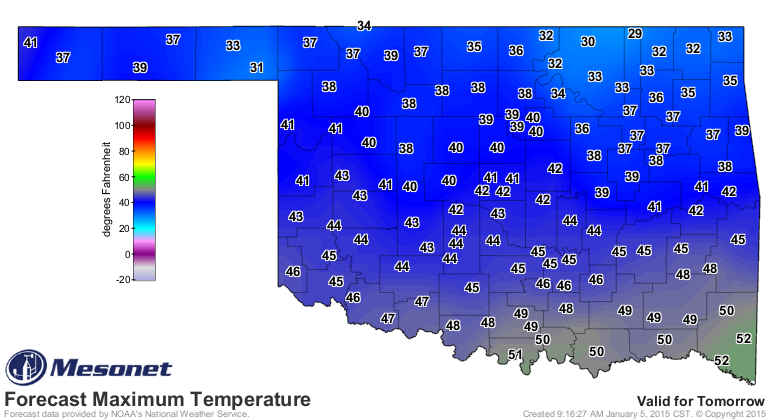
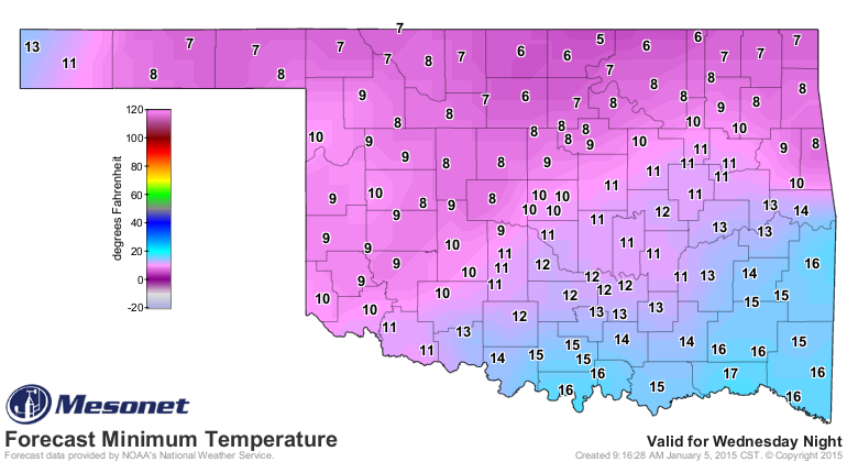
A couple of caveats there, of course. Northern OK won't see many 40s, and on
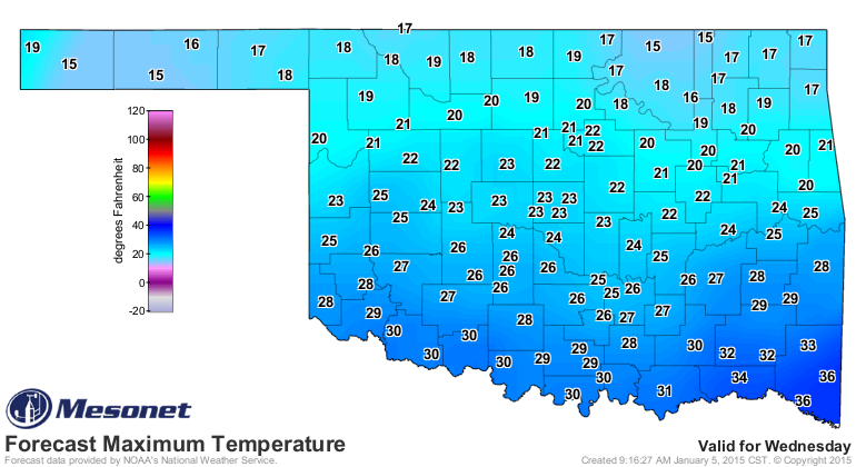
Tuesday we'll see the beginning of the invasion of arctic air again. By
Wednesday, even that Tuesday map will be remembered with envy. For Thursday...just
stay in bed.
http://ticker.mesonet.org/archive/20150105/wednesday-highs.png
http://ticker.mesonet.org/archive/20150105/thursday-lows.png
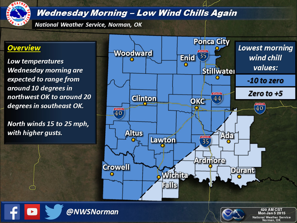
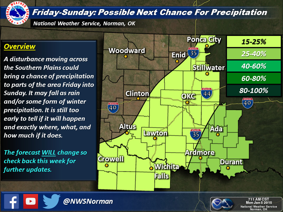
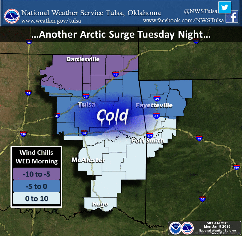
Our friends at the NWS talk about the coming chill, and also the precip chances
that might show up later this week (get the BRAUM'S DEFCON METER ready!).
http://ticker.mesonet.org/archive/20150105/nws-norman1.jpg
http://ticker.mesonet.org/archive/20150105/nws-norman2.jpg
http://ticker.mesonet.org/archive/20150105/nws-tulsa.png
That forecast is subject to lots of change (probably right up until it starts),
so keep checking back with your favorite NWS or media source.
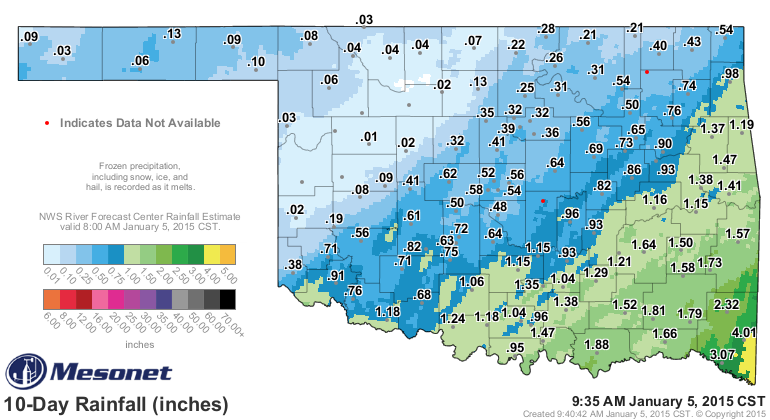
After the decent snowfall totals in the Panhandle, we're still waiting on some
melting to see how much liquid equivalent we ended up with. Guymon reported
5 inches of snow with this last event, and Beaver had 1.5 inches. No doubt
there were others that received somewhere between those two figures (and more
or less), but that's still a nice snow for that area. That's why the gauges up
that way show less than a quarter-inch, but the radar estimates show as much
as three-quarters. And SE OK, as predicted, received some great moisture.
http://ticker.mesonet.org/archive/20150105/10day-rainfall.png
3-4 inches in McCurtain County will calm that drought area down in a hurry.
Last words? Enjoy your 30s and 40s. Come Wednesday morning, those will be but
a fond memory.
Gary McManus
State Climatologist
Oklahoma Mesonet
Oklahoma Climatological Survey
(405) 325-2253
gmcmanus@mesonet.org
==================================================
The OCS/Mesonet Ticker
https://ticker.mesonet.org/
To subscribe or unsubscribe from the Ticker
or for questions about the Ticker or its content
Phone or Email the Ticker Manager at OCS
Phone: 405-325-2253 Email: ticker@mesonet.org
---------------------------------------------------
-C- Copyright 2024 Oklahoma Climatological Survey
===================================================
|


 Tweet
Tweet