Ticker for August 29, 2024
MESONET TICKER ... MESONET TICKER ... MESONET TICKER ... MESONET TICKER ...
August 29, 2024 August 29, 2024 August 29, 2024 August 29, 2024
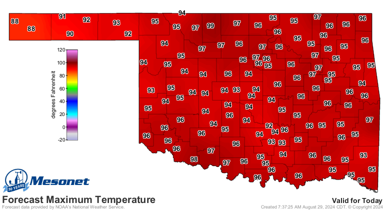
Sayonara
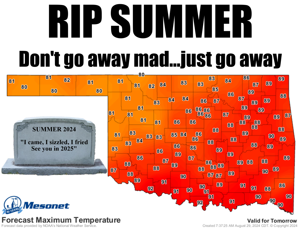
Of course it can still get hot after today. Heck, we can have 100s in October,
for crying out loud! And an ice storm a few days later. But let's face it (okay,
YOU face it because I cannot face my face), the *hottest* part of summer is about
to be over. Much like Thanos (nerds, ya feel me??), it's inevitable.
Ahem...it's called CLIMATOLOGY!

You can see there the long-term average max temperature graph averaged statewide
from Mesonet data shows we're starting our long decline into more temperate
territory climatologically, even though our red line for this year shows that
we've been trying to take that line horizontally (i.e., above normal temps).
Well, after today, that's gonna change, and just in the climatological nick of
time.

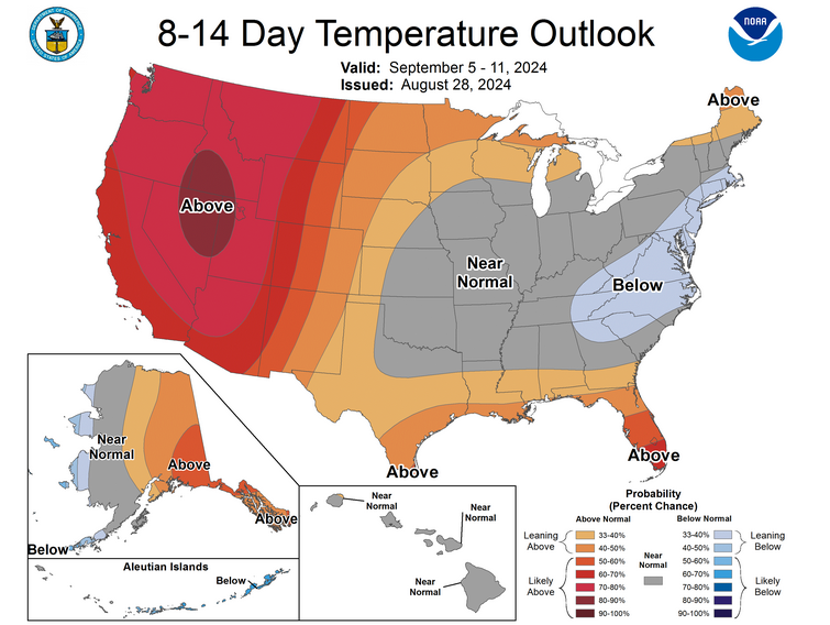
We know this weekend through much of next week is gonna be full of 80s, but
that extended outlook with "near normal" being favored would keep the worst
of our previous heat away. So these numbers are gonna start tapering off pretty
rapidly after this, which is also what my barber told me back in 2002.
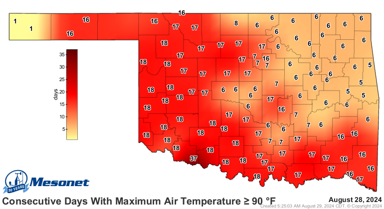

Okay, so we have another problem. No, not that...I told you they sell a cream
for that anyway. I'm talking about drought. We saw another big jump in drought
this week, with our first bout of D3-Extreme drought (is there any other kind?)
in the state since December 2023. Aye, it's only 5%, but 'tis enough, especially
if you're down in SW OK.

Check out a few of these pics we've received from impacted ag operations down
in SW OK.
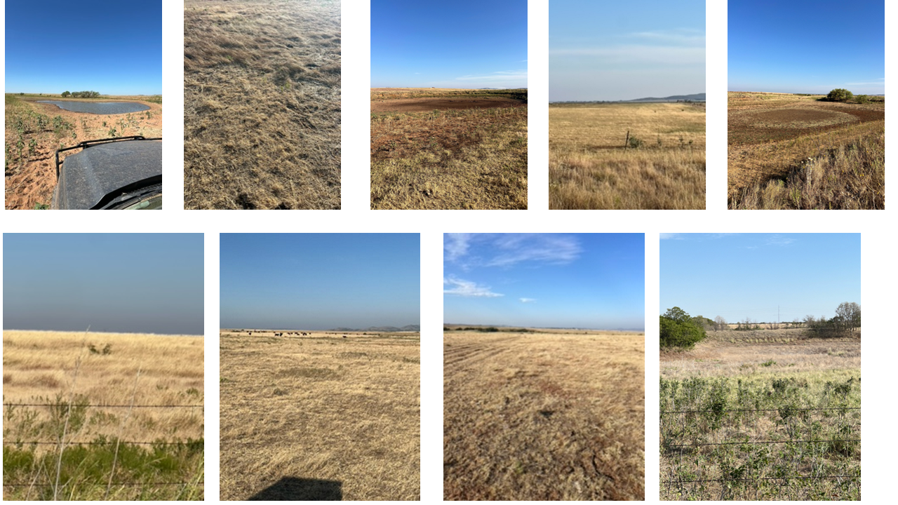
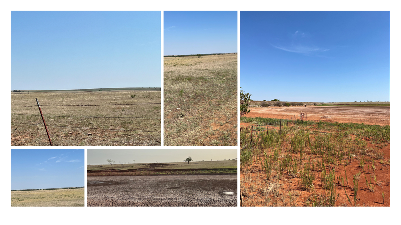
You think that's ugly, check out...whoops, already filled my allotment of
self-deprecation for today. Here's something more pretty.
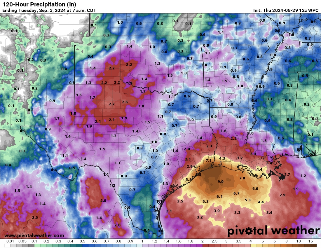
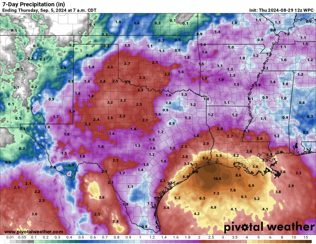
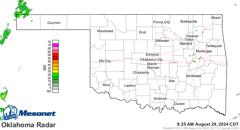
All that rain has to actually happen, of course. Heck, it's raining right now,
for crying out loud! Barely, but the far NW tip of Cimarron County is enjoying
sprinkles right now.
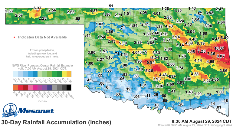
August has not been kind to most of us when it comes to rain, unfortunately.
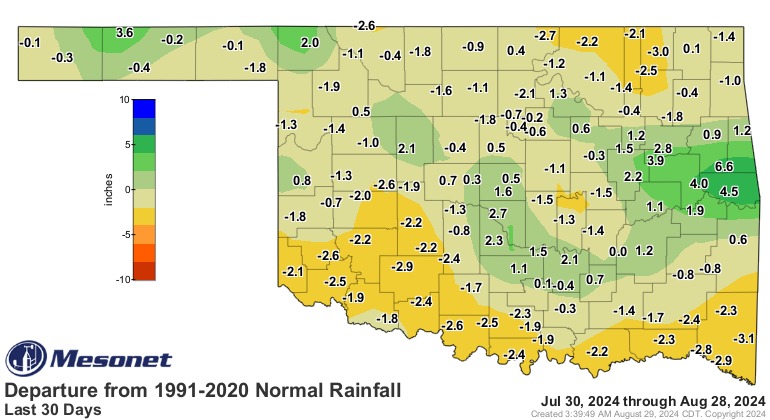
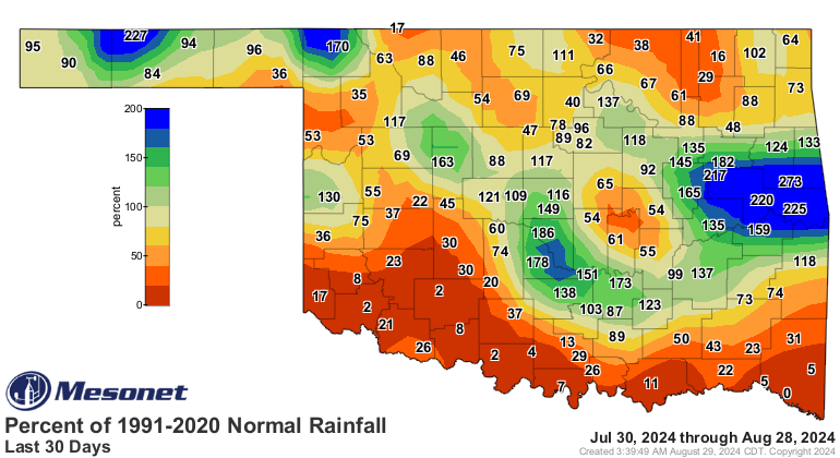
We have a long way to go to get rid of drought, but it's a start.
Gary McManus
State Climatologist
Oklahoma Mesonet
Oklahoma Climate Survey
gmcmanus@ou.edu
August 29 in Mesonet History
| Record | Value | Station | Year |
|---|---|---|---|
| Maximum Temperature | 109°F | WAUR | 2011 |
| Minimum Temperature | 48°F | EVAX | 2017 |
| Maximum Rainfall | 5.06 inches | VINI | 2003 |
Mesonet records begin in 1994.
Search by Date
If you're a bit off, don't worry, because just like horseshoes, “almost” counts on the Ticker website!