Ticker for December 28, 2020
MESONET TICKER ... MESONET TICKER ... MESONET TICKER ... MESONET TICKER ...
December 28, 2020 December 28, 2020 December 28, 2020 December 28, 2020
A Few Good Mesonet Extremes
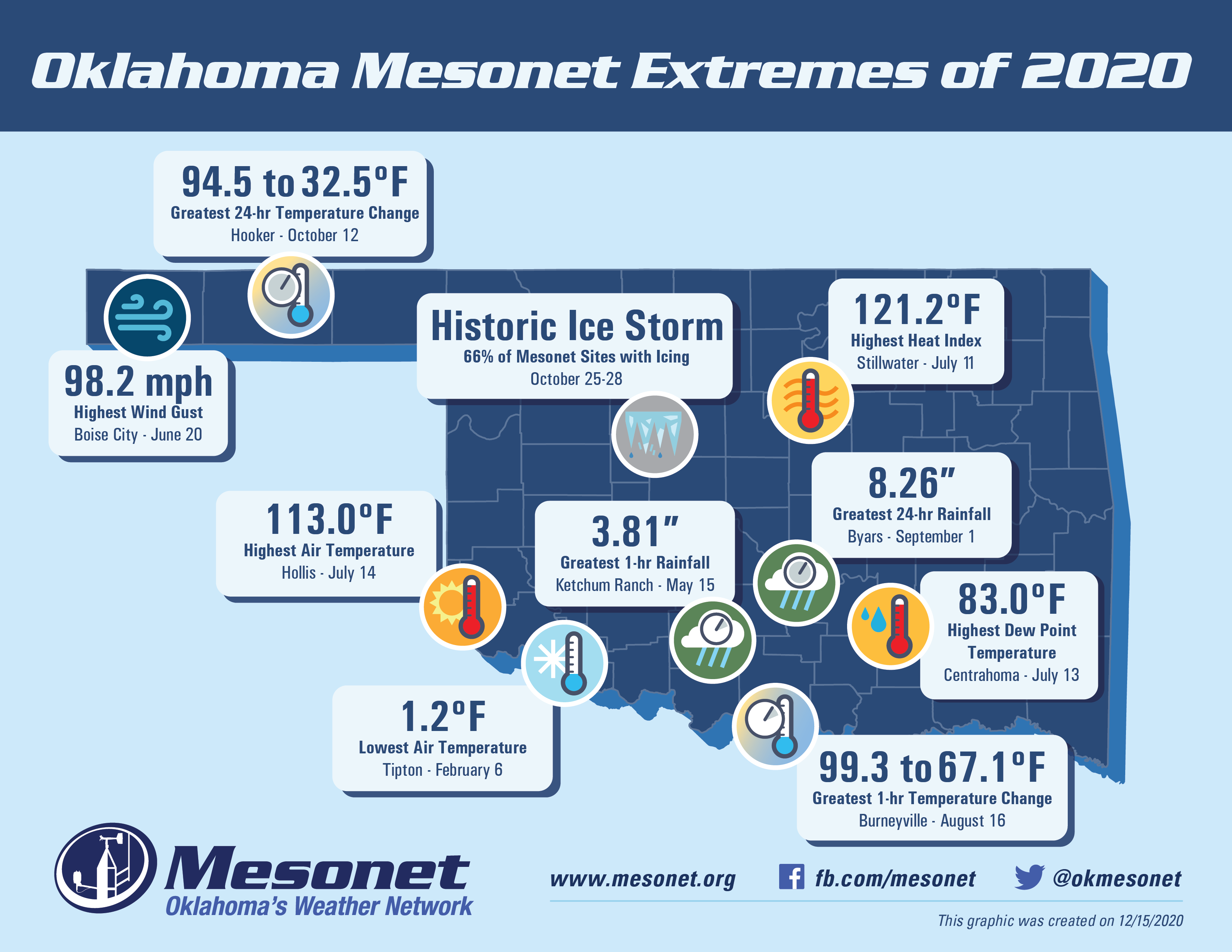
Dare we talk about extremes during 2020? What did we have...asteroid collisions,
volcanoes, tectonic plates spinning on poles at a circus? Well, as it turns out,
2020's weather wasn't QUITE that extreme in Oklahoma, at least compared to what
went on the world in general. The Mesonet's 120 lonely sentinels still stood
their post and watched over us, regardless of the chaos surrounding them, and
recorded another year's worth of the mundane, magnificent, and downright
macabre Oklahoma weather at times.
What was the lowest temperature the Mesonet recorded during 2020?
You want answers?
I WANT THE EXTREMES!
YOU CAN'T HANDLE THE EXTREMES!
Well, that's generally true when it comes to cold weather. I can handle the
extreme heat pretty well, but my teeth chatter like a wheelbarrow collecting rain
when I think of that 1.2 degrees recorded at Tipton on February 6.
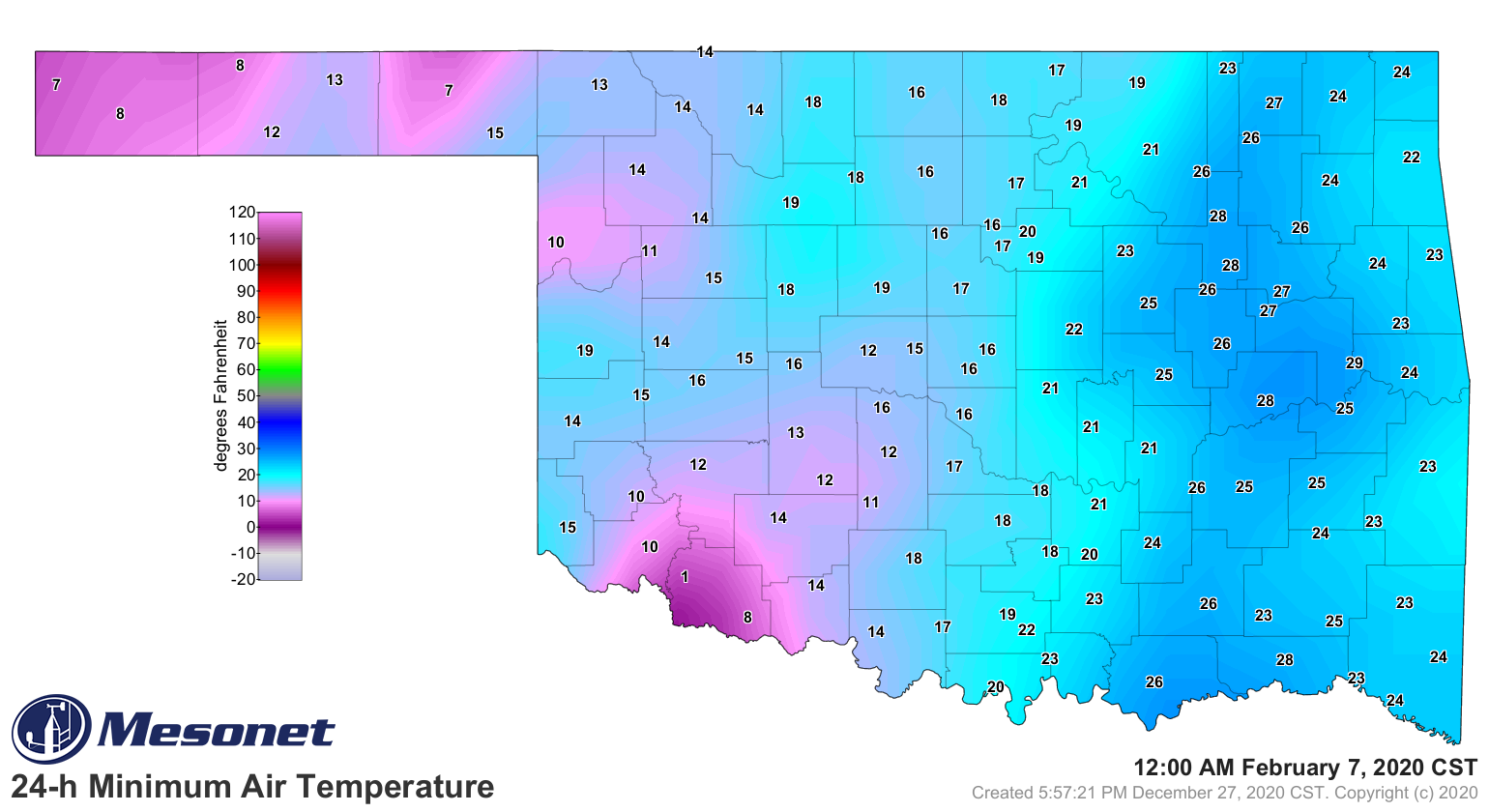
Wait a minute...TIPTON HAS THE LOWEST TEMPERATURE OF 2020? Yeah, that's completely
a 2020 type of deal. Just how often has a "southern" Oklahoma Mesonet site had
the lowest temperature reading of the year, dating back to 1997 when our
temperature archive began? Once, and you're looking at it. This is a statistic
obviously heavily dominated by our Panhandle stations.
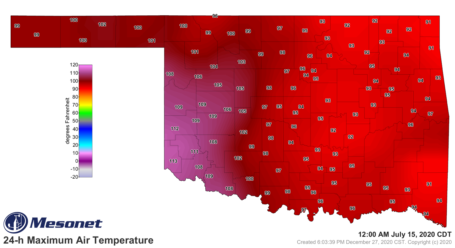
The 2020 high temp of 113 degrees should shock no one, unless you were in Hollis
on July 14 and still drive a car with vinyl seats, THEN you'd be shocked! Once
you scraped your backside off the seat and opened your trusty Mesonet app, you
would have seen why.
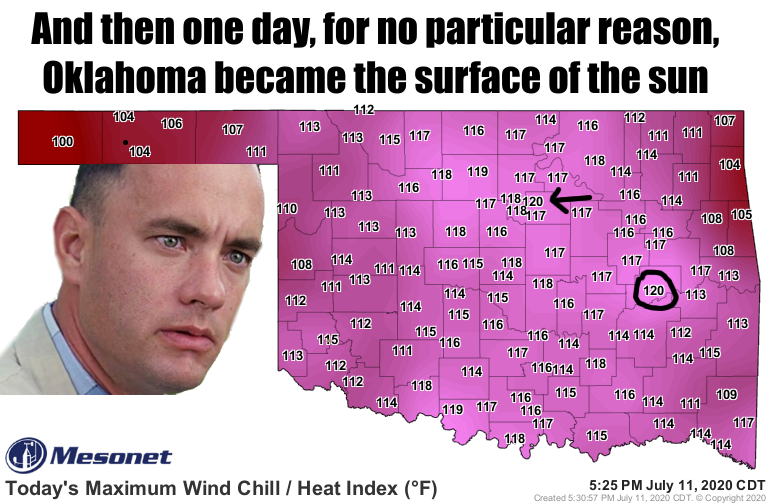
That was probably a dry heat. How about the 121.2 degrees heat index calculated
at Stillwater just a few days earlier on July 11. Word has it Pistol Pete came
down with the prickly heat that afternoon that left HIS hind end his least
favorite color in the world: crimson. We didn't *quite* catch it here, but
Forrest helped us understand what was happening. Eufaula got close to Stillwater,
but probably still got the heat rash.
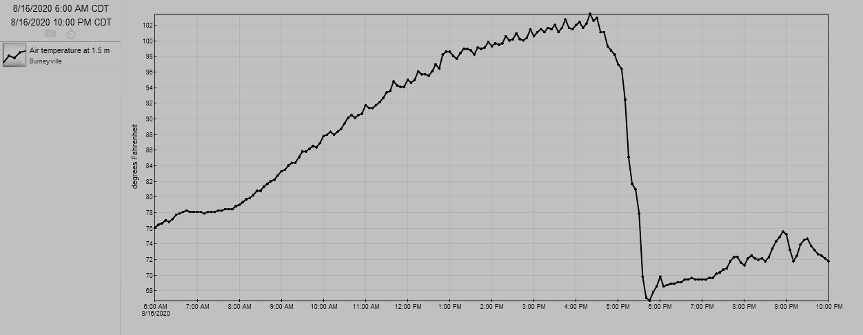
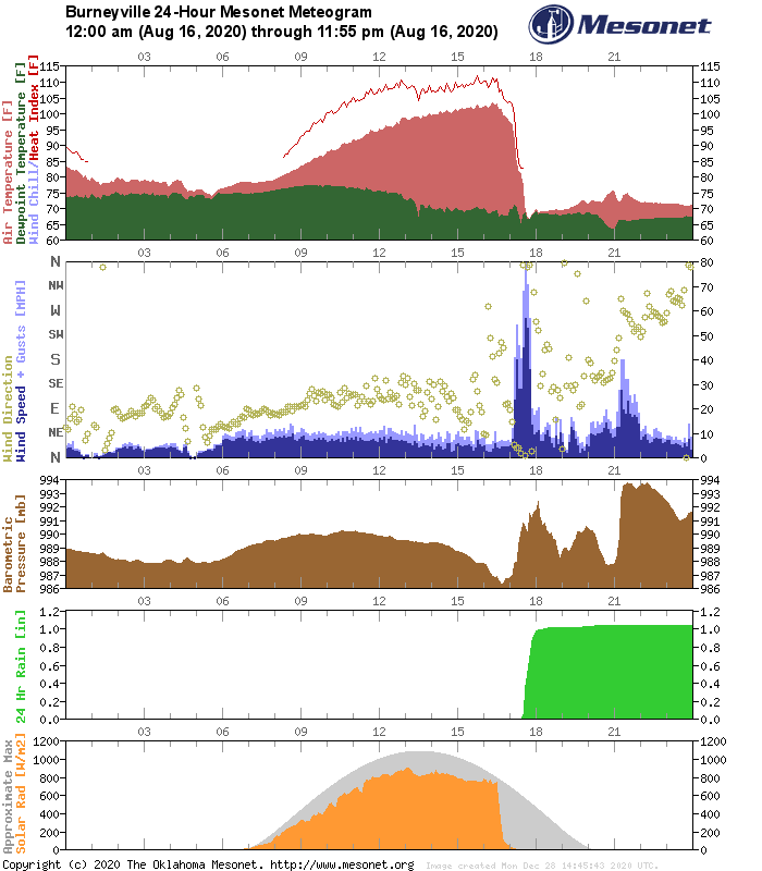
Speaking of temperatures (well, we were), how about that 1-hour temperature
drop of 32.2 degrees at Burneyville on August 16? It occurred between 4:45pm
and 5:40pm that afternoon behind a cold front that also brought a spot of rain
to the area. Check out this temperature trace for Burneyville, then the whole
meteogram. Winds gusted to nearly 80 mph as the storms rolled in!
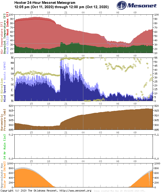
Our greatest 24-hour temperature change of 62 degrees came at Hooker between
October 11 and October 12, along with our first freeze of the year. Hooker
managed to climb to a high of 94.5 degrees on the 11th before a massive
cold front plunged their temperature down to a low of 32.5 degrees the following
morning.
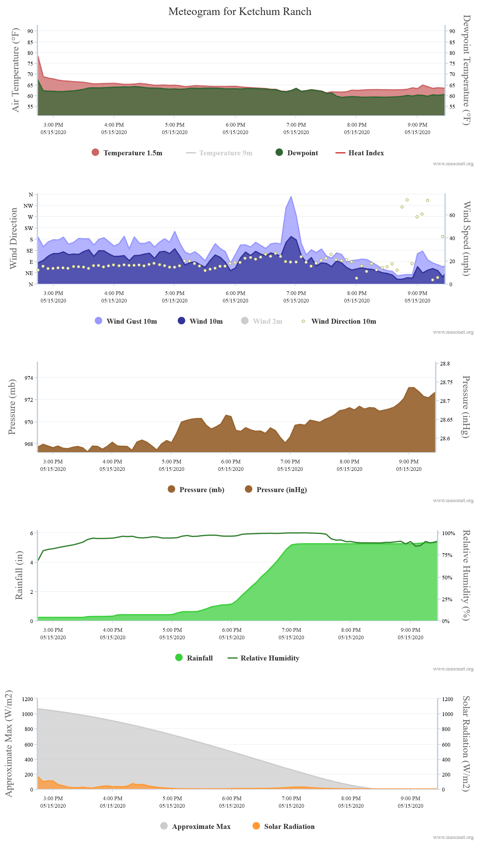
The two rainfall extremes are not too unusual of a sight here in Oklahoma, at
least since the Mesonet started keeping track of Oklahoma's weather. We are
prone to downbursts and toad stranglers like the 3.81 inches at Ketchum Ranch
on May 15.
Byar's 8.26" on September 1 came within a longer rainy period that saw some
big drought relief for southwestern Oklahoma.
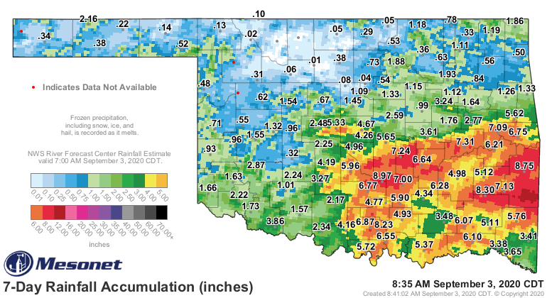
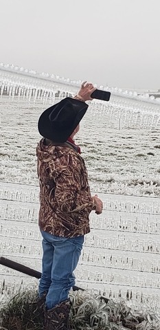
And last but definitely not least, the most 2020 extreme of all...the Historic
Ice Storm of October 25-28. To say it was the most impactful October winter
storm in our state's storied weather history would be an understatement. The
storm left more than 400,000 residences and businesses without power in western
and central Oklahoma, a swath of 4-8 inches of snow in the Panhandle, and
flooding rains across the eastern sections of the state. We'll let a previous
Ticker do our talking, but when 66% of the Mesonet's sites end up iced over,
you know your storm has gone ballistic.
http://ticker.mesonet.org/select.php?mo=11&da=01&yr=2020
So there ya have it, the Mesonet Extremes of 2020. I know we still have a few
days left in the year (OH DARN!), and there's always room to replace one of
these extremes. It *looks* like they're all safe as we enter 2021, but remember,
it's Oklahoma. Anything can happen (and it probably will).
Gary McManus
State Climatologist
Oklahoma Mesonet
Oklahoma Climatological Survey
(405) 325-2253
gmcmanus@mesonet.org
December 28 in Mesonet History
| Record | Value | Station | Year |
|---|---|---|---|
| Maximum Temperature | 82°F | HUGO | 2025 |
| Minimum Temperature | 4°F | EVAX | 2017 |
| Maximum Rainfall | 1.84 inches | PORT | 2019 |
Mesonet records begin in 1994.
Search by Date
If you're a bit off, don't worry, because just like horseshoes, “almost” counts on the Ticker website!