Ticker for July 28, 2011
MESONET TICKER ... MESONET TICKER ... MESONET TICKER ... MESONET TICKER ...
July 28, 2011 July 28, 2011 July 28, 2011 July 28, 2011
Drought, Sunshine, Heat, etc.
With the release of the new U.S. Drought Monitor map this morning, there should
be little surprise that exceptional and extreme drought continue their march to
the east.
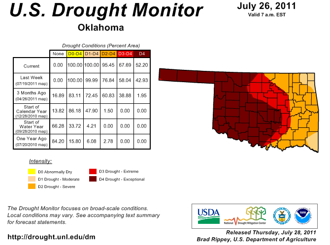
Most of central Oklahoma, including Oklahoma City, is now covered by the
exceptional drought category. We recommended those changes despite the 3" of
rain that has fallen this month at Will Rogers Airport. Typical of summer rains,
that generous total is very localized and an outlier. Our OKC Mesonet stations
have received just a tad less.
OKC West: 1.49"
OKC North: 0.35"
OKC East: 1.22"
Spencer: 0.63"
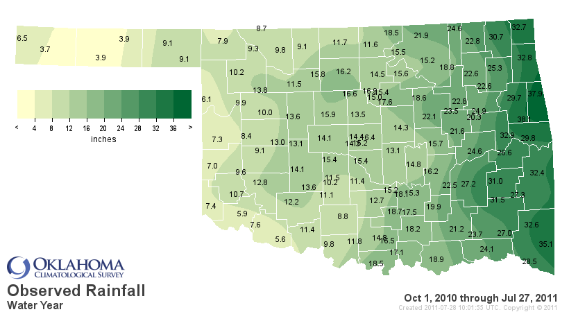
For July thus far, the Mesonet stations at Burneyville, Ringling and Walters
have yet to receive a drop of rainfall, putting things in perspective. Through
July 28, the month is ranked as the third driest such period back to 1921 with
an average of 0.63", 1.84" below normal. Driest? 1980. What a shock!
The water year to date (Oct 1-July 28) now rank as the driest such period on
record going back to 1921 across the state.By region, it's also the driest such
period back to 1921 for the Panhandle, N. Central, W. Central, Central and
Southwest climate divisions.
Climate Div. Total Dep. from Normal Pct of Normal Rank since 1921
Panhandle 6.26" -10.12" 38% 1st driest
N. Central 12.36" -12.72" 49% 1st driest
Northeast 23.23" -10.37" 69% 10th driest
W. Central 9.76" -13.30" 42% 1st driest
Central 14.97" -15.95" 48% 1st driest
E. Central 26.98" -10.89" 71% 12th driest
Southwest 10.40" -14.04" 43% 1st driest
S. Central 16.08" -17.68" 48% 3rd driest
Southeast 29.31" -13.89" 68% 7th driest
Statewide 16.45" -13.31" 55% 1st driest
Oh by the way, Boise City has received 3.7" of rain since October 1, 2010. Yeah,
you read that right.
*************************************
Sunshine
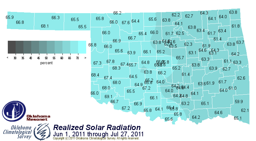
The Oklahoma Mesonet's solar radiation data dates back to 1994. Looking back
at all the June-July solar radiation periods, the amount of possible solar
radiation received at the surface this June-July is easily the highest of any
similar period since 1994 at 64.7%
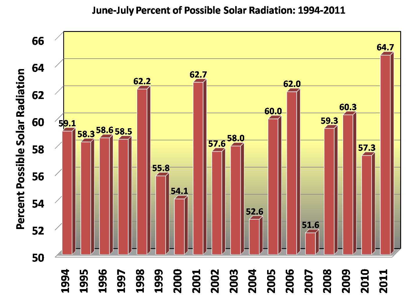
The lowest was 2007's 51.6%, aided by the wettest June on record in Oklahoma
and a wet July as well. The leaders are not surprising ... 1998, 2001, 2006
and 2011. All years with summertime drought periods.
**************************************
Heat
There are so many heat broken heat records to choose from I feel like an
assassin in an apothecary. I would have said a kid in a candy store but there is
little joy in our current situation (I have the electric bill to prove it). I'll
go with a biggie ... July 2011 is poised to become the warmest month on record
in Oklahoma, for any month. July 1954 holds the current record with an average
temperature of 88.1 degrees. Through July 28, the average temperature this July
was 89 degrees. The record is sure to fall with only two days left in the
month. The average high temperature during July across the state was 102.9
degrees.
Following the second warmest June on record, we're also going to shatter the
record average temperature for June-July. Currently we are sitting at a
statewide average temperature of 86.3 degrees. The previous record was 84.6
degrees in 1934. SHATTERED, I TELL YA! Next up? The warmest summer mark of
85.2 degrees set back in 1934.
***************************************
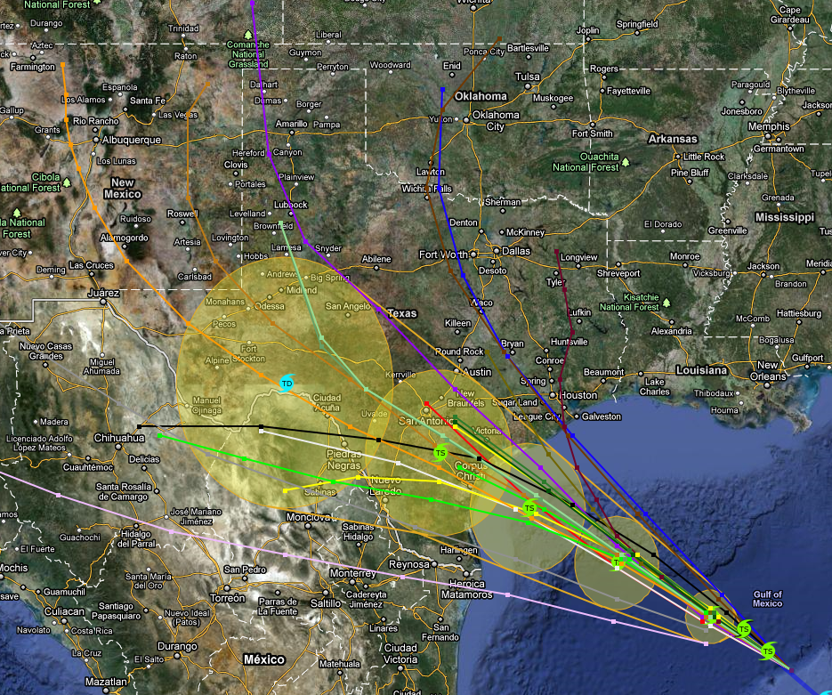
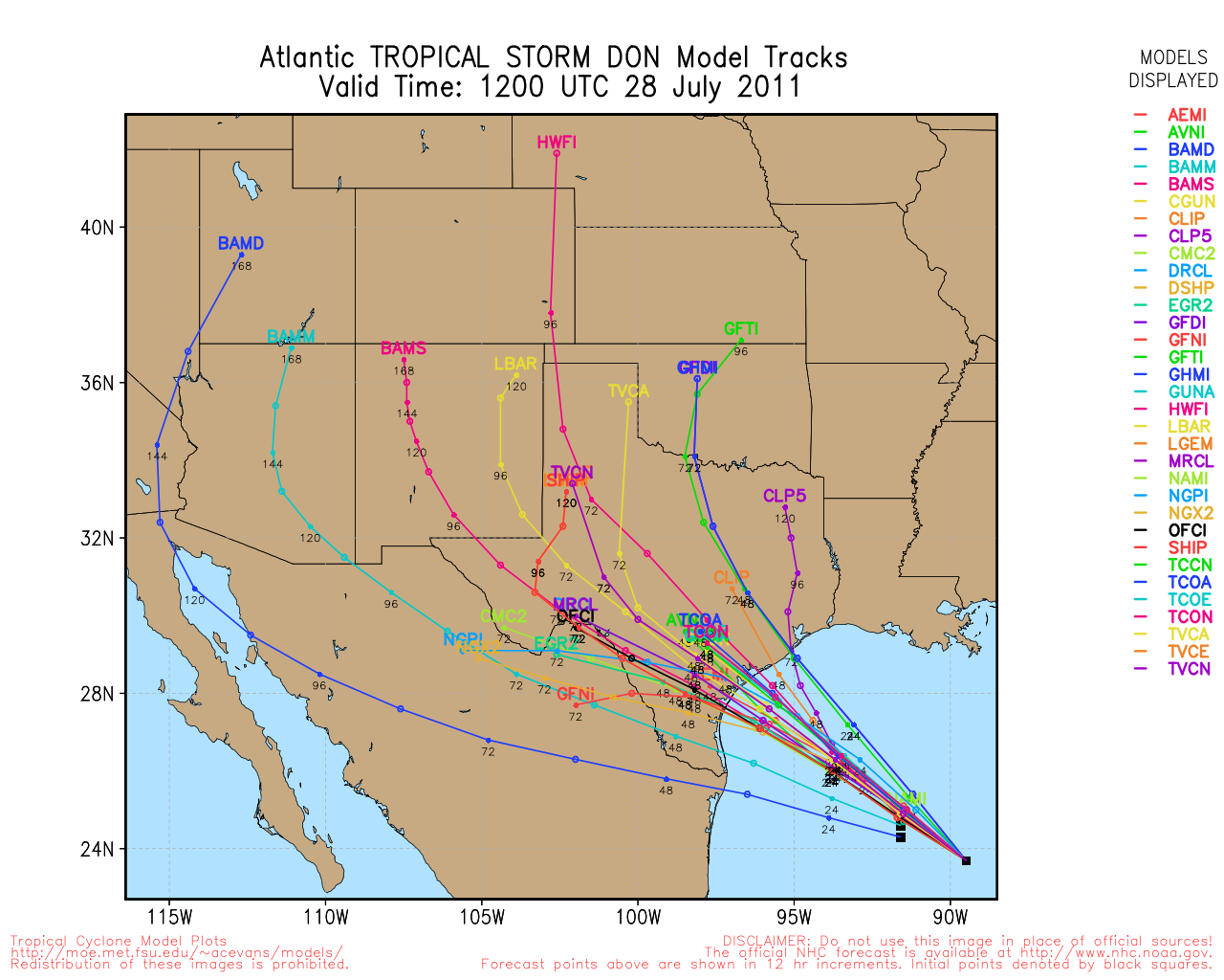
It's the most important rose ceremony yet (my wife made me watch that show, I
swear) and Don appears close to choosing New Mexico over Oklahoma. I refuse to
give up hope, however. I've seen way too many crazy things with these tropical
tracks to discount a curve back over Oklahoma at some point in the future.
Gary McManus
Associate State Climatologist
Oklahoma Climatological Survey
(405) 325-2253
gmcmanus@mesonet.org
July 28 in Mesonet History
| Record | Value | Station | Year |
|---|---|---|---|
| Maximum Temperature | 109°F | GRA2 | 2008 |
| Minimum Temperature | 47°F | MANG | 2005 |
| Maximum Rainfall | 3.50 inches | ALV2 | 2002 |
Mesonet records begin in 1994.
Search by Date
If you're a bit off, don't worry, because just like horseshoes, “almost” counts on the Ticker website!