Ticker for June 28, 2023
MESONET TICKER ... MESONET TICKER ... MESONET TICKER ... MESONET TICKER ...
June 28, 2023 June 28, 2023 June 28, 2023 June 28, 2023
Meltage
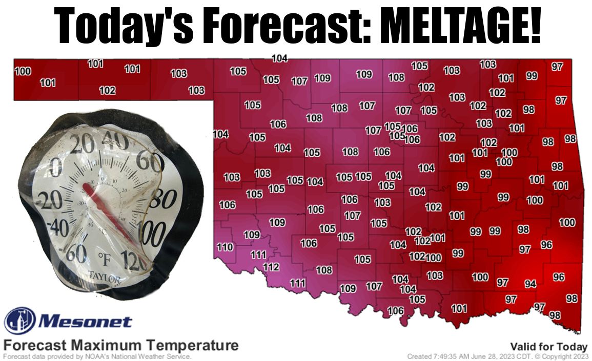
DARN! I knew I should have saved that "Your state is gonna burn" meme from "Legion"
for when it gets REALLY hot. OH well...easy-meme easy-go. We'll just go with the
old melted thermometer bit for today, which will provide us with the hottest day
in Oklahoma since July 19 of last year. Remember that day? If your answer is "no,"
then let me refresh your memory. You can thank me later.
Okay, technically it's later, so you're welcome. I don't think we'll see a 115
today, but if we do that will tie the highest temperature ever recorded by the
Mesonet and we'll have to go down to the decimal point to see who wins. Here are
the winners thus far:
Buffalo 115.2 July 9, 2009
Kingfisher 115.0 Aug. 1, 2012
Wilburton 115.0 Aug. 3, 2011
Hollis 115.0 June 26, 2011
Mangum 114.8 July 19, 2022
Wister 114.6 Aug. 3, 2011
Erick 114.6 June 26, 2011
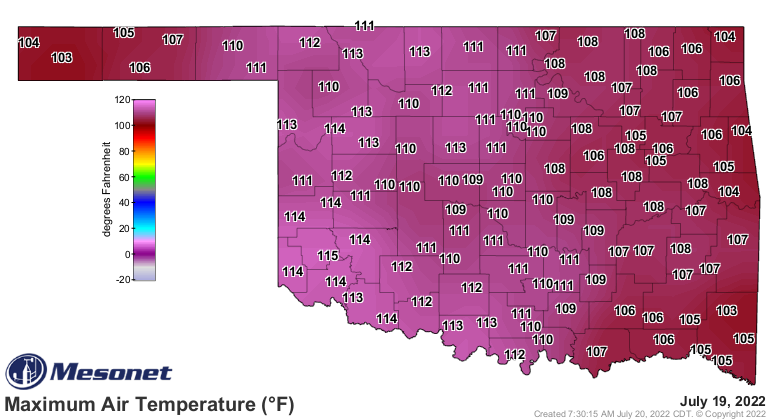
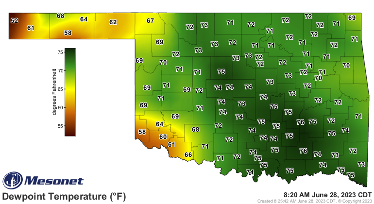
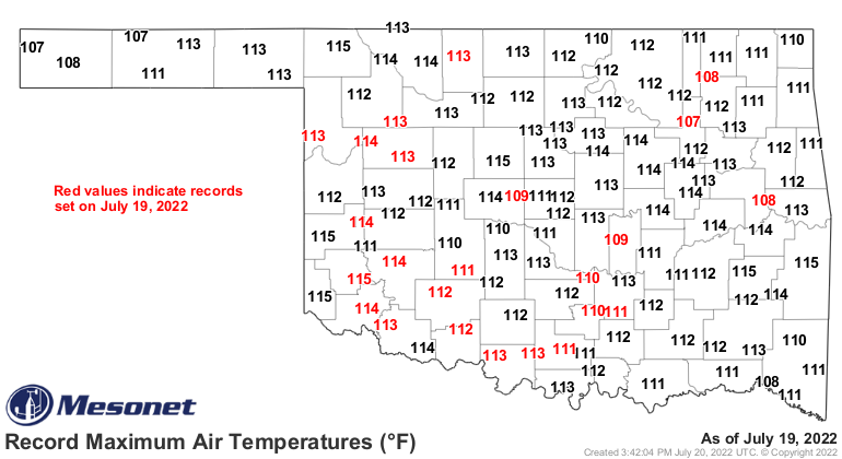
Remember, that was also the first time ALL Mesonet sites reached at least 103
degrees, a feat that won't be accomplished today because of the higher dewpoint
temperatures across eastern OK. They're pretty high in most places right now,
but later today the winds are gonna switch over to the SW and push that moisture
back, and the downslope winds off the higher elevations in West Texas are gonna
compress that air as it dries out, causing temperatures to soar. We could possibly
set some records today, but given the time of year, the bar is set pretty high.
The Mesonet's all-time highs might be threatened in some locations (values in
red were set on July 19 last year).
Eastern OK won't get off easy just because the actual air temperature will
remain in the 90s. Those SW winds might clear the moisture out of western OK,
but it will still be swampy to the east and the heat index values will follow
into the 110-115 degrees range.
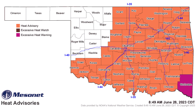
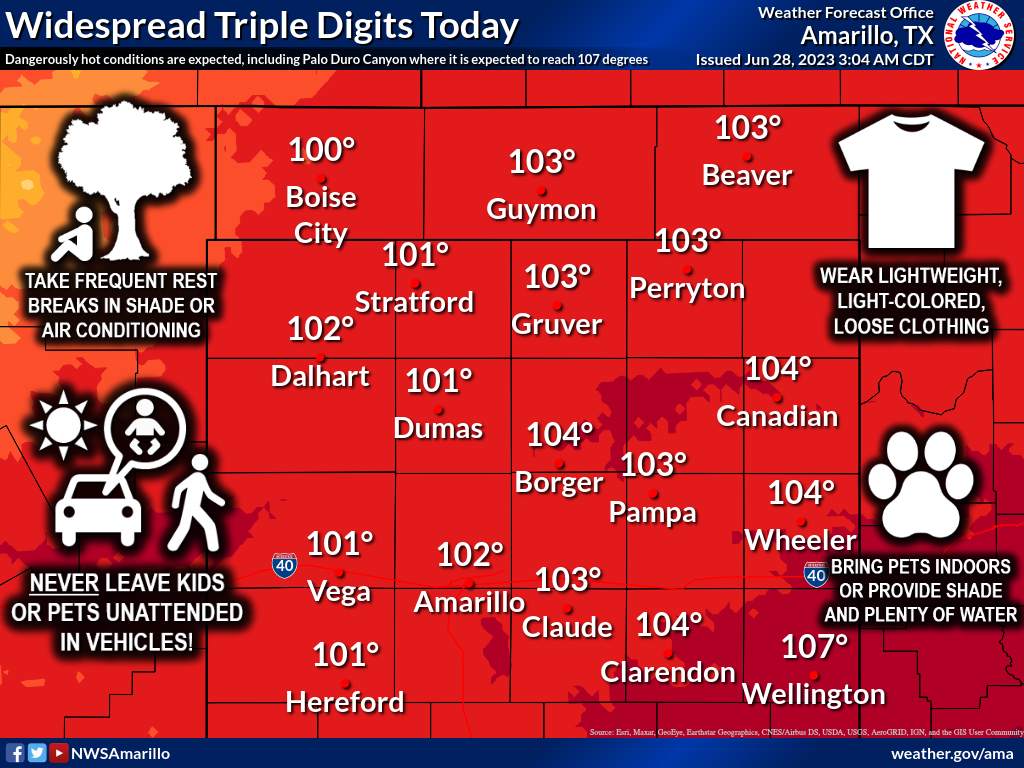
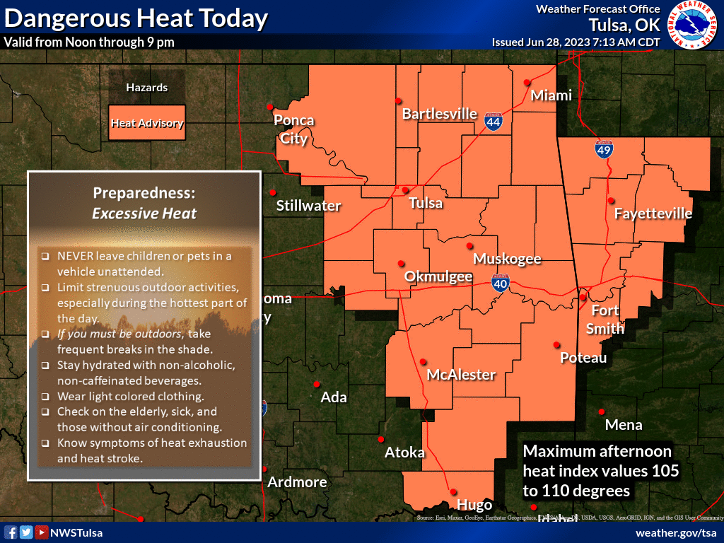
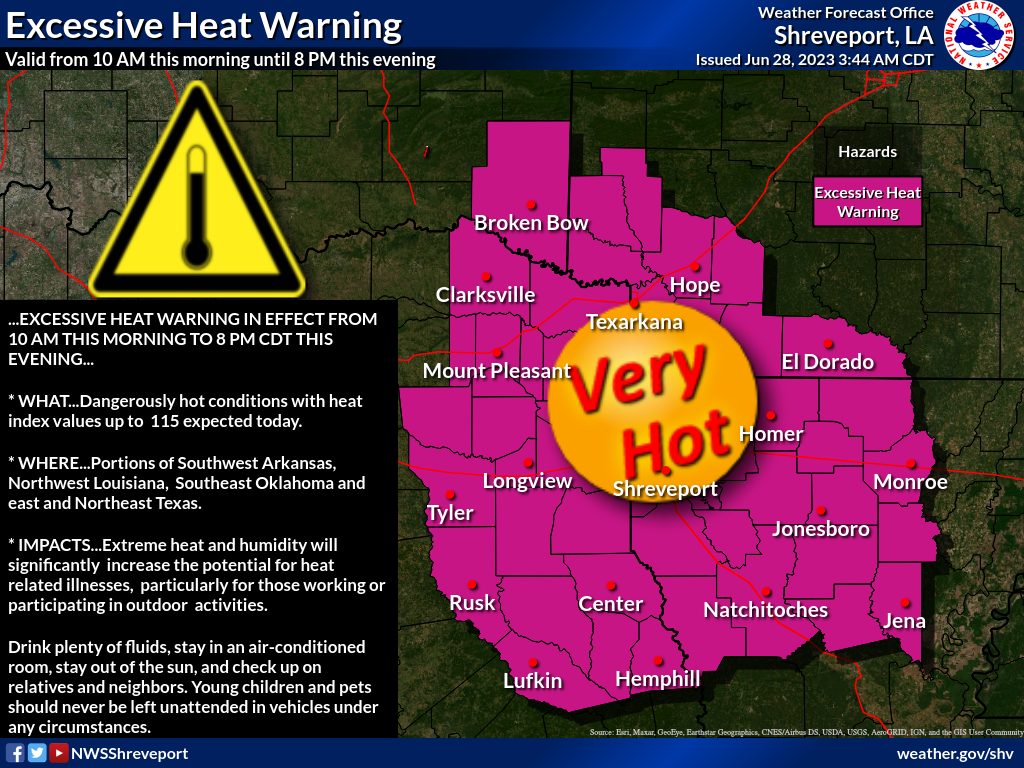
Here are all the proper cautionary tales from the local NWS offices, warning
you of the perils of heat, which you should definitely heed (English to Okie
dictionary: listen to).

Silver linings? Well, today will be the hottest of the week.
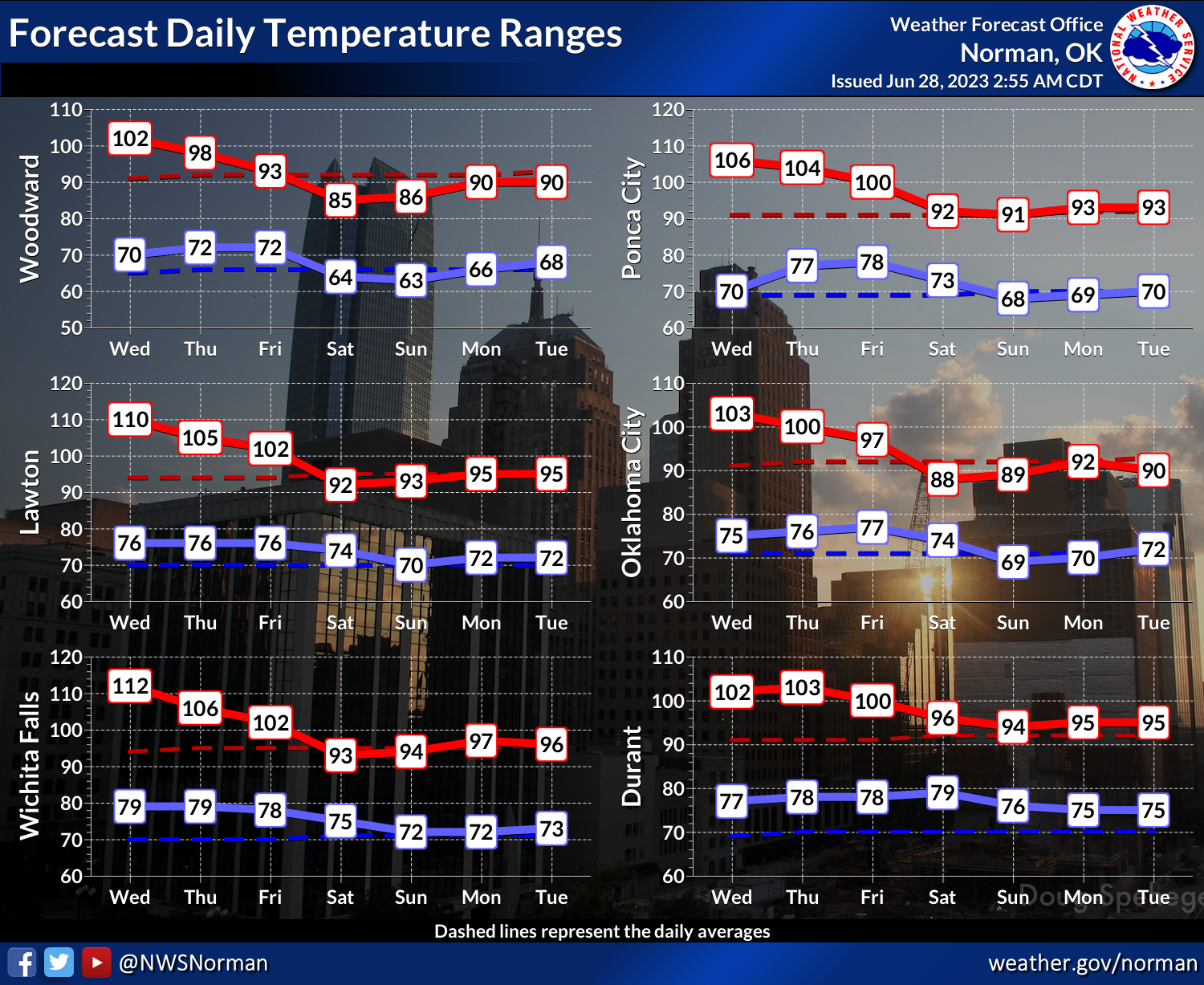
Gold lining? Look at Saturday!

And July 4 ain't looking too bad itself.
Ironically, TODAY will be the firecracker. Don't melt your fingers off.
Gary McManus
State Climatologist
Oklahoma Mesonet
Oklahoma Climatological Survey
gmcmanus@mesonet.org
June 28 in Mesonet History
| Record | Value | Station | Year |
|---|---|---|---|
| Maximum Temperature | 113°F | ALTU | 2023 |
| Minimum Temperature | 48°F | EVAX | 2022 |
| Maximum Rainfall | 3.95 inches | WEST | 2000 |
Mesonet records begin in 1994.
Search by Date
If you're a bit off, don't worry, because just like horseshoes, “almost” counts on the Ticker website!