MESONET TICKER ... MESONET TICKER ... MESONET TICKER ... MESONET TICKER ...
October 27, 2023 October 27, 2023 October 27, 2023 October 27, 2023
The Colding
https://ticker.mesonet.org/archive/20231027/current-wind.chills.png
Hey, come on. It's Halloween.
No, you don't get it...this isn't just some minor blast of cold air. Well, today
and part of tomorrow it is, but when that Arctic air comes screaming through
tomorrow night, that will mean at LEAST 4 days of lows below freezing for
virtually the entire state. This air mass poised to the northwest is actually
gonna be colder than we first thought, with lows in the teens to low 20s in the
NW to the mid-to-upper-20s (HYPHEN-MADNESS!!) as far down as SE OK. Wait, is SE
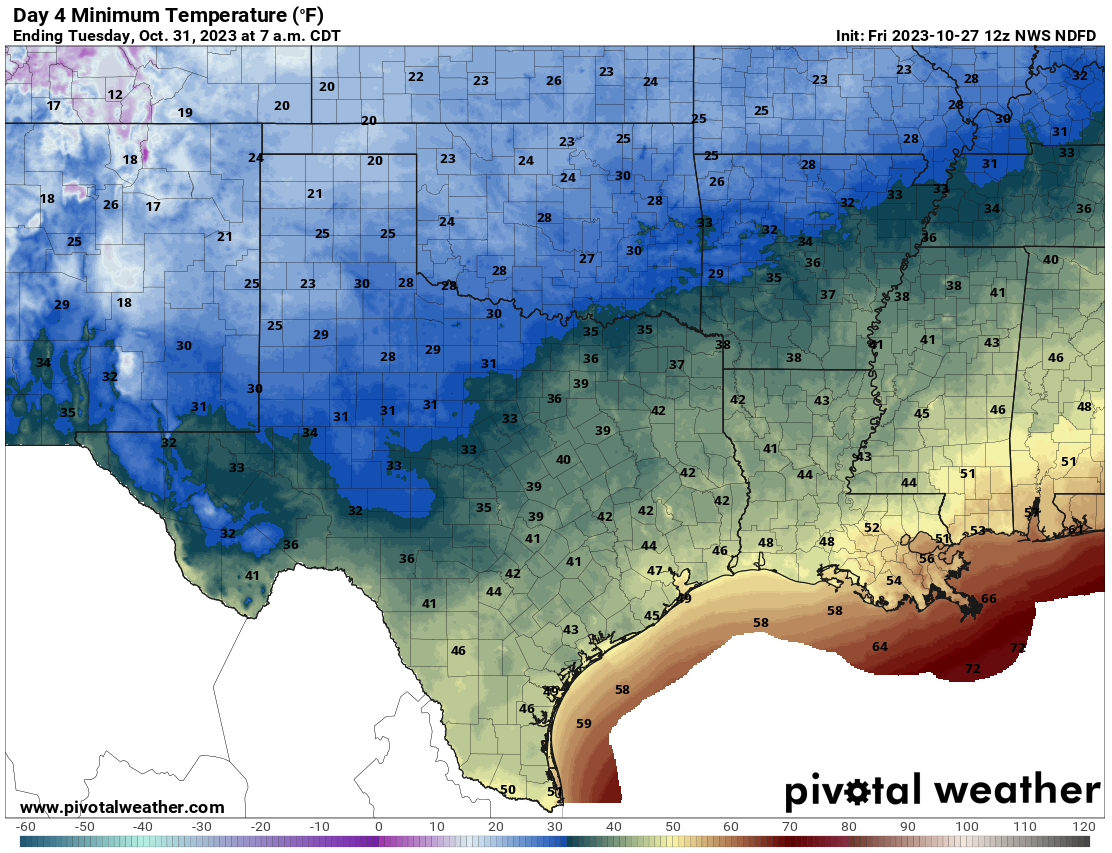
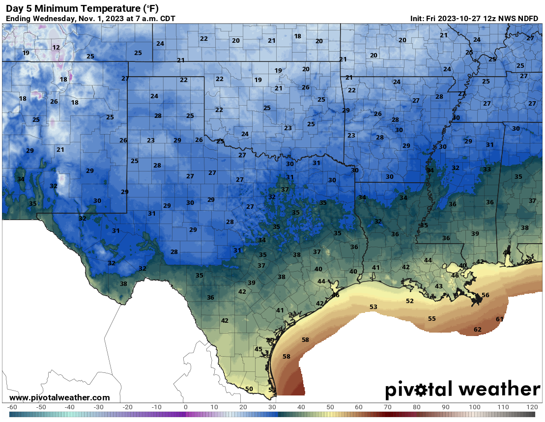
OK up or down? Oh well, check out the low temp maps.
https://ticker.mesonet.org/archive/20231027/sunday-lows.png
https://ticker.mesonet.org/archive/20231027/monday-lows.png
https://ticker.mesonet.org/archive/20231027/tuesday-lows.png
https://ticker.mesonet.org/archive/20231027/wednesday-lows.png
Shouldn't there be a longer grace period than Friday and half of Saturday?? I mean,
we're going from highs in the 80s, a short period of transition, then full-on
winter for crying out loud! Forgot the "heck," but dire times can cause these
types of slip-ups.
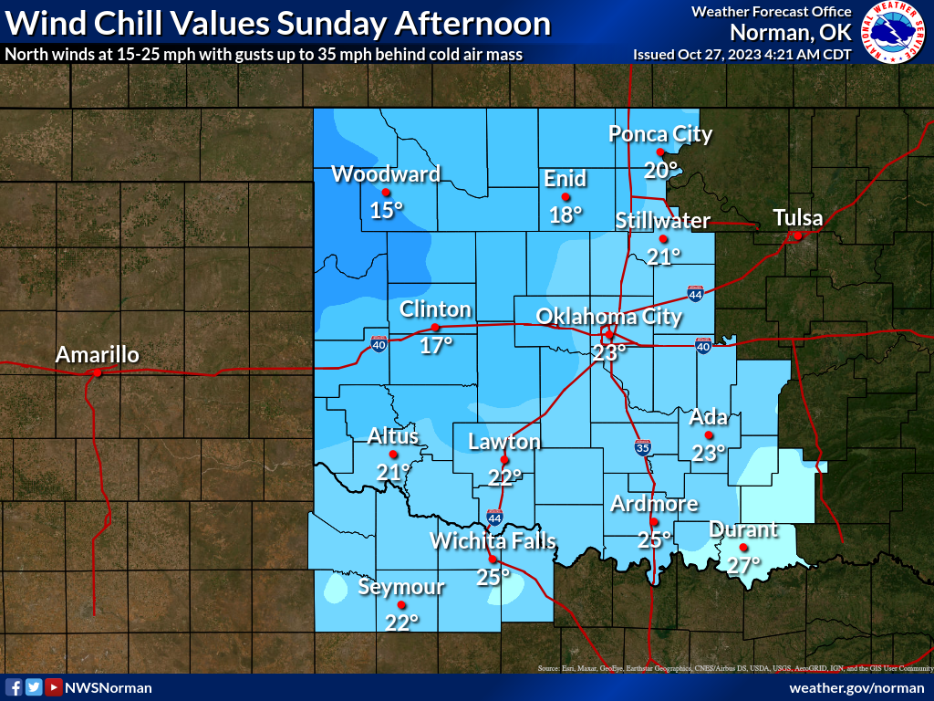
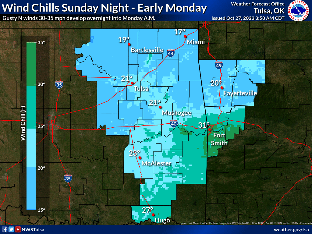
And the wind chills? Forget it! We're talking wind chills down in the teens
and lower 20s on Sunday afternoon.
https://ticker.mesonet.org/archive/20231027/nws-norman-sunday-wind.chills.png
https://ticker.mesonet.org/archive/20231027/nws-tulsa-sunday-wind.chills.png
https://ticker.mesonet.org/archive/20231027/nws-ama-sunday-wind.chills.png
That's not right! Mother Nature is like a crazy person, giving us this abrupt
of a winter transition. Spring doesn't do this to us. Summer doesn't do this
to us. Even winter doesn't do this to us, because it's already winter. Okay,
spring actually can and does do this to us, but it's different coming OUT of
winter to take a step back in than it is to just get through with 6 months of
warm weather and get plunged in, and besides why would I ruin a good rant with
facts and stuff! And I fully understand that most of you reading this are
disagreeing heartily, cold weather lovers that you are. That's allowed. Heck,
some people like STRAWBERRY Pop-Tarts for crying out loud!
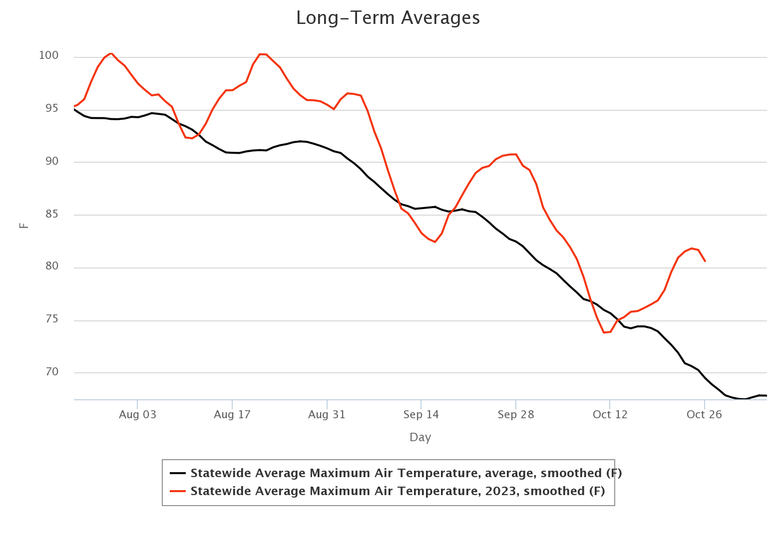
I remembered the "heck." I feel more rational already. But here's the deal
spelled out in this graph...since July 21, we've been almost exculsively
above normal high temperature-wise. You probably didn't realize that, JUST LIKE
YOU DIDN'T REALIZE I MISSPELLED "EXCLUSIVELY!"
https://ticker.mesonet.org/archive/20231027/statewide-hghs-since-july21.png
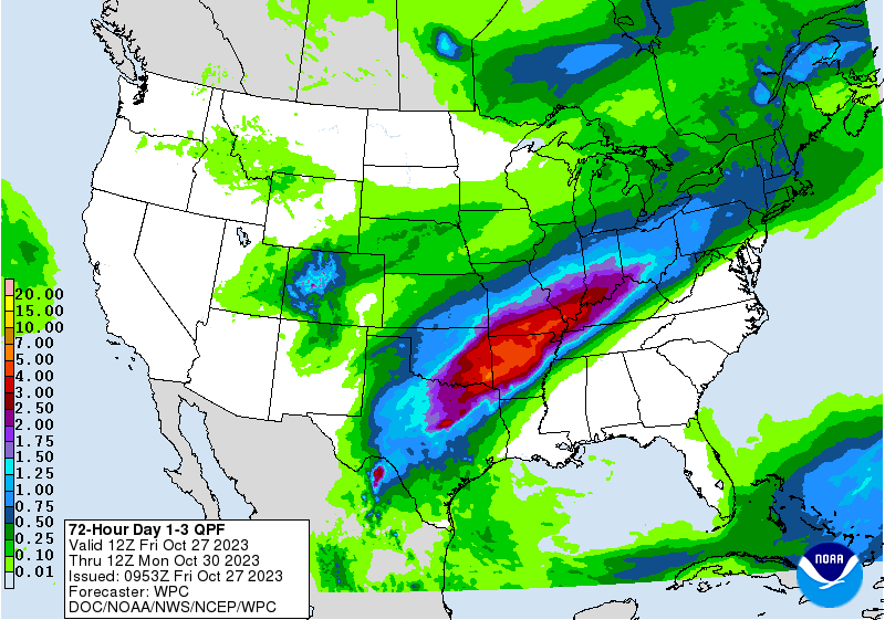
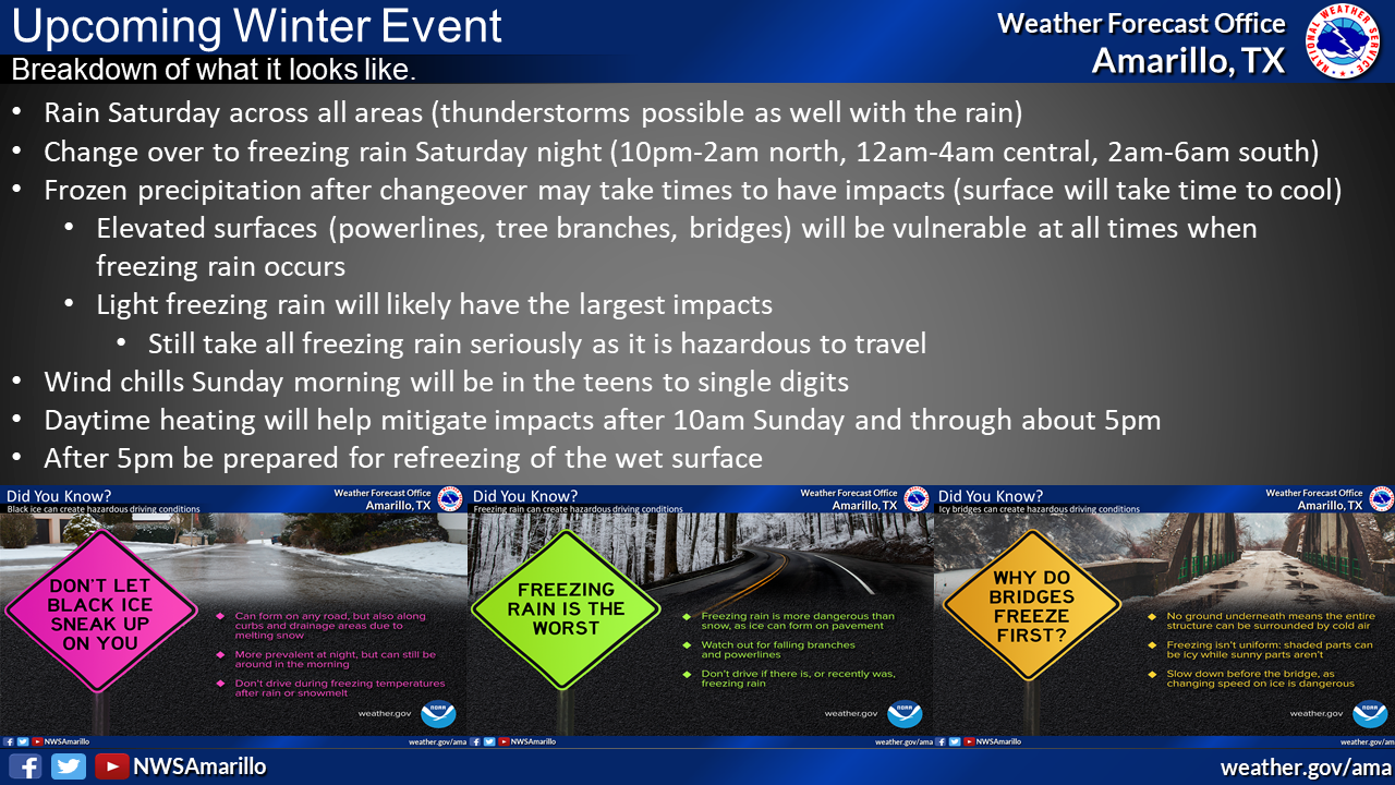
The good news is that there is some more moisture coming with the storm system
today and tomorrow, and into Sunday morning.
https://ticker.mesonet.org/archive/20231027/3day-precp-forecast.gif
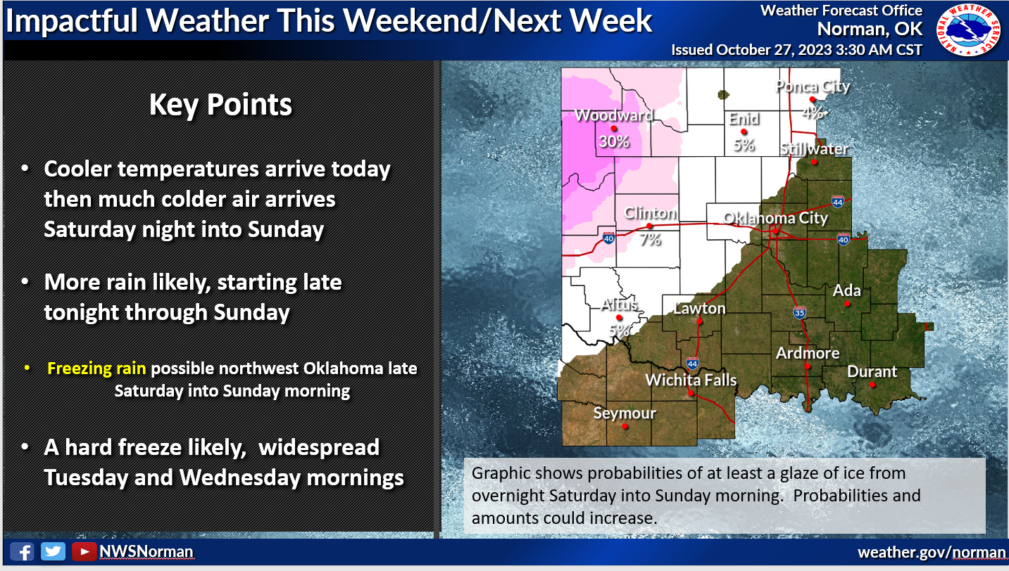
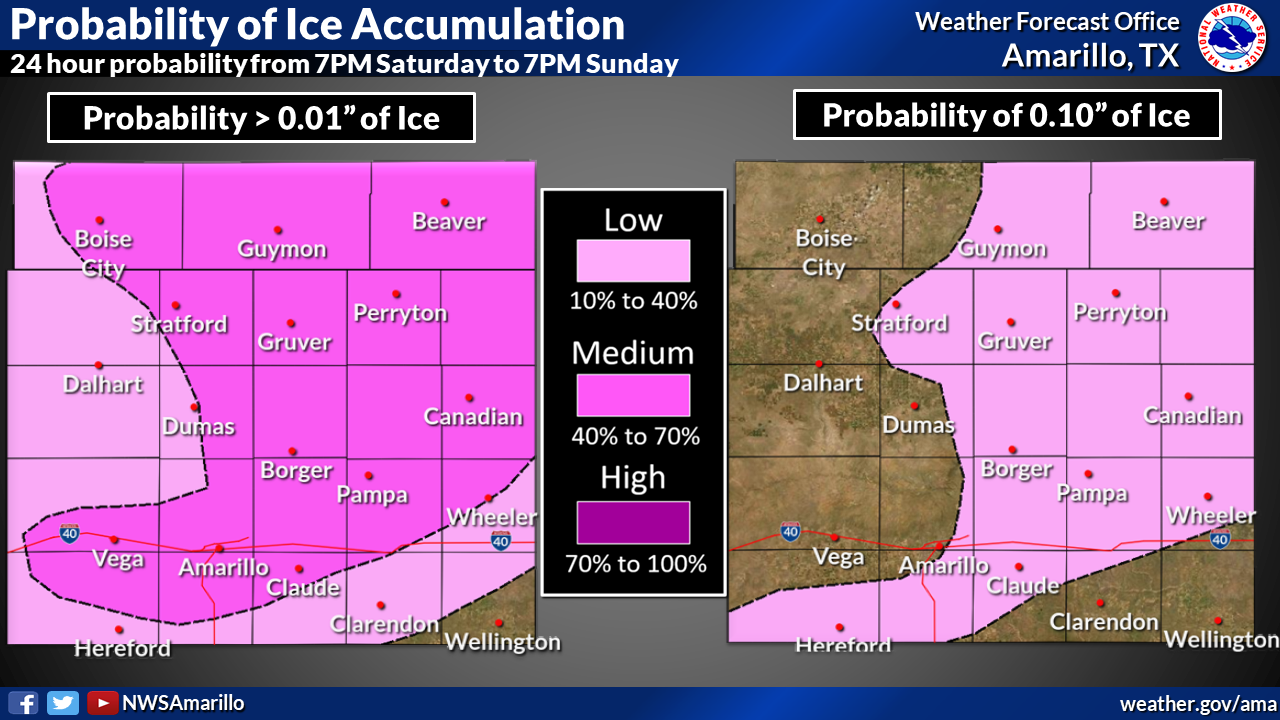
The bad news is it still appears ice is possible up in NW OK and the Panhandle
(do YOU want to call the Panhandle "NW OK"?? Good luck!) Saturday night into
Sunday morning.
https://ticker.mesonet.org/archive/20231027/nws-norman-freezing.rain.png
https://ticker.mesonet.org/archive/20231027/nws-amarillo-ice.png
https://ticker.mesonet.org/archive/20231027/nws-amarillo-arctic-blast.png
We actually do start to warm back up eventually. Imagine that.
https://ticker.mesonet.org/archive/20231027/nov3-9-temp-outlook.png
Okay, rant over. I feel better. But that's only because I haven't stepped
outside yet.
Gary McManus
State Climatologist
Oklahoma Mesonet
Oklahoma Climatological Survey
gmcmanus@mesonet.org
==================================================
The OCS/Mesonet Ticker
https://ticker.mesonet.org/
To subscribe or unsubscribe from the Ticker
or for questions about the Ticker or its content
Phone or Email the Ticker Manager at OCS
Phone: 405-325-2253 Email: ticker@mesonet.org
---------------------------------------------------
-C- Copyright 2024 Oklahoma Climatological Survey
===================================================
|


 Tweet
Tweet