MESONET TICKER ... MESONET TICKER ... MESONET TICKER ... MESONET TICKER ...
July 27, 2020 July 27, 2020 July 27, 2020 July 27, 2020
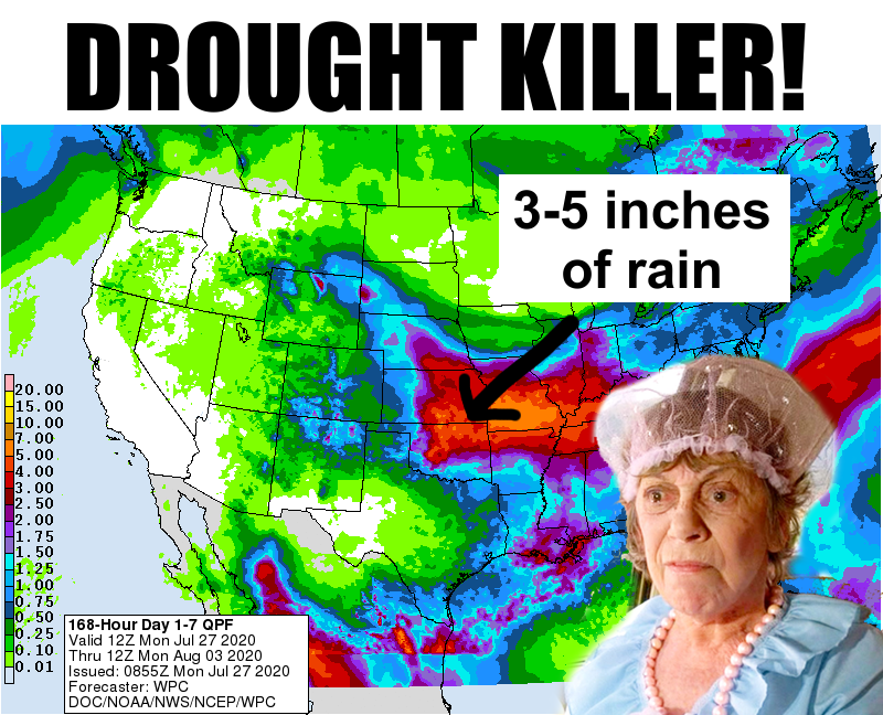
Drought killer!
http://ticker.mesonet.org/archive/20200727/ZOUNDS.png
REAL July rainfall, Eddie?
Nothing but the best, Clark!
You asked for a miracle, Theo, I give you, uhhhh, late July?
Can you get flagged for a "Die Hard" quote directly after a "Vacation" quote? Hey,
it's 2020...all bets are off!
We have a cold front entering northwestern Oklahoma as we speak, which will
interact with all this rich Gulf moisture in place and set us off a nice round of
showers and storms over the next two days. You can see the cold front creeping
into northern Oklahoma in the Mesonet's wind field.
http://ticker.mesonet.org/archive/20200727/current.gustarrows.gif
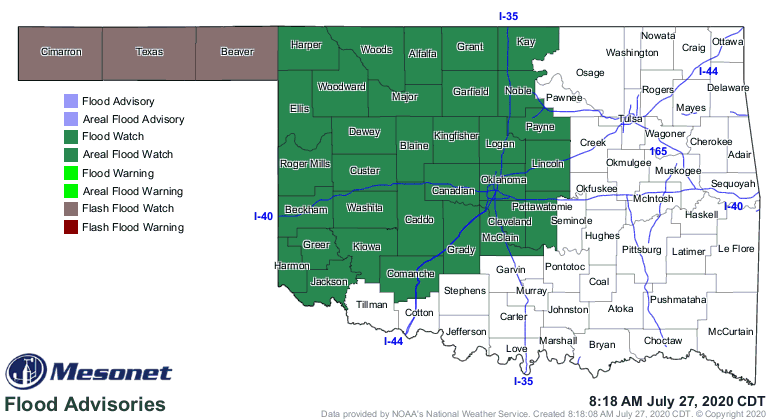
The NWS forecasters are expecting enough rainfall over the next two days to
warrant a flash flood watch in the Panhandle (yeah, WOW indeed) and an areal
flood watch over much of western Oklahoma.
http://ticker.mesonet.org/archive/20200727/latest.oklahoma.flood.gif
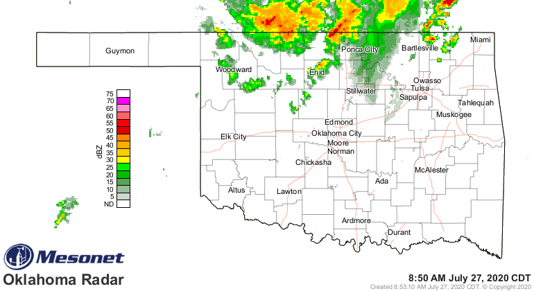
Heck, it's raining RIGHT NOW!
http://ticker.mesonet.org/archive/20200727/current-radar.png
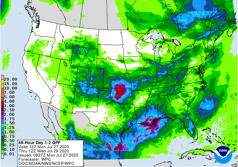
We don't see those watches across eastern Oklahoma yet. The big rains tonight
into tomorrow appear to be in north central and central Oklahoma.
http://ticker.mesonet.org/archive/20200727/mon-tue-forecast-rains.gif
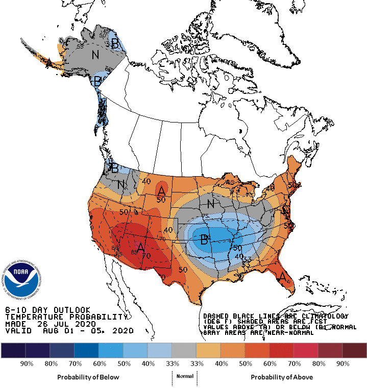
We will then get into a northwesterly flow pattern which will see several
storm systems rotate up and over a high pressure ridge to our west and move
over the state, setting off more showers and storms. That should add to their
(and everybody else's) rainfall totals as we get into the weekend. And this
could extend into next week.
http://ticker.mesonet.org/archive/20200727/aug1-5-precip-outlook.gif
One of the biggest benefits, above and beyond the hopefully drought-quenching
rains over parts of the state, will be a more fall-like temperature regime.
Highs in the 80s...in late July? Dang!
http://ticker.mesonet.org/archive/20200727/tuesday-forecast-highs.png
http://ticker.mesonet.org/archive/20200727/friday-forecast-highs.png
And once again, this cooler trend could extend into next week.
http://ticker.mesonet.org/archive/20200727/aug1-5-temp-outlook.gif
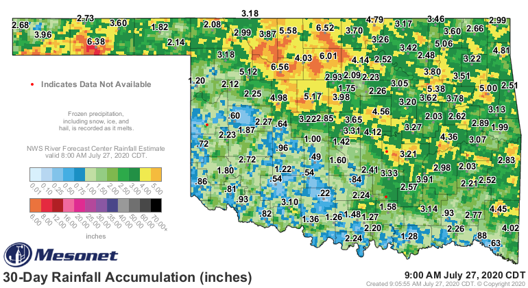
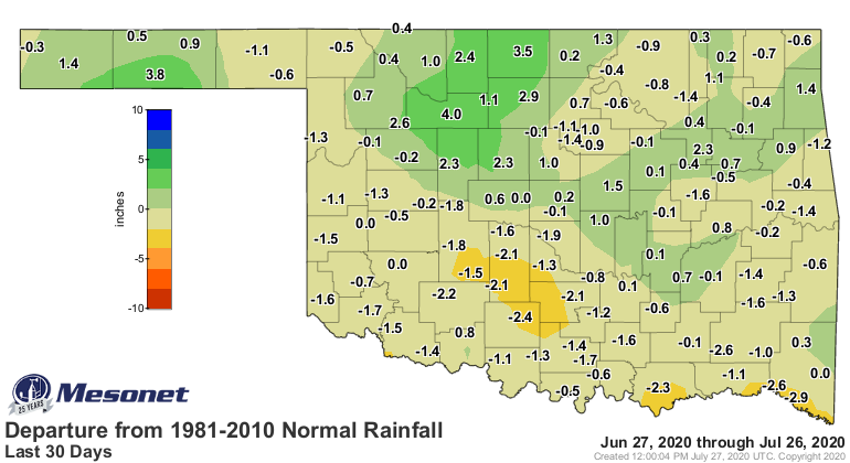
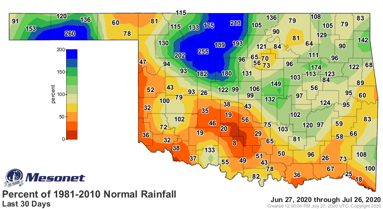
We would like to see more rain in southwestern and south central Oklahoma, our
newest drought hotspots.
http://ticker.mesonet.org/archive/20200727/30day-rain-totals.png
http://ticker.mesonet.org/archive/20200727/30days.norm_dep.png
http://ticker.mesonet.org/archive/20200727/30days.norm_pct.png
So this is incredible for late July and early August, our hottest part of the
year historically.
http://ticker.mesonet.org/archive/20200727/mesonet-longterm.avg-max.temps.png
Don't worry about eating any soggy sandwiches this week. Probably just the rain.
TURN AROUND, DON'T DROWN!
Gary McManus
State Climatologist
Oklahoma Mesonet
Oklahoma Climatological Survey
(405) 325-2253
gmcmanus@mesonet.org
==================================================
The OCS/Mesonet Ticker
https://ticker.mesonet.org/
To subscribe or unsubscribe from the Ticker
or for questions about the Ticker or its content
Phone or Email the Ticker Manager at OCS
Phone: 405-325-2253 Email: ticker@mesonet.org
---------------------------------------------------
-C- Copyright 2024 Oklahoma Climatological Survey
===================================================
|


 Tweet
Tweet