MESONET TICKER ... MESONET TICKER ... MESONET TICKER ... MESONET TICKER ...
October 26, 2023 October 26, 2023 October 26, 2023 October 26, 2023
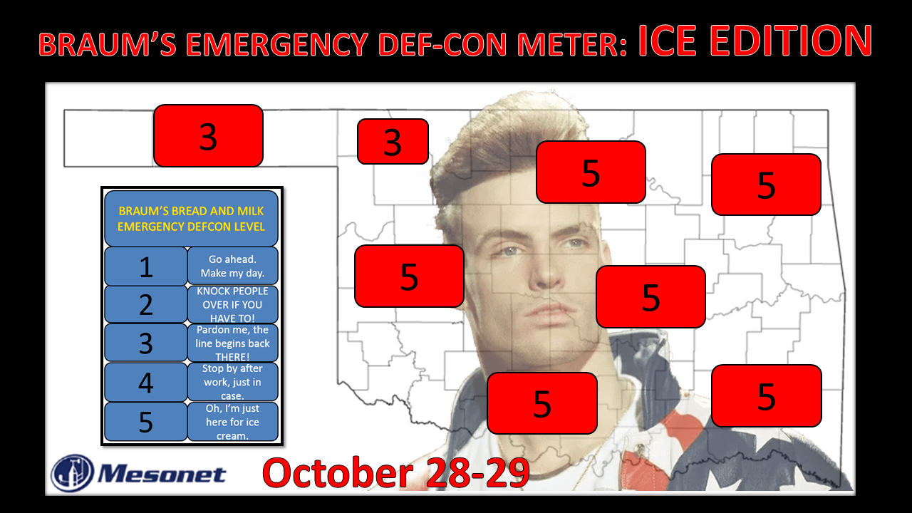
Of bread and milk
https://ticker.mesonet.org/archive/20231026/Braums-DEFCON-meter-Oct28.29-2023.png
Ice is a wonderful thing, ain't it? It's lovely in a soft drink, divine when
swirled into a slushee (slurpie, icie, ect.), and even works in a pinch if your
milk isn't cold enough to quench the fire of the lava-like cherry wonder in a
Pop-Tart fresh out of the toaster.
Know when it flat out sucks (scientific slang for "suckius the mostiest")?
WHEN IT'S ON THE ROAD!
Oh, I've told the story before of how I was duped by not paying attention to the
potential wet bulb cooling on a day when it was close to freezing AND drizzling,
how I foolishly drove my wife and I up to the movies at AMC Quail Springs that
evening from Norman only to come out of the mall and find everything coated in a
very fine (NOT FINE!) layer of ice.
Yada yada yada 2 hours and frayed nerves later, we made it home.
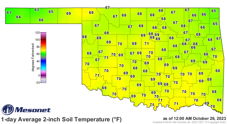
So let's just get our first Braums Emergency DEF-CON Meter for the season out
of the way, shall we? The threat is some possible freezing rain and sleet across
far NW OK and the Panhandle. Yes, ground temperatures are quite warm at the
moment.
https://ticker.mesonet.org/archive/20231026/2inch-soil-temps.png
But here's the deal...that part of the state is gonna get a cold front Friday
that will knock them back to winter in a hurry, with a reinforcing blast of
cold air Saturday night into Sunday. Those ground temps will drop in a hurry.
https://ticker.mesonet.org/archive/20231026/saturday-lows.png
https://ticker.mesonet.org/archive/20231026/sunday-lows.png
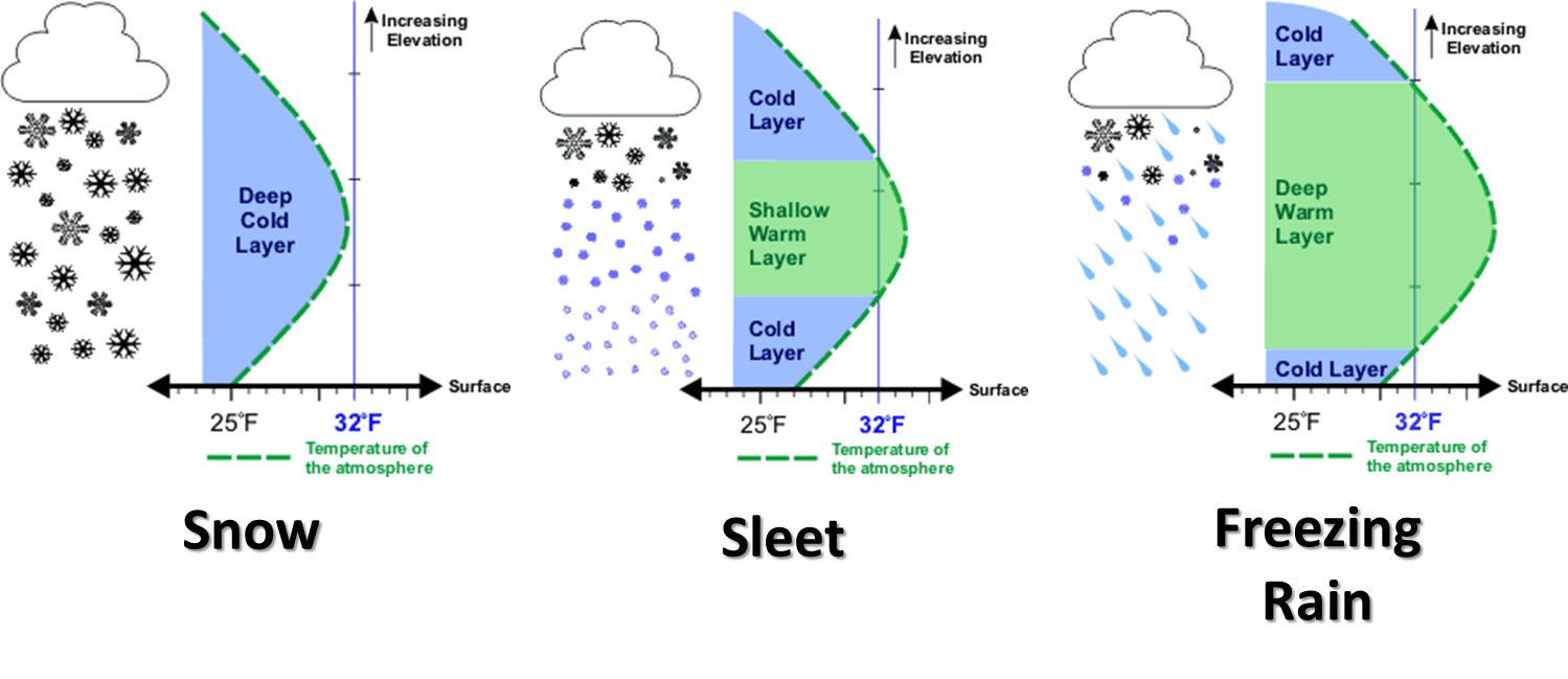
When this second front blasts through, you're gonna be left with a shallow layer
of cold air, and a layer of warm air above it while precipitation is falling.
The thickness of that warm layer above the surface and the thickness of the
freezing layer BELOW that warm layer will determine the precip type...sleet,
freezing rain, snow, or just a plain cold rain. Rhyme unintended.
https://ticker.mesonet.org/archive/20131125/winter-precip-types.png
And always good to remember this storm system is still several days away, so
it could definitely change.
https://ticker.mesonet.org/archive/20221021/forecasting-chaos.png
Now when folks hear that, they always think that means the forecast will change
for the better, but it could actually mean it gets worse. Time will tell. But
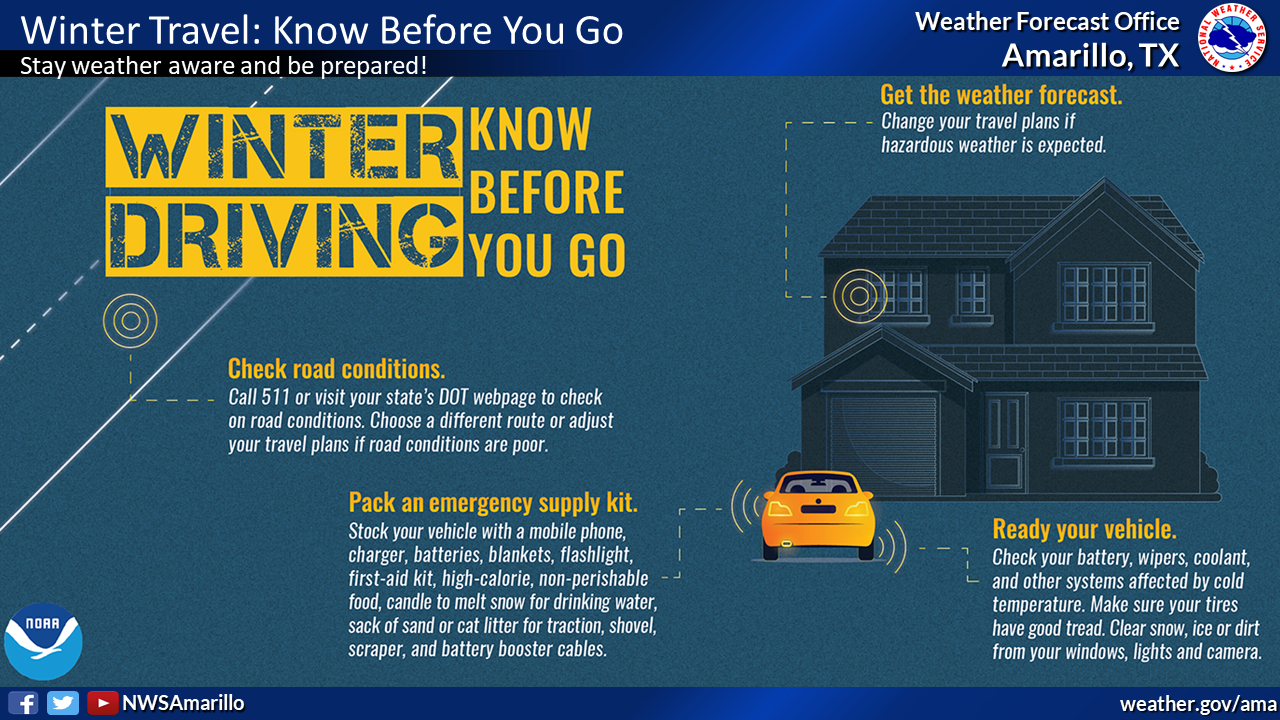
after all that caution, I'd say bridges and overpasses could be quite dangerous
for a time late Saturday night into Sunday morning, so caution is advised.
https://ticker.mesonet.org/archive/20231026/nws-norman-sunday-ice.png
https://ticker.mesonet.org/archive/20231026/nws-amarillo-winter-driving.png
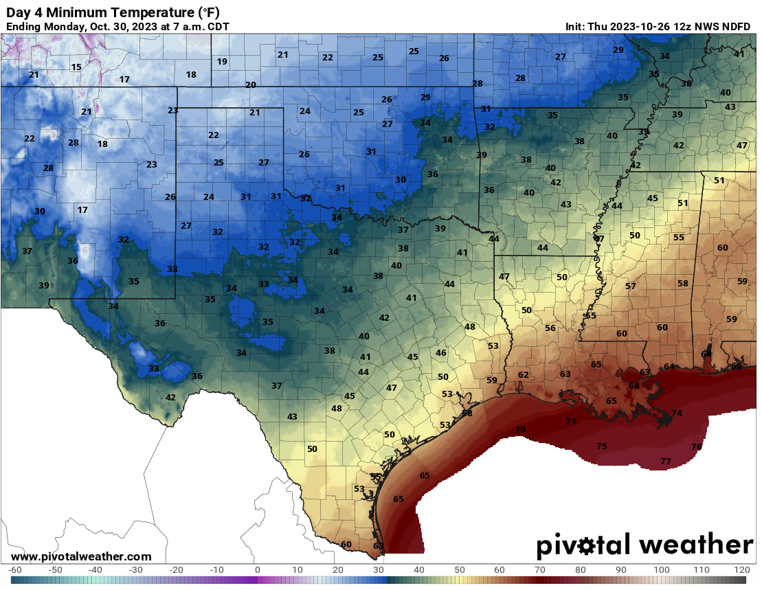
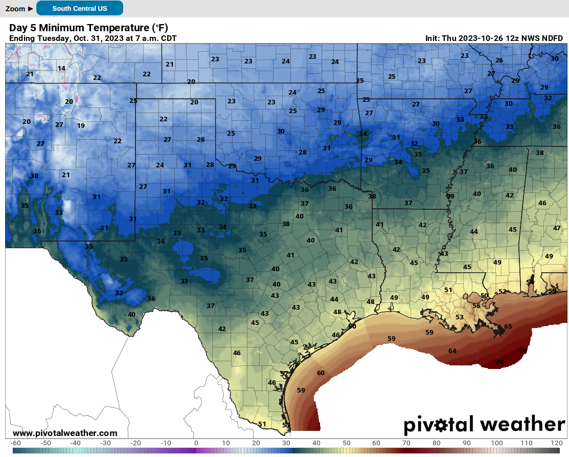
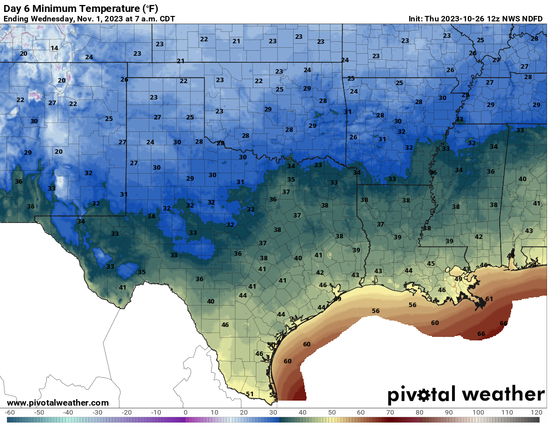
But here's the deal...most of the state is gonna get thrown back into winter,
whether they like it (insane people, mostly) or not! Expect a hard freeze all
the way down to the I-44 corridor, and at least a dip below 32 degrees for all
but the far SE corner of the state, for several consecutive days.
https://ticker.mesonet.org/archive/20231026/monday-lows.png
https://ticker.mesonet.org/archive/20231026/halloween-lows.png
https://ticker.mesonet.org/archive/20231026/wednesday-lows.png
Beware the ice. It's not quite like the ice storm we had right before Halloween
2020 that left about 400,000 folks without power, but it's darned early enough
to just be quite unusual AND unwanted. Here's a reminder of what occurred 3
years ago.
https://ticker.mesonet.org/select.php?mo=10&da=29&yr=2020
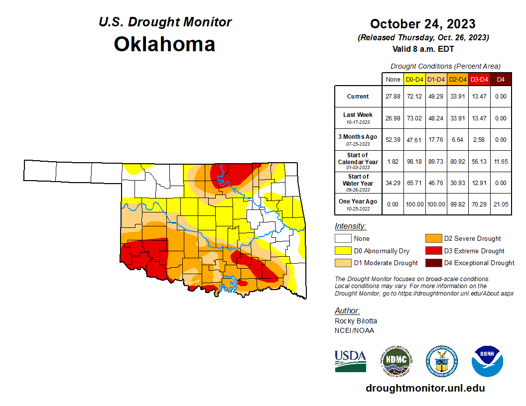
Despite the ice, NW OK DOES need the moisture because they missed out of the
good rains across much of the rest of the state.
https://ticker.mesonet.org/archive/20231026/mesonet.rainfall.quarterinch.png
https://ticker.mesonet.org/archive/20231026/3day-rain-totals.png
Heck, it's raining right now for crying out loud! But not in NW OK.
https://ticker.mesonet.org/archive/20231026/current-radar.png
So the good news...all that rain. The bad news...it won't show up on the
Drought Monitor map until next week, since we can't consider any moisture
past Tuesday at 7 a.m. for this week's map. That'll be 6 a.m. after daylight
savings time ends next week.
https://ticker.mesonet.org/archive/20231026/20231024_ok_trd.png
We're better off than Louisiana though...yikes!
https://ticker.mesonet.org/archive/20231026/20231024_south_trd.png
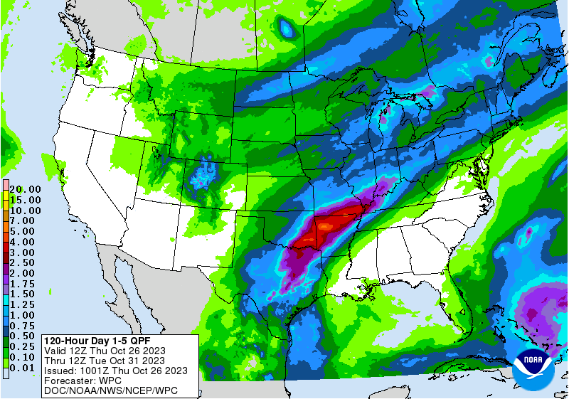
Chances for heavy rain will continue to be in SE OK for this weekend's storm.
https://ticker.mesonet.org/archive/20231026/5day-rain-forecast.gif
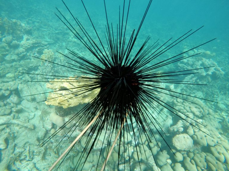
Be sure and dress those urchins warm for Halloween with wind chills looking
to be in the upper 20s by that evening. Although not sure how you're gonna get
that costume over all those spikes?
https://ticker.mesonet.org/archive/20231026/urchin.jpg
Gary McManus
State Climatologist
Oklahoma Mesonet
Oklahoma Climatological Survey
gmcmanus@mesonet.org
==================================================
The OCS/Mesonet Ticker
https://ticker.mesonet.org/
To subscribe or unsubscribe from the Ticker
or for questions about the Ticker or its content
Phone or Email the Ticker Manager at OCS
Phone: 405-325-2253 Email: ticker@mesonet.org
---------------------------------------------------
-C- Copyright 2024 Oklahoma Climatological Survey
===================================================
|


 Tweet
Tweet