MESONET TICKER ... MESONET TICKER ... MESONET TICKER ... MESONET TICKER ...
August 26, 2024 August 26, 2024 August 26, 2024 August 26, 2024
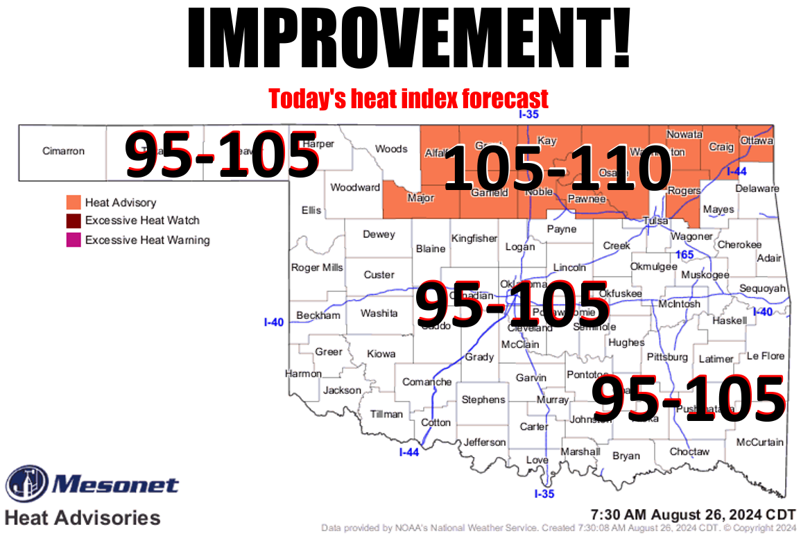
Odds?
https://ticker.mesonet.org/archive/20240826/latest.oklahoma.heat.png
"You ever see coyotes attack a man? It's not a pretty sight." I heard that quote
at a bonfire in a field near Buffalo at a party one night. Was that person
inebriated? Yes. Was I? Heck no, although I had one or two chocolate milks and
I was looking for trouble! But the point is, drunkards can say stupid things, and
as I gazed at that top graphic there, I thought "heat index of 95-110 today, and
I call that "Improvement?"
While I might be stupid (might??), in actuality and for all intensive purposes
(see...proof positive!), yes that is indeed improvement. Just look at yesterday.
Well, look at other things too, but also yesterday.
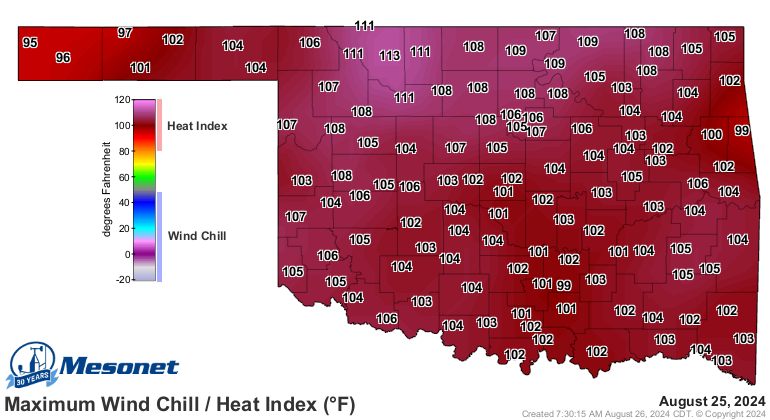
https://ticker.mesonet.org/archive/20240826/yesterdays-heat.index.png
Gross! And this summer has been gross, to tell you the truth. Most of the time
I lie to you, but not this time.
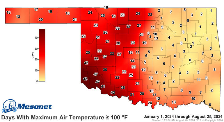
https://ticker.mesonet.org/archive/20240826/tmax.ge100.png
That's a lot of 100s already, with a few weeks (months??) left where triple-digits
could crop up. And already above normal for the year for the western half of the
state.
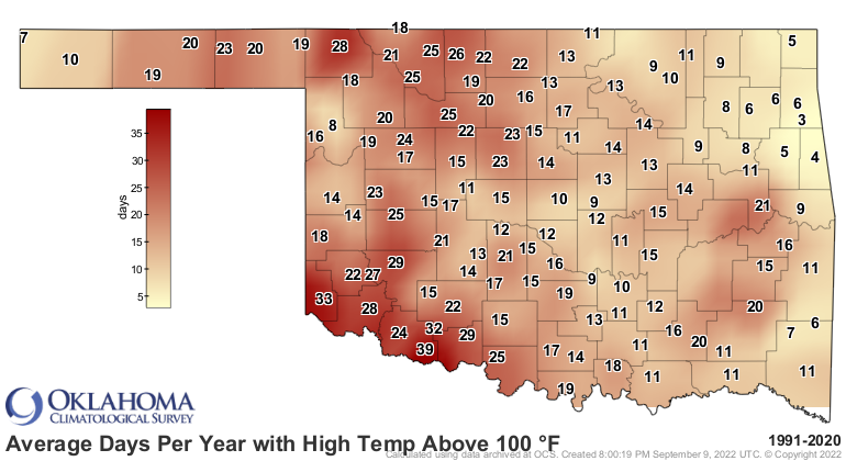
https://ticker.mesonet.org/archive/20240826/avg_x100.1991-2020.png
Eastern Oklahoma's numbers aren't quite as bad, but the prevalence of moist
air over that way has kept the actual air temperatures down but the heat index
up up up (and away!). Check out the departure from normal statewide average
heat index as measured by the Mesonet.
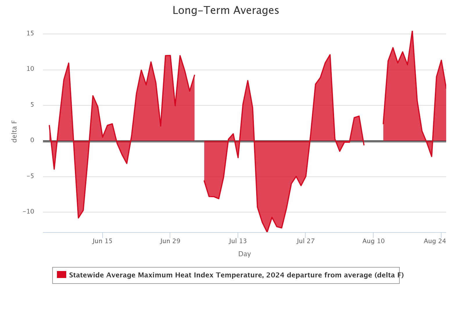
https://ticker.mesonet.org/archive/20240826/statewide-avg-heat.index.png
You can see there that we had 3 fairly substantial "cool" periods in June, and
then twice in July, but we've spent much of August 5-15 degrees above normal on
the heat index chart, as well as several other periods this summer. Yuck!
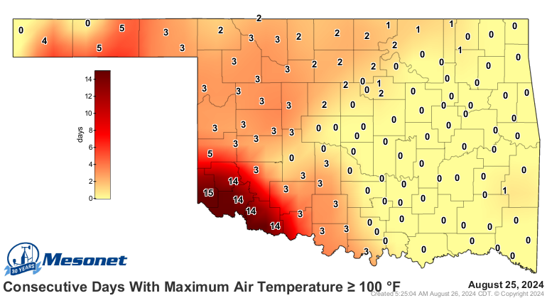
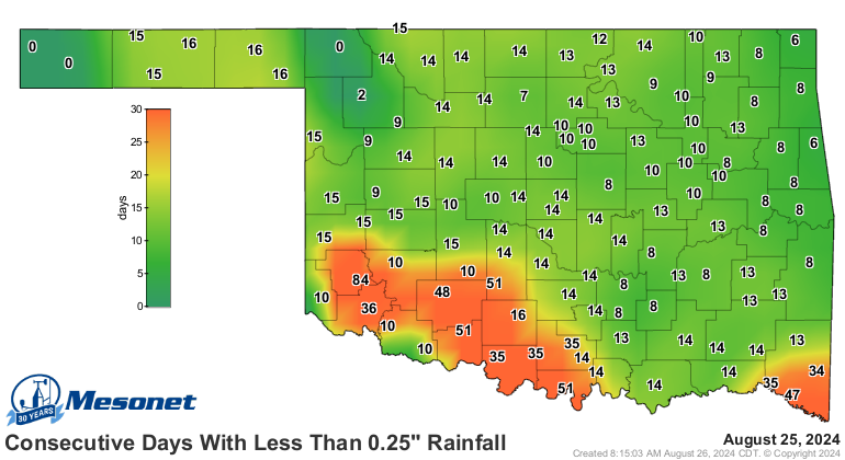
Our current heat wave is nasty enough, but even worse in SW OK.
https://ticker.mesonet.org/archive/20240826/tmax.ge100_streak.png
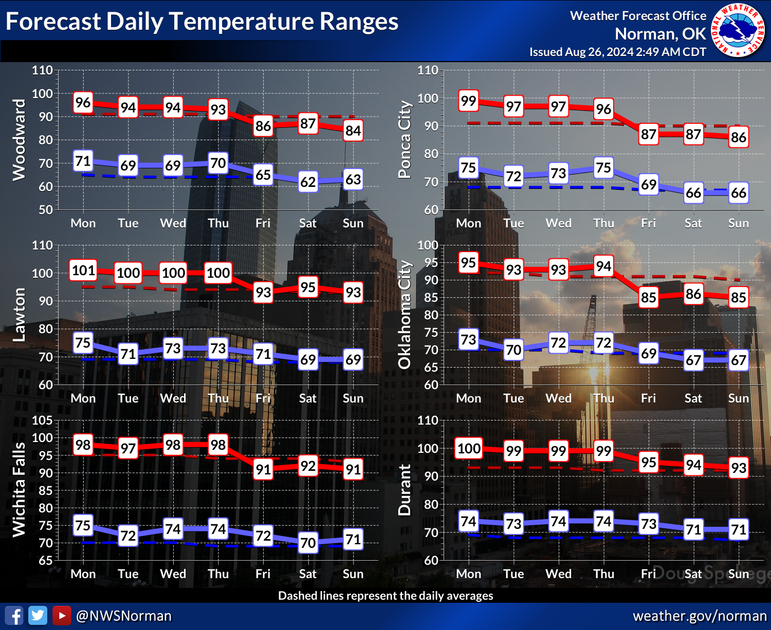
Things WILL cool down as we go through the week, and maybe even approach below
normal territory by the weekend, if not just plain old normal (hey, Plain Old
Normal was my band's name in the State Pen!).
https://ticker.mesonet.org/archive/20240826/nws-norman-7day-temps.png
https://ticker.mesonet.org/archive/20240826/nws-ama-7day-temps.jpeg
Some rain chances as we get into Thursday and Friday as well, and then maybe
again early next week.
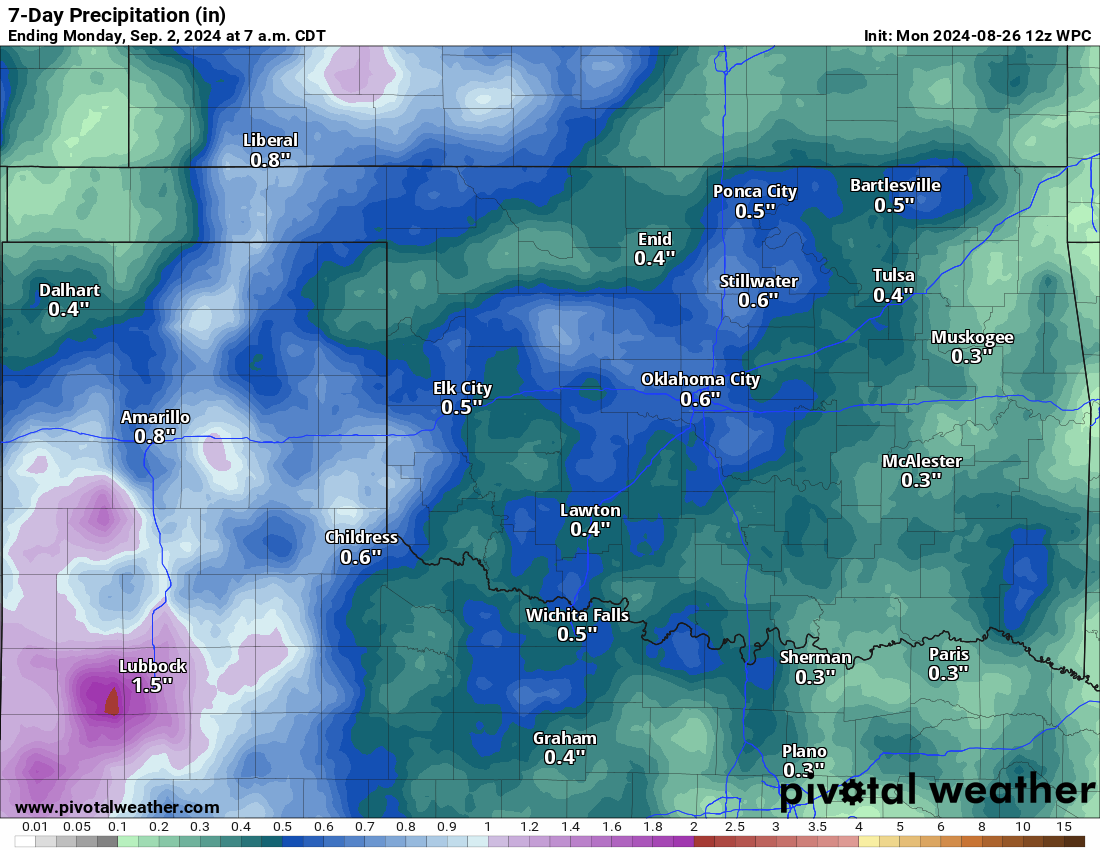
https://ticker.mesonet.org/archive/20240826/7day-rain-forecast.png
You remember rain, right? It's been awhile.
https://ticker.mesonet.org/archive/20240826/mesonet.rainfall.quarterinch.png
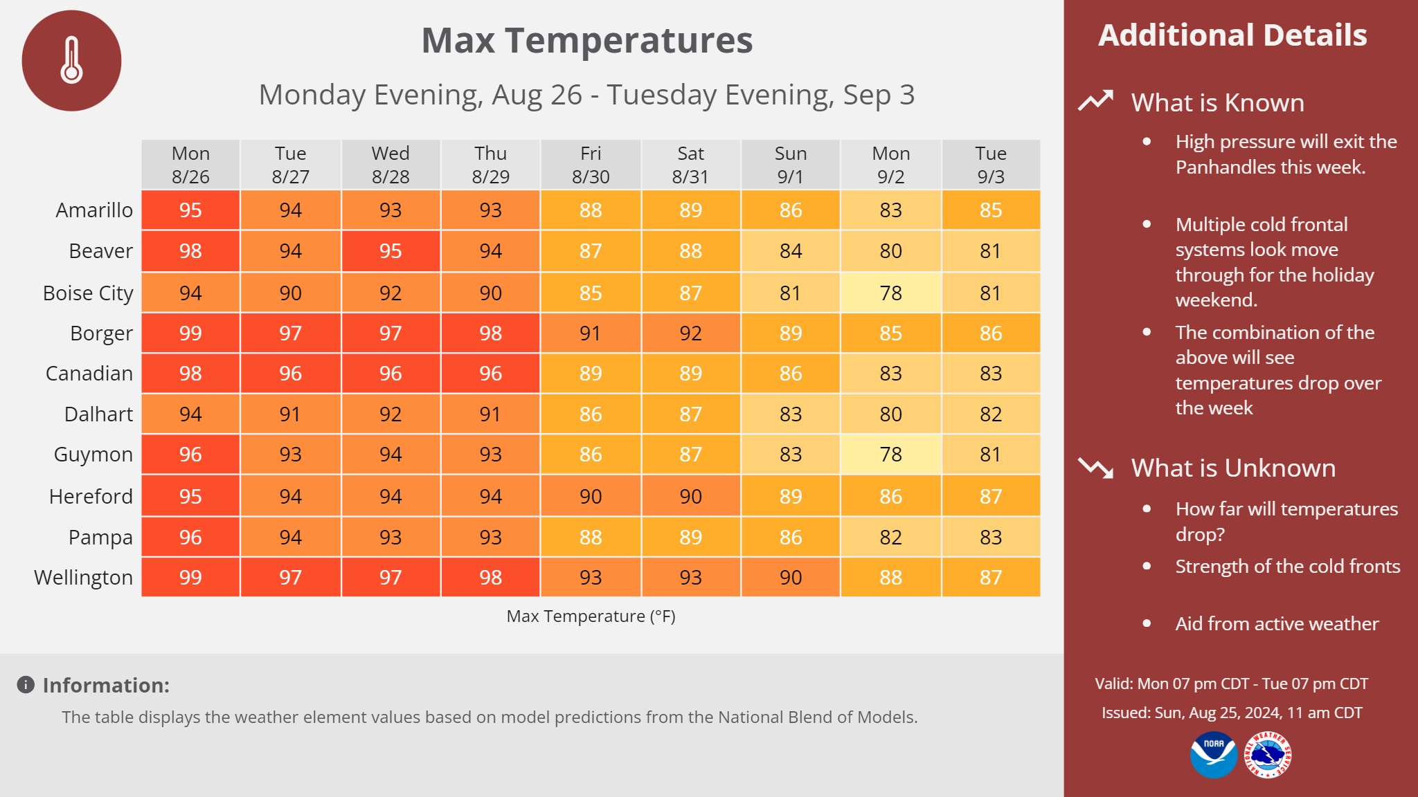
There are still hints of a more potent front early next week, although the models
are going a bit kerflooey with some pretty big variations run-to-run. So for
now, we'll hold out hope.
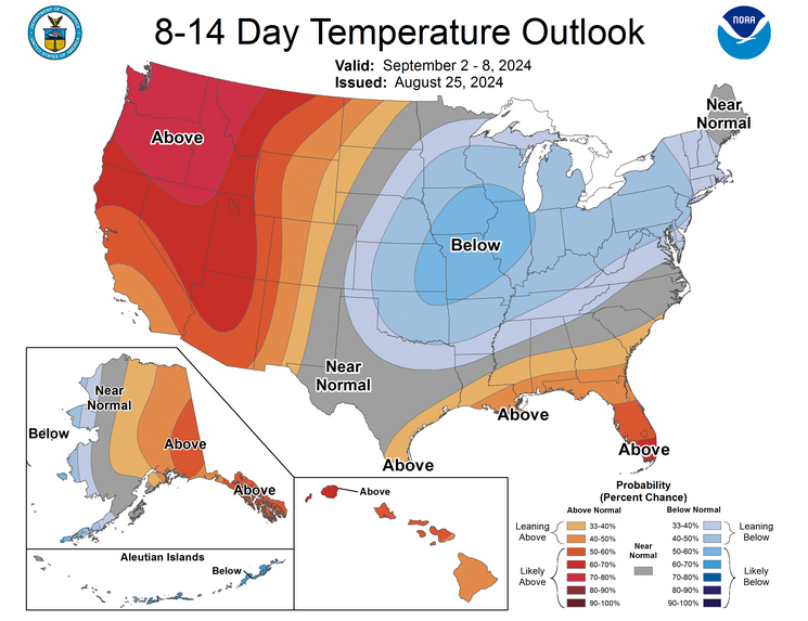
https://ticker.mesonet.org/archive/20240826/sept2-8-temp-outlook.png
The good news is "below normal" and even "normal" is starting to go downward
for its starting base, so below normal might mean 70s for highs and 50s for
lows, at least for a little while.
That's as low as it needs to go, right?
Gary McManus
State Climatologist
Oklahoma Mesonet
Oklahoma Climate Survey
gmcmanus@ou.edu
==================================================
The OCS/Mesonet Ticker
https://ticker.mesonet.org/
To subscribe or unsubscribe from the Ticker
or for questions about the Ticker or its content
Phone or Email the Ticker Manager at OCS
Phone: 405-325-2253 Email: ticker@mesonet.org
---------------------------------------------------
-C- Copyright 2024 Oklahoma Climatological Survey
===================================================
|


 Tweet
Tweet