MESONET TICKER ... MESONET TICKER ... MESONET TICKER ... MESONET TICKER ...
October 25, 2023 October 25, 2023 October 25, 2023 October 25, 2023
For raining out loud!
https://ticker.mesonet.org/archive/20231025/rainrfc.48hr.png
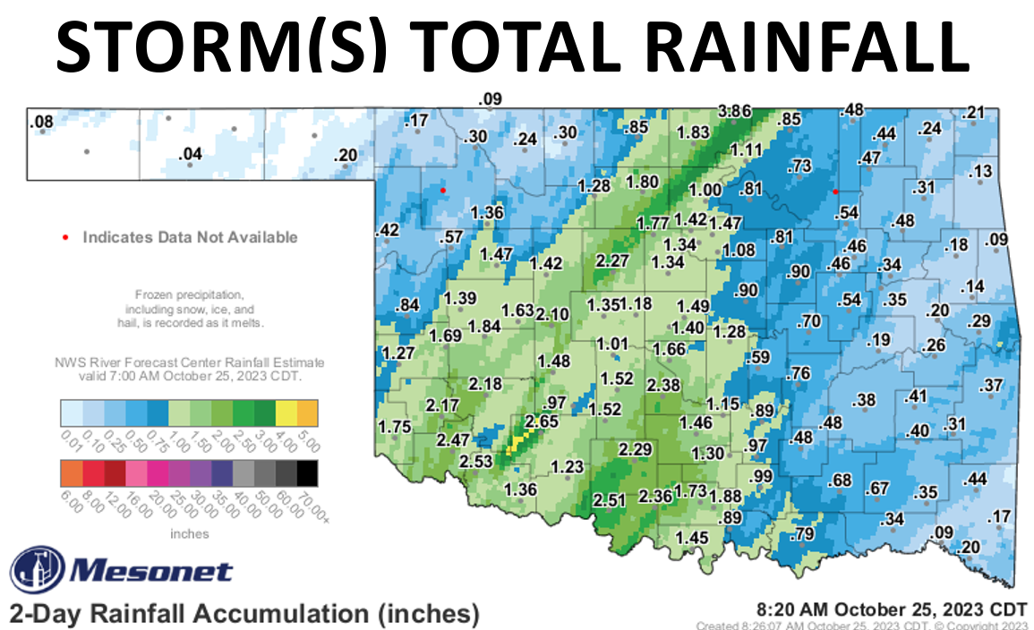
As Brian Bosworth said about beating Nebraska in 1986 to win a trip to the Orange
Bowl: "It's awful sweet!" Very generous rainfall totals adding up over the
remnants of Hurricane Norma hitting yesterday and the current storm #2's passage.
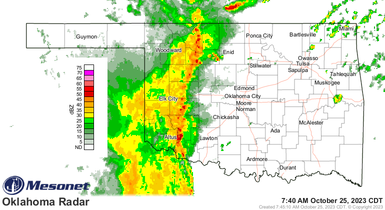
Heck, it's raining right now for crying out loud!
https://ticker.mesonet.org/archive/20231025/current-radar.png
Of course, he spent that Orange Bowl on the sidelines with a "National
Communists Against Athletes-NCAA" jersey on that eventually got him kicked
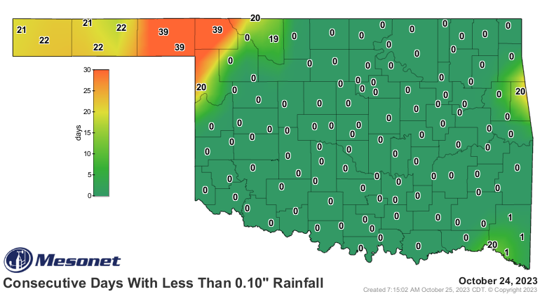
off the team, and that's how NW OK and the Panhandle feel as they've been left
out of the bounty.
https://ticker.mesonet.org/archive/20231025/mesonet.rainfall.tenthinch.png
https://ticker.mesonet.org/archive/20231025/mesonet.rainfall.quarterinch.png
Storm #3 still tracking for this weekend, and if you add up #2 and #3, you get
#5!
MATH!
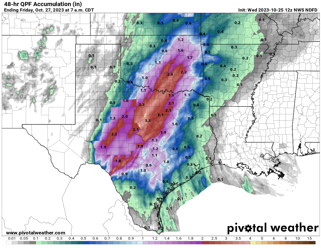
But you also get a lot more rainfall, especially across south central up into
east central OK. Here is #2's (careful!) forecast rainfall:
https://ticker.mesonet.org/archive/20231025/48hour-rain-forecast.png
And here's what you get when you add in #3:
https://ticker.mesonet.org/archive/20231025/5day-rain-forecast.gif
This still-somewhat tropical airmass is providing ample fuel for heavy rainfall,
as western OK is finding out right now. Precipitable water values (i.e., the
amount of water in the air available to be turned into precipitation through
the various physical processes used to produce, uhhhhhhh, precipitation) over
the last couple of days have been extremely extreme given the time of year.
Down near the surface, at least outside of the areas with rainfall which comes
with some evaporation and cooling, we've seen record high morning temperature
mins.
https://ticker.mesonet.org/archive/20231025/oct25-record-hi-tmins.png
https://ticker.mesonet.org/archive/20231025/todays-lows.png
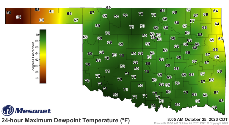
I would imagine to the east we'll see those lows drop below record high levels
as the rain moves in, but again just another way to show how moist it is. Those
high dewpoints act as sort of a barrier to temperatures falling below that
point (dewpoint to be exact) due to the release of heat with condensation if
the temperature reached that dewpoint temperature.
https://ticker.mesonet.org/archive/20231025/24hour-max-dewpoints.png
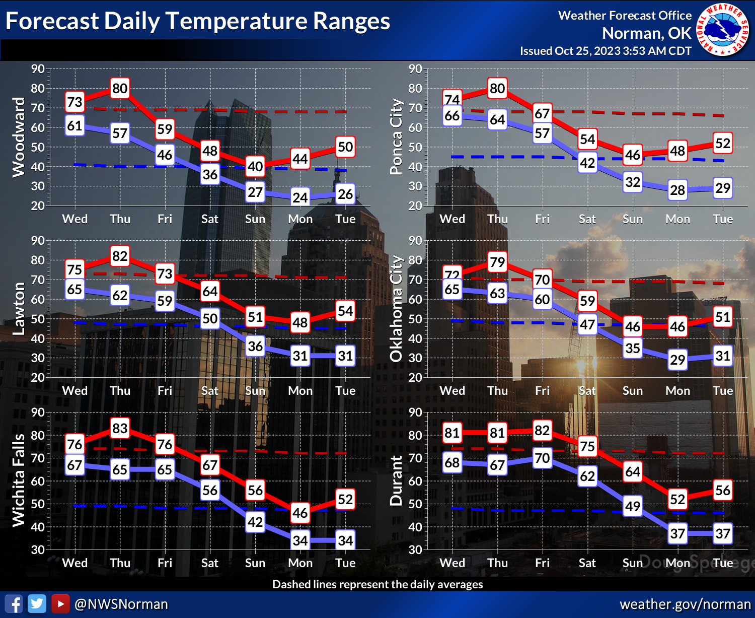
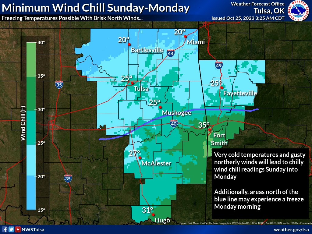
I'm sure I could have said that better but my mind is on WINTER! We're gonna
get a cold front on Friday with storm system #3, but sometime Saturday night
or Sunday, we're gonna get a COLD front, with the first arctic air of the
season. And I'm talking bone-chilling cold if you're out in it, with wind
chills down into the 20s (maybe some teens here and there, and as a father of
3, I can honestly say there's nothing worse than teens), a widespread hard
freeze, and maybe some ice up in NW OK.
https://ticker.mesonet.org/archive/20231025/nws-norman-7day-temps.png
https://ticker.mesonet.org/archive/20231025/nws-tulsa-sun.mon-wind.chills.png
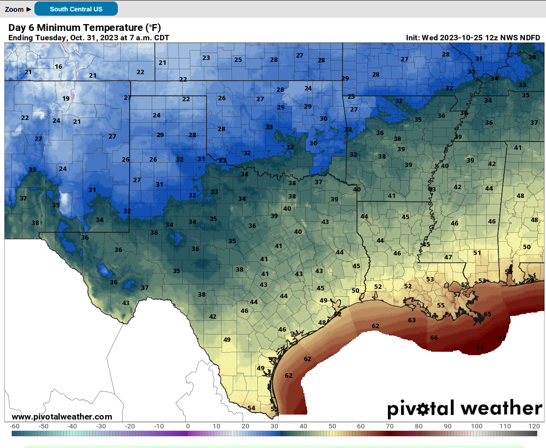
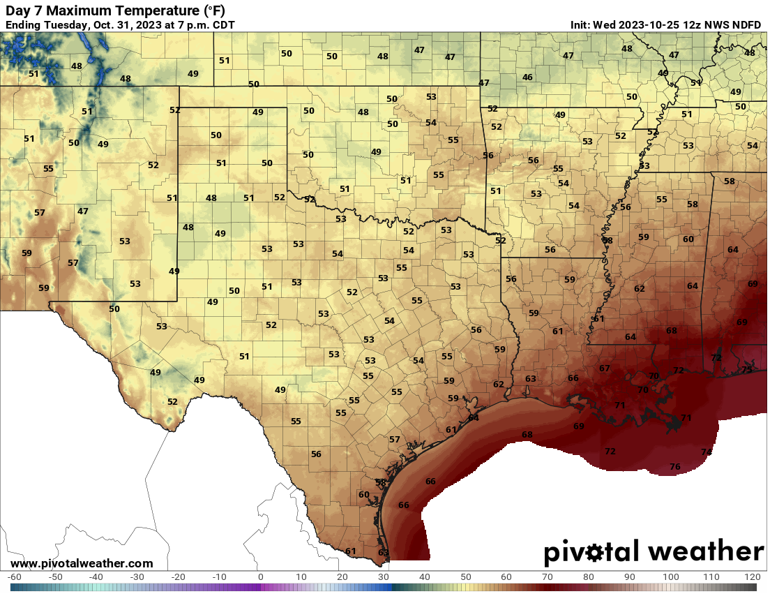
I joked about it for months, but frozen Halloween anyone? At least it warms
up to the 40s that afternoon, but your trick or treaters are gonna be eating
frozen caramel apples as temps fall back into the 30s that evening.
Dentists are gonna have a field day after Tuesday.
https://ticker.mesonet.org/archive/20231025/halloween-lows.png
https://ticker.mesonet.org/archive/20231025/halloween-highs.png
A rock? I got an ice cube!
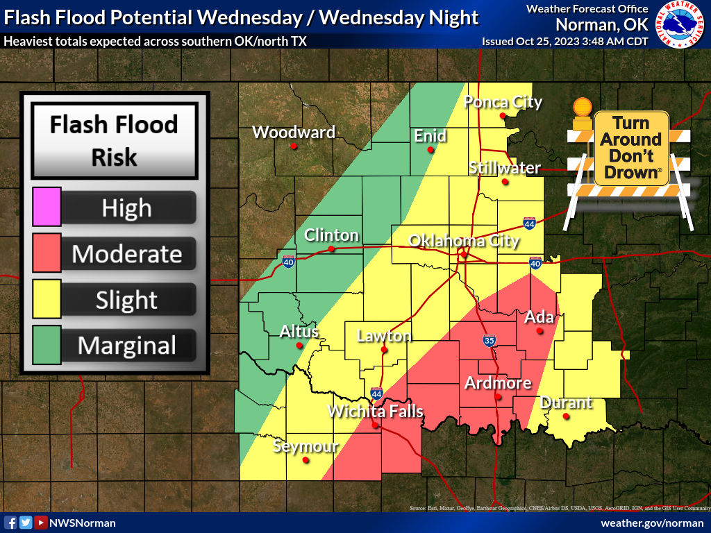
Watch out for flash flooding later today!
https://ticker.mesonet.org/archive/20231025/nws-norman-flood-risk-wed.png
Gary McManus
State Climatologist
Oklahoma Mesonet
Oklahoma Climatological Survey
gmcmanus@mesonet.org
==================================================
The OCS/Mesonet Ticker
https://ticker.mesonet.org/
To subscribe or unsubscribe from the Ticker
or for questions about the Ticker or its content
Phone or Email the Ticker Manager at OCS
Phone: 405-325-2253 Email: ticker@mesonet.org
---------------------------------------------------
-C- Copyright 2024 Oklahoma Climatological Survey
===================================================
|


 Tweet
Tweet