Ticker for July 25, 2012
MESONET TICKER ... MESONET TICKER ... MESONET TICKER ... MESONET TICKER ...
July 25, 2012 July 25, 2012 July 25, 2012 July 25, 2012
It's about to rain, let's see where we're at
Since it's looking more and more like the state is going to get at least *some*
rain scattered about in the next few days ...
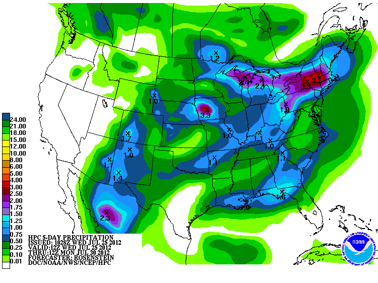
let's take a final look at where we're at now before we start gathering the
animals two-by-two. I think these consecutive days without 0.25" and 0.10" of
rain maps from the Oklahoma Mesonet are pretty telling.
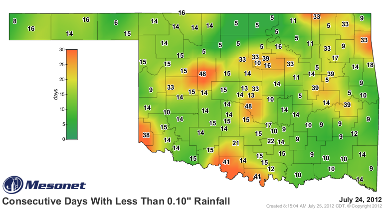
Telling indeed! A bit of explanation ... these maps show the consecutive days,
midnight-to-midnight, without the appropriate amount of rainfall. That is not
to say that a quarter or tenth of an inch could not have fallen, but it didn't
happen within that midnight-midnight time frame. Still, it's a pretty good
indication of how long the state has been without significant rainfall.
Waurika down in Jefferson County has gone 41 days without a 0.10" rainfall event
in a calendar day. Wow! And it's been just slightly hot during this time frame
as well. Not to be outdone, Watonga and Norman upped the ante with 48 days! I
can confirm that in the Norman area. I have lots of cracks showing up in my
yard, and nary a plumber in sight.
A tenth of an inch is pretty much nothing in this heat anyway. You could spit
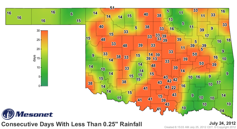
on the sidewalk and get pretty much the same sizzle. The quarter-inch maps are
even worse and indicate that when it has rained, it's generally been pretty
light. Any rain we get will be great, obviously, but indications are the heat
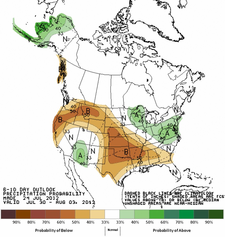
will return this weekend and set up again for next week. Here are the latest
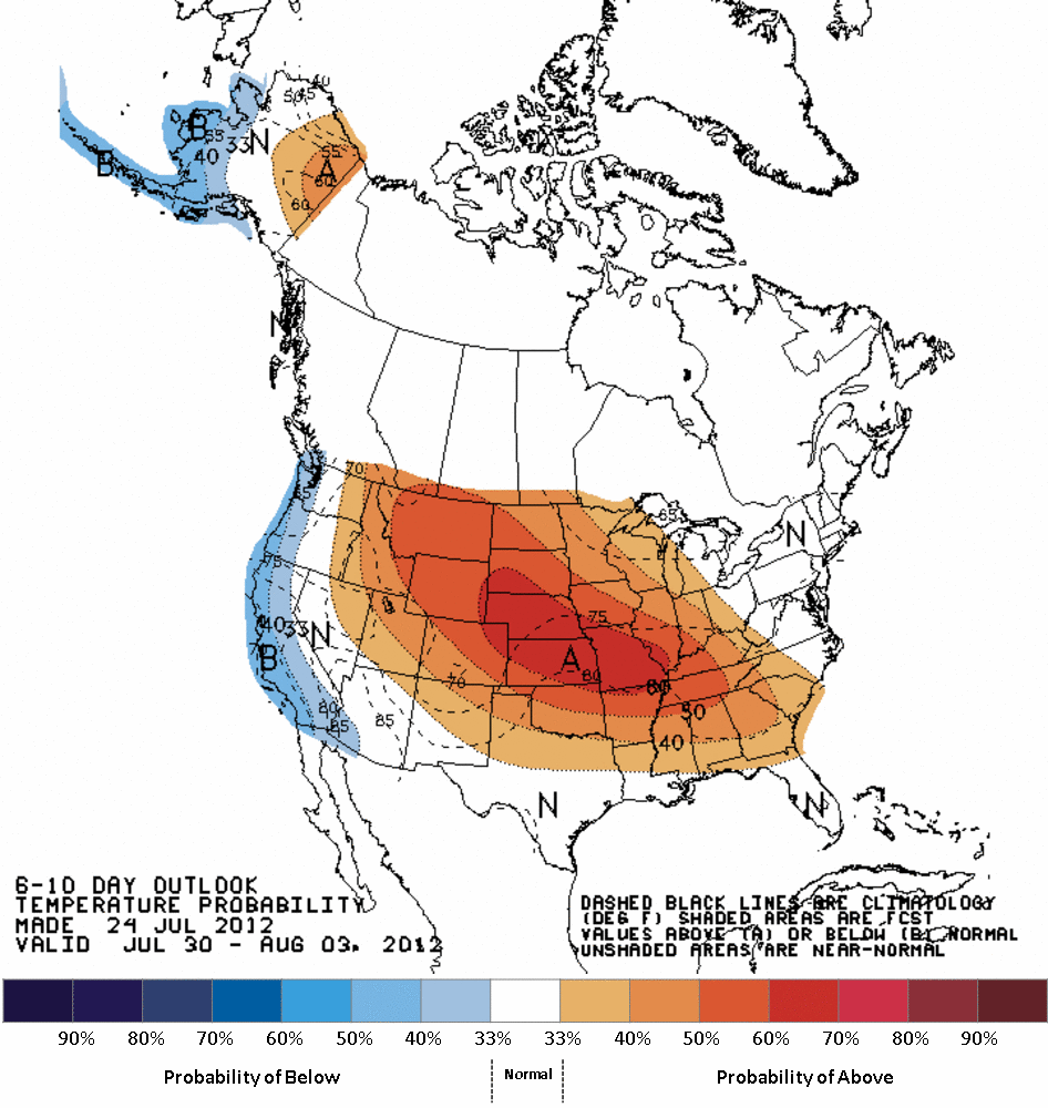
6-10 and 8-14 day outlooks from the Climate Prediction Center.
6-10 day CPC outlooks (July 30-August 3)
8-14 day CPC outlooks (August 1-7)
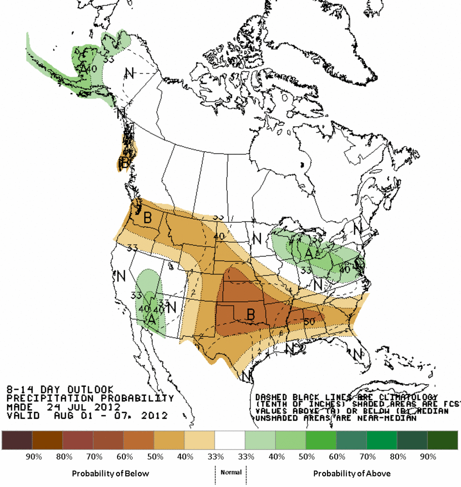
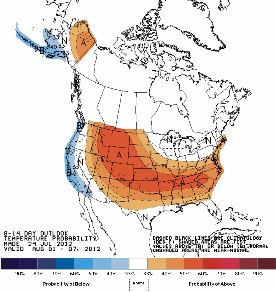
Those are clearly demonstrate the expectation of the dreaded heat dome to be
parked over us again through those periods, with INCREASED ODDS of above normal
temperatures and below normal precipitation. Remember, they don't show how far
above or below normal it could be, but it's summer in Oklahoma during a drought
under a heat dome. Use your imagination.
This could change in a hurry, but again, summer in Oklahoma. This is the pattern
I would expect anyway. The presence of the drought compounds things. So if it
rains in your area, go out and celebrate! Maybe we can slow this runaway drought
down for a few days. But the hottest days of the summer might still be in front
of us.
Gary McManus
Associate State Climatologist
Oklahoma Climatological Survey
(405) 325-2253
gmcmanus@mesonet.org
July 25 in Mesonet History
| Record | Value | Station | Year |
|---|---|---|---|
| Maximum Temperature | 110°F | GRA2 | 2011 |
| Minimum Temperature | 55°F | BOIS | 2004 |
| Maximum Rainfall | 3.16″ | SHAW | 2016 |
Mesonet records begin in 1994.
Search by Date
If you're a bit off, don't worry, because just like horseshoes, “almost” counts on the Ticker website!