Ticker for July 24, 2012
MESONET TICKER ... MESONET TICKER ... MESONET TICKER ... MESONET TICKER ...
July 24, 2012 July 24, 2012 July 24, 2012 July 24, 2012
Oklahoma's drought indicators sinking fast
The latest topsoil moisture and range/pastureland numbers from the USDA's
National Agricultural Statistics Service are out and they ain't pretty. I'll show
you the maps, but Oklahoma's topsoil moisture is now rated as some of the worst
in the country at 96% poor/very poor.
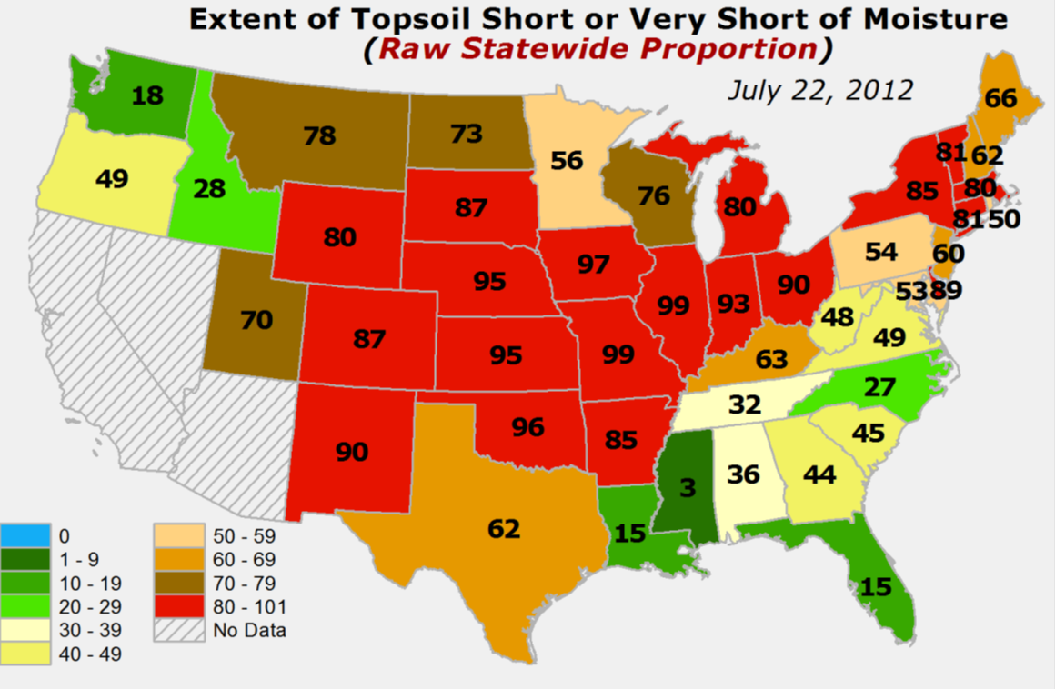
Only Missouri, Indiana and Iowa are worse (there's a joke there but I won't say
it...we're all in this together!). And Oklahoma's 96% is up from only 60% a
mere month ago. Again, evidence of the "flashy" nature of this drought.
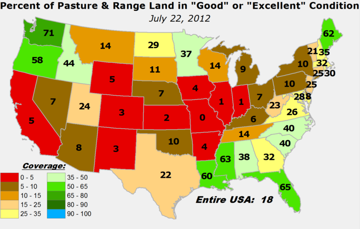
The pasture/rangeland figures aren't quite as bad, but they are worsening
rapidly. Now only 10% of the state's pastures are rated as good/excellent.
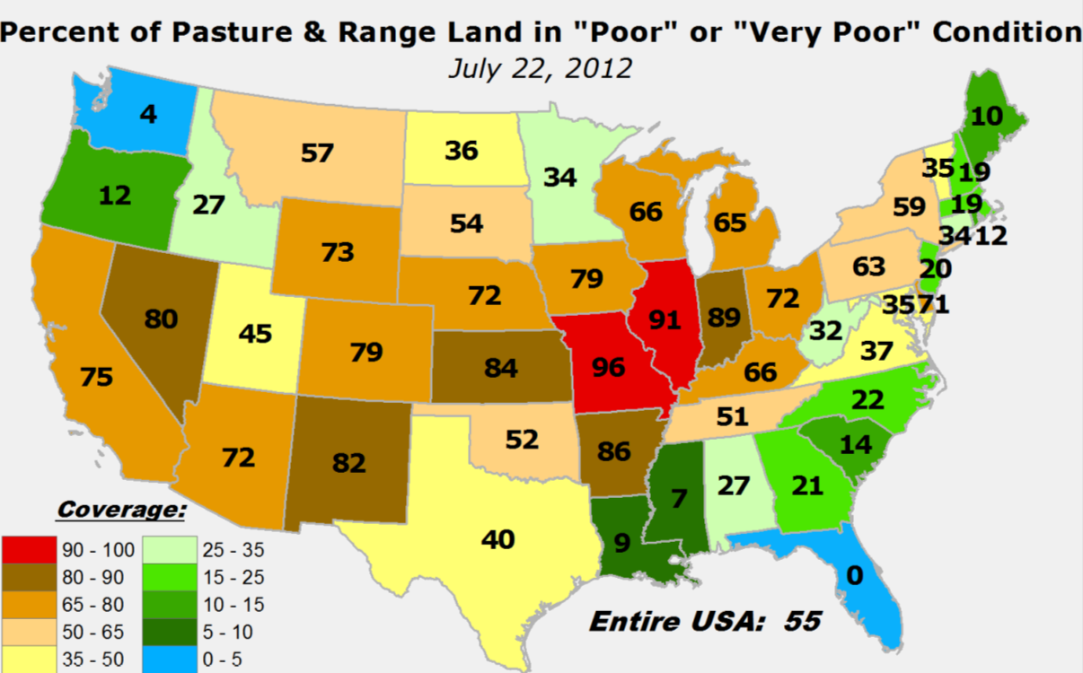
An alternate view is the 52% of pastures rated as poor/very poor. That's up
from 17% a month ago.
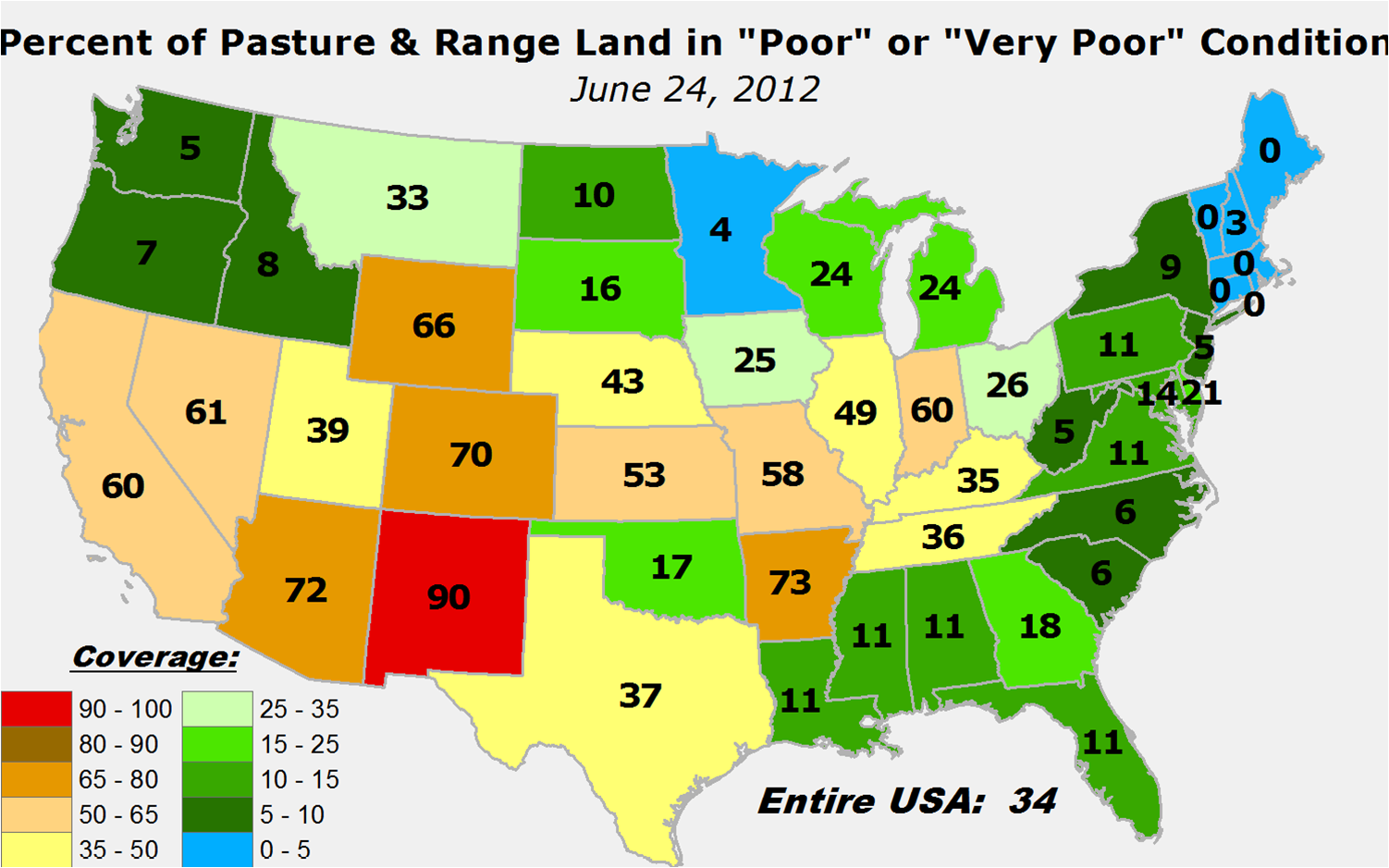
Those are pure flash drought characteristics right there.
Just looking at those maps and the accelerating deterioration they demonstrate,
you can see why agriculture is in trouble with this drought. Here are a couple
of more maps, using the U.S. Drought Monitor depiction from last week, showing
the country's primary cattle and hay production areas are under drought's gun.
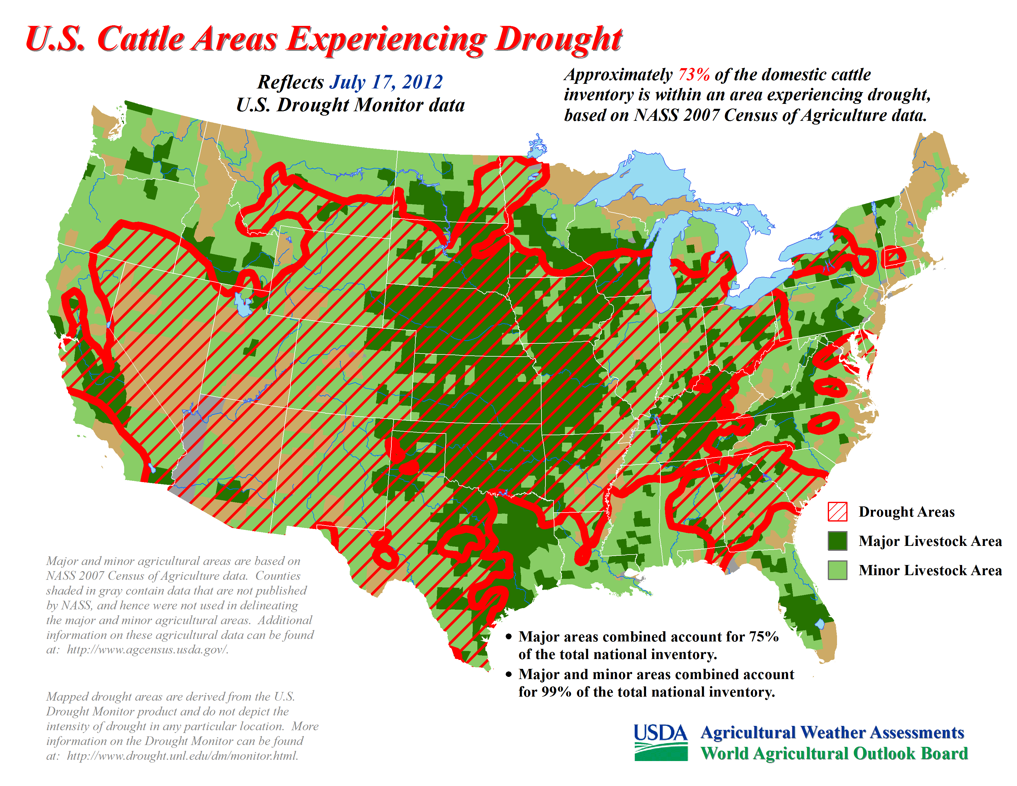
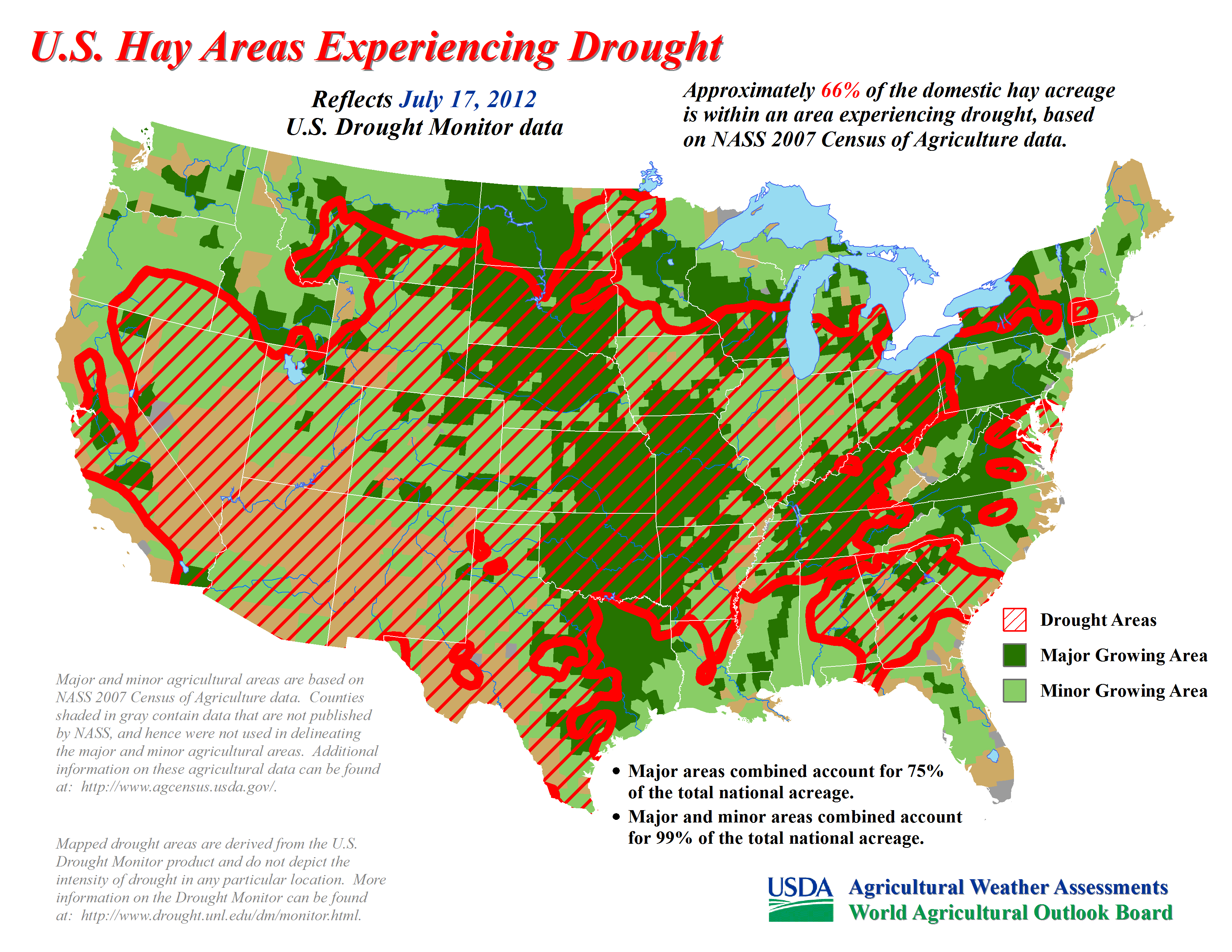
And that red-hatched drought area is more likely to expand this week than
contract. For those reading ahead, that's 77% of the nation's cattle inventory
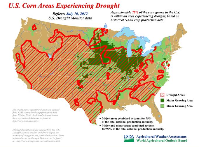
and 66% of the hay acreage under drought of some degree of severity. Remember,
we showed corn a couple of weeks ago. At that point, 78% of the corn grown in
the U.S. was under drought conditions.
Well, the good news is the chance for rain is back in the forecast in a nice
way. It doesn't look like a washout, but it might not be trivial in some
spots either. This might be wishful thinking, but here's the 5-day rain forecast
amounts from the NWS' Hydrometeorological Prediction Center.
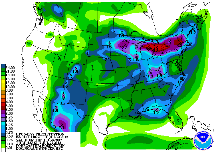
That moisture, if realized, will help keep the temperatures down for awhile as
the dreaded heat dome will be back over place this weekend into next week for
some unknown duration. I won't lie to ya, however. Without reinforcing rainfall,
that moisture will be used up pretty quickly.
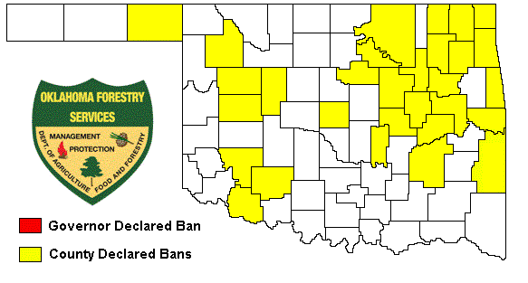
The burn bans continue to multiply as the heat and drought continue to plow
forward, now up to 38 counties.
Don't shoot the messenger (unless it's with a water gun)!
Gary McManus
Associate State Climatologist
Oklahoma Climatological Survey
(405) 325-2253
gmcmanus@mesonet.org
July 24 in Mesonet History
| Record | Value | Station | Year |
|---|---|---|---|
| Maximum Temperature | 110°F | MARE | 2011 |
| Minimum Temperature | 48°F | CAMA | 2019 |
| Maximum Rainfall | 4.43 inches | COOK | 2004 |
Mesonet records begin in 1994.
Search by Date
If you're a bit off, don't worry, because just like horseshoes, “almost” counts on the Ticker website!