MESONET TICKER ... MESONET TICKER ... MESONET TICKER ... MESONET TICKER ...
October 24, 2022 October 24, 2022 October 24, 2022 October 24, 2022
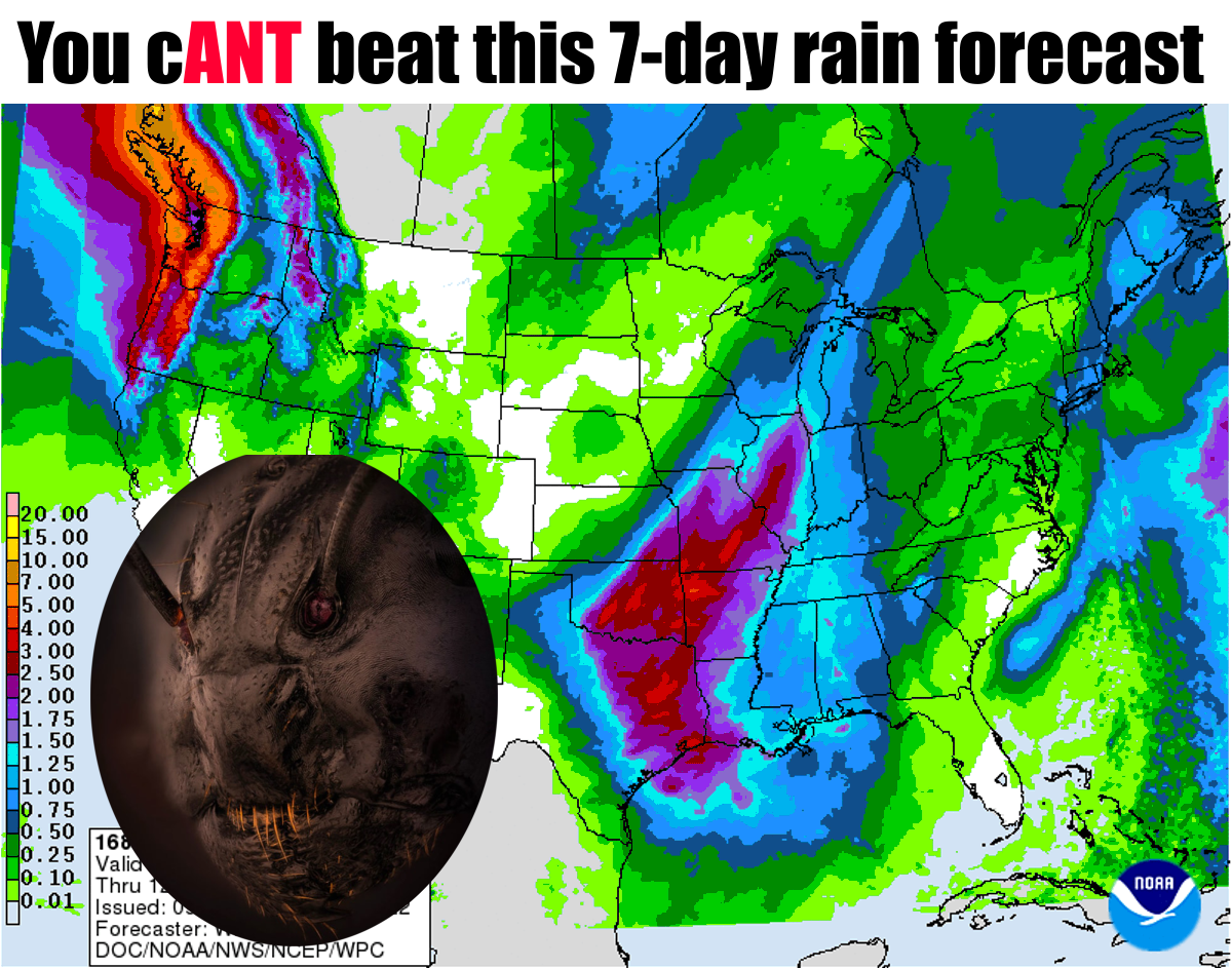
Deluge
https://ticker.mesonet.org/archive/20221024/7day-rain-forecast.png
OHMYGOSH! Guys, ants have faces...AND antennas growing out of their eyeballs! Yeah,
gaze at that picture whilst eating your Wheaties. I cANT look away! Imagine if
you had a giant hair growing out of your eyeball (while you're busy doing that,
I'll imagine just a normal hair growing on my head...anywhere)!
Always have to go with the bald jokes, don't ya? YEAH, I'm doing the typing, but
I could hear ya!
Even more importantly, that 7-day forecast for rain shows the accumulations of
two storm systems...the one hitting us right now through tomorrow, and again at
the beginning of the weekend. Well, not this one again, but another storm system
down the road.
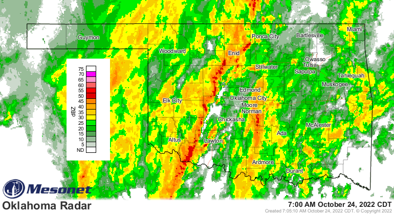
Heck, it's raining right now for crying out loud!
https://ticker.mesonet.org/archive/20221024/current-radar.png
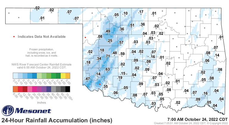
And some decent amounts have already started to pile up.
https://ticker.mesonet.org/archive/20221024/rainrfc.24hr.png
Unfortunately, that demarcation line between the haves and have nots running through
NW OK is a real deal, but there's still time for that rain to spread NW (meaning
the forecast was off a bit...but when has that ever happened?? Yeah, I know,
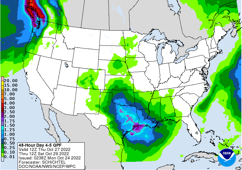
right?). Here is the current storm's forecast amounts, then the weekend storm's
expected totals. Obviously, the weekend storm is a bit more iffy being 4-5 days
out.
https://ticker.mesonet.org/archive/20221024/mon-tues-forecast-rains.gif
https://ticker.mesonet.org/archive/20221024/thur-fri-forecast-rains.gif
One thing not really focused on lately is (FINALLY) the changing of the seasons.
Oh, I know that we passed summer by a long time ago, but the 90s this weekend
say otherwise. With the current storm system moving through and it's associated
cold front, we will see a longer stretch of actual fall weather, not the "few
days of fall followed by bursts of summer" we've gotten used to. The drought
has gotten used to that as well, increasing in intensity with each stretch of
unusual warmth.
https://ticker.mesonet.org/archive/20221024/extended-summer-2022.png
That chart of statewide average highs shows the reality of how after June 10,
almost the majority of time since the temperatures have stayed above (and often
much above) normal for nearly the entire 5+ month period since. We had one
brief interlude with fall last week, but now we get an extended period of highs
mostly in the 60s and lows in the 40s.
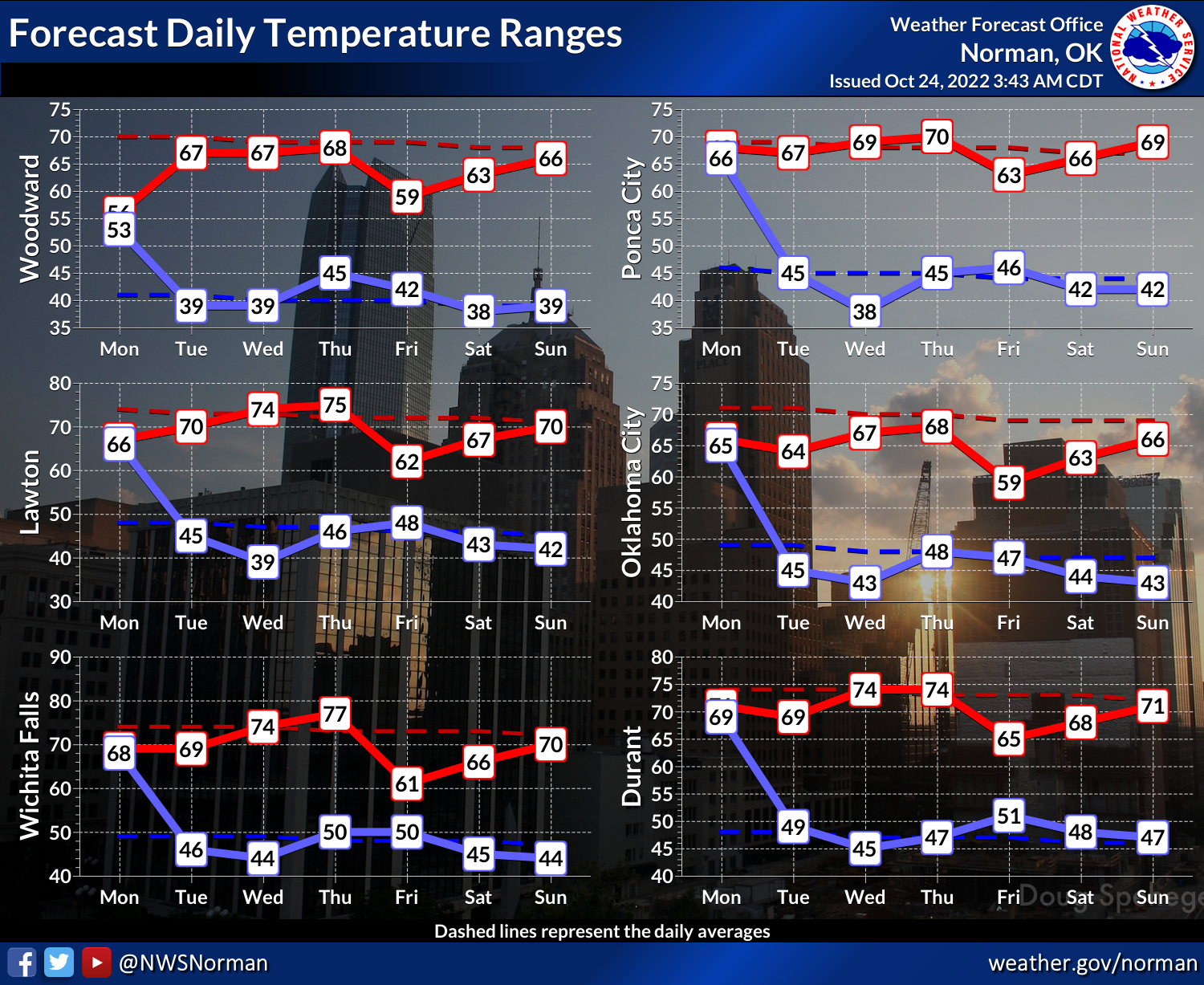
https://ticker.mesonet.org/archive/20221024/nws-norman-temps.png
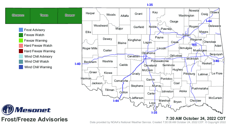
The Panhandle is under a freeze watch for tomorrow morning...odd since they've
already had a freeze, but I guess they're due for another?
https://ticker.mesonet.org/archive/20221024/latest.oklahoma.frostfreeze.gif
https://ticker.mesonet.org/archive/20221024/tuesday-lows.png
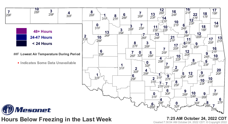
https://ticker.mesonet.org/archive/20221024/7day-freeze-totals.gif
While we wish that the rain would be a bit more prolific up that way, as always,
we'll take what we can get ANYWHERE in the state.
And remember...ANTS HAVE FACES!
Gary McManus
State Climatologist
Oklahoma Mesonet
Oklahoma Climatological Survey
gmcmanus@mesonet.org
==================================================
The OCS/Mesonet Ticker
https://ticker.mesonet.org/
To subscribe or unsubscribe from the Ticker
or for questions about the Ticker or its content
Phone or Email the Ticker Manager at OCS
Phone: 405-325-2253 Email: ticker@mesonet.org
---------------------------------------------------
-C- Copyright 2024 Oklahoma Climatological Survey
===================================================
|


 Tweet
Tweet