Ticker for September 24, 2018
MESONET TICKER ... MESONET TICKER ... MESONET TICKER ... MESONET TICKER ...
September 24, 2018 September 24, 2018 September 24, 2018 September 24, 2018
Fittstown revisited
What else can you say when you break an all-time Mesonet record? Nothing but
the facts. Maybe a bit histrionically, but still, nothing but the facts.
Between 6:25am on September 21 through 6:20am on September 22, 14.48 inches of
rain fell at the Oklahoma Mesonet site at Fittstown.
Now you are probably saying to yourself "But Gary, doesn't Mesonet consider
midnight-midnight as their daily total, while COOP measurements can be 7am-7am,
6pm-6pm, etc?" First off, that's a weird thing to be saying to yourself unless
your name is actually Gary, but point well taken. Keep in mind as we discuss
these records that we are in somewhat uncertain territory due to the different
periods Mesonet vs. COOP use in their measurements. There is also the
distinction between 24-hour records and daily records. These and other
considerations have all been...uhhhh...considered. In the end, if we want to
stick strictly to midnight-midnight periods, we have a total of 14.20 inches
with this event, so we're still safe.
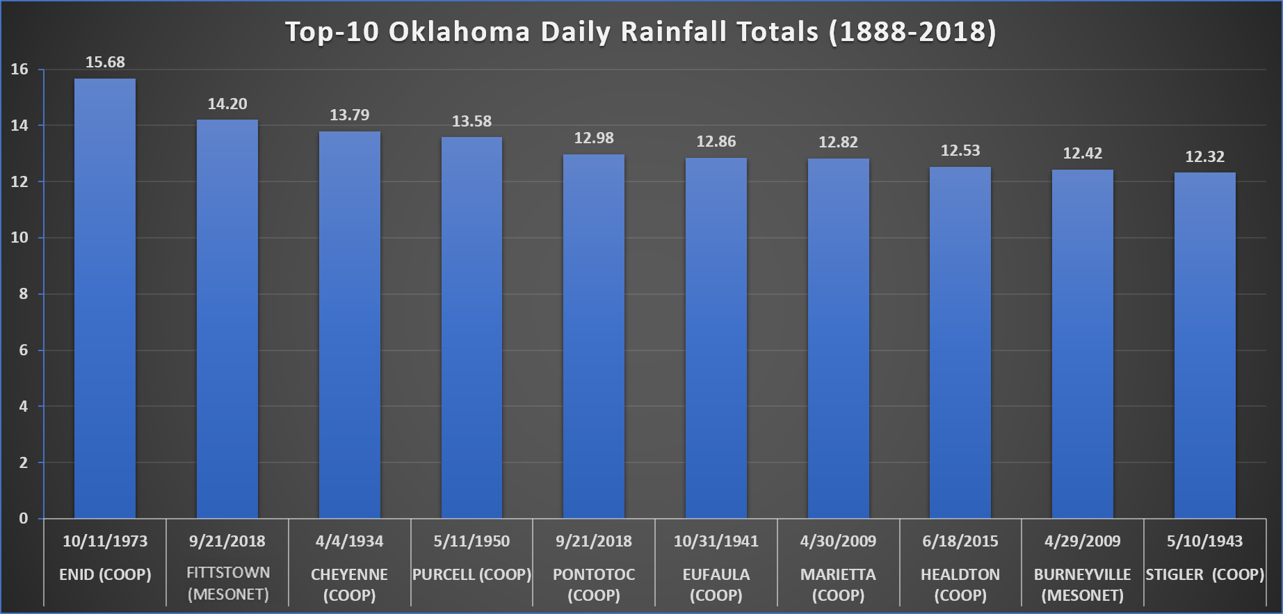
So here are the new all-time top 5 Daily Mesonet rainfall totals (Jan. 1, 1994
through Sept. 24, 2018):
-***-
Fittstown 09/21/2018 14.20 inches
Burneyville 04/29/2009 12.42 inches
Oklahoma City North 06/14/2010 11.26 inches
Newport 06/17/2015 10.49 inches
Cheyenne 06/14/1994 9.89 inches
-****-
Or if you like purty pictures, click here.

And while 14.20 inches is a MASSIVE amount of rain for a daily total, it's still
just a tad short of the *HISTORICAL* state record 15.68 inches from Enid back
on Oct. 11, 1973. It did place second on the list, however. The Enid record was
reported by a NWS cooperative observer. Here are the new top 10 highest daily
total rainfall amounts, complete with the network it was measured by, Mesonet
or COOP. This is a bit complicated by the fact that the Mesonet sites within
the NWS-Norman forecast area (in Oklahoma) are also COOP stations, but we'll
still distinguish between the two networks.
-***-
Enid (COOP) 10/11/1973 15.68 inches
Fittstown (Mesonet) 09/21/2018 14.20 inches
Cheyenne (COOP) 04/04/1934 13.79 inches
Purcell (COOP) 05/11/1950 13.58 inches
Pontotoc (COOP) 09/21/2018 12.98 inches
Eufaula (COOP) 10/31/1941 12.86 inches
Marietta (COOP) 04/30/2009 12.82 inches
Healdton (COOP) 06/18/2015 12.53 inches
Burneyville (MESONET) 04/29/2009 12.42 inches
Stigler (COOP) 05/10/1943 12.32 inches
-****-
Again, in graphical format:
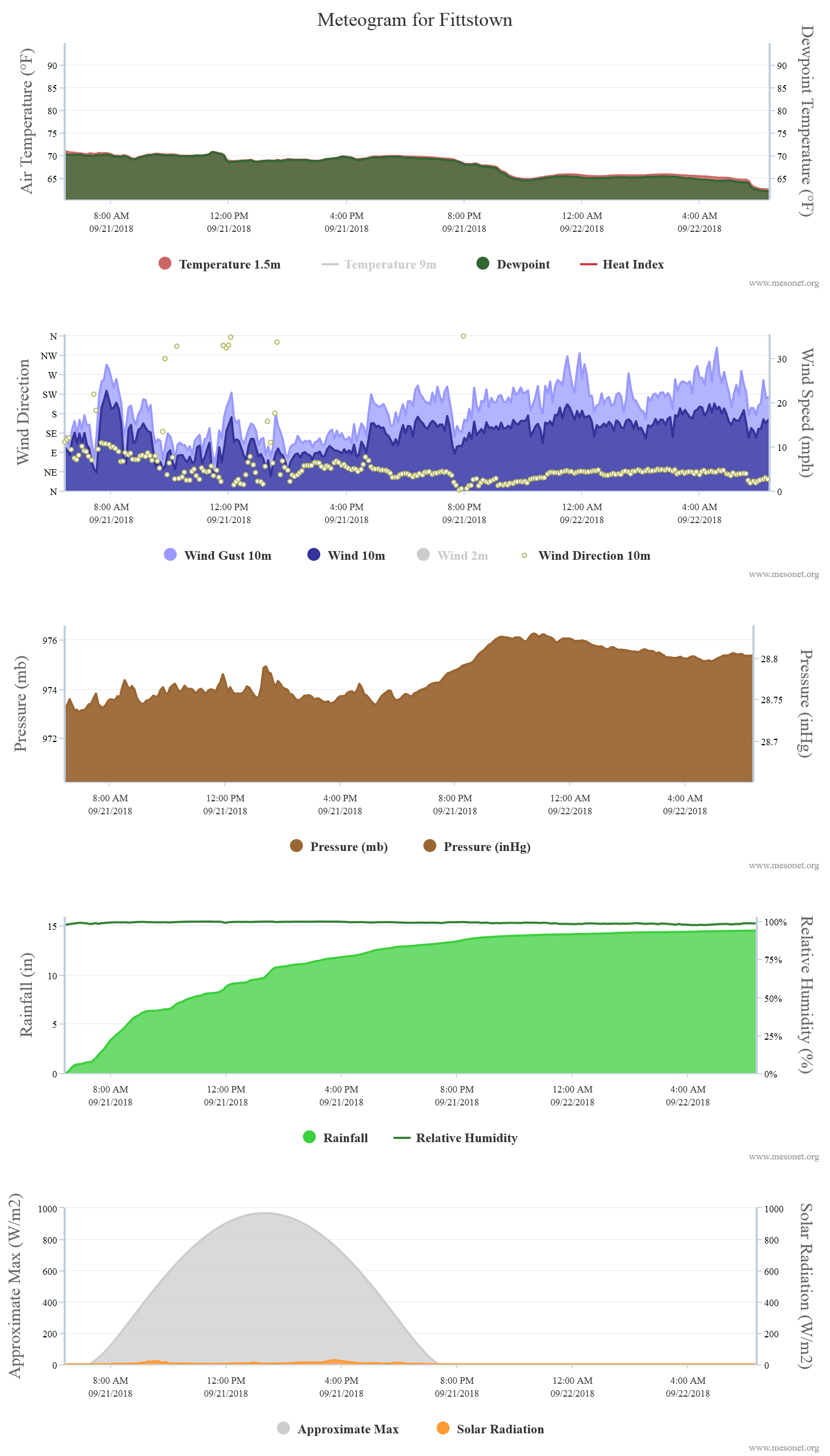
As I said previously, the 24-hour total was a bit different than the daily total
in that it had another 6 hours and 20 minutes to accumulate after midnight
on the 22nd. So that total was 14.48 inches from 6:25am on Sept. 21 through
6:20am on Sept. 22. That is obviously the new 24-hour record for the Mesonet
as well, beating Burneyville's 12.89 inches from Burneyville from April 29-30,
2009. You can see the deluge from Fittstown quite nicely on this 24-hour
meteogram.
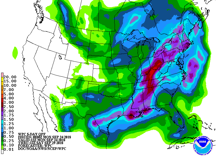
And of course the rain didn't stop there. If we look back at the 4-day rainfall
map, just to make sure we capture everything as it continued to fall, we see
Fittstown ended that 96-hour period with 15.81 inches of rainfall.
We're going to stop there, before we give you our own data deluge. Our last
word...there's more rain on the way. "UGH" for SE OK, "send more" for SW OK!
Gary McManus
State Climatologist
Oklahoma Mesonet
Oklahoma Climatological Survey
(405) 325-2253
gmcmanus@mesonet.org
September 24 in Mesonet History
| Record | Value | Station | Year |
|---|---|---|---|
| Maximum Temperature | 101°F | BUFF | 1998 |
| Minimum Temperature | 29°F | BOIS | 2000 |
| Maximum Rainfall | 4.77 inches | CLAY | 2019 |
Mesonet records begin in 1994.
Search by Date
If you're a bit off, don't worry, because just like horseshoes, “almost” counts on the Ticker website!