MESONET TICKER ... MESONET TICKER ... MESONET TICKER ... MESONET TICKER ...
June 24, 2024 June 24, 2024 June 24, 2024 June 24, 2024
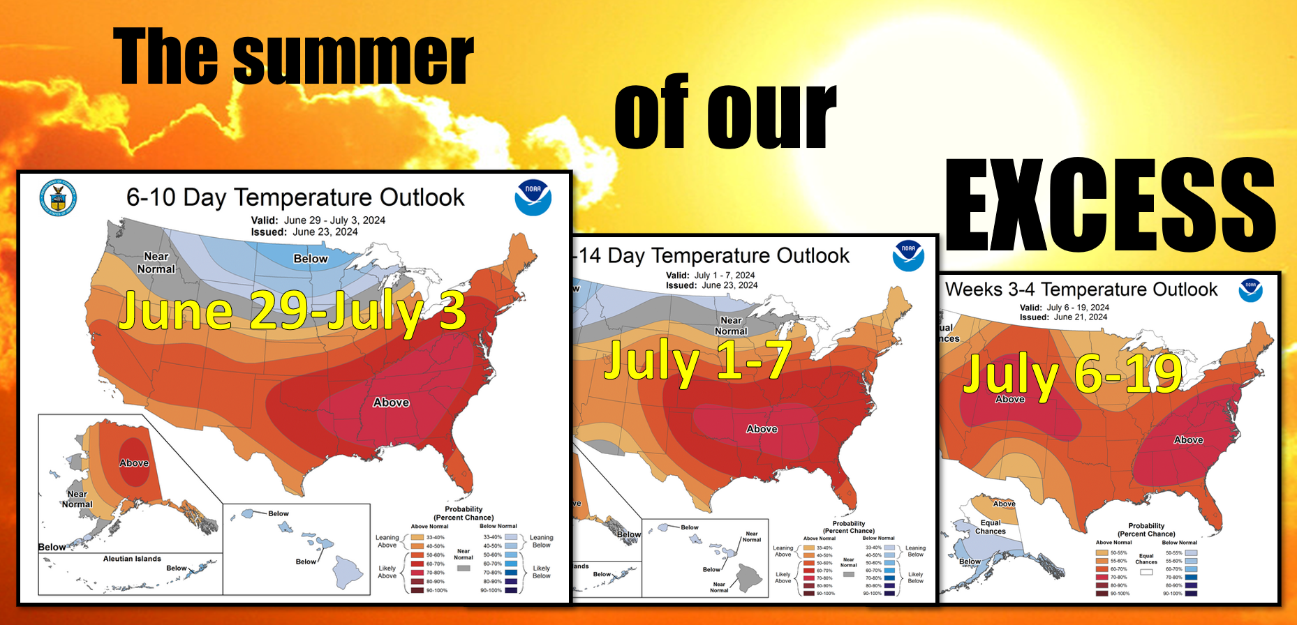
A bit much, no?
https://ticker.mesonet.org/archive/20240624/temperature-outlooks.png
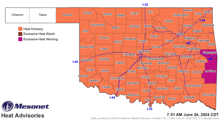
The next 4 weeks? Heck (no, it's not raining right now for crying out loud), I
could have just gone with the current week where we'll see heat index values
up into the 110s off and on through the next 5 days.
https://ticker.mesonet.org/archive/20240624/latest.oklahoma.heat.gif
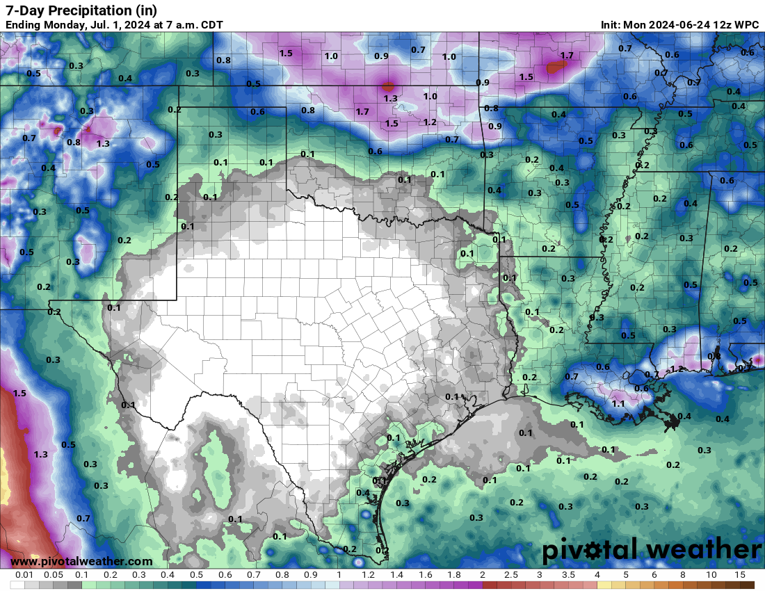
But lasting through the next 4 weeks? Well, the odds are certainly tilted towards
that in the outlooks, but here's some hope...those outlooks can and will change
as the heat dome from hades meanders about, and our dim rainfall hopes could
also improve as that occurs. As it is now, we see chances for some storms to
fire up to the north and head down our way pretty much each night for the next
week, but this is pretty iffy right now. We'll hold out hope on this as well.
https://ticker.mesonet.org/archive/20240624/7day-rain-forecast.png
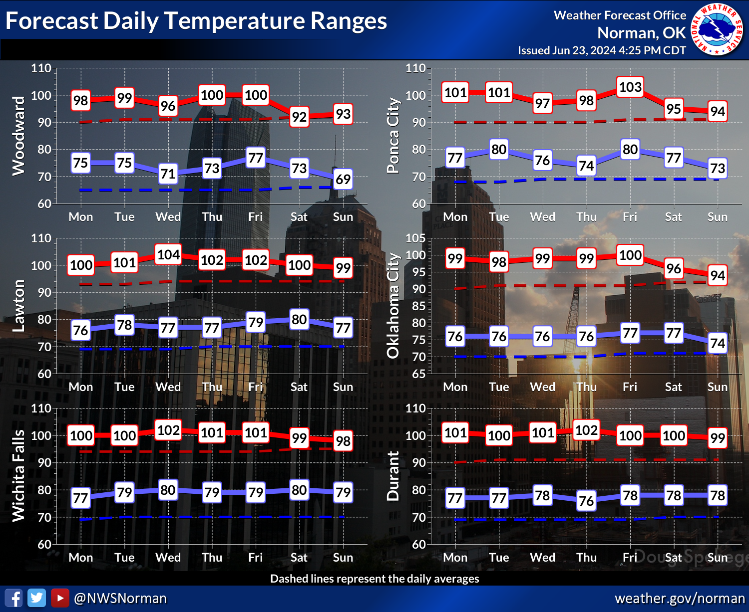
But like we said last week...welcome to the summer doldrums.
https://ticker.mesonet.org/archive/20240624/nws-norman-7day-temps.png
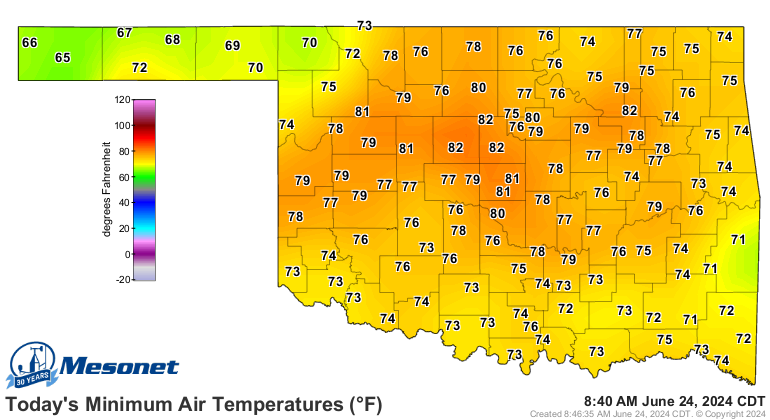
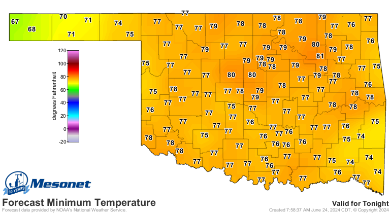
Everybody concentrates on the highs, of course, but we tend to neglect the lows.
Without the ability to refresh overnight and lose the heat stress of the day,
that just exacerbates the following day's heat stress. So it's a cumulative
impact on living things, from plants and livestock to us humans. So when you
see lows like this this morning, and what's expected overnight tonight, be
sure to check on your vulnerable friends and family, as well as pets and
livestock.
https://ticker.mesonet.org/archive/20240624/todays-lows.png
https://ticker.mesonet.org/archive/20240624/tonights-lows.png
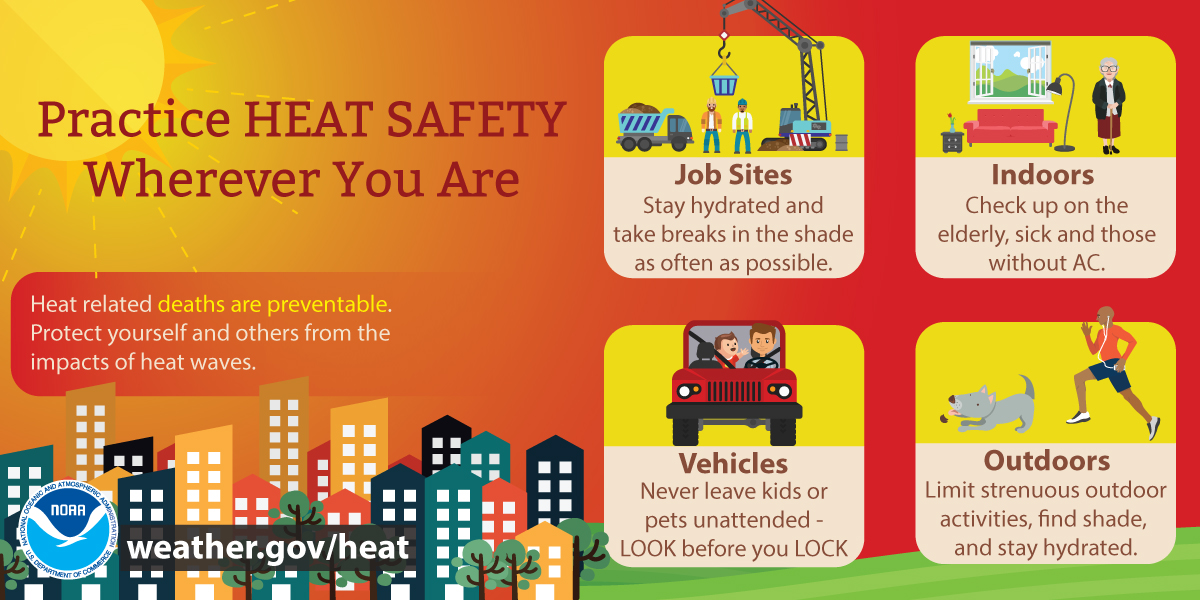
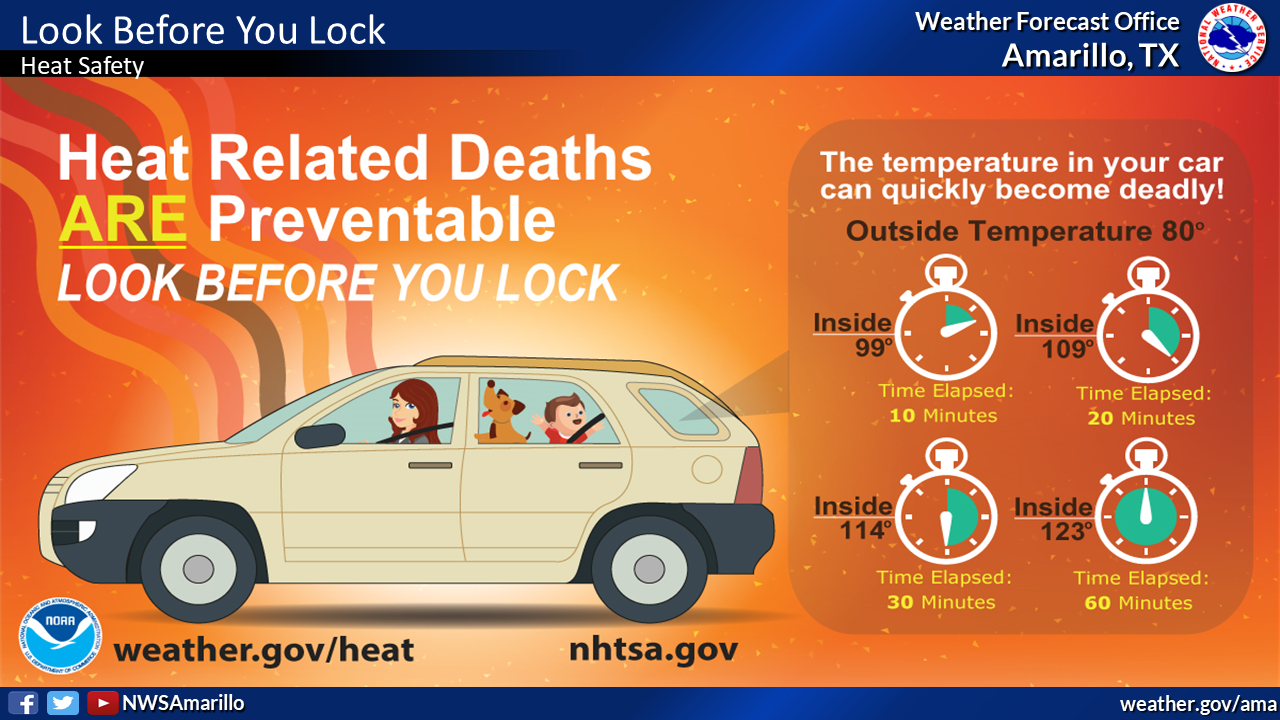
A very dangerous time indeed. Here are some heat safety tips.
https://ticker.mesonet.org/archive/20240624/heat.safety1.png
https://ticker.mesonet.org/archive/20240624/heat.safety2.png
I can hear it already (wait...am I the only one hearing that??), "it's ALWAYS
hot in the summer in Oklahoma!" Well, that's true, at least relative to the
rest of the year. But when we see patterns like this set up, it can be a
harbinger of things to come. There's a difference between being hot and being
ABOVE NORMAL hot. Above normal temperatures, so sought after in the winter,
are a curse during the summer. And we've seen all types of summers just over
the last 3 years.
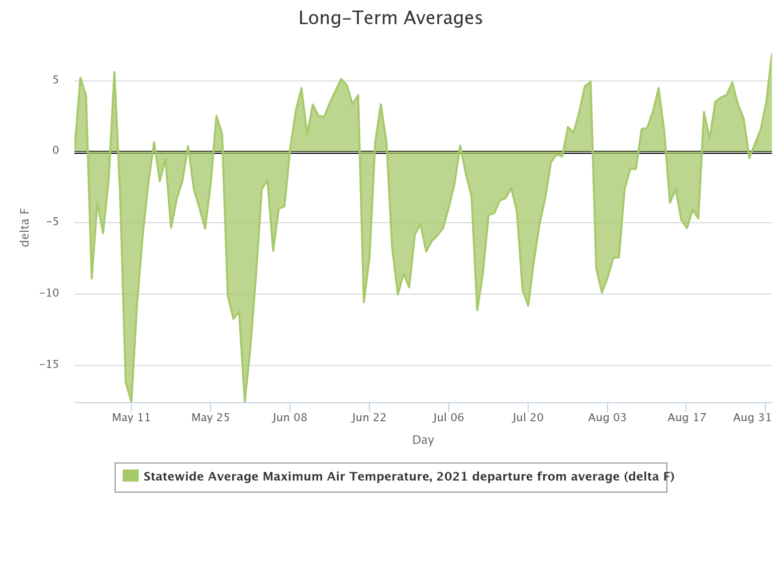
There's the MILD summer of 2021 (yes, still "hot," but not really by Oklahoma's
standards).
https://ticker.mesonet.org/archive/20240624/2021-summer-temps.png
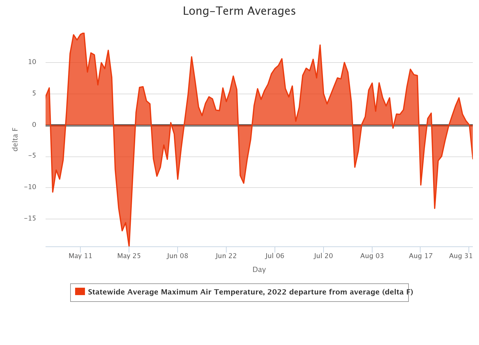
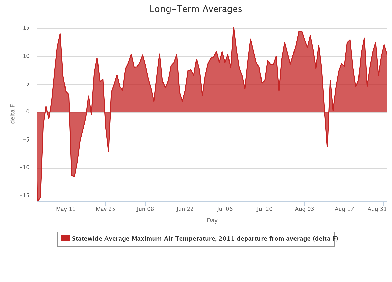
Then there was the summer of 2022...the hottest in the state since our hottest
summer on record (hottest for any state!) back in 2011. There was really very
little relief from the heat, and it led to an intense flash drought in early
June. Summer pretty much lasted through mid-fall that year.
https://ticker.mesonet.org/archive/20240624/2022-summer-temps.png
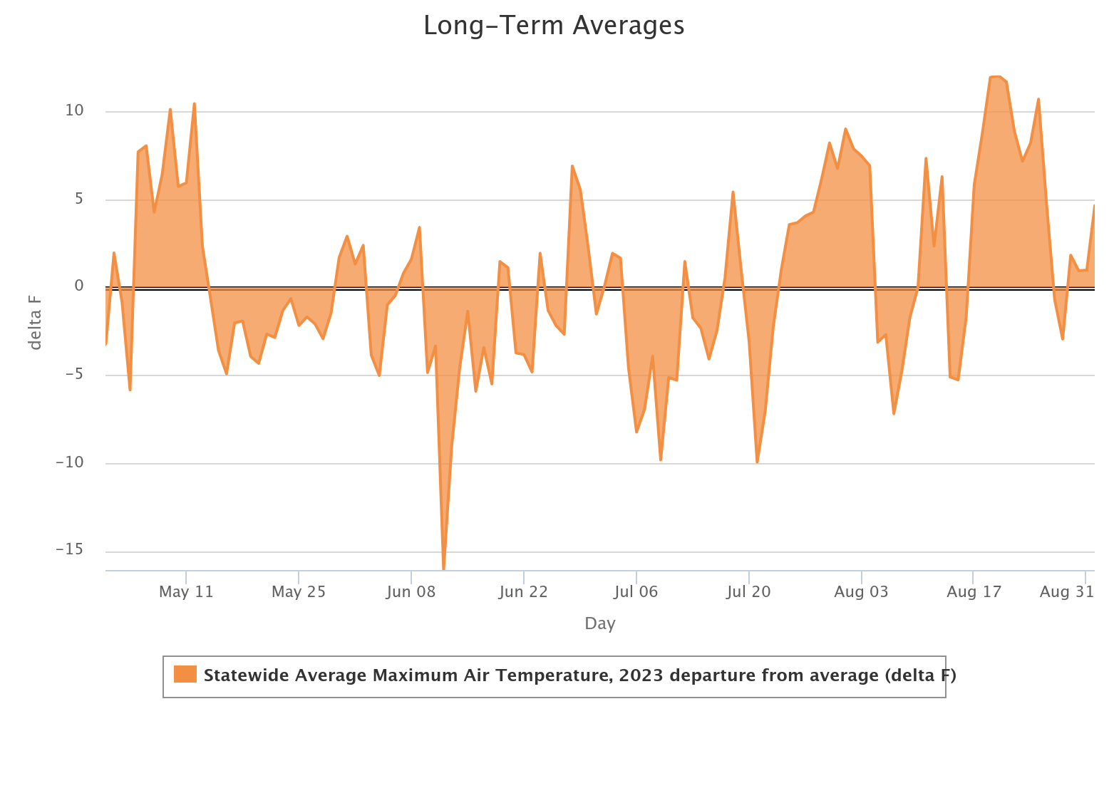
Then we had last year's no summer-yes summer where it was mild through the
3rd week of July, then another scorcher straight through October.
https://ticker.mesonet.org/archive/20240624/2023-summer-temps.png
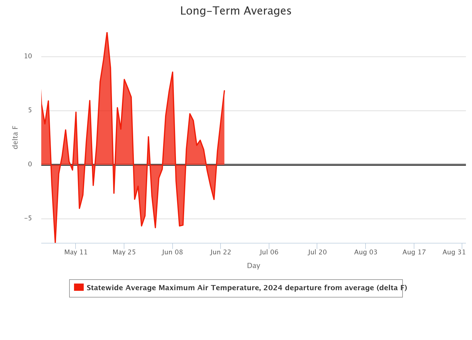
I'd say this year we're looking more like 2022 than 2021 or 2023. But just as
summer did a huge switcharoo in 2023, maybe it can switch the other way in 2024.
https://ticker.mesonet.org/archive/20240624/2024-summer-thus-far.png
Nothing like this, though. At least not yet.
https://ticker.mesonet.org/archive/20240624/2011-summer-temps.png
Gary McManus
State Climatologist
Oklahoma Mesonet
Oklahoma Climatological Survey
gmcmanus@ou.edu
==================================================
The OCS/Mesonet Ticker
https://ticker.mesonet.org/
To subscribe or unsubscribe from the Ticker
or for questions about the Ticker or its content
Phone or Email the Ticker Manager at OCS
Phone: 405-325-2253 Email: ticker@mesonet.org
---------------------------------------------------
-C- Copyright 2024 Oklahoma Climatological Survey
===================================================
|


 Tweet
Tweet