Ticker for May 24, 2024
MESONET TICKER ... MESONET TICKER ... MESONET TICKER ... MESONET TICKER ...
May 24, 2024 May 24, 2024 May 24, 2024 May 24, 2024
Put me in Coach!
Now listen here, I don't mind Monday morning quarterbacking...I'm pretty good at
it myself. For example:
"Oh, I shouldn't have bought all those combs!"
and
"Ugh, I really thought that was a Baby Ruth."
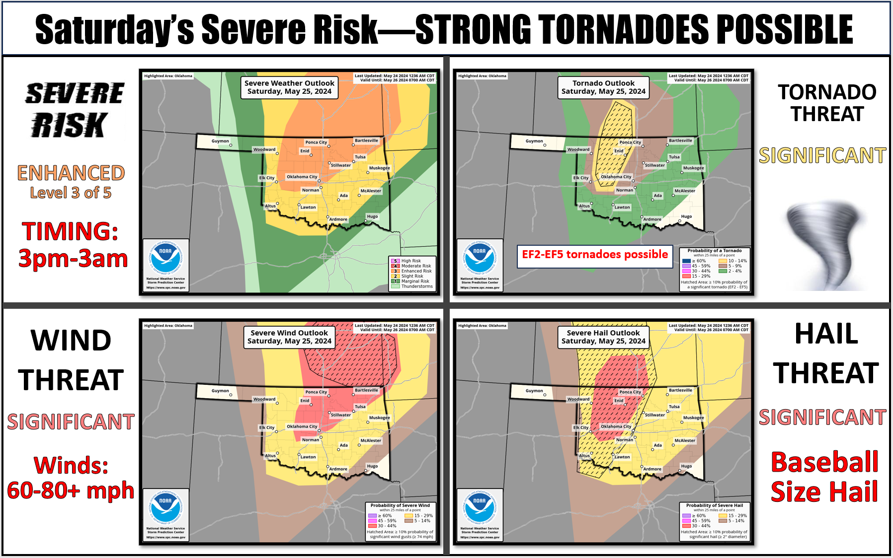
But here's the deal...every time one of these risk maps come out that shows
elevated risk of severe weather for Oklahoma, we get the Wisenheimers and
Naysayers pooh-poohing the chances. Also some comments from Nayheimers and
Wisensayers. The worst comes from the Wisenpoohers and Naypoohers (there's
medicine for that), however. Usually "Oh, this is normal for spring in Oklahoma."
No, it's not. This year has been one of the most active spring severe weather
seasons we've seen in the last decade, and at somewhere around 90 tornadoes (and
counting, unfortunately), we're already up to top-10 on record (since 1950)
for those numbers, with 7 months to go. We've had 2 violent tornadoes for the
first time since 2013. We've had 9 significant tornadoes, 7 strong, and 2
violent. And it's much more than that...it's the
softball-size hail, the 80-100 mph winds, etc. Did you know we probably broke
Oklahoma's record for largest hail stone back in April at over 6 inches?
Yes, we probably did!
Sure, not everybody will see severe weather...some folks won't even see a
storm on these types of days, but if you do get hit with severe weather, then
all of a sudden you stop being a naysayer and become a believer. And Heaven
forbid you become a statistic because you didn't take the risk seriously.
Have a plan to keep you and yours safe, take steps to protect your property
and your lives, have several ways to get warnings should you lose power. My
family and I were without TV for a few days last weekend when the tornadoes
were hitting the fan, so I was streaming live severe weather coverage on my
phone to my TV, and if the power went out I had a portable radio AND my NOAA
WX radio to hear any important information on, in addition to apps on my
phone (which I kept charged AND had two portable chargers, uhhh...charged up).
My family and I were in Edmond at a jazz concert (dig it!) when a significant
tornado entered far western OKC headed east. I followed the warnings and
coverage during the concert and left with plenty of time to head south to
Norman before the storm would intersect my path.
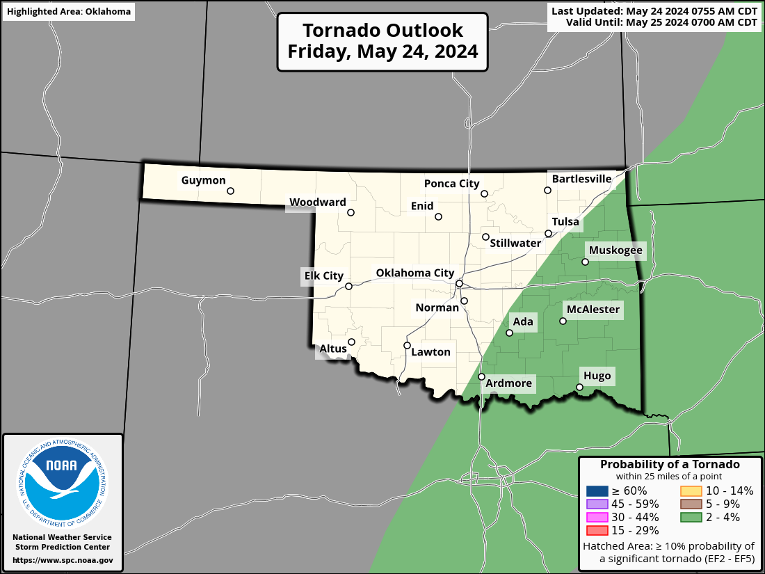
You have to stay weather aware! And again, for the naysayers, let me repeat
a part of that: "...a significant tornado entered far western OKC!" And the
risk was very low that day, and OKC was in the lowest category on the tornado
risk map. In the last few weeks (including yesterday), we've had several
VIOLENT tornadoes that haven't been categorized that way because they didn't
hit something and cause enough damage to hit EF4 or even EF5 on the Enhanced
Fujita scale. It's all luck because if one of those hits somewhere densely
populated, we have Moore 1999/2013 all over again.
So again, I don't mind the Monday Morning QB'ing. Just have a plan, for crying
out loud! We all hope nothing happens tomorrow, and that could happen. Or we
could have an outbreak with several long-tracked strong tornadoes. Do I know
what's gonna happen? Of course not. But I know what CAN happen, and therefore
I'll be staying weather aware no matter what I'm doing. And I won't be taking
those risk maps as gospel...they're great tools, but we have to remember fuzzy
boundaries. Just because you aren't in the hatched area where more widespread
significant severe weather is expected doesn't mean YOU won't see significant
severe weather.
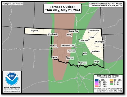
No hatched area on yesterday's tornado risk for Oklahoma, but we still had a
large, long-tracked violent tornado (regardless of EF rating) in SW OK.
This rant's about over, but I just gotta finish with one more: go out and enjoy
your weekend tomorrow. No reason to be scared UNLESS YOU GO OUT UNPREPARED FOR
SEVERE WEATHER WITHOUT A PLAN.
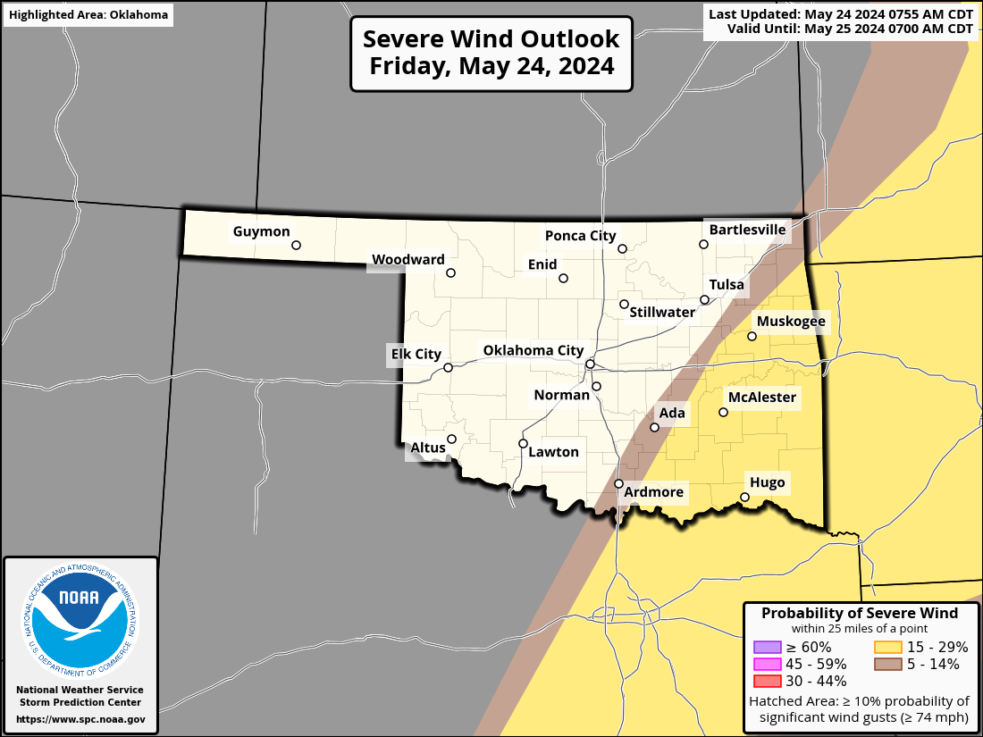
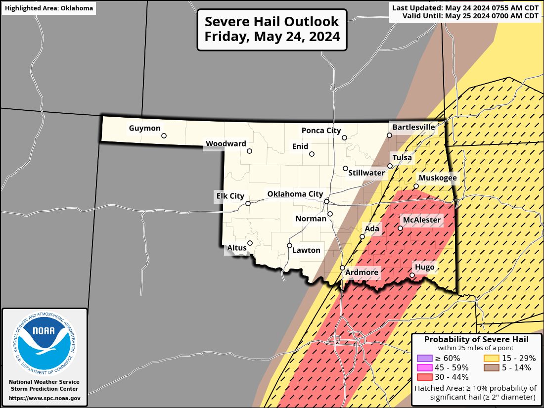
And that planning should be in effect for later this afternoon and evening across
SE OK.
Better safe than a statistic.
Gary McManus
State Climatologist
Oklahoma Mesonet
Oklahoma Climatological Survey
gmcmanus@mesonet.org
May 24 in Mesonet History
| Record | Value | Station | Year |
|---|---|---|---|
| Maximum Temperature | 111°F | TIPT | 2000 |
| Minimum Temperature | 36°F | EVAX | 2017 |
| Maximum Rainfall | 6.54″ | MCAL | 2015 |
Mesonet records begin in 1994.
Search by Date
If you're a bit off, don't worry, because just like horseshoes, “almost” counts on the Ticker website!