Ticker for May 23, 2024
MESONET TICKER ... MESONET TICKER ... MESONET TICKER ... MESONET TICKER ...
May 23, 2024       May 23, 2024       May 23, 2024       May 23, 2024


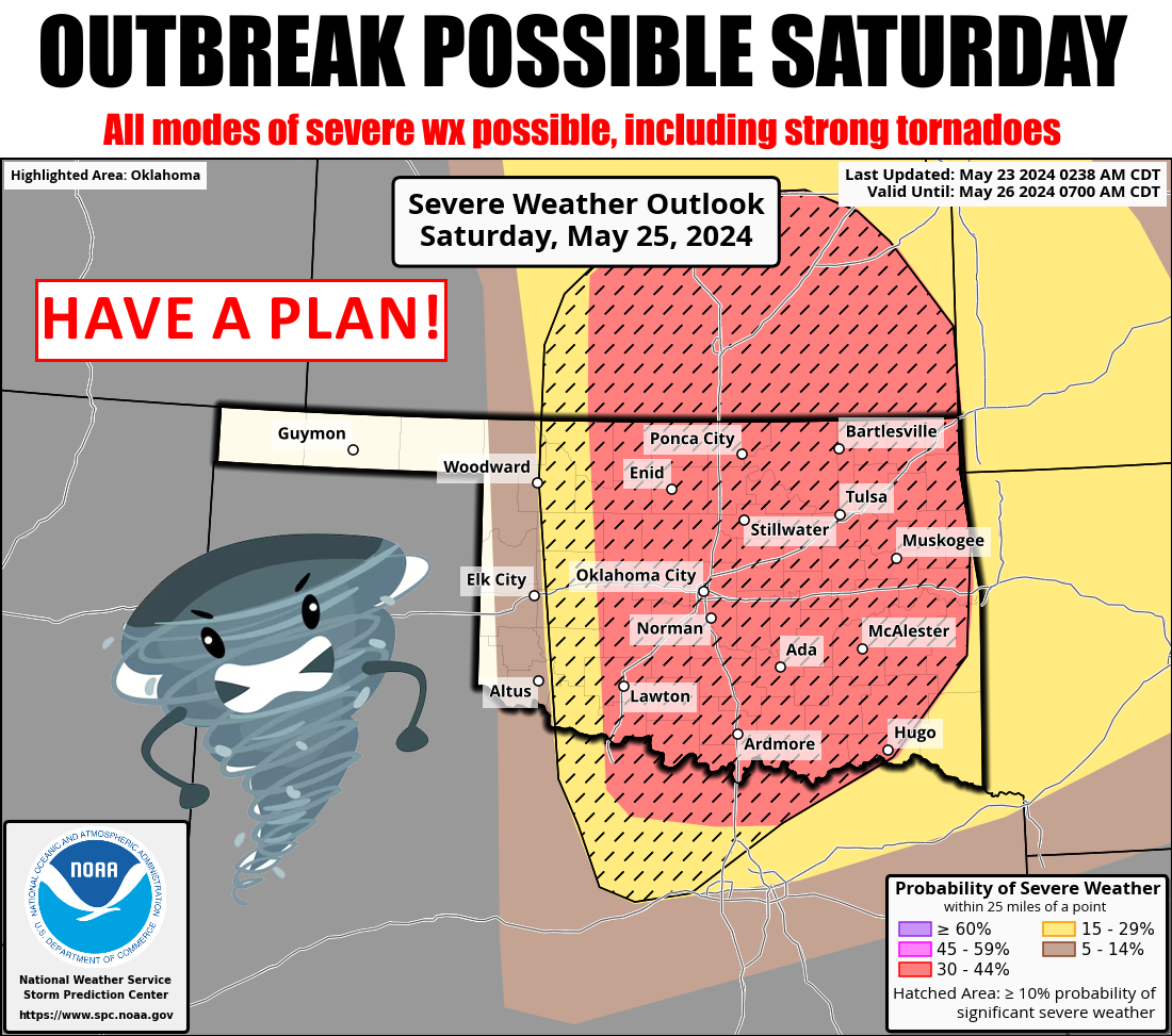
One of THOSE days?


Saturday? PFFFTTTTT (Childish to Okie translation: "Yer kiddin', right?")...don't
sleep on today!


Also, don't sleep on ants. Get this and other sage advice in my new pamphlet:
'"No Duh" Advice From An Idiot," so bad we couldn't make it a book. But yes,
today is one of THOSE days in Oklahoma...one of those days where you wake up and
go check to storm shelter for dead frogs that might have gotten trapped and
croaked (get it?) since you were in there a couple of days ago. Now I led with
Saturday's "One of THOSE days" because I know most (many...okay, some) of you
probably have big Labor Day Weekend plans. Hey, I know it's Memorial Day Weekend,
but I still get confused, so just in case...but anyway, you can't go into zombie
mode this weekend in the midst of your grand plans and let the weather get away
from you. Because you might be stuck trying to get away from the weather at the
last minute. Have a plan, and stay weather aware, in other words.

Oh, my grand plans? Well, I'm going to eat at the Braum's in Guthrie, stop at
Sonic for a Reese's Blast, and then use the bathroom at Love's.

Jealous.

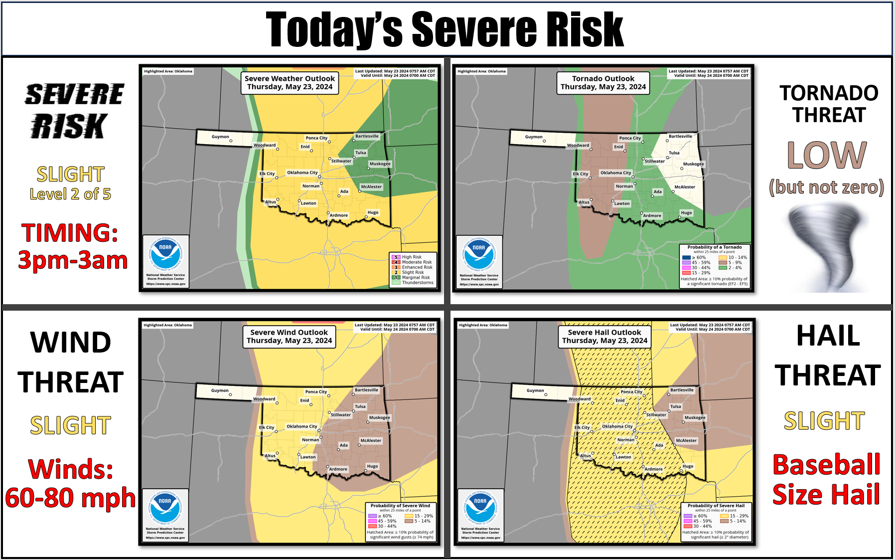
Today could be "bad," so we definitely need to stay weather aware with storms
firing along the dryline later this afternoon across far western OK, but also
farther east in the warm sector where a warm front is lifting northward,
bringing us all that rich moisture-laden air. The storms along the dryline will
have the highest tornado potential, but beware the moors, and stick to the road.
Whoops, how did the "An American Werewolf in London" advice get in here? Beware
the big supercells that get well established and start marching east. Think back
to Sunday's singular cell that dropped tornadoes from western into central
Oklahoma. Have a plan if those storms begin to approach your area. Have 2 or 3
ways to get warnings from the NWS, SPC, and your favorite local media source
should you lose power, or be out and about. What about your family? Pets? Your
Uncle Harvey with that bad body odor? Yes, he needs to know about the severe
weather approaching him as well, so give him a call...he might not see a text,
you know.

Then, take a break on Friday, because Saturday could be a doozie. We're close
to 90 tornadoes for Oklahoma in 2024 thus far, and that number will undoubtedly
go up through the next few days, then possible more chances next week as well.
The atmosphere is obviously primed to act up this spring, with a record 55
tornadoes in April (beating 2012's 54), and already around 30 for May.

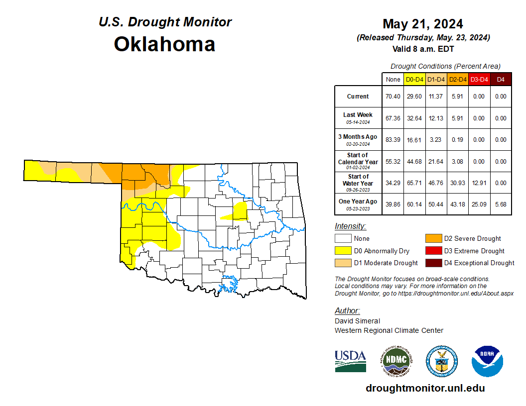
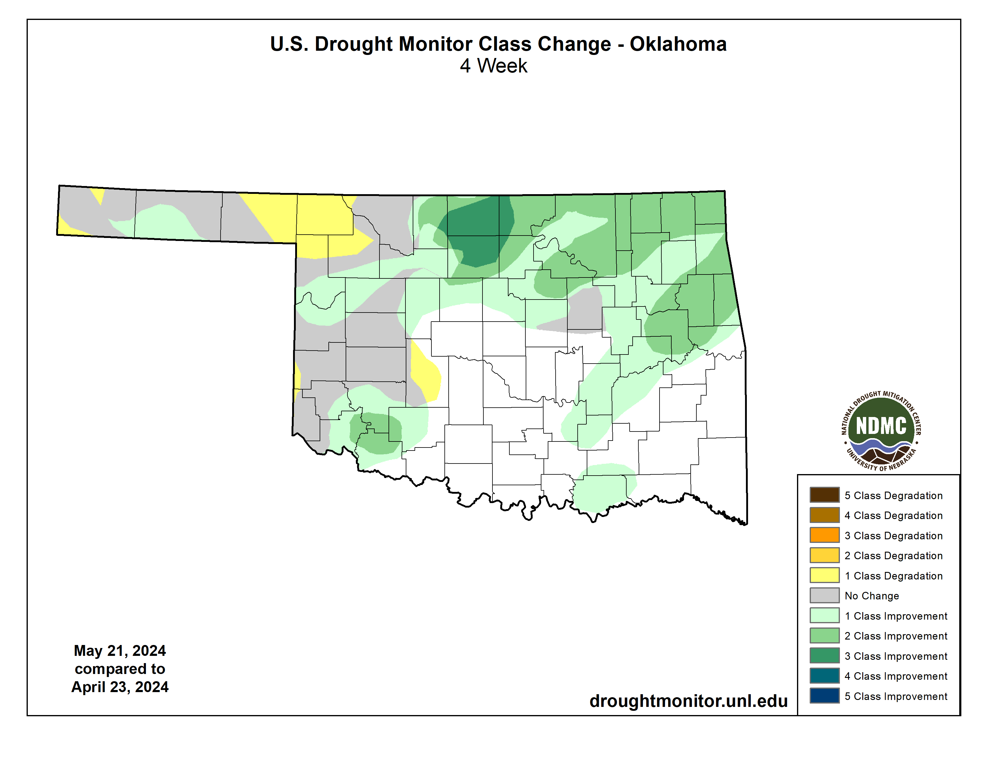
At least we get rain from these storms, and drought continues to shrink across
the eastern two-thirds of the state. We really need to get some more rain up
in far NW OK, though. Preferably without tornadoes or giant hail.


We also need some drying for that wheat to continue curing. Then more drying to
allow equipment into the field. Not sure if Mother Nature is in a cooperative
mood this spring, but we'll hope for the best.

To sum up:

1) Stay weather aware today, with storms possibly starting early afternoon.
2) You have to be vigilant Saturday...don't let your fun end with disaster due
to a possible high-end severe weather event.
3) Beware the moors, and stick to the road.

Feel free to forward this e-mail to you and yours. No no no, don't tell them to
read it, for crying out loud! You want them to still talk to you, right? Tell
them it's a reminder to get weather aware, today and potentially especially on
Saturday.

Gary McManus
State Climatologist
Oklahoma Mesonet
Oklahoma Climatological Survey
gmcmanus@mesonet.org
May 23 in Mesonet History
| Record | Value | Station | Year |
|---|---|---|---|
| Maximum Temperature | 112°F | ALTU | 2000 |
| Minimum Temperature | 40°F | EVAX | 2017 |
| Maximum Rainfall | 9.67 inches | VINI | 2011 |
Mesonet records begin in 1994.
Search by Date
If you're a bit off, don't worry, because just like horseshoes, “almost” counts on the Ticker website!