MESONET TICKER ... MESONET TICKER ... MESONET TICKER ... MESONET TICKER ...
October 23, 2020 October 23, 2020 October 23, 2020 October 23, 2020
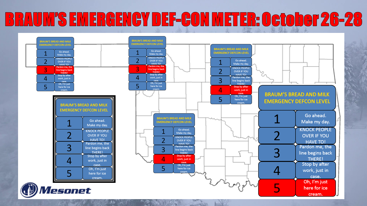
Get thee to a Braum's
http://ticker.mesonet.org/archive/20201023/Braums-DEFCON-meter-oct2020.png
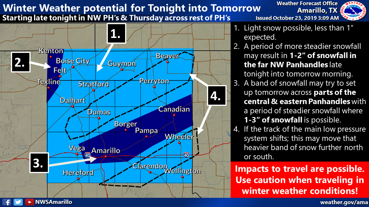
We're still haunted by last October's (see what I did there?) forecast snow
event where it appeared a couple-three inches were on tap for select locations,
and we ended up with 13 inches in Arnett.
THESE IMAGES ARE FROM LAST OCTOBER'S SNOWSTORM!
http://ticker.mesonet.org/archive/20191023/nws-amarillo-snow.png
http://ticker.mesonet.org/archive/20191025/nws-norman-snow-totals.png
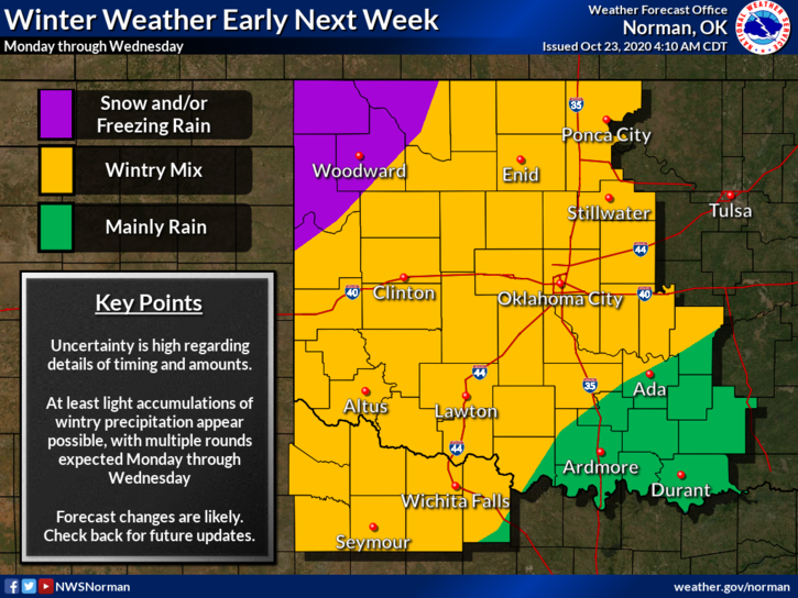
Regardless of that event, which was of no fault of local forecasters (you try
and forecast wintry precip in the Plains, then you can miraculously give me a
full head of hair!), the mere mention of ice stand my hair on end. No, not that
hair, the other one.
http://ticker.mesonet.org/archive/20201023/nws-norman-next.week.png
http://ticker.mesonet.org/archive/20201023/nws-amarillo-next.week.png
Obviously the storm's timing, track, and strength are still a up in the air (pun
intended), so once the even draws near, the forecast models and therefore the
forecasters will have a better handle on the precip types and locations. Still,
doesn't take much to mess up a winter precip scenario. One warm nose of air
aloft can change everything.
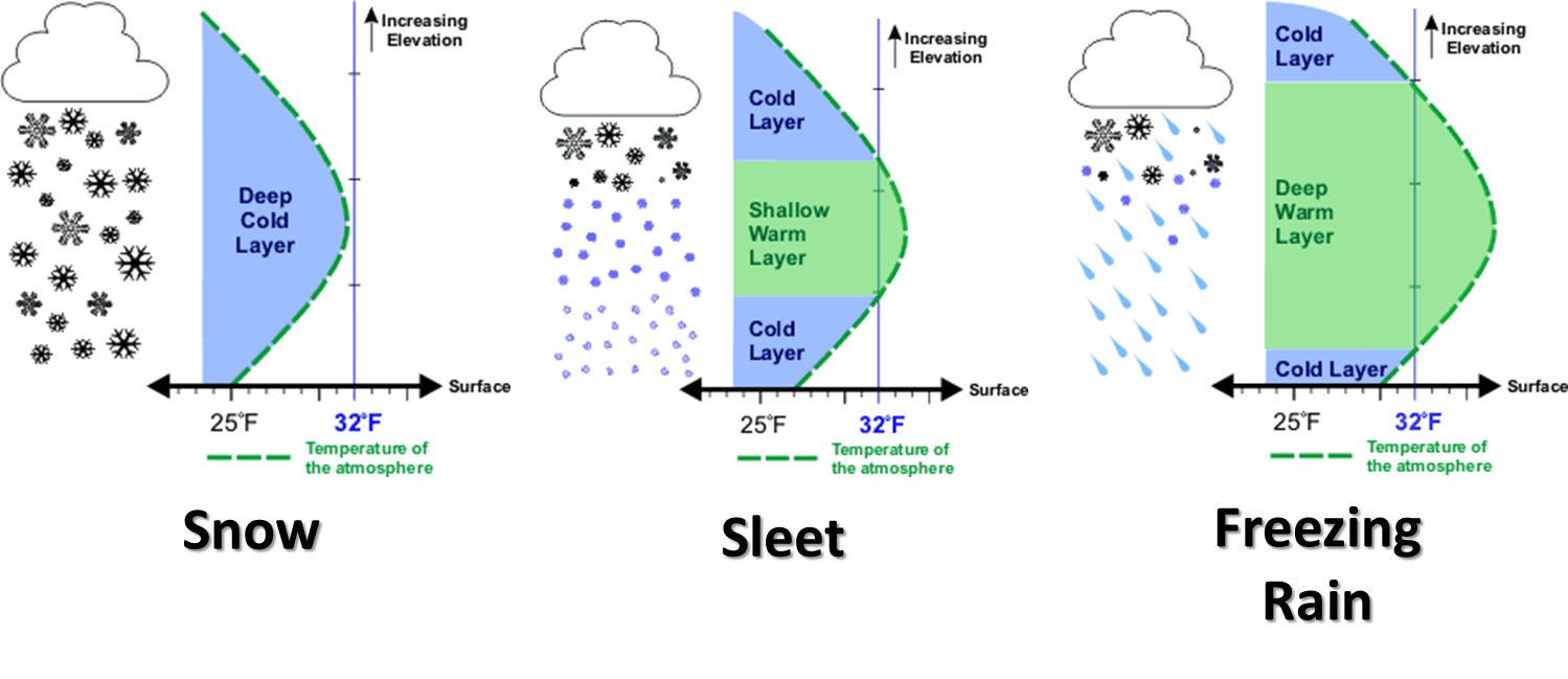
http://ticker.mesonet.org/archive/20131125/winter-precip-types.png
So just be prepared to be prepared, in preparation of things you should have
already been preparing to prepare for. One thing that is more certain is much
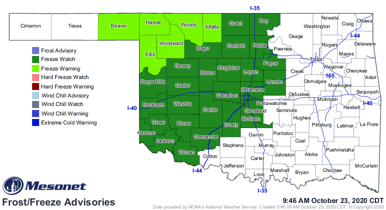
more of the state will see a killing frost over the next few days. We already
have freeze watches and warnings out across the NW half of the state or so for
tomorrow morning.
http://ticker.mesonet.org/archive/20201023/latest.oklahoma.frostfreeze.gif
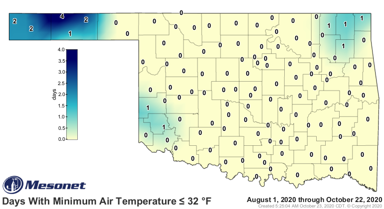
The western Panhandle doesn't need a watch/warning since it's already experienced
freezing weather. I would expect another map for much of the remainder of OK
for early next week.
http://ticker.mesonet.org/archive/20201023/tmin.le32.png
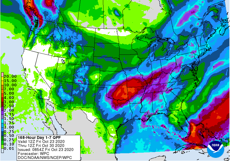
Finally, above all else, we COULD see a good dose of moisture with this storm,
which would go a long way to alleviate some of those drought impacts, the most
of which is the possible decimation of the wheat crop that's been or being
planted.
http://ticker.mesonet.org/archive/20201023/7day-rain-forecast.gif
Stay warm, stay safe!
Gary McManus
State Climatologist
Oklahoma Mesonet
Oklahoma Climatological Survey
(405) 325-2253
gmcmanus@mesonet.org
==================================================
The OCS/Mesonet Ticker
https://ticker.mesonet.org/
To subscribe or unsubscribe from the Ticker
or for questions about the Ticker or its content
Phone or Email the Ticker Manager at OCS
Phone: 405-325-2253 Email: ticker@mesonet.org
---------------------------------------------------
-C- Copyright 2024 Oklahoma Climatological Survey
===================================================
|


 Tweet
Tweet