MESONET TICKER ... MESONET TICKER ... MESONET TICKER ... MESONET TICKER ...
June 23, 2023 June 23, 2023 June 23, 2023 June 23, 2023
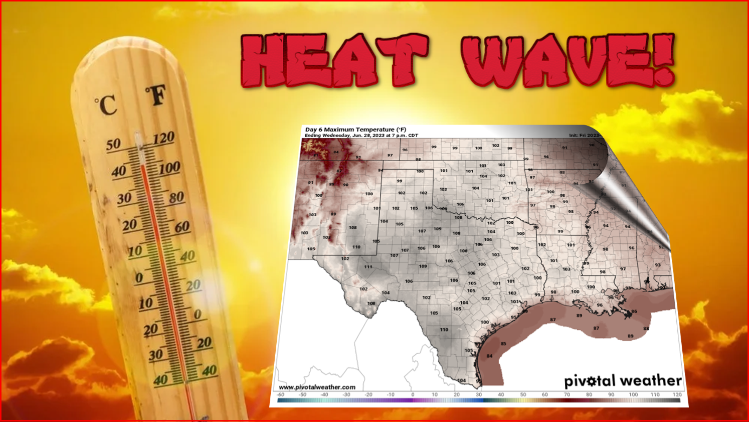
HOT HOT HOT!
https://ticker.mesonet.org/archive/20230623/heat.wave.png
Sorry, very little time to Tock today. I'm working on the follow-up to my #1
smash hit "The Tornado Blowed Over My Beer." Many people thought it sounded more
like a #2.
Wait for it...
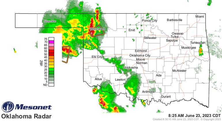
Okay. Same setup today as the past several days with storms rolling in this
morning, then more storms out west this afternoon that also might roll in.
https://ticker.mesonet.org/archive/20230623/current-radar.png
https://ticker.mesonet.org/archive/20230623/OK_swody1.png
So be sure to remain weather aware for severe weather. As you can see, there is
(or was, as you read this) a severe thunderstorm warning up in the NW, so these
storms aren't wimps, necessarily. Trust me, I know wimpy. I served with wimpy
in...okay, it's me.
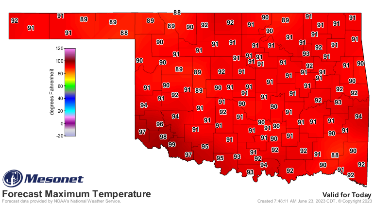
Also not wimpy...the heat today in the southwest. Watch for heat index values up
above 110 degrees. Also, NWS Tulsa is still watching those heat index values
rise close to 100 degrees with so many still without power after the derecho
devastated that area last weekend.
https://ticker.mesonet.org/archive/20230623/latest.oklahoma.heat.gif
https://ticker.mesonet.org/archive/20230623/todays-highs.png
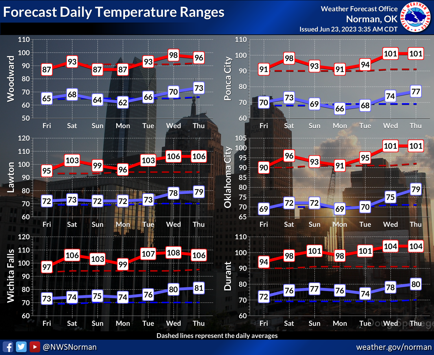
Then a brief cooldown early next week before summer comes roaring back. You see
above we have actual air temperatures forecast to be in the triple-digits across
most of the state by the middle of next week. Looks to not last long, but that's
getting out into the 7-day period where those forecasts get a bit shaky.
As long as that heat dome is hanging around the Southern Plains, we could
easily slide in and out of extreme temperatures, so something to keep an
eye on.
https://ticker.mesonet.org/archive/20230623/nws-norman-7day-temps.png
https://ticker.mesonet.org/archive/20230623/june28-july2-outlooks.png
Now, back to my tunes...
Gary McManus
State Climatologist
Oklahoma Mesonet
Oklahoma Climatological Survey
gmcmanus@mesonet.org
==================================================
The OCS/Mesonet Ticker
https://ticker.mesonet.org/
To subscribe or unsubscribe from the Ticker
or for questions about the Ticker or its content
Phone or Email the Ticker Manager at OCS
Phone: 405-325-2253 Email: ticker@mesonet.org
---------------------------------------------------
-C- Copyright 2024 Oklahoma Climatological Survey
===================================================
|


 Tweet
Tweet