MESONET TICKER ... MESONET TICKER ... MESONET TICKER ... MESONET TICKER ...
September 21, 2020 September 21, 2020 September 21, 2020 September 21, 2020
No fall of fall
http://ticker.mesonet.org/archive/20200921/7day-precip-forecast.png
Okay, we gotcha, tropics...you can form tropical cyclones and hurl them towards
the U.S. mainland. Big deal, have you ever seen what monkeys can do in a zoo? Now
knock it off. Or, you could at least send one of these remnants a little farther
to the west to impact western OK, a place that REALLY needs some rain. In case
you haven't noticed, southeastern Oklahoma doesn't really need any more rainfall
right now.
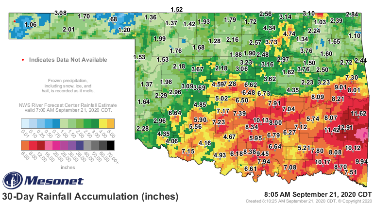
http://ticker.mesonet.org/archive/20200921/30day-rain-totals.png
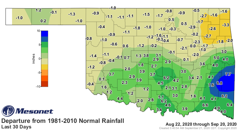
http://ticker.mesonet.org/archive/20200921/del30day_rain.current.png
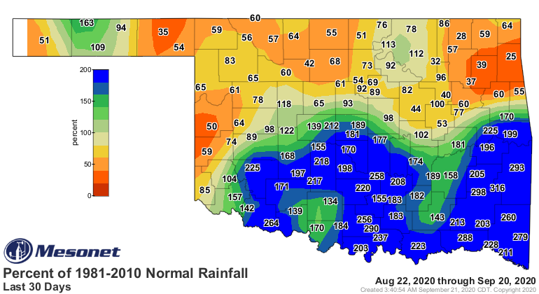
http://ticker.mesonet.org/archive/20200921/pct30day_rain.current.png
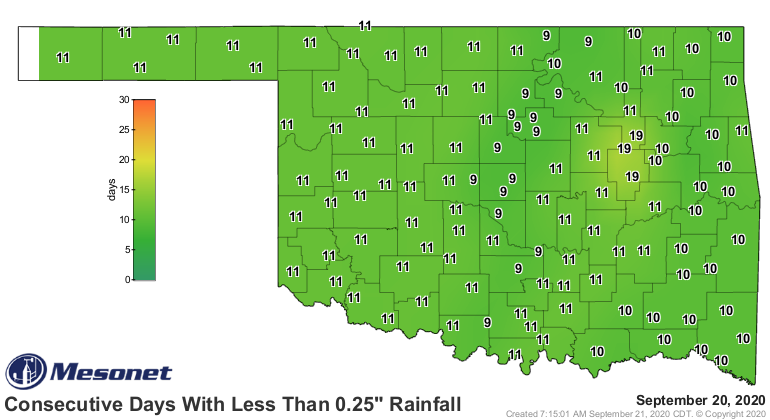
From those maps, you can see western Oklahoma and even the northern half or so of
the state could definitely use some rain. We began to dry out about 11 days ago,
regardless what part of the state you look at, a consequence of our record
breaking cold front that barreled through the state that second week of
September. Just a smattering of rain has fallen since then.
http://ticker.mesonet.org/archive/20200921/mesonet.rainfall.quarterinch.png
http://ticker.mesonet.org/archive/20200921/10day-rain-totals.png
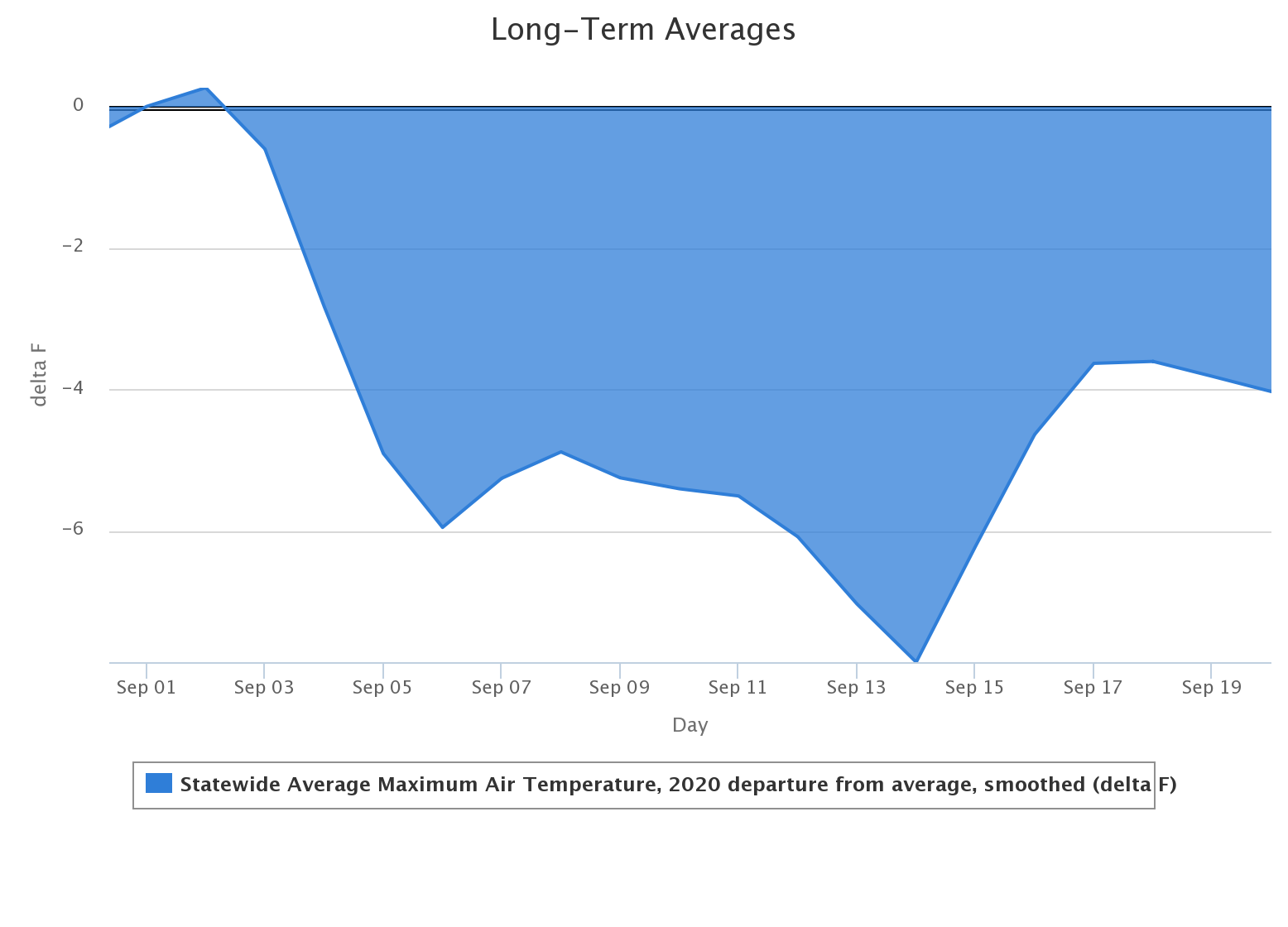
That front kicked summer to the curb and left the state in one of
the longest extended periods of actual fall weather I can remember. Doesn't
mean that it definitely is one of the longest recently, but more of a testament
to my failing memory. Check out this statewide average departure from the
Mesonet's long-term average high temperature graph for the month of September
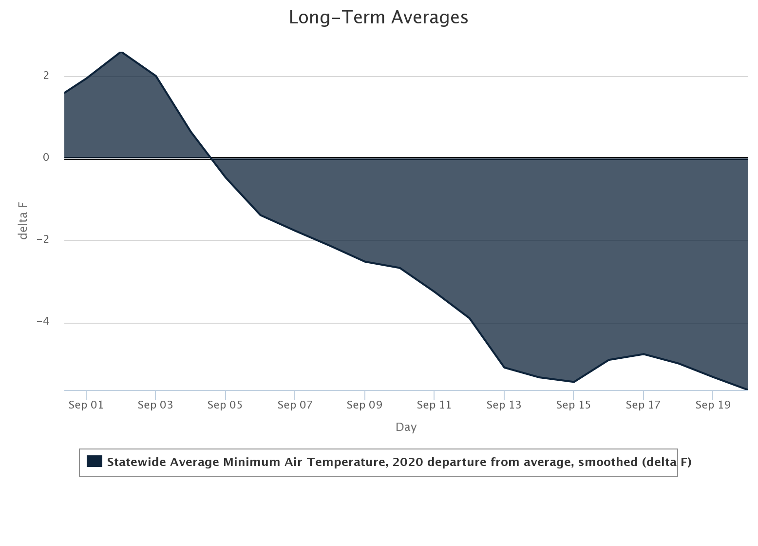
thus far. And our minimum temperatures have also been well below normal.
http://ticker.mesonet.org/archive/20200921/september-swoon.png
http://ticker.mesonet.org/archive/20200921/september-minimums.png
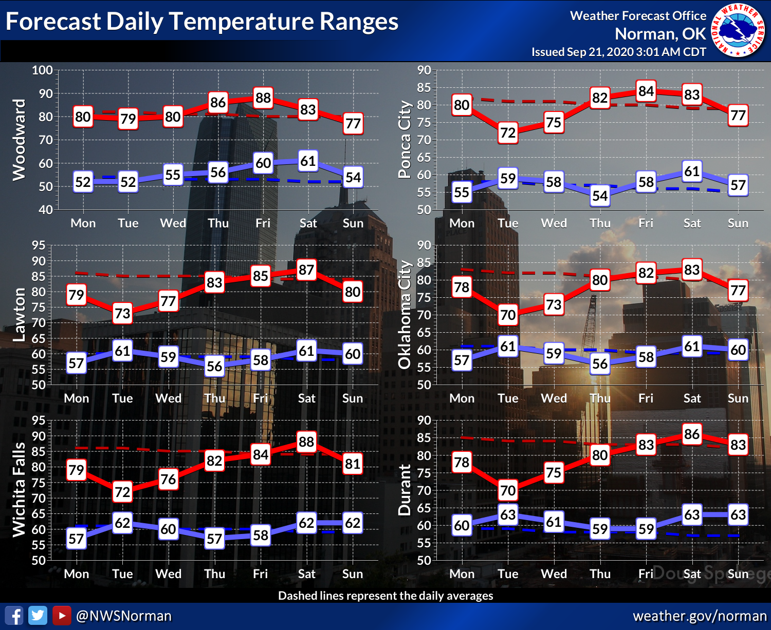
I see little change in the current weather pattern, at least right around the
corner, the impact of tropical storm Beta notwithstanding. We'll see more clouds
the next couple of days as the remnant moves inland, but that won't be much
different than what we've been seeing (or not seeing) thanks to the thick layer
of smoke from the West Coast. That will cause our temperatures to bottom out a
bit, at least those maximum temperatures, but those will quickly rebound after
Beta's passage.
http://ticker.mesonet.org/archive/20200921/7day-temperatues-nws-norman.png
Well, there you have it. You wanted fall, you got fall. Enjoy while it lasts...
summer starts again in 6 short months! Yep...sometime in March. Winter? We'll
see.
Gary McManus
State Climatologist
Oklahoma Mesonet
Oklahoma Climatological Survey
(405) 325-2253
gmcmanus@mesonet.org
==================================================
The OCS/Mesonet Ticker
https://ticker.mesonet.org/
To subscribe or unsubscribe from the Ticker
or for questions about the Ticker or its content
Phone or Email the Ticker Manager at OCS
Phone: 405-325-2253 Email: ticker@mesonet.org
---------------------------------------------------
-C- Copyright 2024 Oklahoma Climatological Survey
===================================================
|


 Tweet
Tweet