MESONET TICKER ... MESONET TICKER ... MESONET TICKER ... MESONET TICKER ...
June 21, 2023 June 21, 2023 June 21, 2023 June 21, 2023
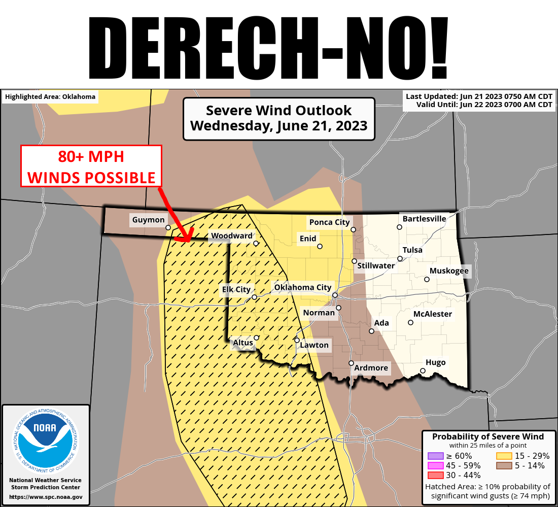
How about NO derecho?
https://ticker.mesonet.org/archive/20230621/derech-no.png
Sorry, little time to Tock today with an appointment looming, so let's Tock about
MY fears of another long-blown windstorm. Hey, some would describe me that way
(and they would hurt my feelings if I had any)! At any rate, the setup today is
for a dryline and outflow boundary to intersect and overcome a pretty substantial
cap to produce severe weather later today. Don't worry too much, I haven't seen
too many folks talking derecho (and if you can talk derecho, get a hold of the
NWS...they're looking for translators), but it's something I worry about in the
hot summer air.
Anyway, IF convection starts up later this afternoon, we could see western OK get
hit by hail to the size of baseballs and 80+ mph winds. The worry about the
derecho comes, at least to me, if a large complex of storms form and then
march to the SE, blowing and going along its path.
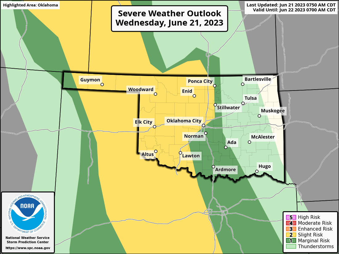
https://ticker.mesonet.org/archive/20230621/OK_swody1.png
https://ticker.mesonet.org/archive/20230621/OK_swody1_HAIL.png
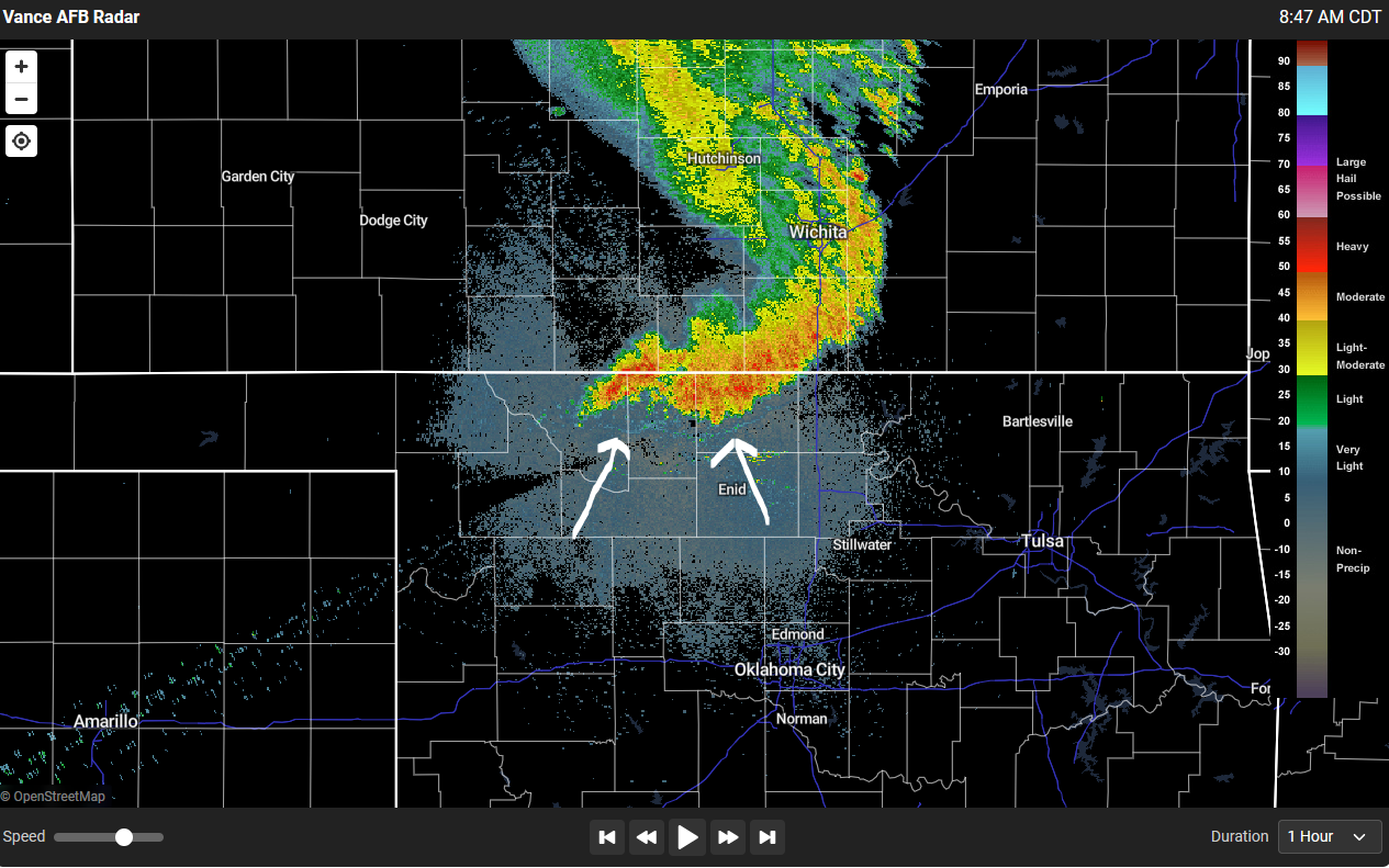
We get the possible outflow boundary from a complex of storms this morning
moving out of the High Plains into far northern OK.
https://ticker.mesonet.org/archive/20230621/outflow.png
And yes, it is raining right now for crying out loud!
So that's something to watch for later this evening into the overnight hours,
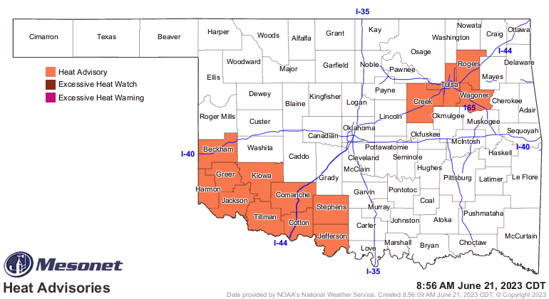
particularly for western OK. Otherwise, watch for more extreme heat in the SW
today, and a bit of a reprieve for points east.
https://ticker.mesonet.org/archive/20230621/latest.oklahoma.heat.gif
https://ticker.mesonet.org/archive/20230621/4pm-heat-index-forecast.png
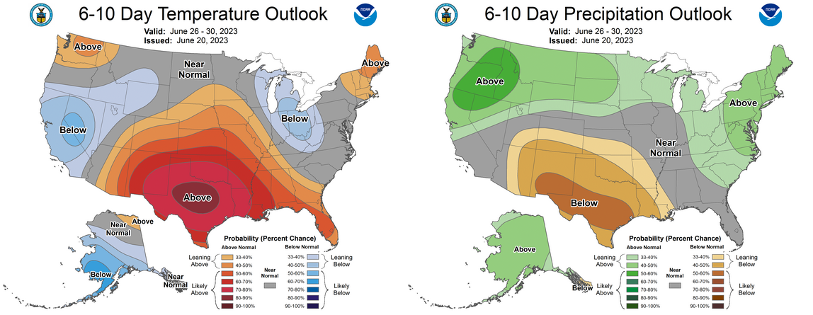
A bit more mild tomorrow and the next couple of days before summer comes back
this weekend, and it looks like it's gonna be here to stay for awhile.
https://ticker.mesonet.org/archive/20230621/june26-30-outlooks.png
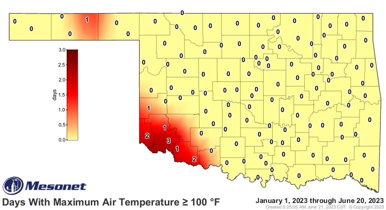
This map might be ready to explode.
https://ticker.mesonet.org/archive/20230621/tmax.ge100.png
Gary McManus
State Climatologist
Oklahoma Mesonet
Oklahoma Climatological Survey
gmcmanus@mesonet.org
==================================================
The OCS/Mesonet Ticker
https://ticker.mesonet.org/
To subscribe or unsubscribe from the Ticker
or for questions about the Ticker or its content
Phone or Email the Ticker Manager at OCS
Phone: 405-325-2253 Email: ticker@mesonet.org
---------------------------------------------------
-C- Copyright 2024 Oklahoma Climatological Survey
===================================================
|


 Tweet
Tweet