Ticker for September 20, 2022
MESONET TICKER ... MESONET TICKER ... MESONET TICKER ... MESONET TICKER ...
September 20, 2022 September 20, 2022 September 20, 2022 September 20, 2022
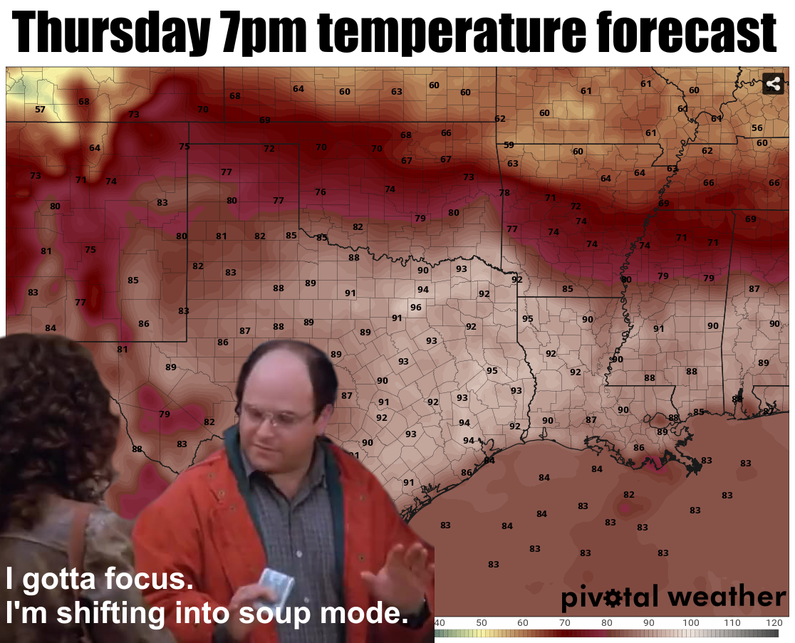
Soup mode!
Sorry I'm getting the Ticking so early, but my State Climatologist Book Club is
reading Archie comics and I'm trying to watch old episodes of "Riverdale" to
catch up.
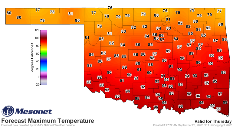
So we may go through hell (but definitely no high water) to get there, but we are
in for a blast of fall come Thursday, which coincidentally is the lesser beginning
of fall...astronomical fall (as opposed to the much more superior "Climatological
Fall" on Sept. 1...and let me say "meteorological fall" is a falsehood perpetrated
by the weather community since climatologists are the ones that track seasonal
statistics). And just as George is preparing for soup above, so should you. You
might not get to eat until just about bedtime if you're down south, but this
blast of cool air will be a welcome change from the record breaking temperatures
of the next couple of days. Today's highs, for instance, should see some records
fall up north.

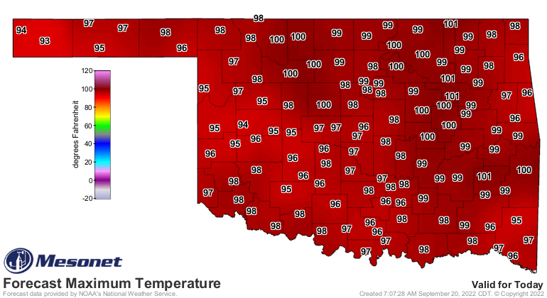
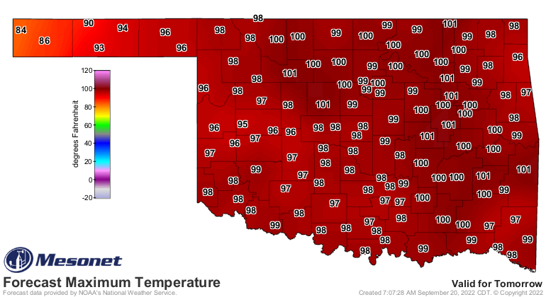
Tomorrow will be the hottest day as those winds pump up ahead of the cold
front, but even Thursday will bake until it arrives.
We then get hot again for the weekend, then see a longer cooldown early next
week before getting hot once again. But how about rainfall? Well, like I said
no high water, but looking back things are getting worse. If we go back to the
beginning of the flash drought, which is now just...drought, on June 11, we
can see just how desperate things have become.

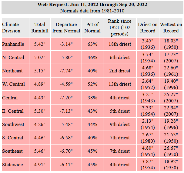

The 4th driest June 11 through Sept. 20 dating back to at least 1921 is pretty
impressive, climatologically speaking (don't try it, you'll end up a babbling
loon like me), but even more so is the 2nd driest such period the Northeast
climate division has suffered, nearly 8 inches below normal on average. And
trying to bump 1954 off the record as the driest is pretty bold, considering
the 1951-57 drought is THE drought of record for the main body of the state,
arguably. But with that heat dome in place cutting off any moisture from the
Gulf of Mexico, the next couple of fronts will be mostly dry, so no hope for
the next week or so.
So we remain in standby mode, but at least we can switch to soup mode come
Thursday.
Gary McManus
State Climatologist
Oklahoma Mesonet
Oklahoma Climatological Survey
gmcmanus@mesonet.org
September 20 in Mesonet History
| Record | Value | Station | Year |
|---|---|---|---|
| Maximum Temperature | 107°F | FREE | 2024 |
| Minimum Temperature | 41°F | NOWA | 2003 |
| Maximum Rainfall | 5.83 inches | MTHE | 2019 |
Mesonet records begin in 1994.
Search by Date
If you're a bit off, don't worry, because just like horseshoes, “almost” counts on the Ticker website!