Ticker for September 20, 2018
MESONET TICKER ... MESONET TICKER ... MESONET TICKER ... MESONET TICKER ...
September 20, 2018 September 20, 2018 September 20, 2018 September 20, 2018
The
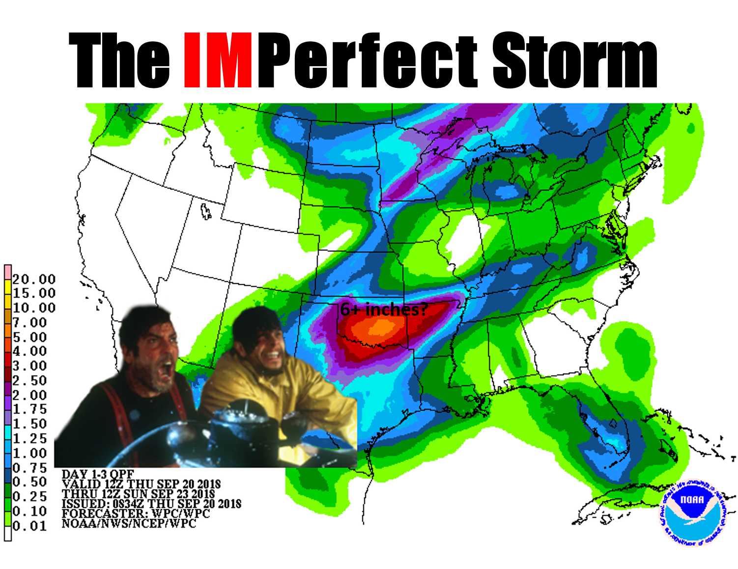
An early Tick today as we Tock about rain rain and more rain. We have a classic
Oklahoma fall heavy rain setup in the works for this weekend, starting late
tonight and lasting into Saturday. And as you can see, the forecasters at WPC are
pegging central Oklahoma with 5-7 inches of rainfall already. That means some
places could get 3 inches, but others could get 8. Just how it works when we're
dealing with tropical moisture and frontal boundaries and wayward storm systems
all meeting over us.
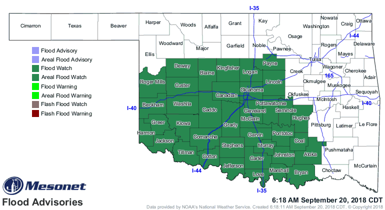
In advance, the NWS office in Norman has already issued flash flood watches for
much of their forecast area. I'd expect this might expand some, but for now, this
is the area of interest.
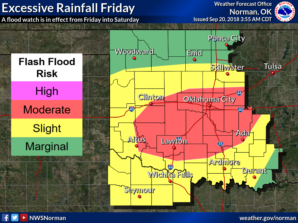
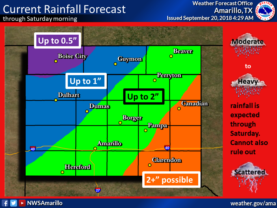
Keep checking with your favorite NWS and/or media provider to stay abreast of the
latest watches and warnings. Here are some graphics from said NWS offices to help
guide us in preparation beforehand.

We can thank the tropics for all this mess...the Gulf of Mexico for most of it,
but also the remnants of a tropical depression in the pacific for filling out
the vertical moisture profile. The NWS Norman office gives us a summary of that
scenario:
"Precipitable water values are forecast to be 1.8 to 2.25"+.
Moisture from both the remnants of Tropical Depression 19 in the
Pacific and from the western Gulf of Mexico will advect into the
area, which will result in a anomalously high (potentially record-
breaking) precipitable water values. As result of this moist
environment, warm cloud depths are forecast to be >12,000 ft AGL.
This will result in efficient, warm-rain processes."
To roughly translate, the precipitable water is the amount of water in the air
that could fall as rain if it was all squeegeed out. Wow(!), I could lose my
license for that definition, but you get the gist. What you really need to know
is that the amount available is near record-breaking, and the warm-rain
processes will ensure that much of it will indeed precipitate out.
Skinny people, you won't have to run around to get wet. The drops will find you.
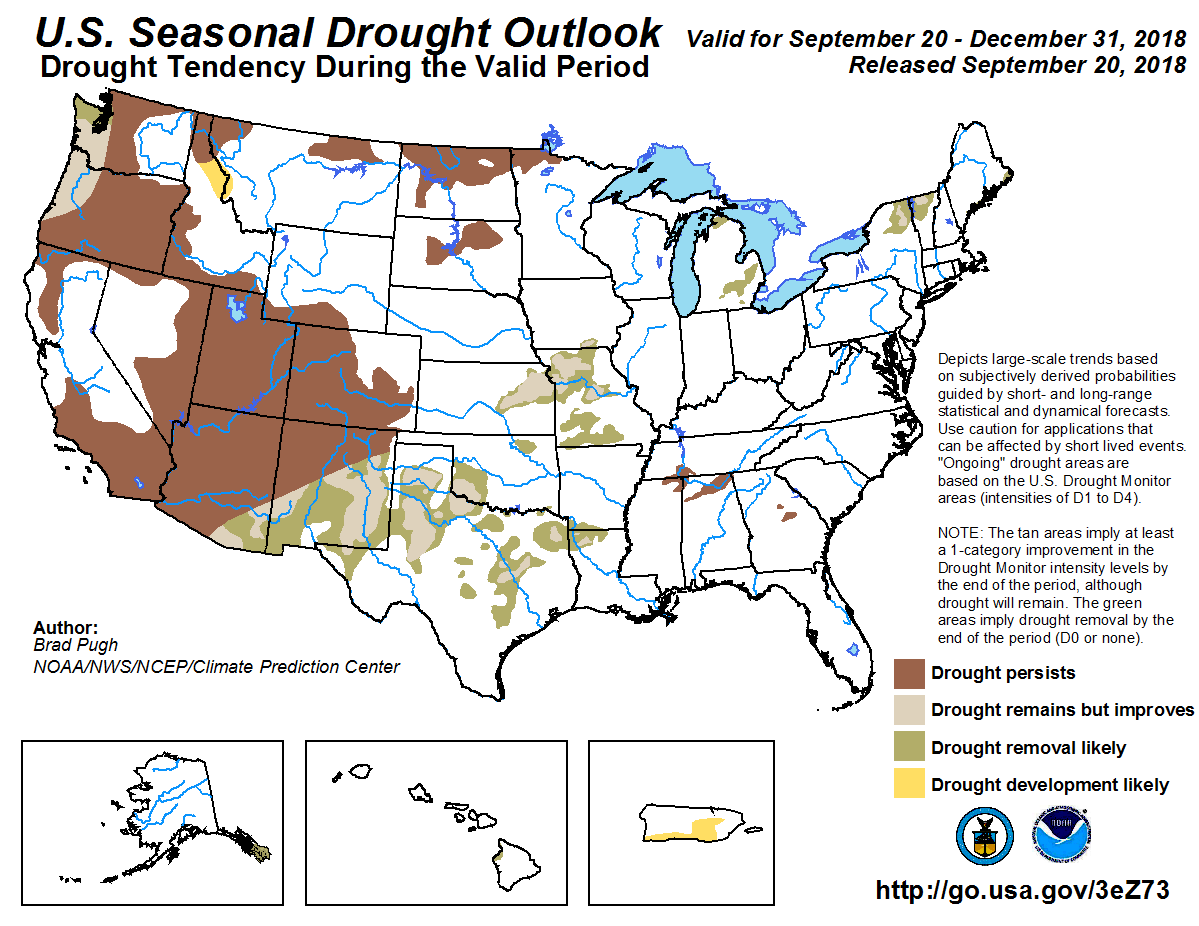
We do need the help since drought still plagues parts of the state, and is
actually trying to build back into the SE corner of Oklahoma. The latest
Drought Monitor map shows an increase in the amount of "abnormally dry"
conditions, right on the heels of some pretty impressive drought reductions.
While the D0 designation isn't drought, it does signal areas either coming into
or exiting drought. In the case of eastern OK, from McCurtain all the way up to
Adair County, it means drought initiation is becoming more likely.
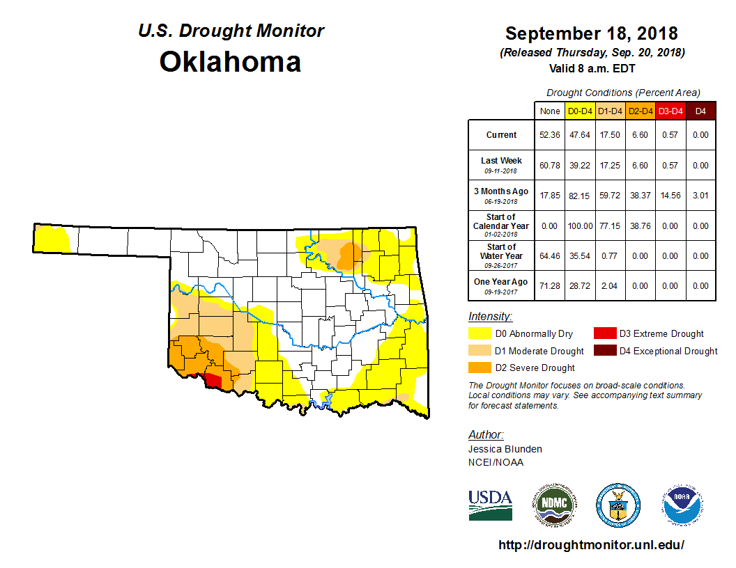
It's hard to imagine much of those colors not changing for next week after the
coming monsoon, but we've fallen for that trap before. For now, we'll just say
that that SW OK is still drastically dry, Osage and Washington counties need a
good drink, and eastern OK is staring drought in the face.
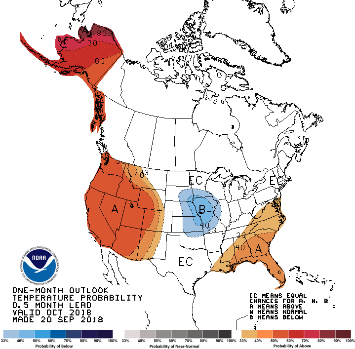
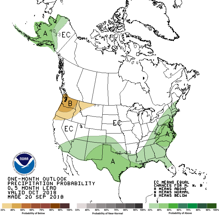
Now looking farther out, CPC sees increased odds of below normal temperatures
for October across far NE OK (not much indication of anomalies elsewhere) and
above normal precipitation across the SW 2/3rds (higher odds in the far SW).
And as we expand that period to the Oct-Dec 3-month time frame, we see about the
same for precip, but increased odds of above normal temperatures for the entire
state, but especially western Oklahoma.
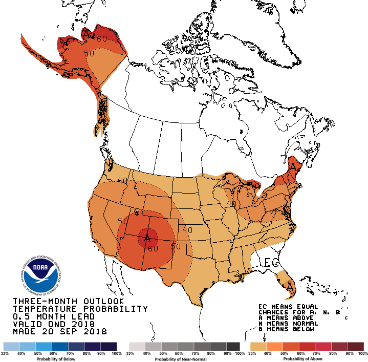
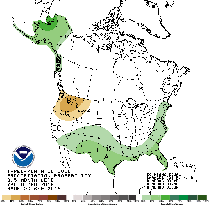
The good news from all that is the drought that currently exists in the state
is expected to either improve or disappear by the end of December.
How about we worry about this weekend first, though. What do you say?
Gary McManus
State Climatologist
Oklahoma Mesonet
Oklahoma Climatological Survey
(405) 325-2253
gmcmanus@mesonet.org
September 20 in Mesonet History
| Record | Value | Station | Year |
|---|---|---|---|
| Maximum Temperature | 107°F | FREE | 2024 |
| Minimum Temperature | 41°F | NOWA | 2003 |
| Maximum Rainfall | 5.83″ | MTHE | 2019 |
Mesonet records begin in 1994.
Search by Date
If you're a bit off, don't worry, because just like horseshoes, “almost” counts on the Ticker website!