MESONET TICKER ... MESONET TICKER ... MESONET TICKER ... MESONET TICKER ...
May 20, 2024 May 20, 2024 May 20, 2024 May 20, 2024
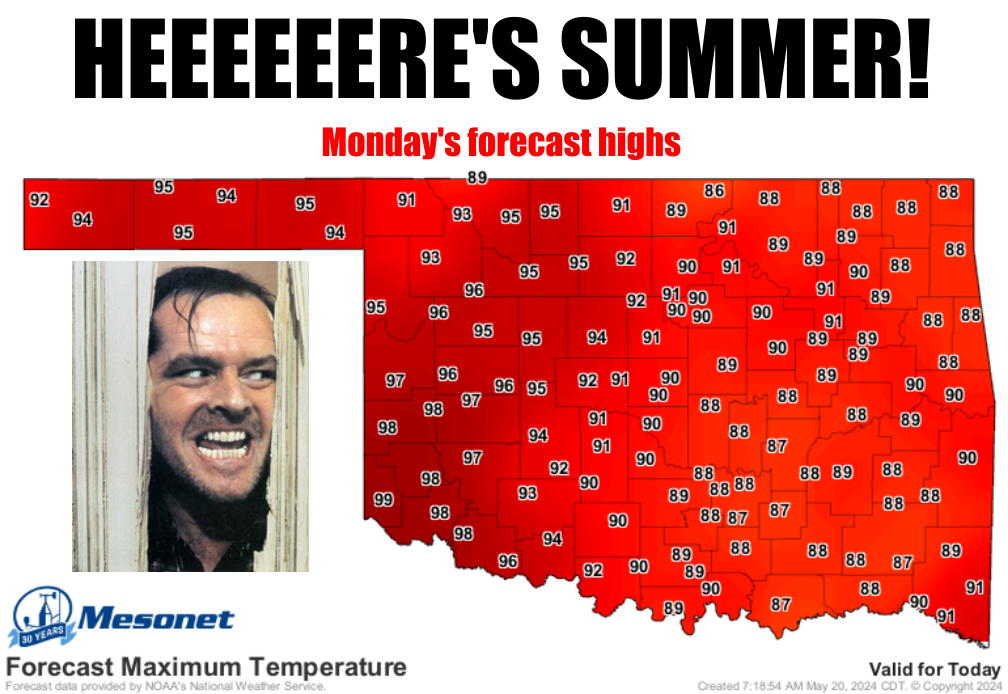
The Summering
https://ticker.mesonet.org/archive/20240520/monday-forecast-highs.png
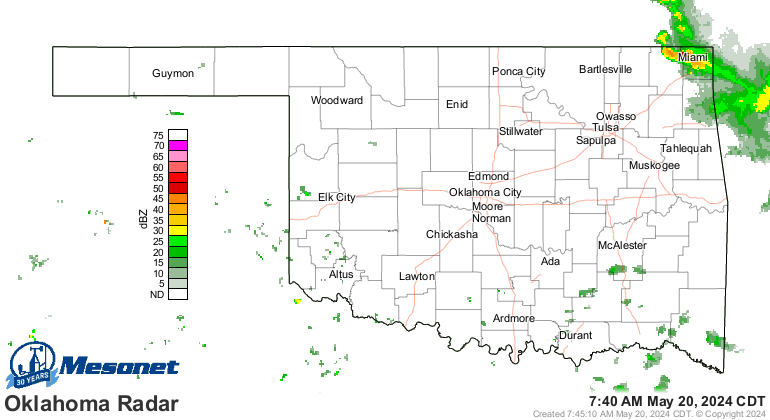
Wait, before it's gone...Heck,it'sstormingrightnowforcryingoutloud!
https://ticker.mesonet.org/archive/20240520/current-radar.png
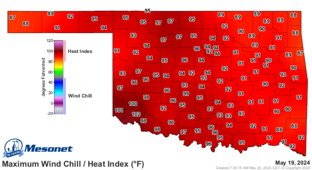
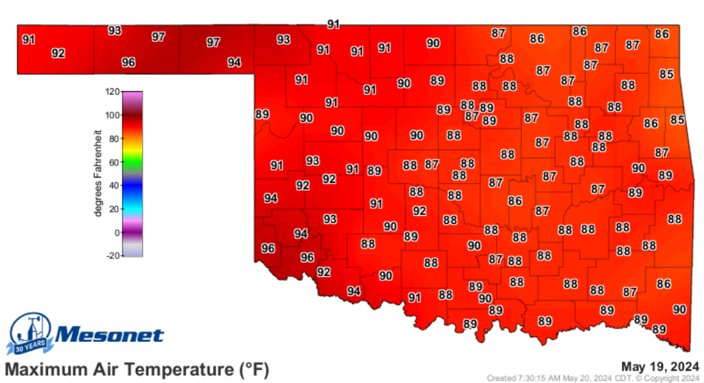
Okay, that being said, I know temperatures like we are looking at today are a
horror movie for many of you, but for some of us, they're a Rom-Com. Yesterday
we busted the triple-digit mark in the heat index values, and got close in the
actual air temperatures.
https://ticker.mesonet.org/archive/20240520/yesterdays-max-heat.index.png
https://ticker.mesonet.org/archive/20240520/yesterdays-highs.png
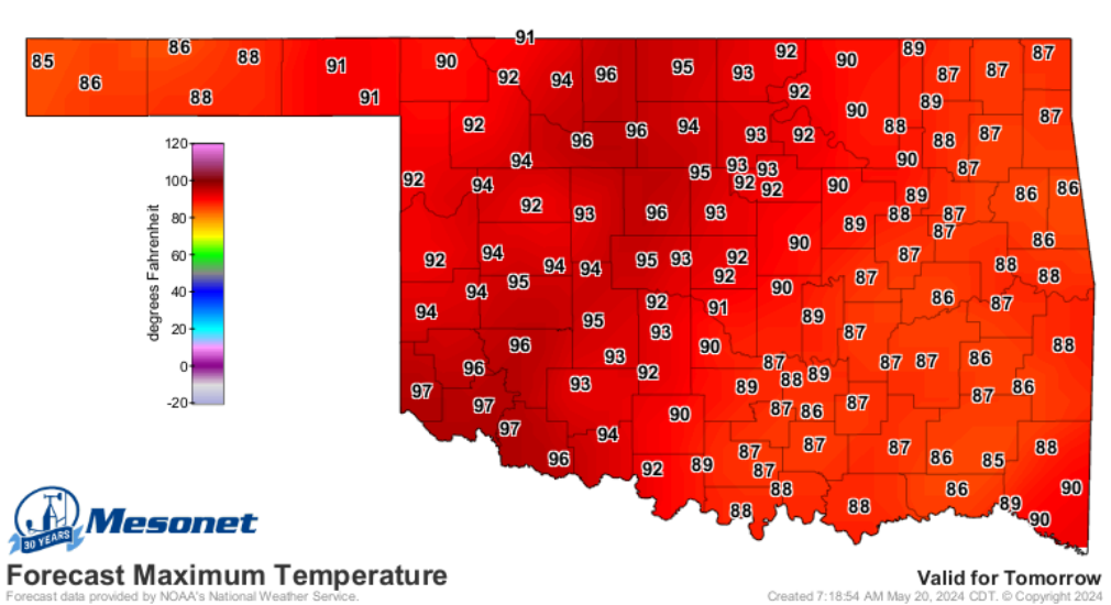
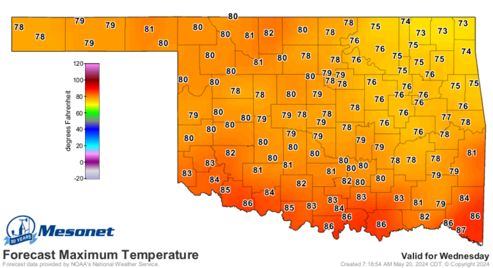
And we'll see more of the same for another couple of days before a cold front cools
us down on Wednesday.
https://ticker.mesonet.org/archive/20240520/tuesday-forecast-highs.png
https://ticker.mesonet.org/archive/20240520/wednesday-forecast-highs.png
Will today be that magical 100 day in the actual air temperatures? Will Harry
meet Sally? Could Sleepless be in Seattle? Will Notting Ham?
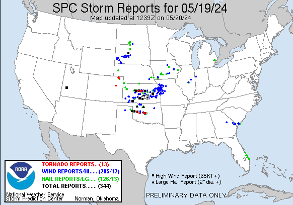
Okay, we're reaching...all I can do to avoid talking severe weather, but hard to
ignore after last night's debacle by Mother Nature that gave us another 6 or 7
tornadoes to play with. We were already at 75 for 2024 thus far (preliminary
numbers) and 19 for May, so we're gonna bump that up just a bit.
https://ticker.mesonet.org/archive/20240520/yesterday.png
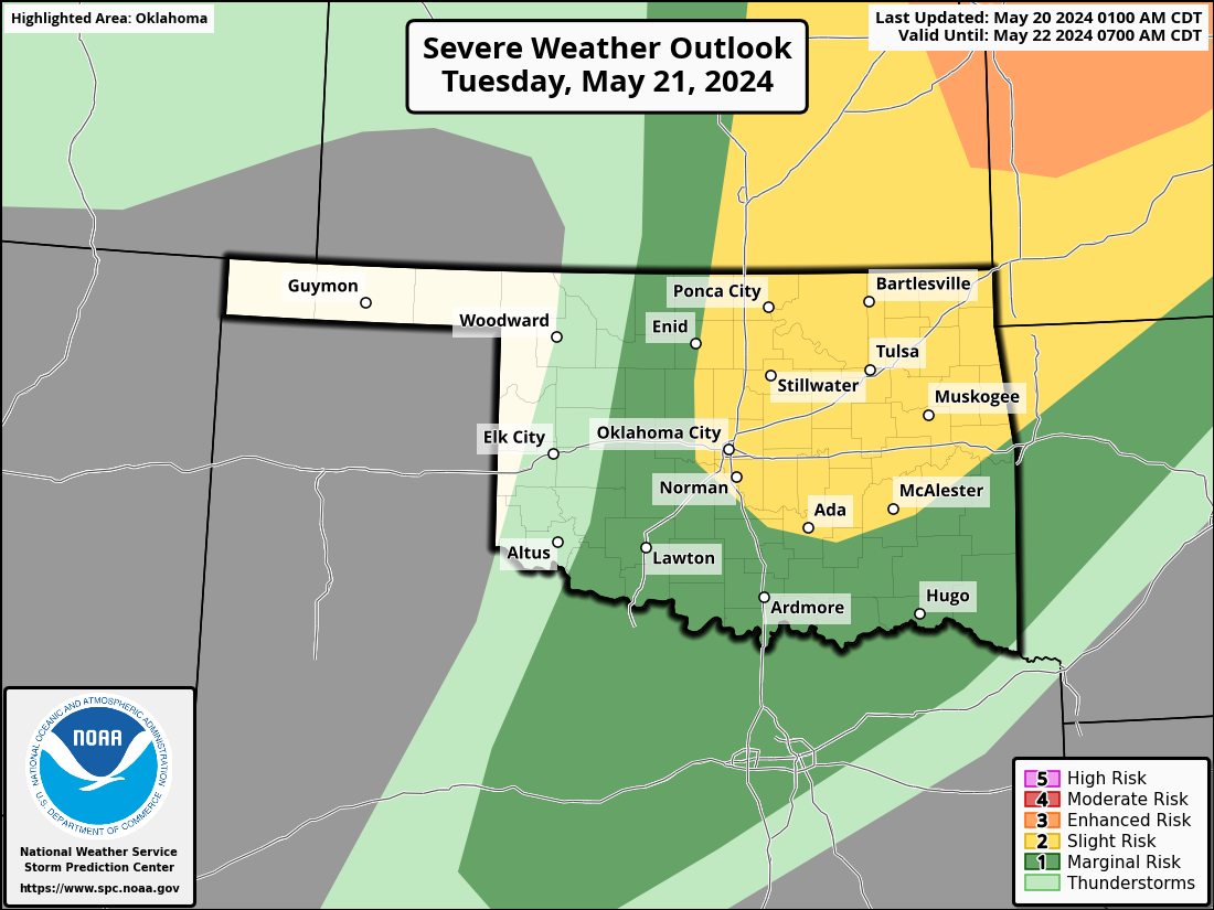
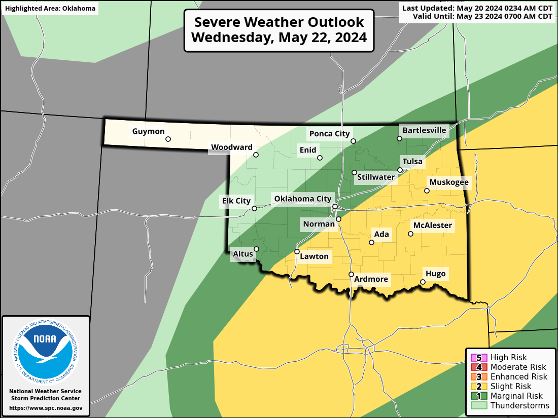
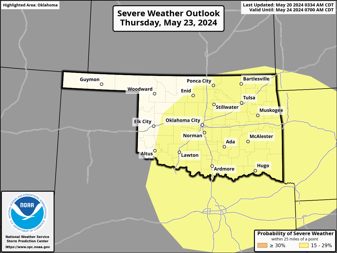
And we're not done yet. We have another 3 days starting tomorrow with severe
weather chances.
https://ticker.mesonet.org/archive/20240520/OK_swody2.png
https://ticker.mesonet.org/archive/20240520/OK_swody3.png
https://ticker.mesonet.org/archive/20240520/OK_swody4_PROB.png
I would say nothing high end coming up, but that just guarantees lots of
tornadoes. And then we have early next week to contend with. As always, the one
silver lining that comes from severe weather is that it does bring us rainfall,
and the totals were pretty hefty in places yesterday through the overnight
hours.
https://ticker.mesonet.org/archive/20240520/24hour-rain-totals.png
Too much severe weather, though. THAT'S why "When Oklahoma Met Summer" is much
better than "The Springing."
Gary McManus
State Climatologist
Oklahoma Mesonet
Oklahoma Climatological Survey
gmcmanus@mesonet.org
==================================================
The OCS/Mesonet Ticker
https://ticker.mesonet.org/
To subscribe or unsubscribe from the Ticker
or for questions about the Ticker or its content
Phone or Email the Ticker Manager at OCS
Phone: 405-325-2253 Email: ticker@mesonet.org
---------------------------------------------------
-C- Copyright 2024 Oklahoma Climatological Survey
===================================================
|


 Tweet
Tweet