Ticker for November 19, 2020
MESONET TICKER ... MESONET TICKER ... MESONET TICKER ... MESONET TICKER ...
November 19, 2020 November 19, 2020 November 19, 2020 November 19, 2020
Ho Ho NO!
Oh, you want snow for Christmas, do ya? Have you thought of moving? Yeah, not
looking like we're going to have favorable background climate conditions
conducive to a snowy December, but all is not lost. Well, SOME is lost, but when
it comes to hoping for snow, just keep telling yourself "extreme events!"
Remember when our mostly dry and mostly boring October was interrupted by a
historic ice storm that blasted the western half of the state? That occurred
during La Nina conditions as well, and reset the complete October weather
story line. So that's your hope for snow, you just have to time it up correctly.
My early Christmas forecast for Oklahoma?
Clear to partly pie.
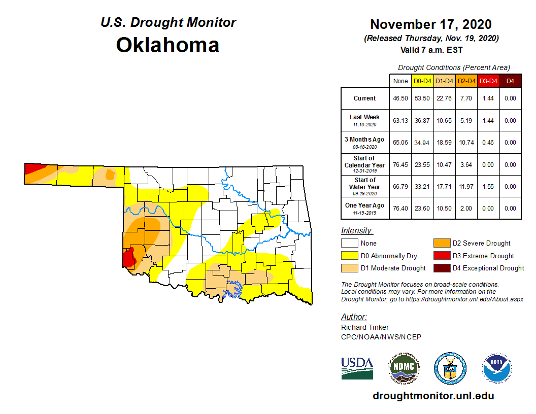
Let's not worry about that for now, let's worry about our drought conditions. We
now have drought starting to encroach on south central Oklahoma, coming up from
Texas. So football players coming up from Texas...good. Drought coming up from
Texas...bad (channel George Bush Sr.'s voice there if it helps).
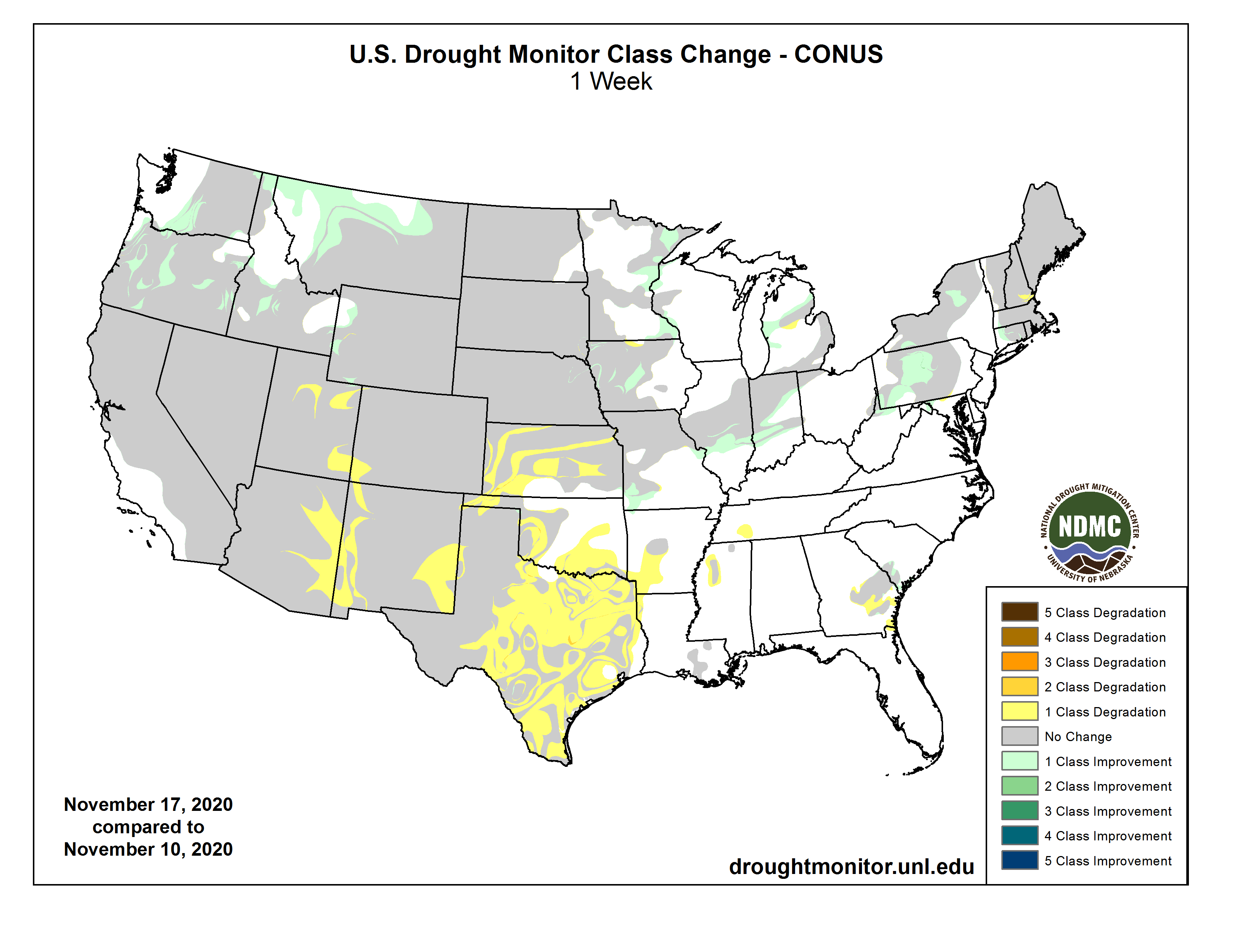
Want to see something interesting? Well, you're in the wrong place, but humor
me. Take a look at this 4-week change in the DM map. Notice how Texas has had
lots of deterioration while Oklahoma has had lots of improvements, for the most
part?
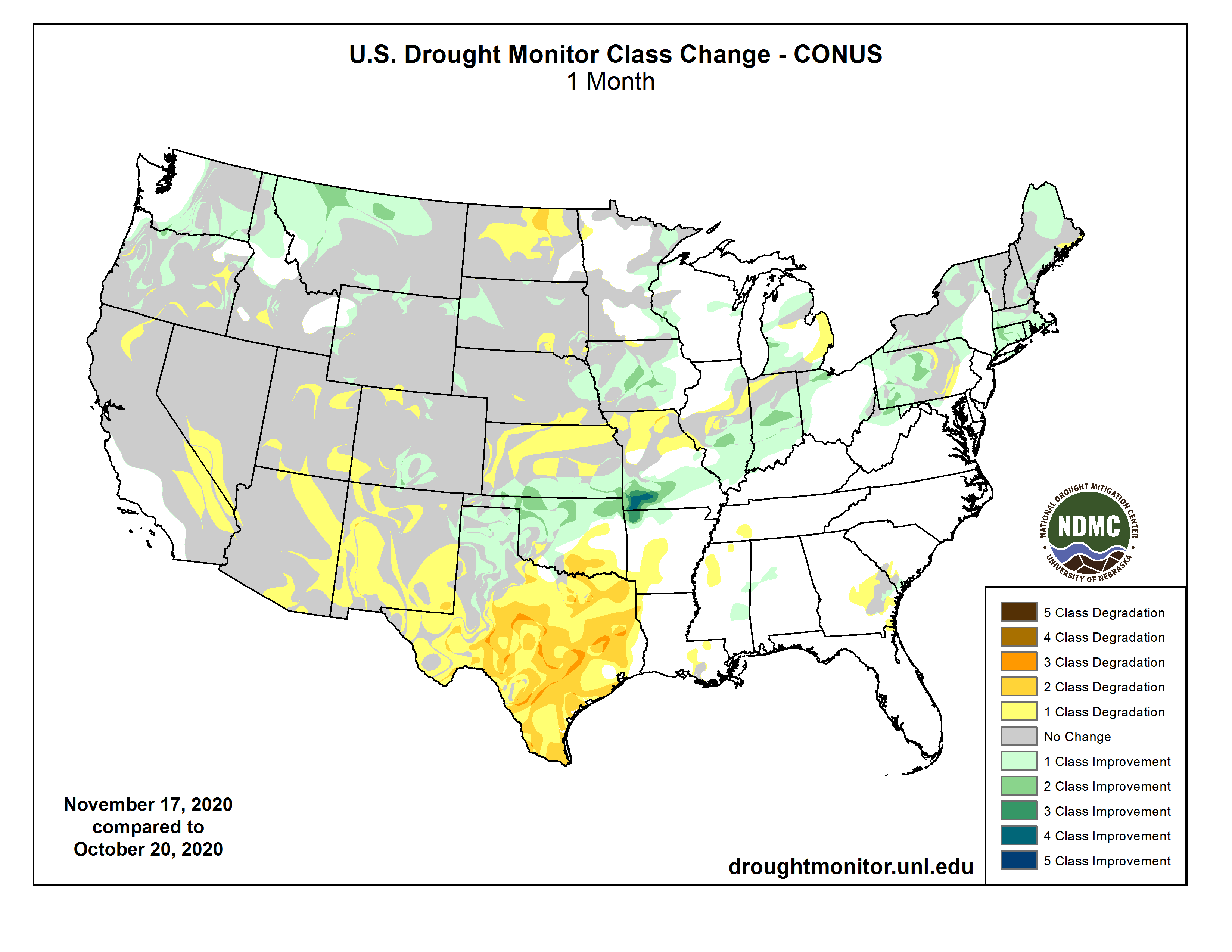
That's probably not entirely happenstance. La Nina does tend to have a more
powerful signal to our south, so Texas gets more of the "warm, dry" cool season
changes than we do, more often than not. However, that is also tempered by our
extreme event, which can happen regardless of the ENSO status. Texas possibly
just missed out while we were lucky. If you call 3 inches of radial ice and
about a million people without power "lucky!" Let's say lucky in moisture,
unlucky in moisture state. Now far western Oklahoma gets caught up in that area
where the La Nina impacts are a bit more likely/impactful, so let's not forget
the worst of the drought still remains in the far SW and western Panhandle
areas.
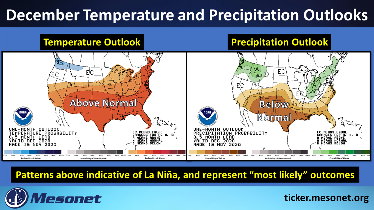
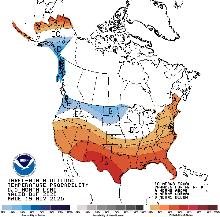
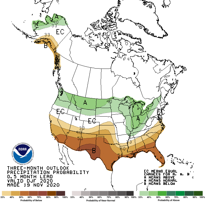
And that's why we have our not-so-pretty December outlooks above, and our
not-so-beautiful outlooks for the December-February time frame as well.
Not only was La Nina already pretty darned strong in October, with a key Sea
Surface Temperature anomaly of -1.3C (threshold for La Nina is < -0.5C), but
it's probably going to get stronger. We thought it would be a borderline
moderate-strong event, but maybe more emphasis on the strong is in order.
Moderate would be considered -1C to -1.4C, while strong is < -1.5C.
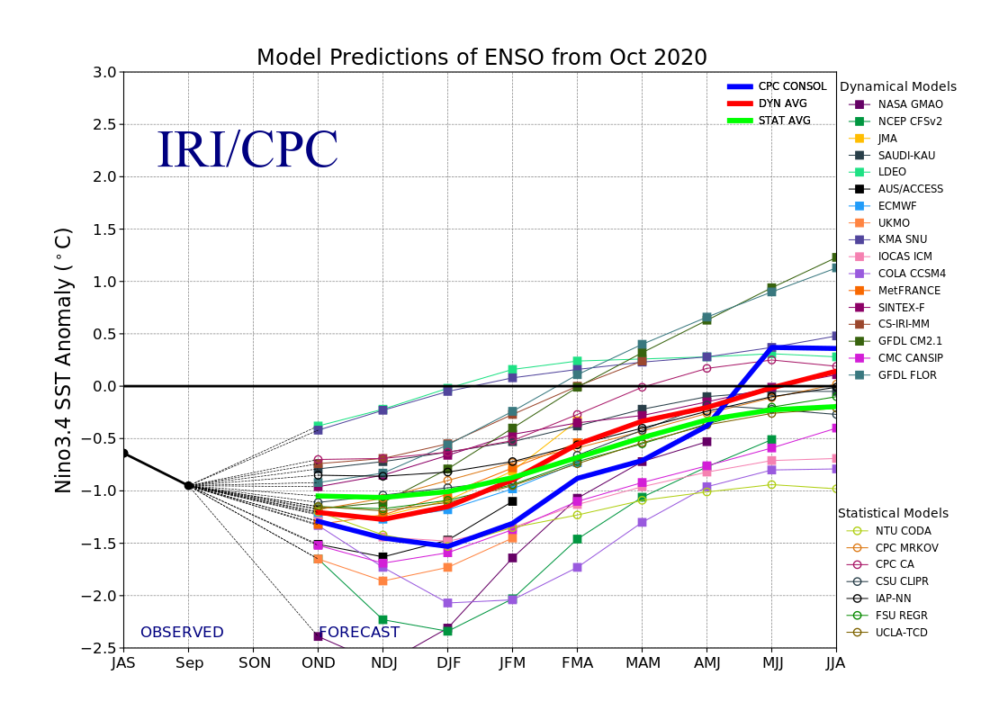
More and more of that model output is starting to dip below the -1.5C line
into strong territory as we get later into the winter. Officially, CPC says
there will be AT LEAST a 95% chance La Nina lasts through the winter, and 65%
chance it will hang around through the spring. Impacts are a bit lesser
usually on the tail end, as in the beginning as well. There will be a bit of
momentum to those impacts, however, which can mess up our April and definitely
our March, should the forecast come to fruition.
We have hope for the weekend and again next week for some decent moisture. This
is after we've gone a good 3 weeks without significant rainfall for most of the
state. And the weaknesses are showing up on the 60-day rainfall maps, which
sort of filters out the extreme event to end April.
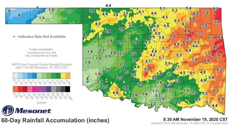
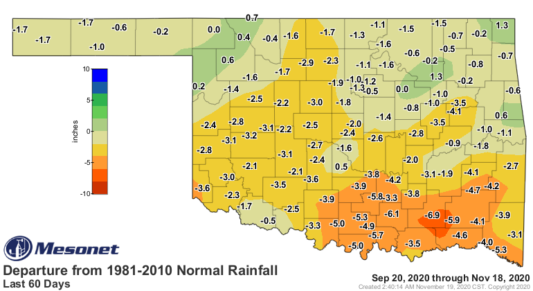
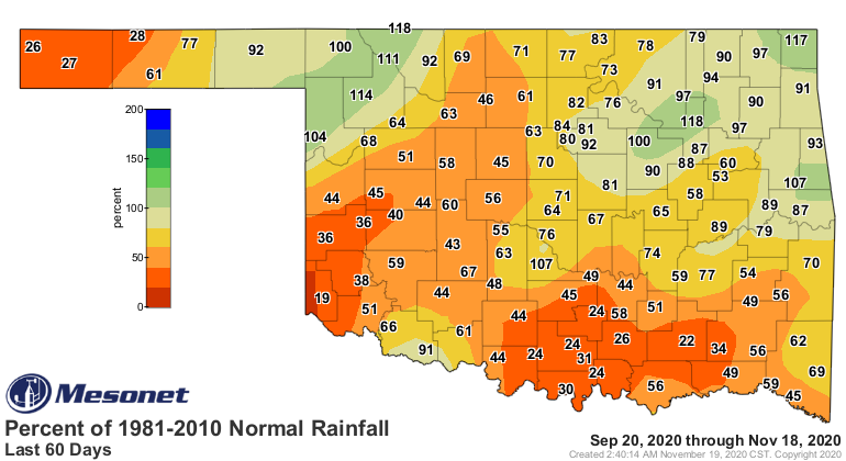
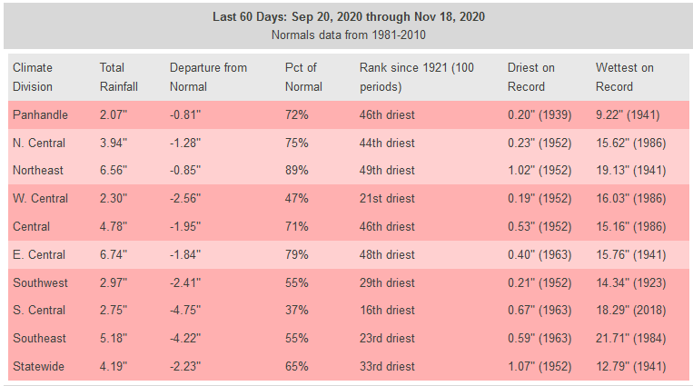
The 30-day maps look much nicer, and so do the stats, but sometimes its
important to remember those antecedent conditions.
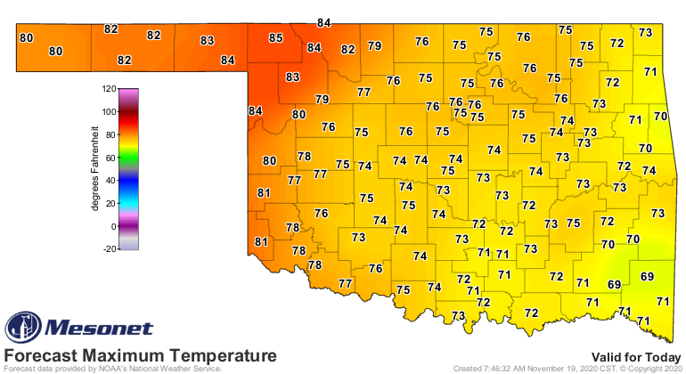
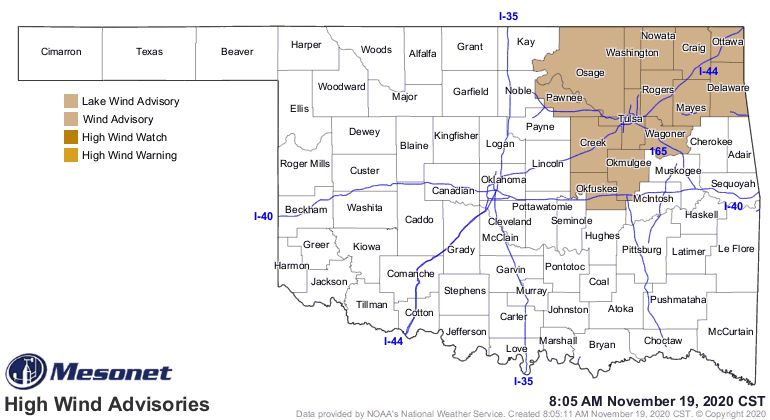
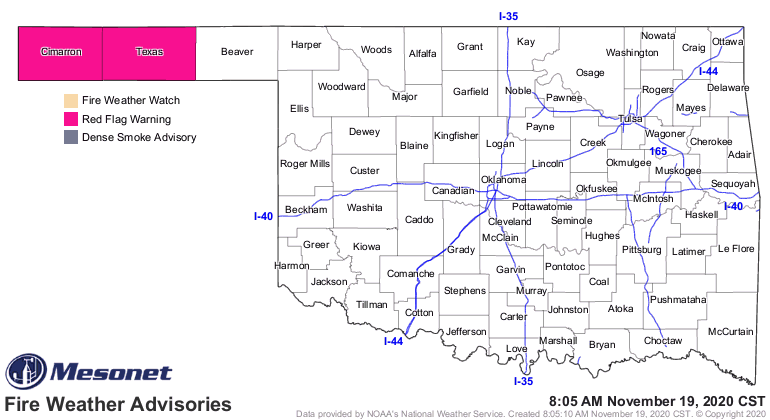
And again we have to get past today, where we will see near record temperatures
in the NW, and plenty of wind to make matters worse for fire danger.
Notice how the rainfall forecast for this weekend and into next week looks much
nicer for Oklahoma than it does Texas? Hmmmmmm.
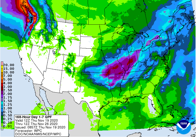
We will definitely end up drier than normal if we keep going 3 weeks between
precip events, but not as bad as Texas is going to be. La Nina favors the
south, as I said, but the south definitely doesn't favor La Nina.
This won't be an extreme event...just a couple of good old November storm
systems, without the cold, bringing us some rain. Let's hope it doesn't fizzle.
As for those snow hopes about 5 weeks from now? Let's lay off the "extreme
event" angle and just go with "moderate event," shall we?
Gary McManus
State Climatologist
Oklahoma Mesonet
Oklahoma Climatological Survey
(405) 325-2253
gmcmanus@mesonet.org
November 19 in Mesonet History
| Record | Value | Station | Year |
|---|---|---|---|
| Maximum Temperature | 86°F | GOOD | 2020 |
| Minimum Temperature | 6°F | KENT | 2022 |
| Maximum Rainfall | 3.26 inches | KING | 1994 |
Mesonet records begin in 1994.
Search by Date
If you're a bit off, don't worry, because just like horseshoes, “almost” counts on the Ticker website!