MESONET TICKER ... MESONET TICKER ... MESONET TICKER ... MESONET TICKER ...
October 19, 2020 October 19, 2020 October 19, 2020 October 19, 2020
OctSnowber?
http://ticker.mesonet.org/archive/20201019/next-week-fantasycast.png
Yeah, a forecast 7-8 days out has very little chance of happening.
SO YOU'RE TELLING ME THERE'S A CHANCE!!
And it wouldn't be unprecedented. Remember last year around this time? That same
area across NW OK does, with 13" of snow falling in Arnett, the earliest mostest
(work with me) snow we've ever seen in Oklahoma. Graphic sez 11 inches in Arnett,
but NWS Norman updated that a bit later.
http://ticker.mesonet.org/archive/20191025/nws-norman-snow-totals.png
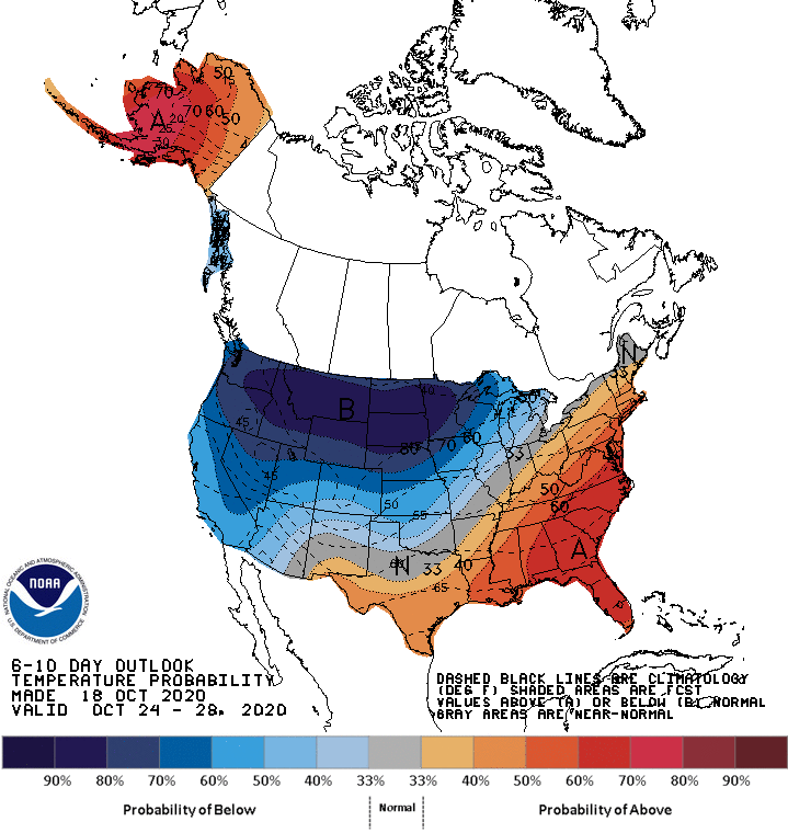
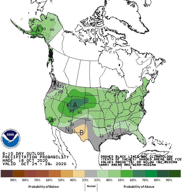
Lots of cold air could be hanging around that time period, with a bit of moisture.
This scenario is showing up on the medium-term outlooks from CPC, at least.
http://ticker.mesonet.org/archive/20201019/oct24-28-temp-outlook.gif
http://ticker.mesonet.org/archive/20201019/oct24-28-precip-outlook.gif
This cold weather wouldn't be unprecedented, either. Just a few days short of
our earliest mostest coldest temperature ever recorded for October...0 degrees
in Kenton last Halloween.
http://ticker.mesonet.org/archive/20191031/today.TAIR.min.grad.png
So we can't ALWAYS blame it on 2020. Nobody said "yeah, 2019!" last year when
October turned into January.
Other than that, prepare for more dry weather and wild swings in temperature.
In other words (no, not 2020), Oklahoma weather. Yesterday's cold front brought
us back below reality into a winter feel, and in a couple of days we'll be back
in early fall mode again, only to see the bottom drop out this weekend, then
possibly REALLY drop out early next week. We could see a decent killing freeze
across much of NW OK by early next week.
http://ticker.mesonet.org/archive/20201019/nws-norman-7day-temps.png
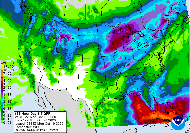
Chance of drizzle/light rain for the next couple of days, then another chance of
light rain across eastern OK later in the week. Might have to wait until
early next week for any decent chances across western OK. The 7-day rain forecast
map has a few more colors on it, at least. Nothing major in our drought area
to the west, however.
http://ticker.mesonet.org/archive/20201019/7day-rain-forecast.gif
When it comes to chances for significant moisture, let's say an inch of total
accumulation, the Canadian forecast model is coming up 0-fer October, mostly.
http://ticker.mesonet.org/archive/20201019/O-fer.png
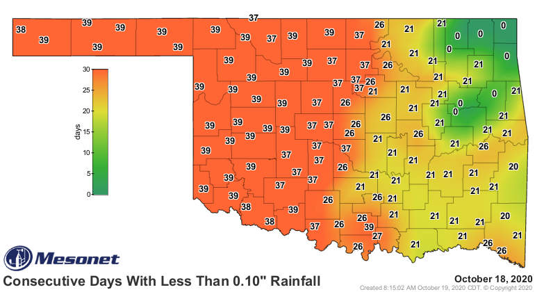
Something has to give sooner or later, because this ain't pretty.
http://ticker.mesonet.org/archive/20201019/mesonet.rainfall.tenthinch.png
Ugh. THAT'S why we need a snow fantasycast, because reality seems to be pretty
depressing.
Gary McManus
State Climatologist
Oklahoma Mesonet
Oklahoma Climatological Survey
(405) 325-2253
gmcmanus@mesonet.org
==================================================
The OCS/Mesonet Ticker
https://ticker.mesonet.org/
To subscribe or unsubscribe from the Ticker
or for questions about the Ticker or its content
Phone or Email the Ticker Manager at OCS
Phone: 405-325-2253 Email: ticker@mesonet.org
---------------------------------------------------
-C- Copyright 2024 Oklahoma Climatological Survey
===================================================
|


 Tweet
Tweet