MESONET TICKER ... MESONET TICKER ... MESONET TICKER ... MESONET TICKER ...
September 19, 2023 September 19, 2023 September 19, 2023 September 19, 2023
Dent-ist appointment
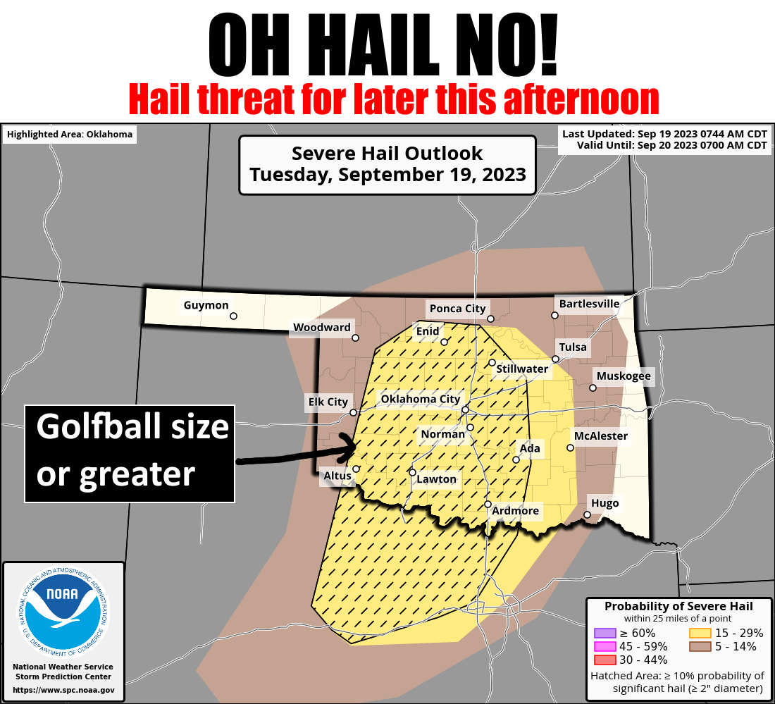
https://ticker.mesonet.org/archive/20230919/OK_swody1_HAIL.png
Imagine you're an alien (Wait...or do you even HAVE to imagine? The truth is out
there.) and you show up at planet earth to take a stroll. Then some strange
formation rolls in overhead AND STARTS RAINING DOWN MOLTEN FINGERS OF ELECTRICAL
DEATH! Crashing and booming all around you! 300 million volts and 30,000 amps
of electricity threatening to flow through your weirdly-shaped (some humans have
this problem as well) body, boiling your green blood and blowing out your
bug-eyes! Yeah, we're Okies, so we're used to it! So you jump back on your ship
and report to your Great Overlord that this ain't the place for you to invade.
Earth saved.
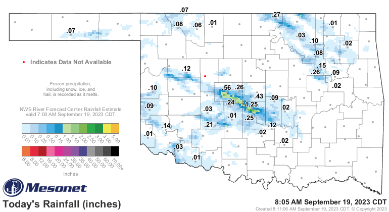
See, thunderstorms can be good. Oh yeah, and they can also bring rain.
https://ticker.mesonet.org/archive/20230919/today.rainrfc.png
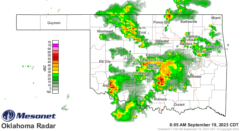
Heck, it's storming right now for crying out loud!
https://ticker.mesonet.org/archive/20230919/current-radar.png
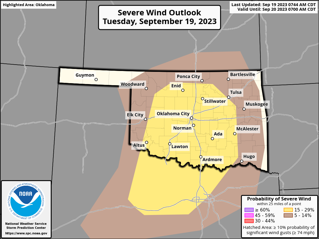
So today would not be a good day to go strolling without your hard hat, lest
golfball-size hail (or larger) put knots on your noggin faster'n you can rub
'em. You might also get blown over in 60+ mph winds, whisked down a churning
stream since you didn't turn around from that flooded area, AND maybe whacked
by a tornado or two since the tornado threat is not zero.
Just what the heck is wrong with you anyway, Zeebork (or whatever your alien
name is)??
https://ticker.mesonet.org/archive/20230919/OK_swody1.png
https://ticker.mesonet.org/archive/20230919/OK_swody1_TORN.png
https://ticker.mesonet.org/archive/20230919/OK_swody1_WIND.png
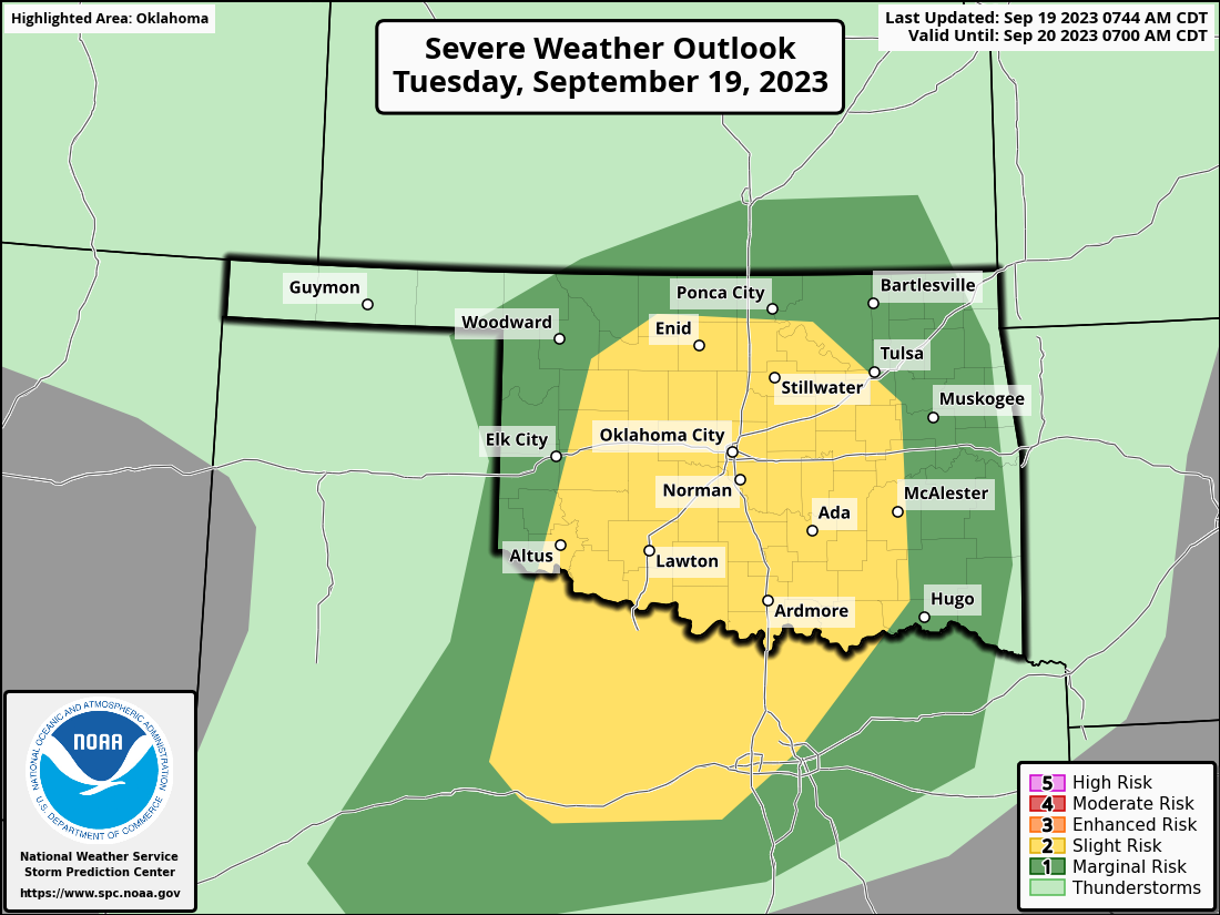
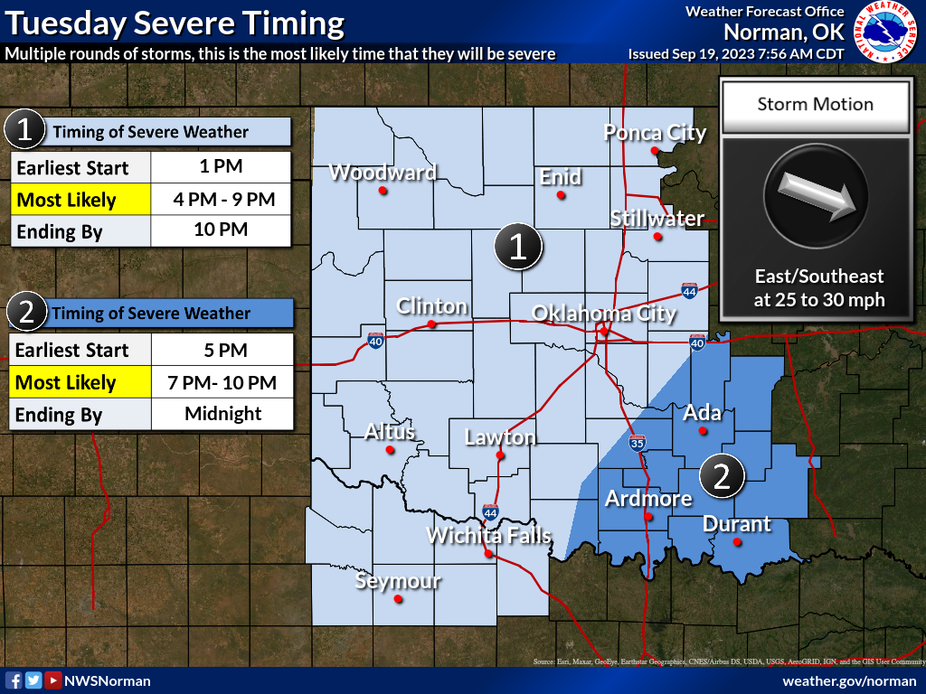
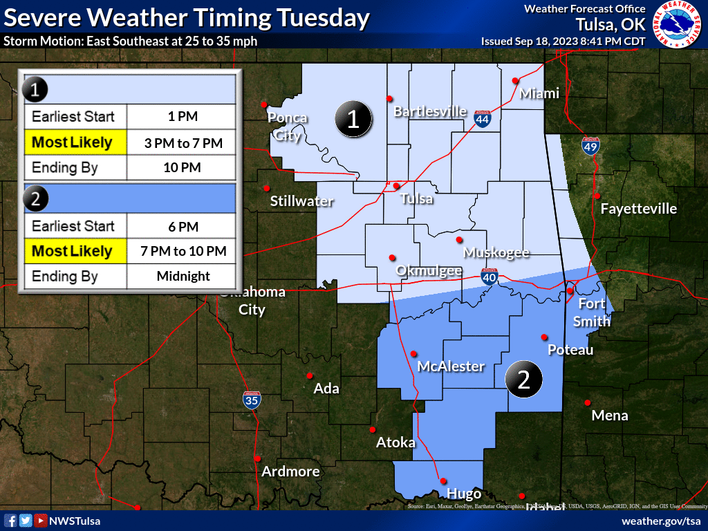
Keep in mind there could be several rounds of storms today, but the biggies
should be later this afternoon, but could start as early as 1pm or so. AND
this morning's convection could foul things up and push things around, so
definitely stay tuned to your local NWS office and/or favorite media weather
provider.
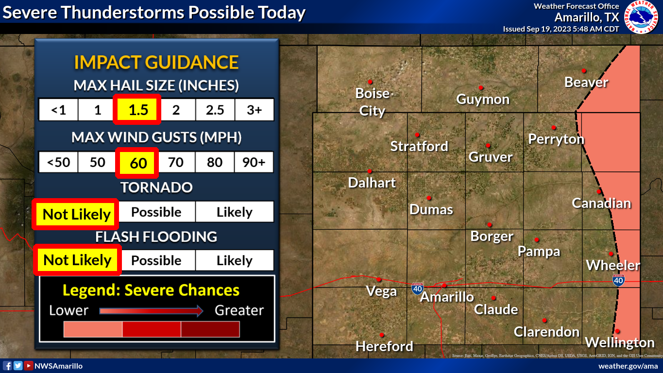
https://ticker.mesonet.org/archive/20230919/nws-ama-severe.png
https://ticker.mesonet.org/archive/20230919/nws-norman-severe-timing.png
https://ticker.mesonet.org/archive/20230919/nws-tulsa-severe-timing.png
And then we'll have multiple opportunities for severe weather later this week,
and these chances can and probably will change (better OR worse), so stay
tuned. Also, those rain chances will come with the storms. Looks like mostly
eastern OK, unfortunately for those to the west.
https://ticker.mesonet.org/archive/20230919/7day-rain-forecast.gif
But hey, at least summer is back! But as I mentioned previously, this is FALL
summer, not SUMMER summer. After the big State Fair cold front, that kicked
us into FALL mode from that last month and a half of miserable summer. Yesterday
was sorta hot, but in a comfortable dry heat kind of way.
https://ticker.mesonet.org/archive/20230919/yesterdays-highs.png
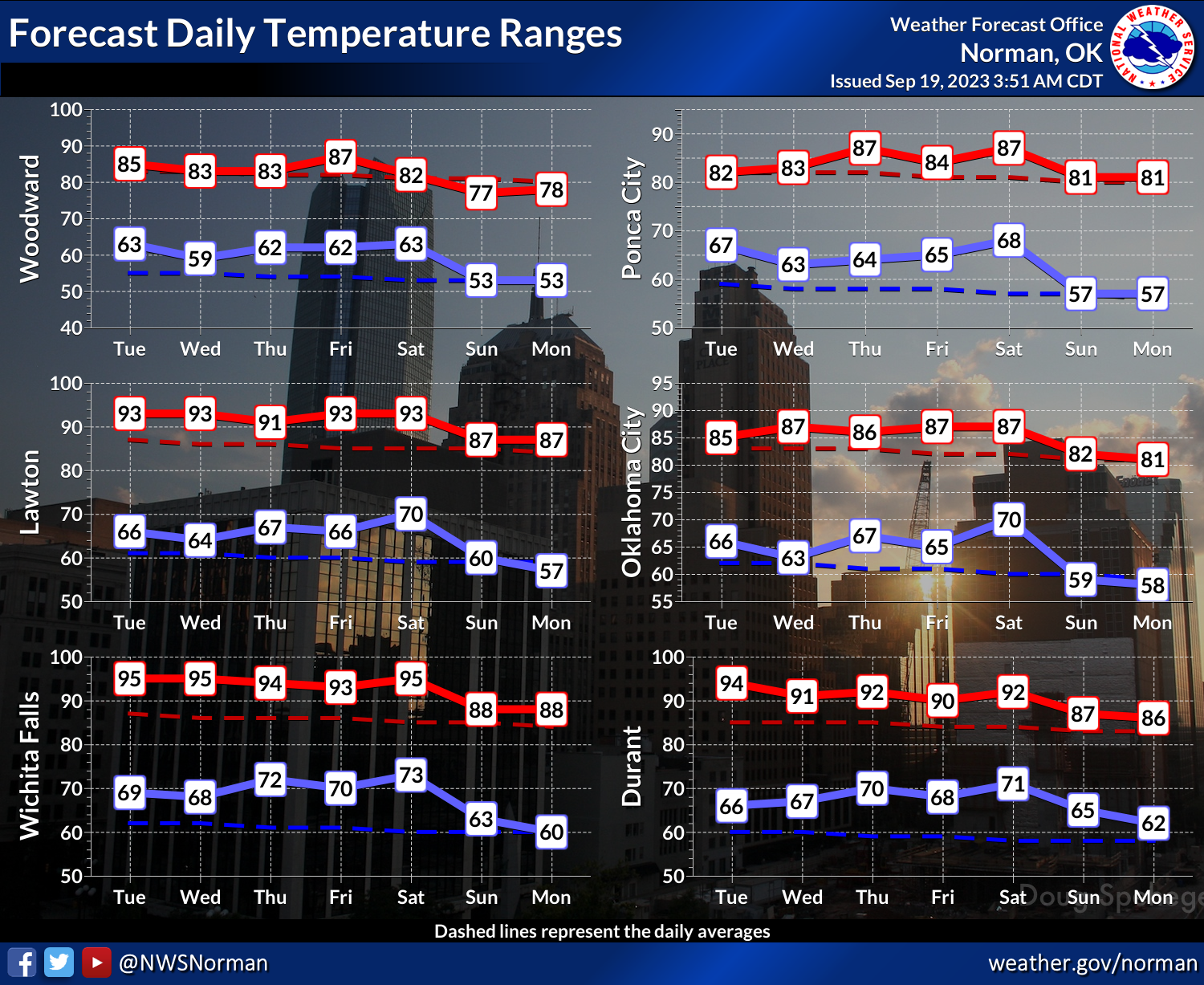
But don't expect TOO much heat going forward. It will be marginally above normal,
but seasonable nonetheless.
https://ticker.mesonet.org/archive/20230919/nws-norman-7day-temps.png
So there you go. Tell your friends Queegloo and Breegrox to go find another
planet to mess with. Mother Nature is already busy with ours. And pick up your
trash or I *WILL* turn you in for littering.
Gary McManus
State Climatologist
Oklahoma Mesonet
Oklahoma Climatological Survey
gmcmanus@mesonet.org
==================================================
The OCS/Mesonet Ticker
https://ticker.mesonet.org/
To subscribe or unsubscribe from the Ticker
or for questions about the Ticker or its content
Phone or Email the Ticker Manager at OCS
Phone: 405-325-2253 Email: ticker@mesonet.org
---------------------------------------------------
-C- Copyright 2024 Oklahoma Climatological Survey
===================================================
|


 Tweet
Tweet