MESONET TICKER ... MESONET TICKER ... MESONET TICKER ... MESONET TICKER ...
September 18, 2023 September 18, 2023 September 18, 2023 September 18, 2023
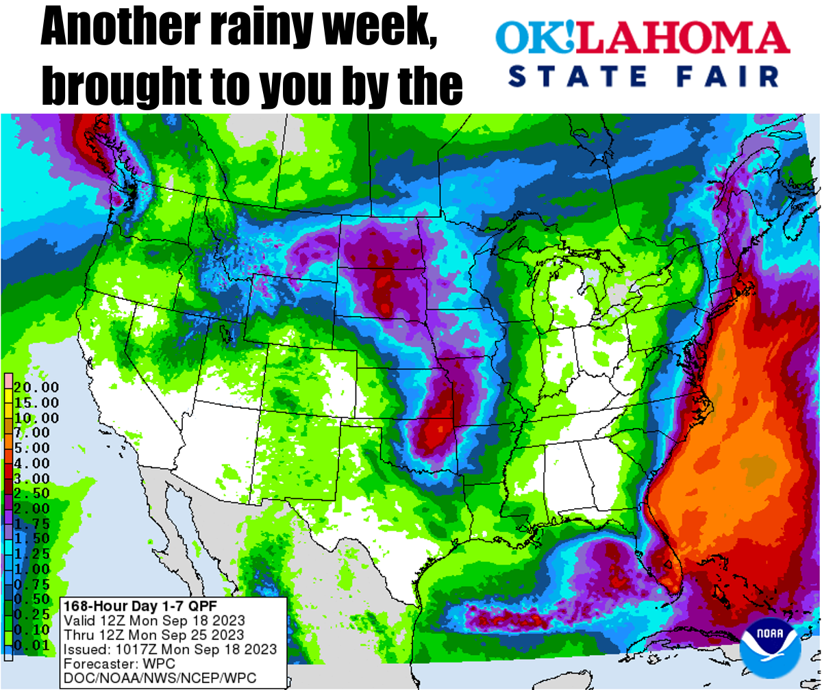
Soggy corn dogs?
https://ticker.mesonet.org/archive/20230918/7day-rain-forecast.png
There's nothing worse than soggy corn dogs (Soggy Corn Dogs was my band's name
in parochial school), except for maybe mayonnaise on hot links. Ugh, you think
that's gross, take a look at how much rain we STILL need after last week's respite.
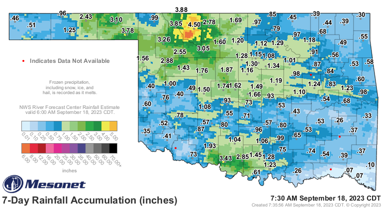
https://ticker.mesonet.org/archive/20230918/7day-rain-totals.png
Not bad for some folks. Heck, southern Woods County saw over 5 inches of rain,
and even a drought-plagued area in south central got 2-3+ inches. But compared
to the longer period of the flash drought (and long-term drought in far SW and
NC OK), still need lots more where those totals didn't add up to nearly as much.
Ugh...oh well, I'll worry about grammar later.
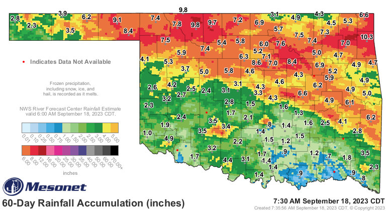
https://ticker.mesonet.org/archive/20230918/60-day-rain-totals.png
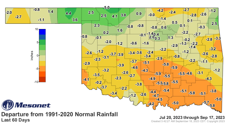
https://ticker.mesonet.org/archive/20230918/del60day_rain.current.png
https://ticker.mesonet.org/archive/20230918/pct60day_rain.current.png
https://ticker.mesonet.org/archive/20230918/60day-rain-stats.png
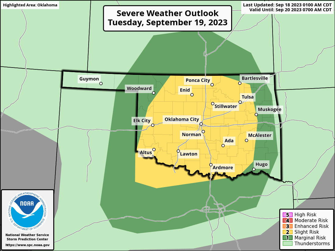
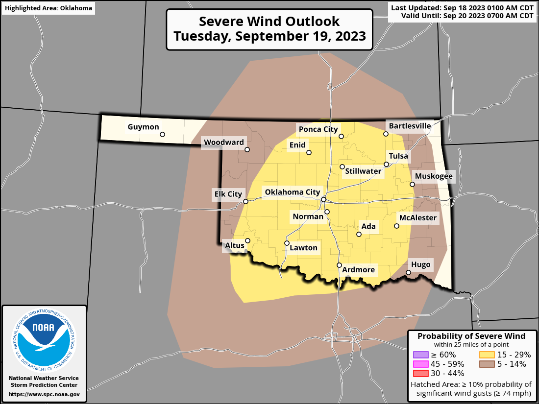
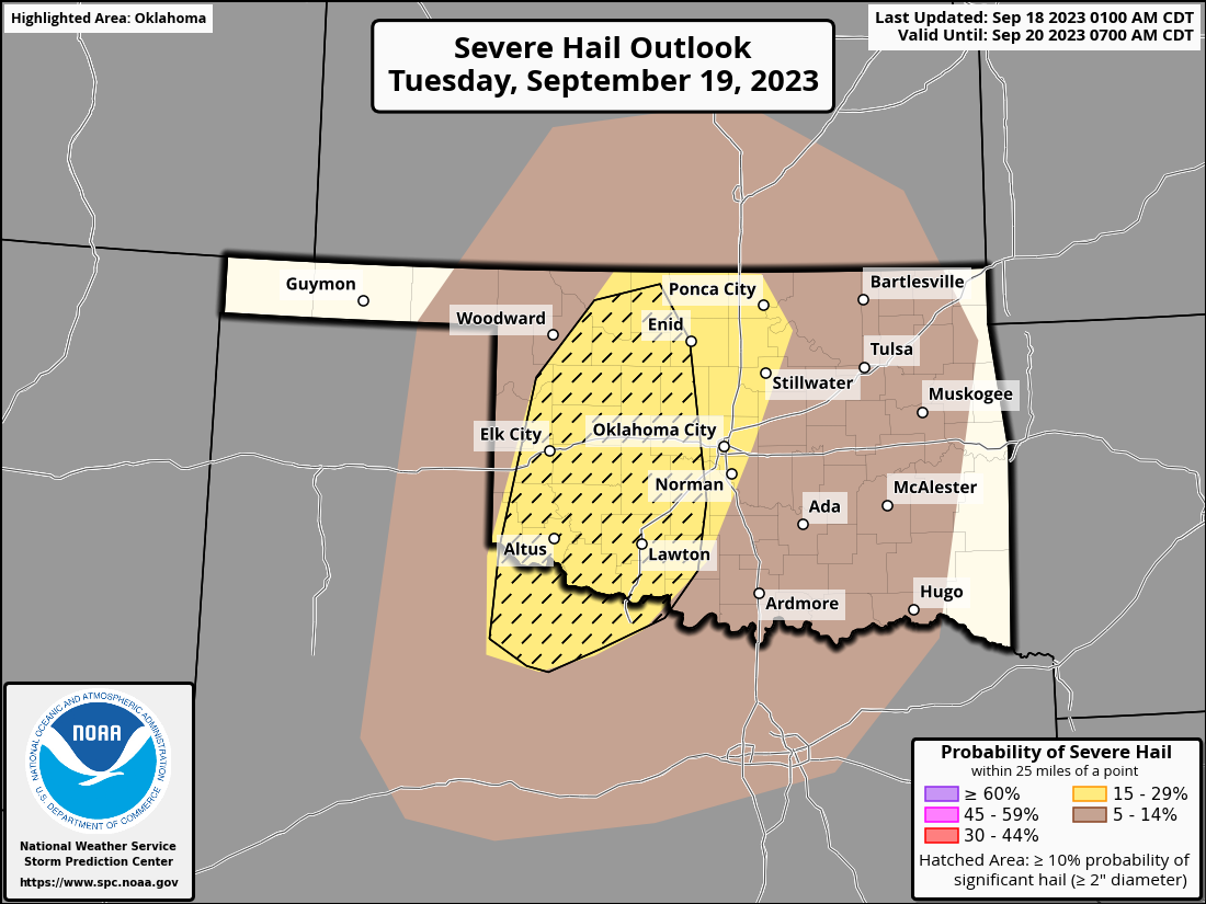
Yeah, not good. And another "not good" remark is needed if severe weather being
forecast comes to fruition (and we all know just how painful fruition can be!).
This is our "secondary severe weather season," although in Oklahoma it's ALWAYS
severe weather season. But at this time of year, we see that jet stream start
to dip back to the south, so more powerful storm systems with more instability
and all the usual ingredients Okies love to hate. Several rounds of storms
could traverse the state over the next week, with the shooting match starting
early morning tomorrow and really ramping up into the evening. Big hail and
damaging winds are the primary threats.
https://ticker.mesonet.org/archive/20230918/OK_swody2.png
https://ticker.mesonet.org/archive/20230918/OK_swody2_WIND.png
https://ticker.mesonet.org/archive/20230918/OK_swody2_HAIL.png
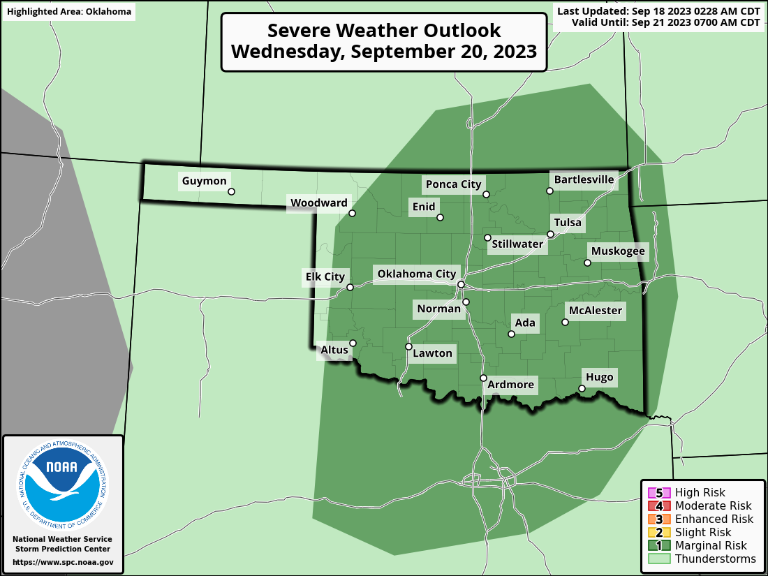
Monday and Wednesday also have their chances, but not as robust as tomorrow's
threats.
https://ticker.mesonet.org/archive/20230918/OK_swody1.png
https://ticker.mesonet.org/archive/20230918/OK_swody3.png
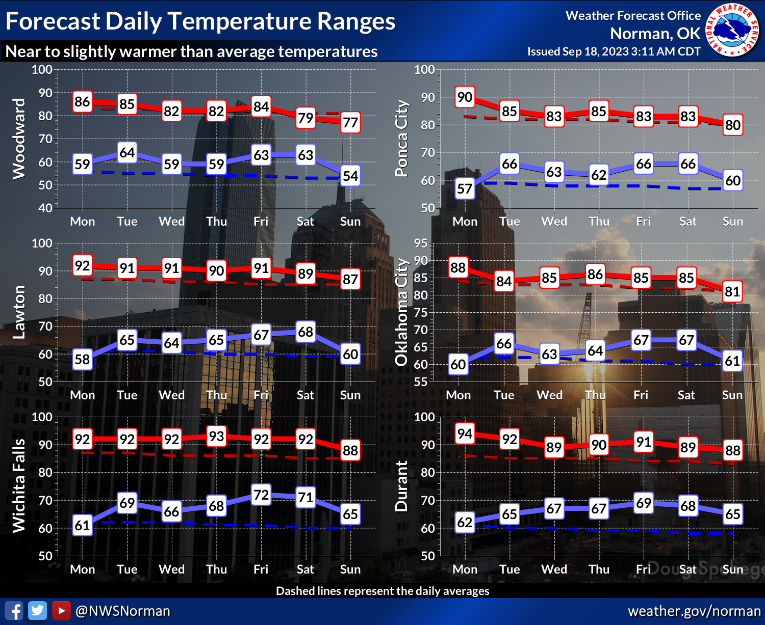
The heat is back as well, but as I preached...nagged...persisted in telling
you for the last 2 weeks...it ain't your Grandpappy's heat. At least not like
what we saw earlier this month.
https://ticker.mesonet.org/archive/20230918/nws-norman-7day-temps.png
Remember, as we go through the month, our normal avg. high temperature starts
to drop precipitously (English to Okie translation: steeply), so if you go back
to 10 degrees above normal, you're in the 90s instead of 100s. But even then,
we're really just looking at 80s for this week. Much more seasonable, if not a
bit above normal.
https://ticker.mesonet.org/archive/20230918/statwide-avg-highs.png
Gary McManus
State Climatologist
Oklahoma Mesonet
Oklahoma Climatological Survey
gmcmanus@mesonet.org
==================================================
The OCS/Mesonet Ticker
https://ticker.mesonet.org/
To subscribe or unsubscribe from the Ticker
or for questions about the Ticker or its content
Phone or Email the Ticker Manager at OCS
Phone: 405-325-2253 Email: ticker@mesonet.org
---------------------------------------------------
-C- Copyright 2024 Oklahoma Climatological Survey
===================================================
|


 Tweet
Tweet