MESONET TICKER ... MESONET TICKER ... MESONET TICKER ... MESONET TICKER ...
August 17, 2020 August 17, 2020 August 17, 2020 August 17, 2020
Pace change
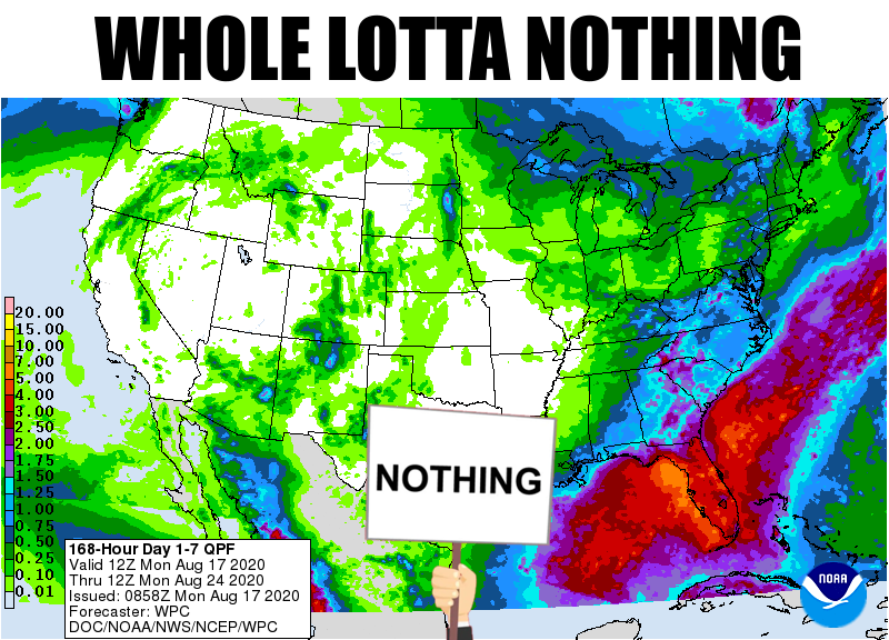
http://ticker.mesonet.org/archive/20200817/7day-rain-forecast.png
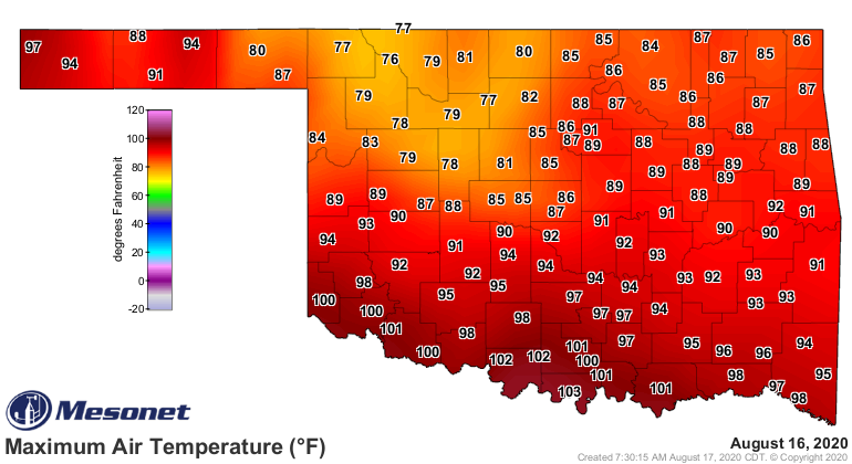
Where were ya yesterday on the comfort-meter? Were you basting in your own juices
in southern Oklahoma, or reveling in downright autumnal weather in north central
Oklahoma, or one of the "dang, I can't wait until tomorrow" people in the rest
of the state?
http://ticker.mesonet.org/archive/20200817/yesterdays-high-temps.png
http://ticker.mesonet.org/archive/20200817/yesterdays-high-heat.index.png
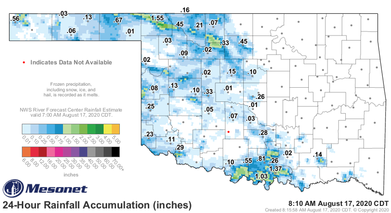
That rain yesterday made for great temperatures up there in northern Oklahoma,
while southern Oklahoma absolutely broiled.
http://ticker.mesonet.org/archive/20200817/24hour-rain-totals.png
The cool front that slipped through yesterday has given us a nice little, ummmm,
anti-boost in temperatures? In other words, we're already starting out a bit
better than what we did yesterday.
http://ticker.mesonet.org/archive/20200817/24hour-temp-change.png
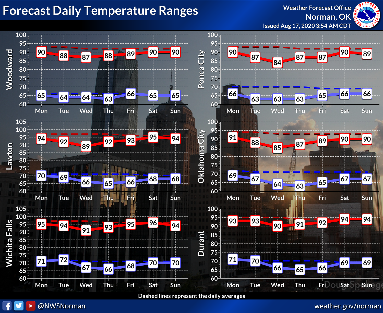
And there's another reinforcing front approaching from the north with our
upper-level air now coming from that direction, spinning around that heat dome
to our west. That puts us in northwesterly flow, so we should stay on the
cooler side of summer for another few days.
http://ticker.mesonet.org/archive/20200817/nws-norman-7day-temps.png
http://ticker.mesonet.org/archive/20200817/nws-tulsa-7day-temps.png
Here's the kicker, though. We *probably* won't see any large thunderstorm
complexes kick off in the High Plains and head to the southeast across the state
like the last few weeks. That's both good and bad, since we won't see much in
the way of severe weather, but we will also miss out on much needed rain across
far western Oklahoma. Another benefit will be the humidity kicking it down a
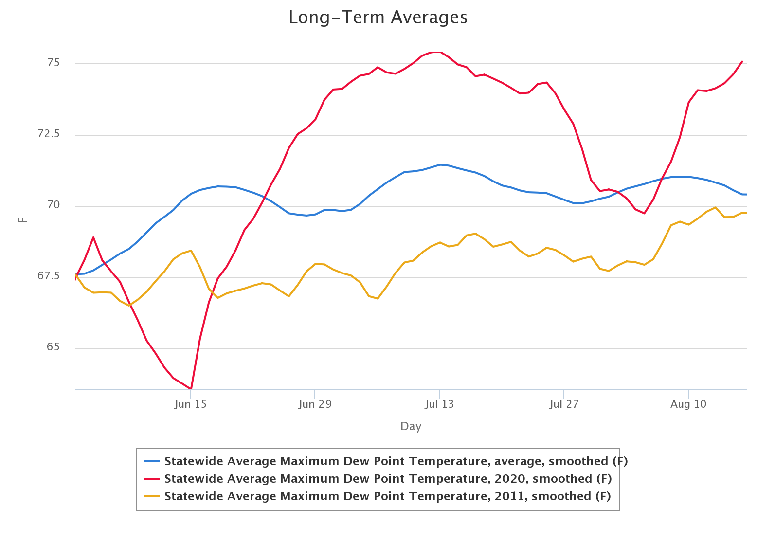
notch, just below "ridiculous." As you can see, our summer maximum dewpoints
thus far (red line) have been well above our long-term (2005-2019) average (blue
line). I threw in our mega-drought year of 2011 (brown-ish line) for comparison.
Yeah, it really was a dry heat back then.
http://ticker.mesonet.org/archive/20200817/jun1-aug16-max-dewpts.png
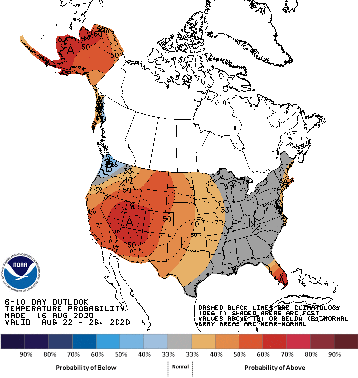
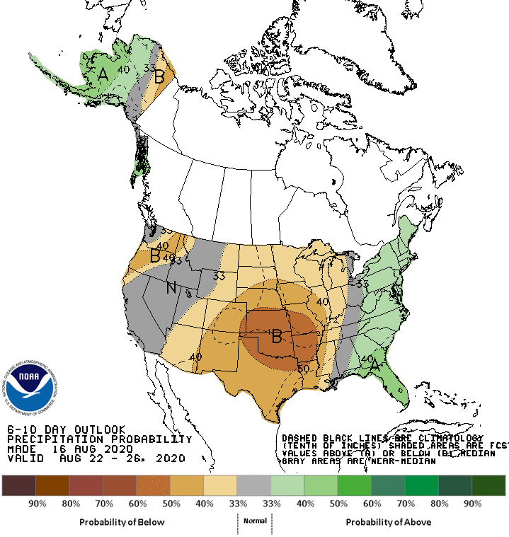
I think we make a quick transition back to summer after this week, however,
and the rain outlook doesn't hold much in the way of good news (should you be
in a part of the state needing rain).
http://ticker.mesonet.org/archive/20200817/aug22-26-temp-outlook.gif
http://ticker.mesonet.org/archive/20200817/aug22-26-precip-outlook.gif
As per usual, some will be happy this week, whilst others will be forlorn.
Wait until next week, then we can all be downright angry again.
Gary McManus
State Climatologist
Oklahoma Mesonet
Oklahoma Climatological Survey
(405) 325-2253
gmcmanus@mesonet.org
==================================================
The OCS/Mesonet Ticker
https://ticker.mesonet.org/
To subscribe or unsubscribe from the Ticker
or for questions about the Ticker or its content
Phone or Email the Ticker Manager at OCS
Phone: 405-325-2253 Email: ticker@mesonet.org
---------------------------------------------------
-C- Copyright 2024 Oklahoma Climatological Survey
===================================================
|


 Tweet
Tweet