MESONET TICKER ... MESONET TICKER ... MESONET TICKER ... MESONET TICKER ...
June 16, 2023 June 16, 2023 June 16, 2023 June 16, 2023
SUMMER IS HERE!
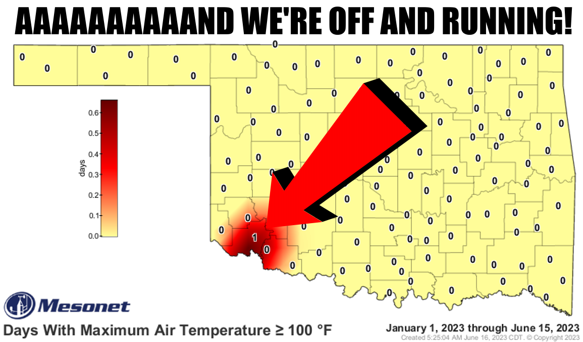
https://ticker.mesonet.org/archive/20230616/tmax.ge100.png
Well there ya go...our first triple-digit temperature of the year signalling
summer's take off. Sometimes it comes in March, sometimes it comes in April or
May, but it always comes, don't it? Yes it do.
Sorry, I'm boycotting "does" until it pays me my money.
And not only did we see that first 100 down there in SW OK at Altus--like who
else would it be...Nowata??--but you combine the incredible moisture that had
surged into the state and it was downright NASTY down that way!
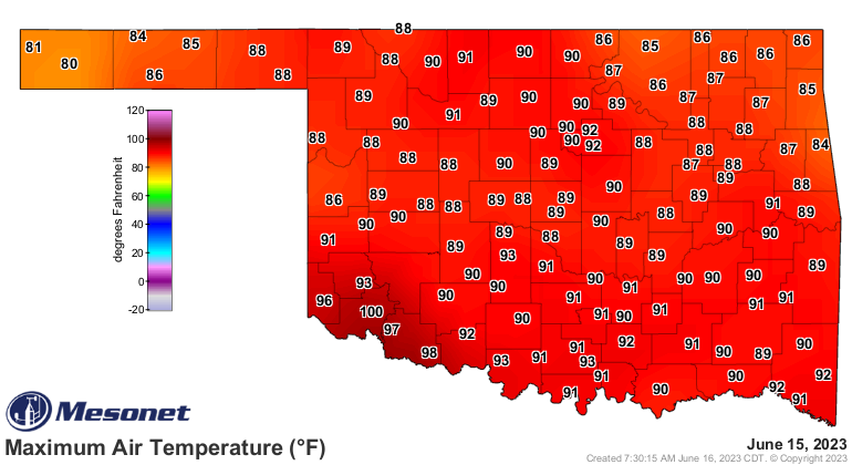
https://ticker.mesonet.org/archive/20230616/yesterdays-high-heat.index.png
Not quite so bad in the rest of the state. Here are the actual air temperatures.
https://ticker.mesonet.org/archive/20230616/yesterdays-highs.png
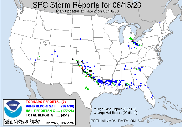
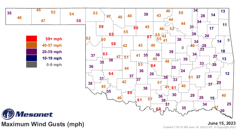
All that heat and moisture fed the severe weather outbreak of yesterday, which
saw a few tornadoes (NWS personnel will be investigating a handful over the
next few days), lots of hail and high winds across the SW half of the state,
largely.
https://ticker.mesonet.org/archive/20230616/yesterday.png
https://ticker.mesonet.org/archive/20230616/yesterday.gust.gif
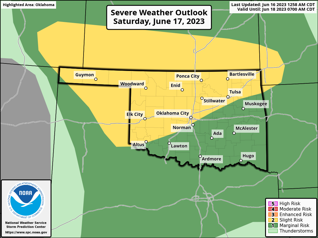
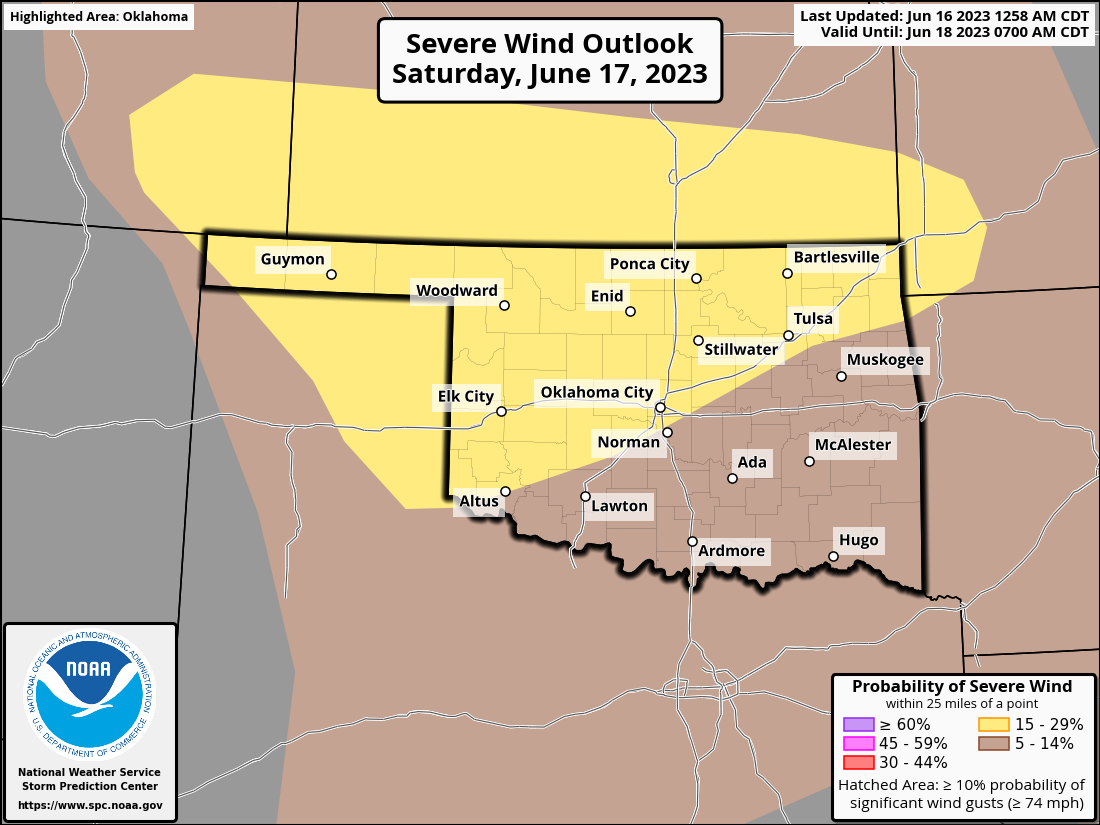
More severe weather is possible today, although the chances for impactful
weather appear greater tomorrow with wind and hail being the primary threat.
https://ticker.mesonet.org/archive/20230616/OK_swody2.png
https://ticker.mesonet.org/archive/20230616/OK_swody2_TORN.png
https://ticker.mesonet.org/archive/20230616/OK_swody2_WIND.png
https://ticker.mesonet.org/archive/20230616/OK_swody2_HAIL.png
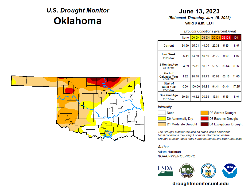
At least it's bringing more rain, which is bringing us LESS drought.
https://ticker.mesonet.org/archive/20230616/rainrfc.24hr.png
https://ticker.mesonet.org/archive/20230616/20230613_ok_trd.png
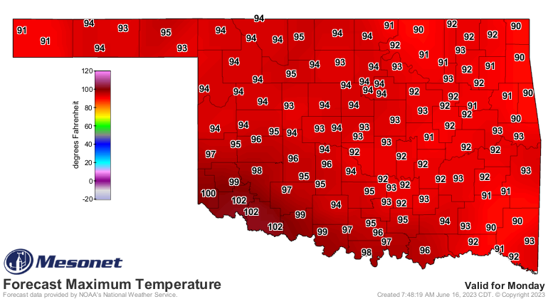
Now back to summer! A bit of a lull over the weekend before we go back to the
frying pan early next week.
https://ticker.mesonet.org/archive/20230616/monday-forecast-highs.png
https://ticker.mesonet.org/archive/20230616/tuesday-forecast-highs.png
Yeah, not everybody appreciates it but it's better'n tornadoes! And before you
complain too much, it could be worse. You could be in Texas...just in general,
but for the weather, too.
https://ticker.mesonet.org/archive/20230616/monday-SP-highs.png
I KID! I KIIIIIID!
Gary McManus
State Climatologist
Oklahoma Mesonet
Oklahoma Climatological Survey
gmcmanus@mesonet.org
==================================================
The OCS/Mesonet Ticker
https://ticker.mesonet.org/
To subscribe or unsubscribe from the Ticker
or for questions about the Ticker or its content
Phone or Email the Ticker Manager at OCS
Phone: 405-325-2253 Email: ticker@mesonet.org
---------------------------------------------------
-C- Copyright 2024 Oklahoma Climatological Survey
===================================================
|


 Tweet
Tweet