Ticker for June 15, 2023
MESONET TICKER ... MESONET TICKER ... MESONET TICKER ... MESONET TICKER ...
June 15, 2023 June 15, 2023 June 15, 2023 June 15, 2023
May in June
Yep, it's one of THOSE days in Oklahoma...one of those days where you thought
going to the bathroom once was good enough, but your nerves tell ya otherwise.
One of those days where you get up in the morning dreading to see the newest
outlooks from the Storm Prediction Center. Can't imagine that? Well, think of me
looking in the mirror each morning.
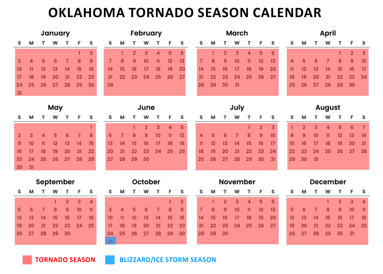
Oh, it's mid-June alright, but don't worry about the calendar. Sure, we're
supposed to be mired in air mass thunderstorms right now as the jet stream meanders
far to the North and we're left with those aimless rainers that go up, don't move,
then collapse, only to form again. In fact, that's what we've largely seen since
our last big tornado outbreak on May 11. But Mother Nature doesn't care about the
calendar, does she? In fact, I've made up this handy-dandy Tornado Season
calendar for ya!
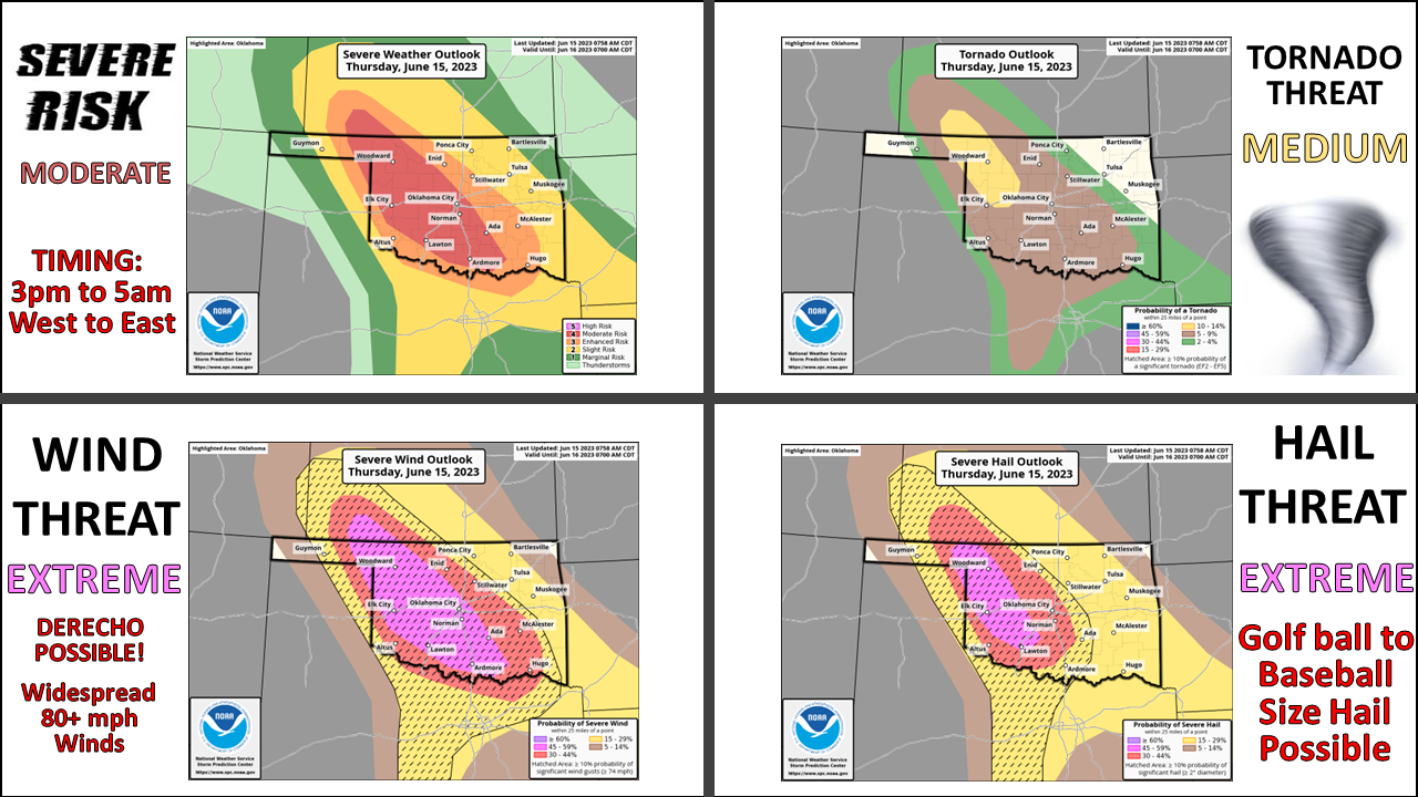
So we have a classical springtime severe weather setup today with lots of moisture
streaming into Oklahoma and the Southern Plains from south Texas and the Gulf
of Mexico.

Watch for those 70+ dewpoints to make it all the way to NW OK by this afternoon
on strong SE winds in the lower levels. Combine that with a mid-level storm
system (shortwave trough) moving through, a deepening low pressure system at
the surface with a cold front and dryline to focus the storm initiation, AND
an unusually-strong-jet-stream-for-this-time-of-year creating strong shear...and
you have the recipe for supercell thunderstorms with all hazards possible.
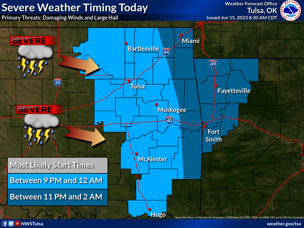
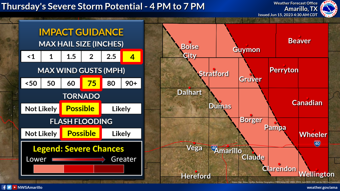
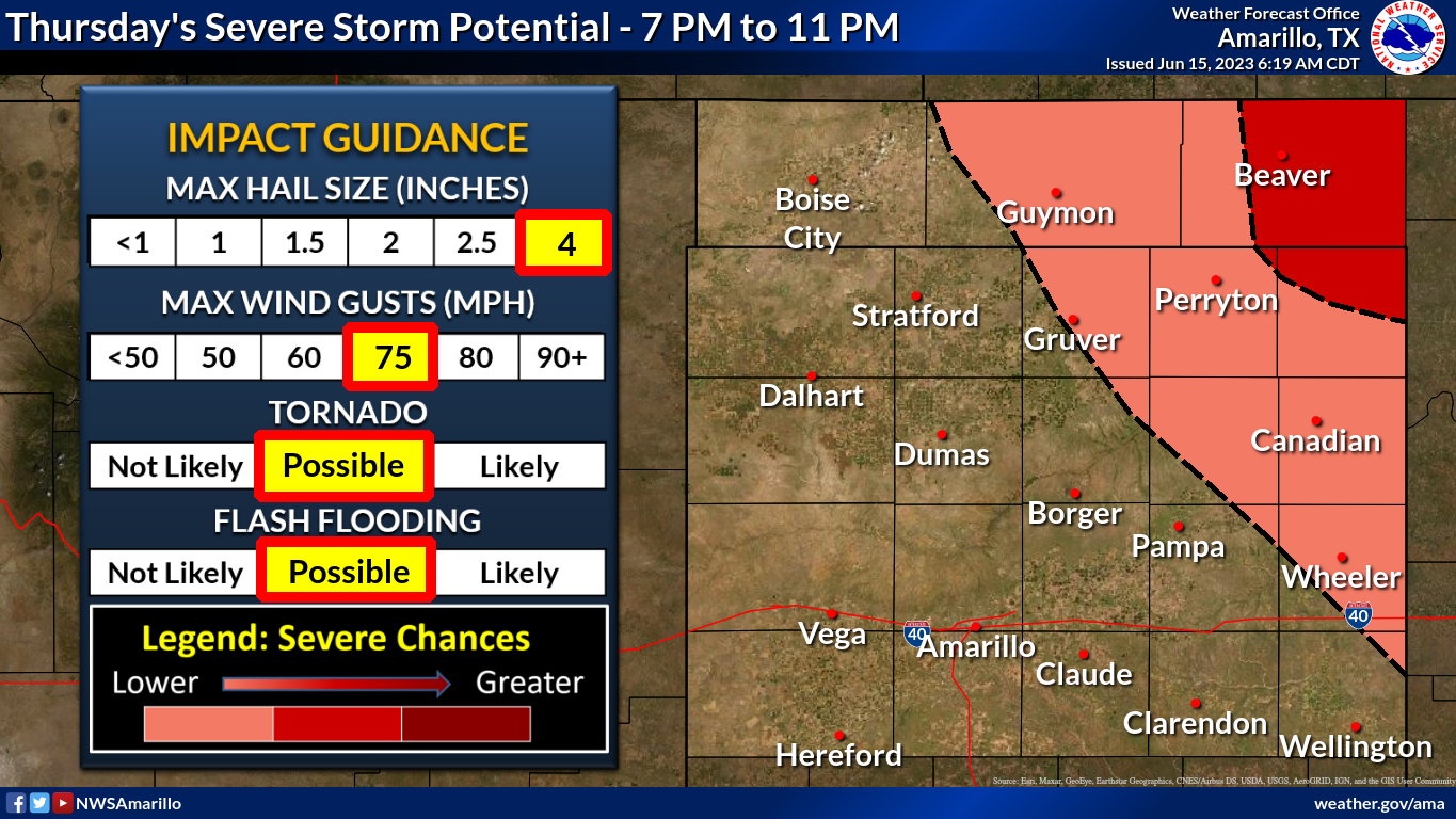
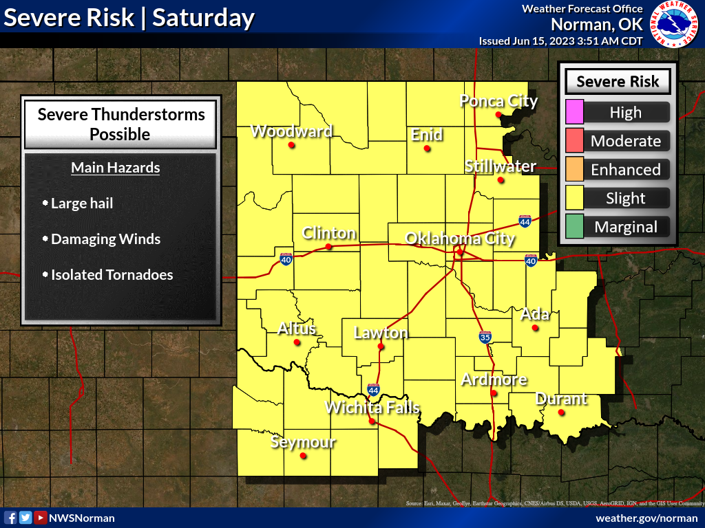
Here's a look at the timing possible today from our friends at our local NWS
offices.
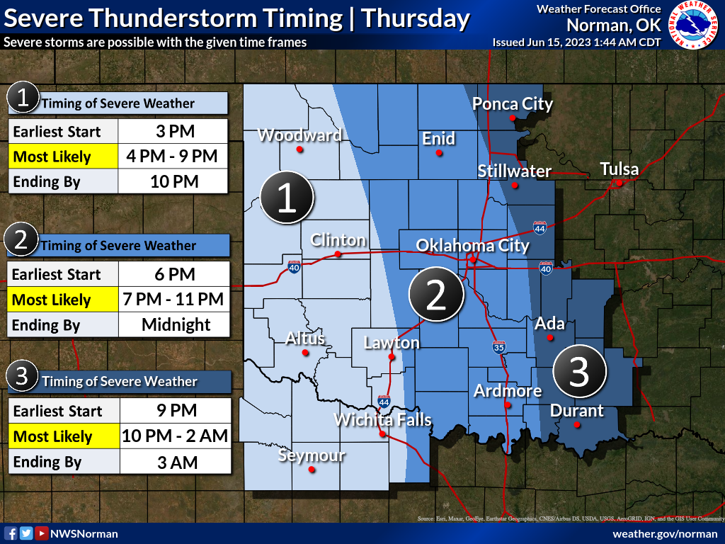
As NWS Norman Warning Coordination Meteorologist Rick Smith says for today:
"Plan for tornado watches, numerous severe thunderstorm warnings and
some tornado warnings. The storms will not lose their punch after dark,
with the threat continuing until after midnight east of I-35."
Exactly! PLAN for these things, but hope for a big old bust today. Trust me,
there's nobody more hoping to be wrong about this mess today than the folks
forecasting it.
So know your safety plan for this afternoon into evening, depending on your
location. You KNOW some Junebugs got into your storm shelter, so clean those
out. Have those batteries charged on your mobile devices in case power goes
out, and in those NOAA Wx Radios, because you need at least two ways to get
warnings.
Don't underestimate the severe wind threat! Seeing that word "Derecho" thrown
around should give you pause. It gives me that Taco Bell Colon Blow (SCIENCE!),
but widespread 70-80+ mph winds will be possible with the storms, and those
can be just as damaging as those weaker tornadoes.
I might be putting a bit more OOMPH in today's seriousness, because I'm a bit
worried folks are again concentrating on that calendar instead of the weather.
So stay tuned to your favorite local media weather team and the NWS office that
covers your area, because today's action can and probably will evolve from
this point forward.
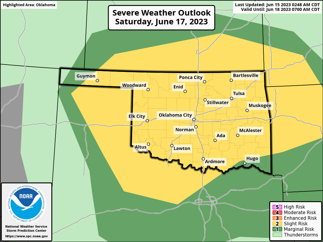
And then get ready to do it all over again Saturday, May 17...I mean JUNE 17.
Gary McManus
State Climatologist
Oklahoma Mesonet
Oklahoma Climatological Survey
gmcmanus@mesonet.org
June 15 in Mesonet History
| Record | Value | Station | Year |
|---|---|---|---|
| Maximum Temperature | 104°F | ALTU | 2022 |
| Minimum Temperature | 42°F | KENT | 2001 |
| Maximum Rainfall | 5.22″ | BYAR | 2007 |
Mesonet records begin in 1994.
Search by Date
If you're a bit off, don't worry, because just like horseshoes, “almost” counts on the Ticker website!