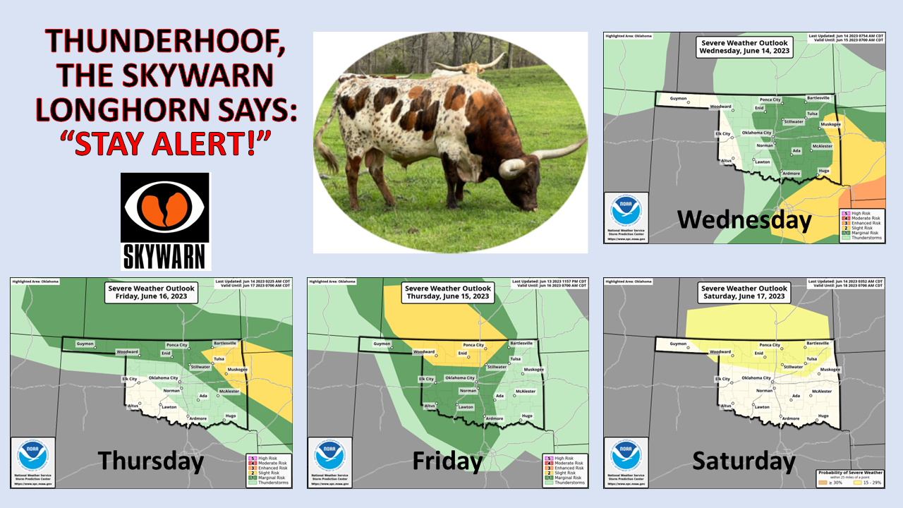
Ticker for June 14, 2023
MESONET TICKER ... MESONET TICKER ... MESONET TICKER ... MESONET TICKER ...
June 14, 2023 June 14, 2023 June 14, 2023 June 14, 2023
Moo
Good Ticker reader Danny sent me that pic a couple of weeks ago, but we haven't
really had a good (bad?) stretch of severe weather since, so four straight days of
possible severe weather finally gives me a chance. Oh, the Skywarn bit? Keep
looking, you'll see it. Now, how about this?
Why did the cow go to space?
Because it wanted to see the mooooon! 🐄🚀
Hey pal, they can't all be gems, right?
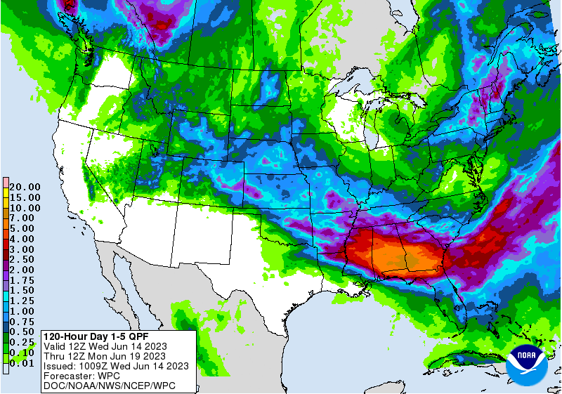
An unusually strong jet stream and several small storm systems look to wreak
havoc on our weather over the next 3-4 days, our last chance of organized rains
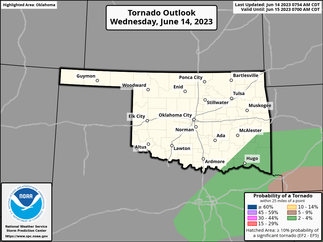
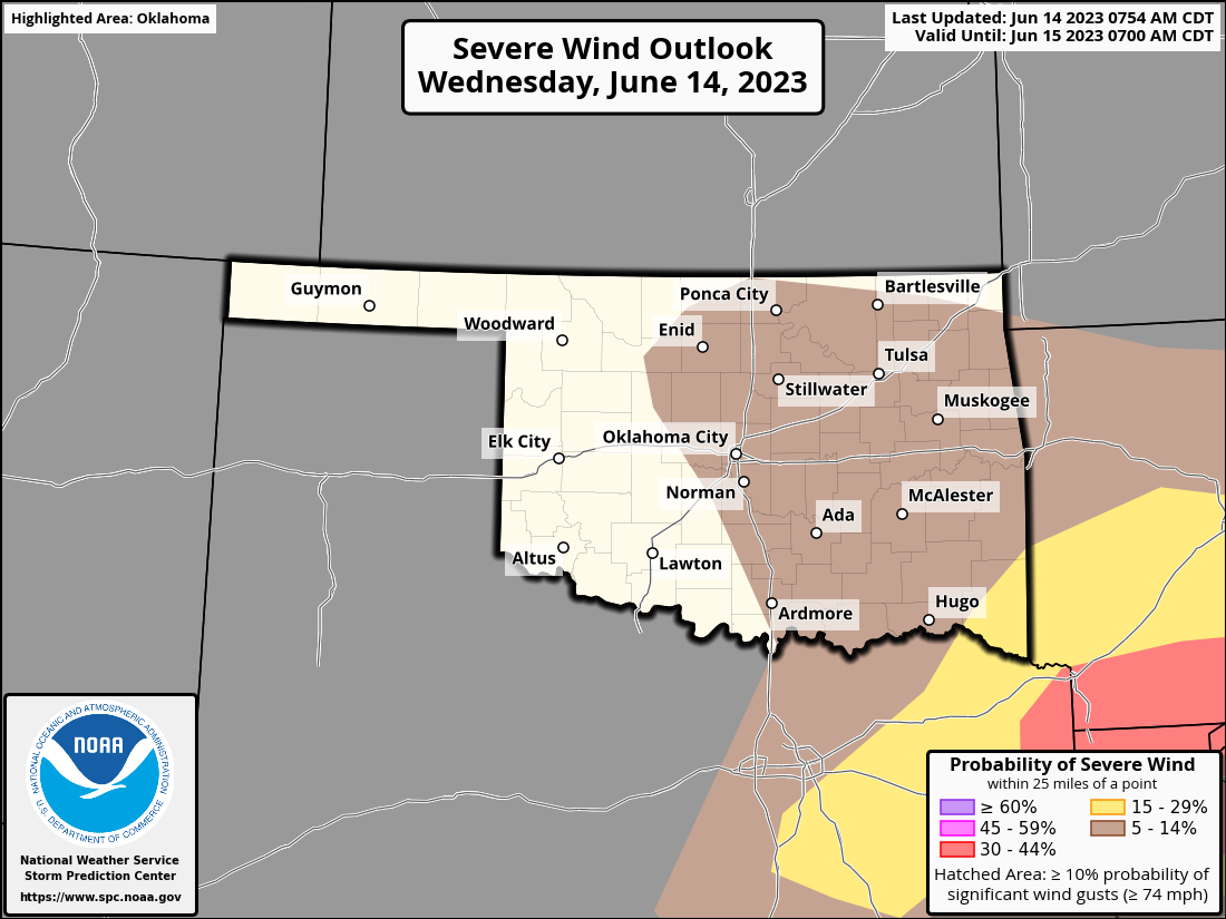
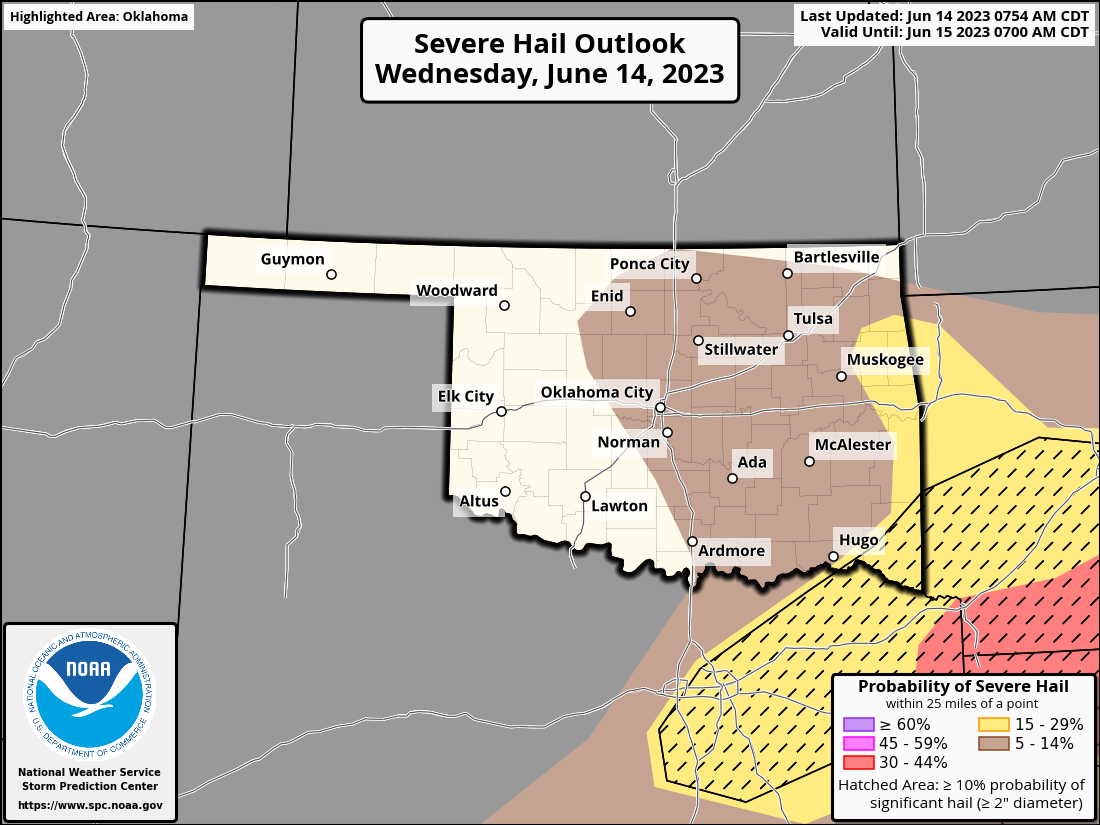
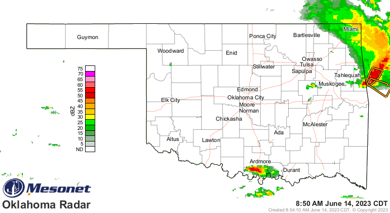
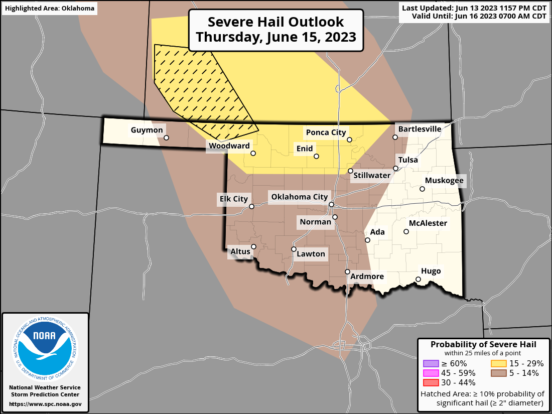
before the dreaded heat dome starts to move in and bring summer back. Today will
be in eastern Oklahoma, for the most part, and all hazards are possible (but
still rather low...we're not talking May here).
Heck, it's been severe stormin' up in the northeast this morning already, for
crying out loud!
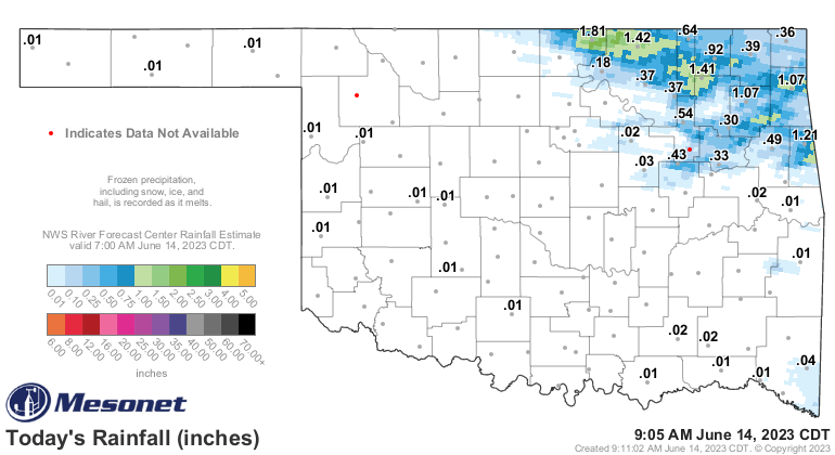
And filled some more rainfall holes.
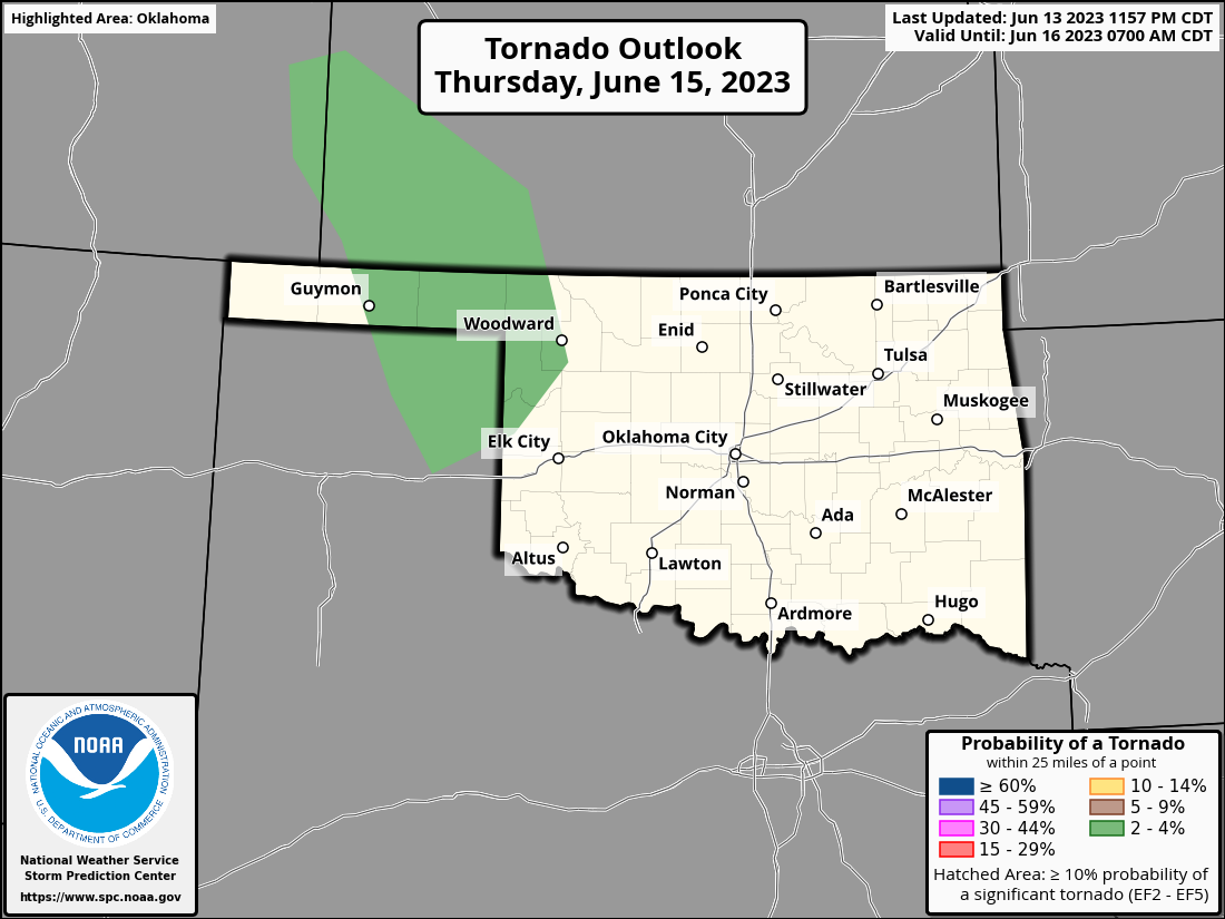
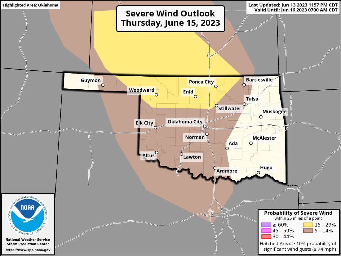
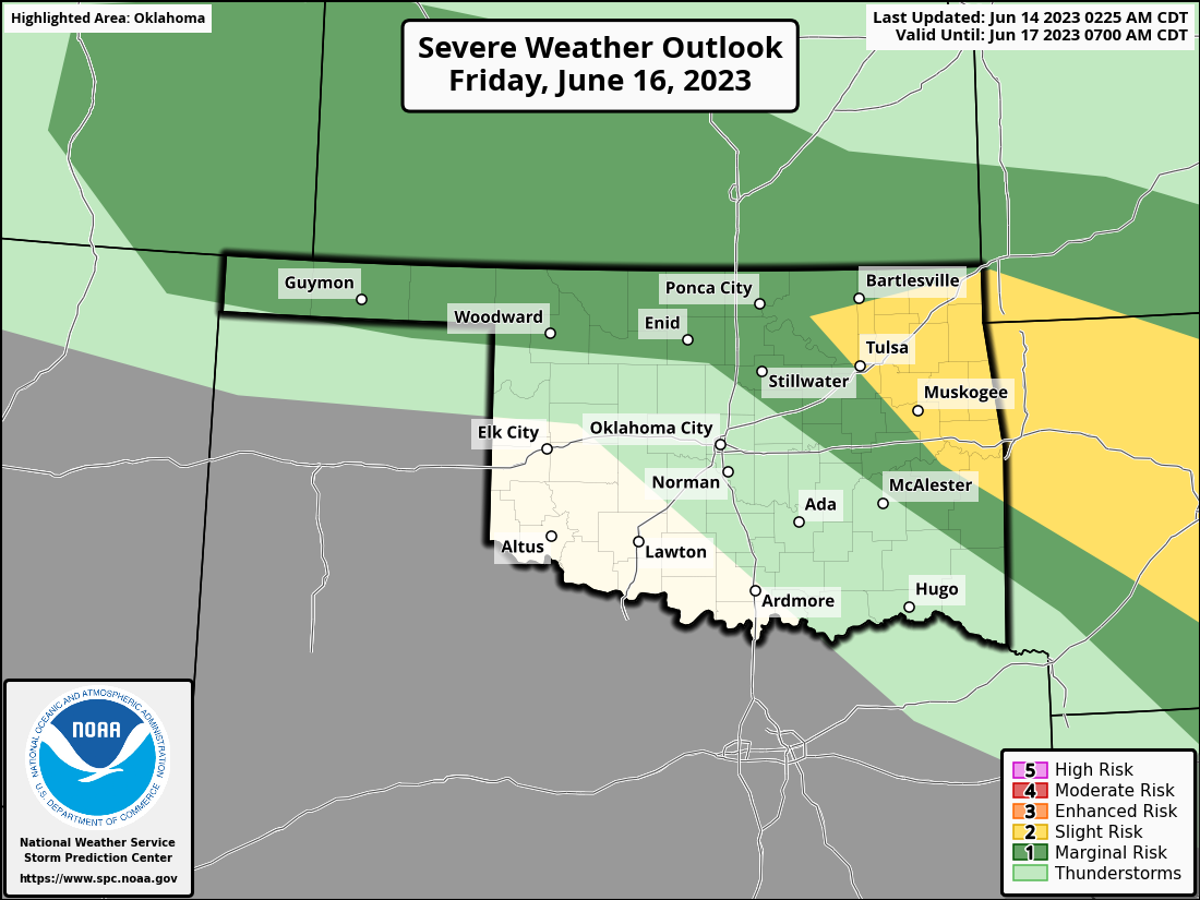
Tomorrow, we will have a dryline out in western OK with a small storm system
moving through, so if we can beat the cap, we could see isolated supercells
with all hazards possible (still low, however). Otherwise, a mass of storms
should build up to the NW of OK and move into the state overnight.
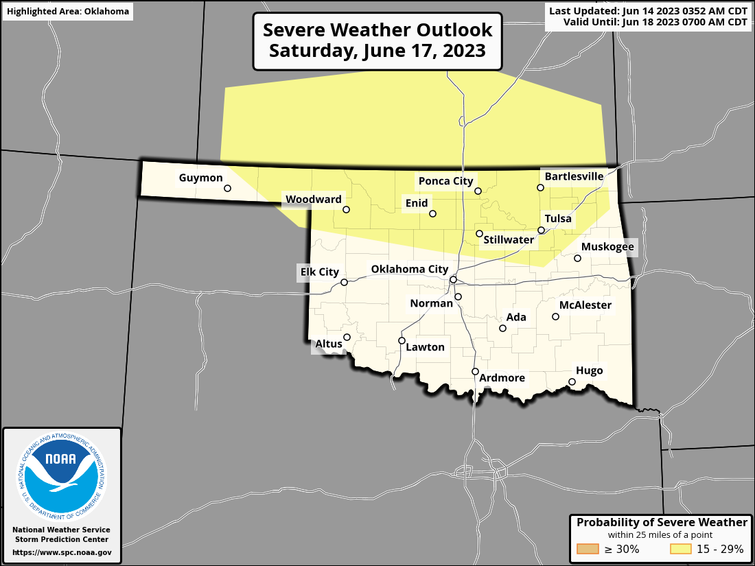
Then we get into the weekend with Friday and Saturday both possibly being
stormy.
Now these areas could and probably will shift around over the next few days
as the forecasts become a bit more clear. No, not the areas themselves...they're
rooted in place. The danger zones! You know what I'm talking about, come on.
These repeated storm chances, if they pan out where they look to occur now (and
they won't so why even say this?), will give these areas the best rain chances.
After that, summer hits the fan and we see our first triple-digit temps in
the state, possibly.

Now, let me leave ya with this:
What do you call a cow with no legs?
Ground beef! 🐄🥩
Gary McManus
State Climatologist
Oklahoma Mesonet
Oklahoma Climatological Survey
gmcmanus@mesonet.org
June 14 in Mesonet History
| Record | Value | Station | Year |
|---|---|---|---|
| Maximum Temperature | 108°F | GRA2 | 2011 |
| Minimum Temperature | 42°F | BOIS | 2001 |
| Maximum Rainfall | 11.26 inches | OKCN | 2010 |
Mesonet records begin in 1994.
Search by Date
If you're a bit off, don't worry, because just like horseshoes, “almost” counts on the Ticker website!