Ticker for October 14, 2022
MESONET TICKER ... MESONET TICKER ... MESONET TICKER ... MESONET TICKER ...
October 14, 2022 October 14, 2022 October 14, 2022 October 14, 2022
BIGTIME!
I have very little time to Tock to you today, I got hit in the head by a pillow
this morning and it gave me a concushion. I wanted to Tick anyway because we got
big goings on happening in the weather in the next few days.
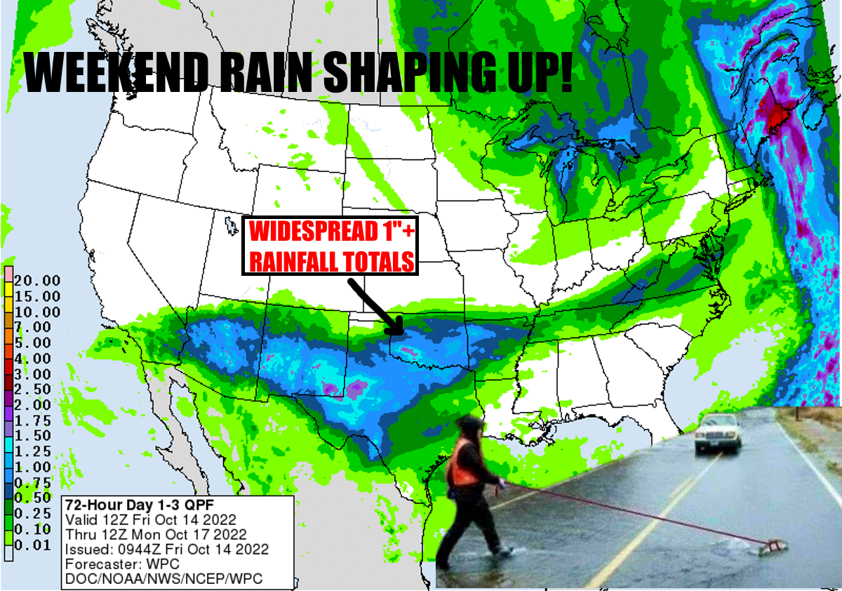
FIRST, the rain. Yes, I managed to use my power to have that rain SPREAD-NOT-SHIFT
(I'll never live that one down) to the north and now most of Oklahoma will see
appreciable rainfall. In doing so, I hope to see appreciable bags of money from
all of you. Okay, maybe it wasn't MY doing, but the models have certainly given
us some hope for a good 1" of rain across a good portion of the state, and a bit
less (or more) here and there, associated with this cold front coming to the state
Saturday. Should rain through parts of Sunday.
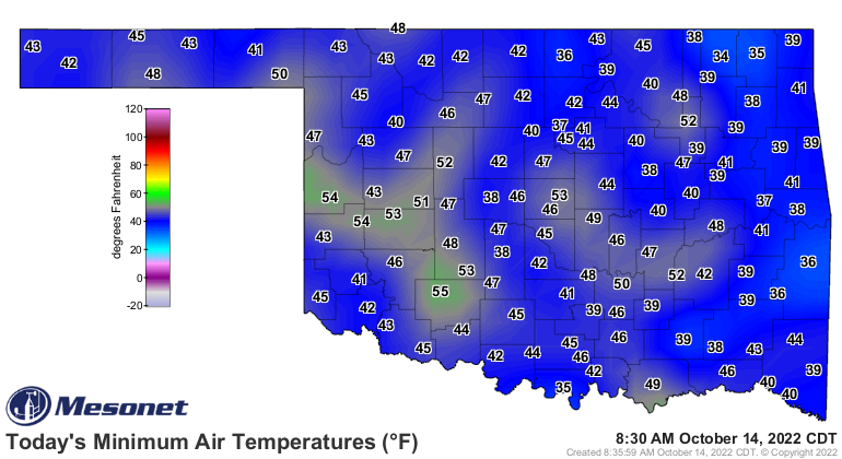
Ahhh, the cold front. Turns out it's bringing a bit of winter with it. Some would
say fall, I says winter when I see widespread lows in the 30s. Now we had Nowata
come pretty close to freezing this morning with 34 degrees.
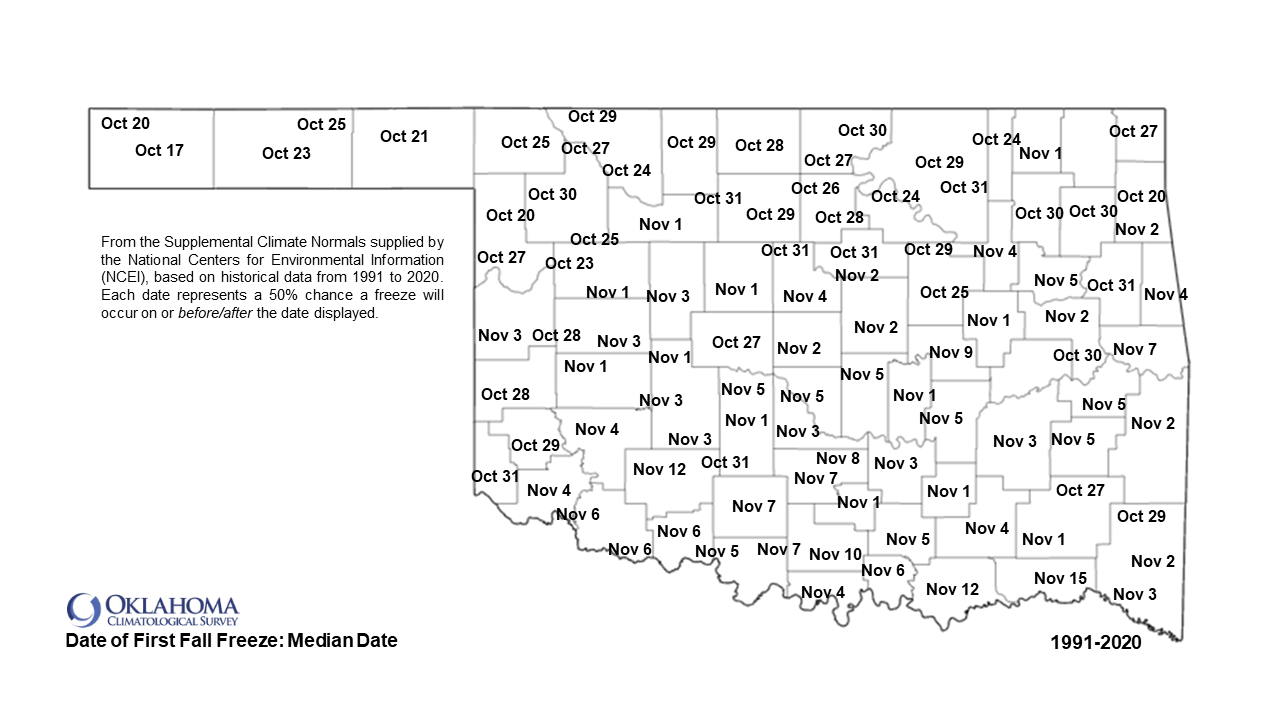
So we haven't seen the state's first freeze yet. I'm thinking SOMEBODY hits
32 degrees Monday morning. But if not, Tuesday looks downright frosty.
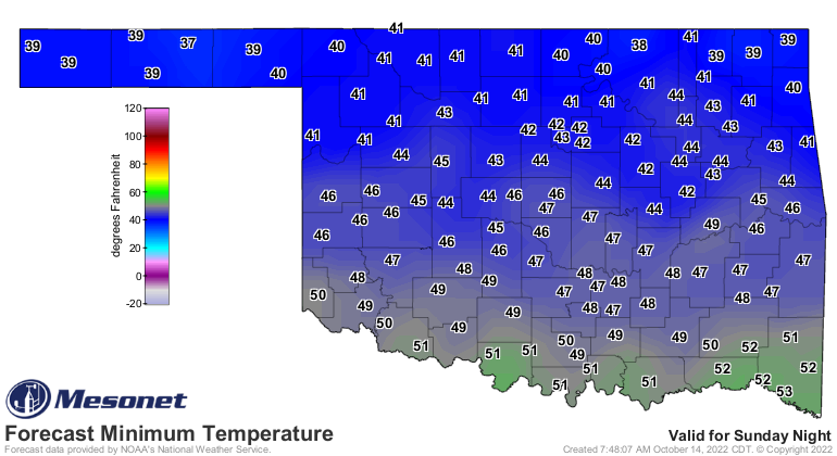
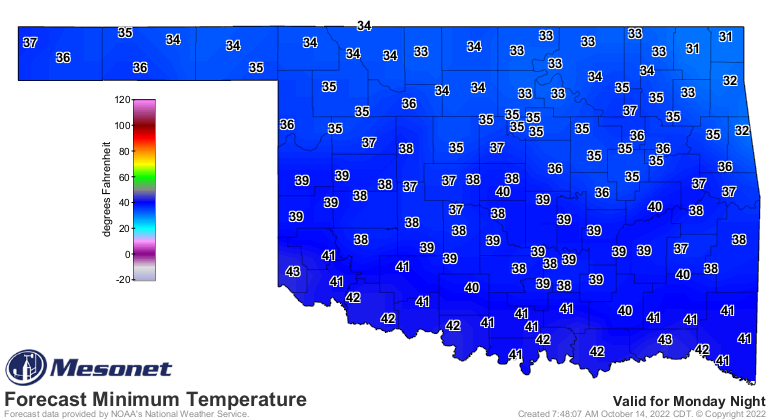
And going along with really stupid weather in 2022, that would indeed be a very
early first fall freeze for even northern OK (but not the Panhandle).
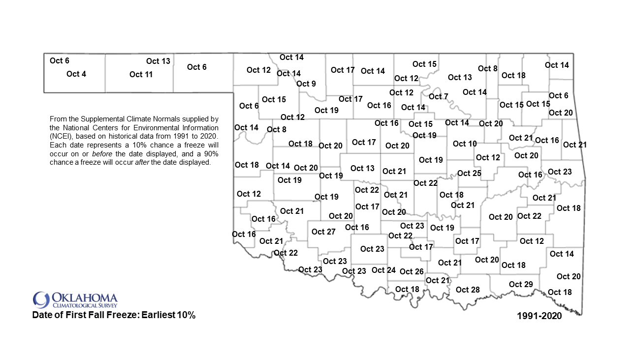
We don't like to say the F-word ("freeze," potty mouths!) this early, but
it looks like it's gonna happen.
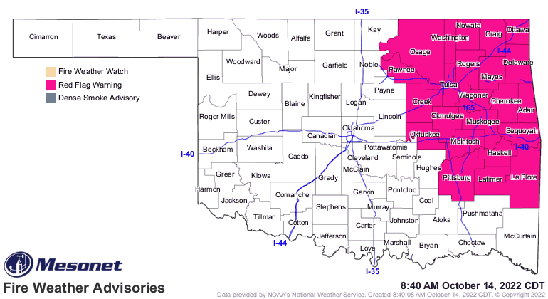
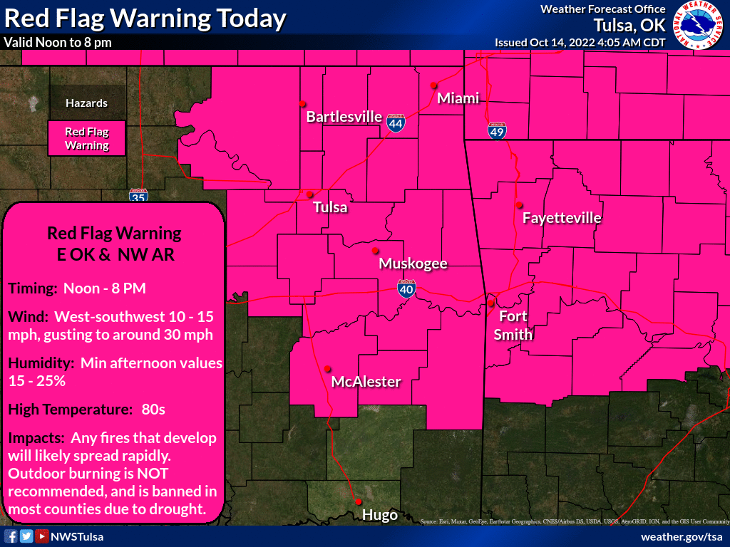
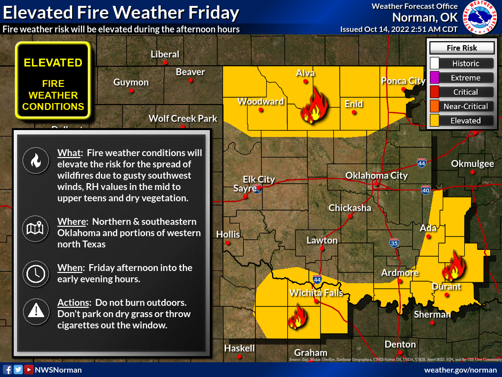
Another F-word...fire. Yeah, it's gonna be a big problem today, especially
across the historically dry NE OK area.
For those of you (like me) that dread breaking out the coats and whatnot, let's
just celebrate the last 2 days of late-summer!
Gary McManus
State Climatologist
Oklahoma Mesonet
Oklahoma Climatological Survey
gmcmanus@mesonet.org
October 14 in Mesonet History
| Record | Value | Station | Year |
|---|---|---|---|
| Maximum Temperature | 100°F | HOLL | 2020 |
| Minimum Temperature | 26°F | PRYO | 2002 |
| Maximum Rainfall | 2.83 inches | ARD2 | 2013 |
Mesonet records begin in 1994.
Search by Date
If you're a bit off, don't worry, because just like horseshoes, “almost” counts on the Ticker website!