Ticker for October 13, 2022
MESONET TICKER ... MESONET TICKER ... MESONET TICKER ... MESONET TICKER ...
October 13, 2022 October 13, 2022 October 13, 2022 October 13, 2022
No thanks!
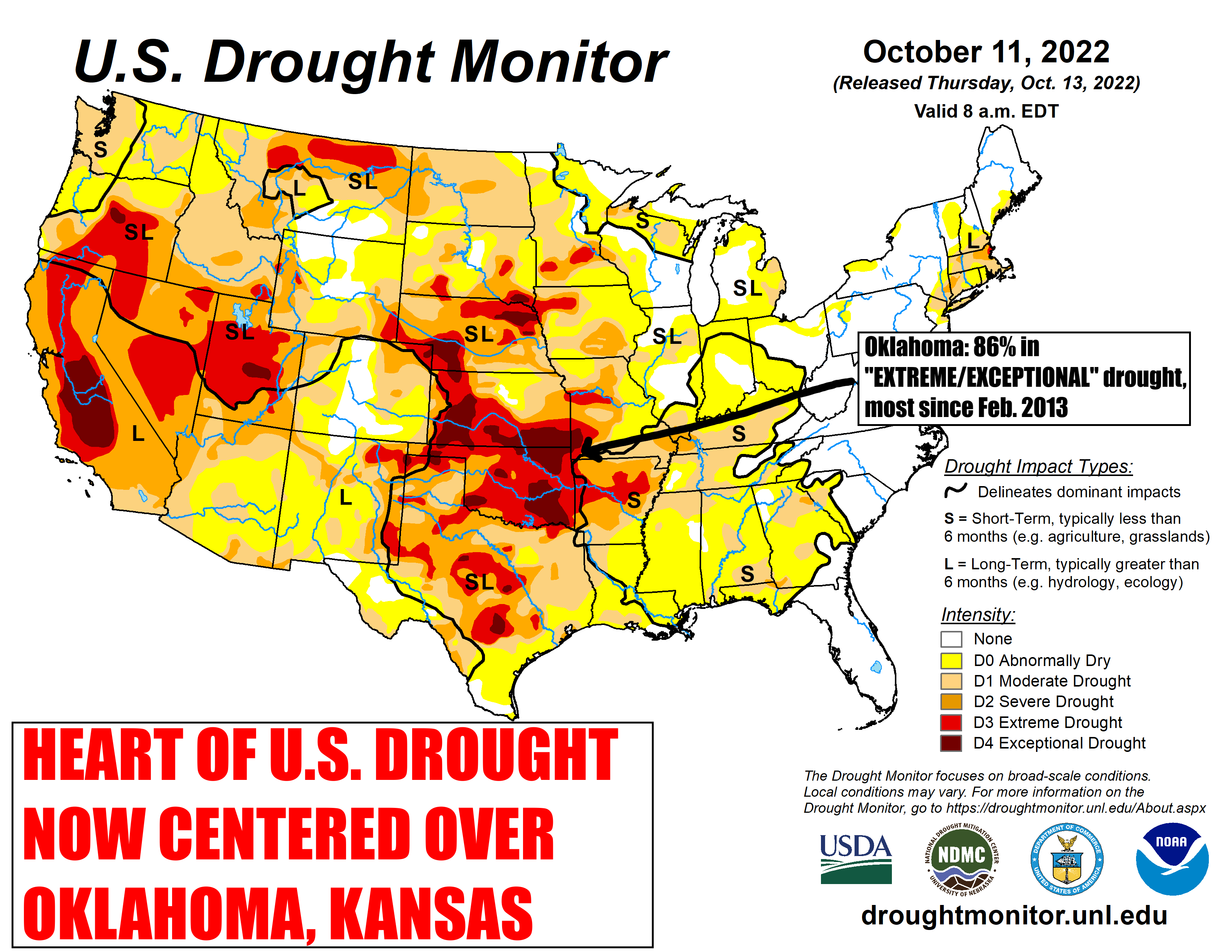
We asked for and received a major increase in the worst categories of drought
intensity coverage for the state of Oklahoma by the U.S. Drought Monitor. Now
don't get us wrong...we didn't ask for the DROUGHT, just the drought designations.
We wouldn't ask for this on our worst enemy.
DENNIS QUAID, YOU ARE LUCKY WE CAN'T!
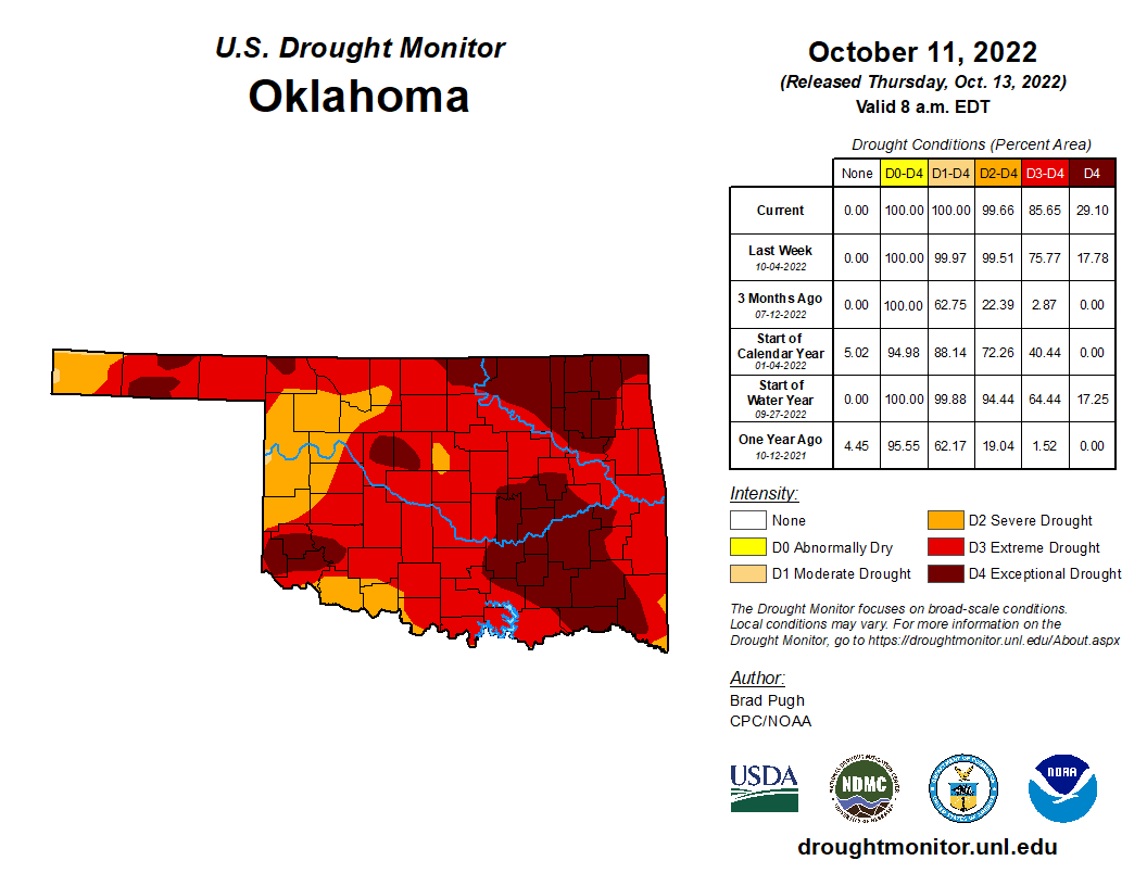
Don't ask. But here's the deal...this is again the most of those two worst
USDM drought designations since Feb. 19, 2013. Here you can see comparisons from
that map and our current map...Oklahoma only.

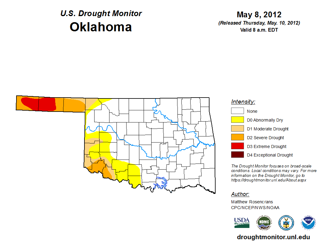
Now it was probably at its worst back then in the Sept. 2011 time frame, right
after we survived the hottest summer in U.S. history for any state.

A lot of folk probably don't remember but it started raining right after that,
and by spring of 2012, we were nearly out of drought.
But by the end of that summer, we were right back at it again.
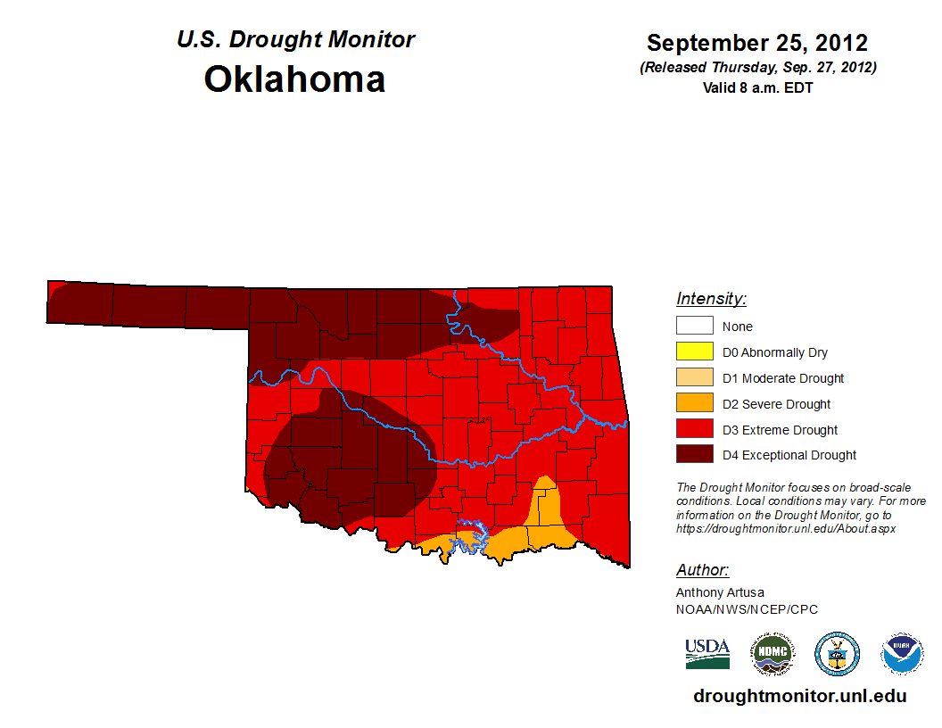
Here's a look at Oklahoma's drought timeline for that 2010-15 drought, which was
actually a series of shorter droughts stitched together, much like our current
drought is actually an amalgam of long-term (Aug. 2021-present) and a short-
term (June 11-present) droughts.


All of this is chronicled, along with COVID, Disco, McDonald's McRib sandwich,
and Flamin' Hot Mountain Dew, in my new book: "Things I Never Want to Experience
Again."
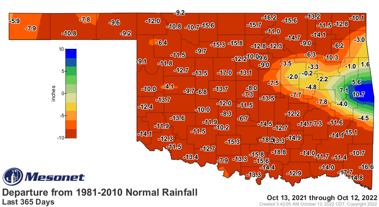
We had this worsening of drought despite some somewhat decent rains over the
last week, but you simply cannot erase deficits of 8-to-12-to-20 inches of rain
over the last year or so with a quarter or even an inch of moisture.


There appears to be help on a way associated with that cold front coming this
weekend. The front should stall out and allow some rain to occur Saturday night
into Sunday. Mostly across Southern OK, but we have hopes for it to spread
north. Very small hopes, but that's about all ya got during these big droughts.
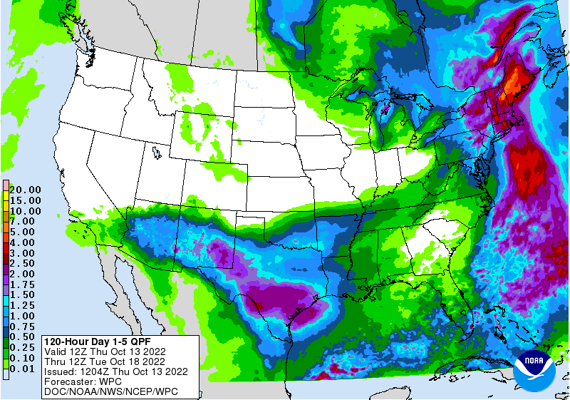
That will probably be the end of the rain for awhile, unfortunately, as we go
into NW flow and see mostly-dry cold fronts during the following week or so.
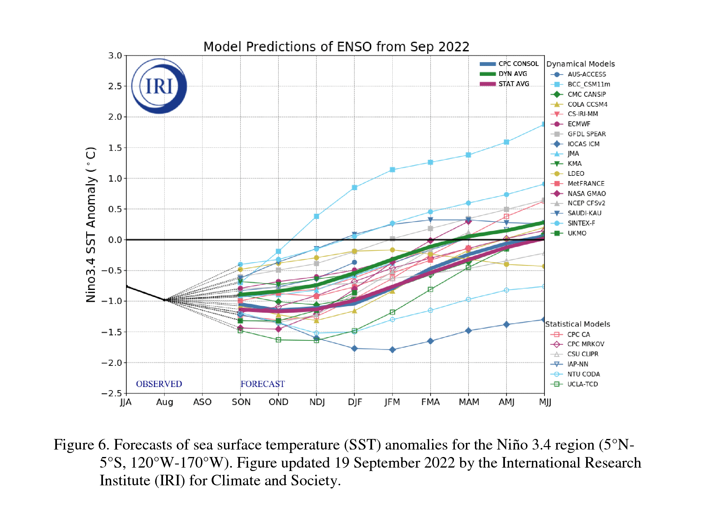
La Nina is expected to continue, reaching borderline moderate strength in
the following months, before transitioning to ENSO Neutral by spring.
That's not good news, climatologically speaking (and if you start speaking
climatologically, seek out mental health services immediately, especially if you
combine it with Flamin' Hot Mountain Dew), but it's not so bad meteorologically
speaking. Lots of bigtime stuff can still happen in the day-to-day weather,
including big storms, big rains, big snows, and in the worst case scenario,
big fires.
Gary McManus
State Climatologist
Oklahoma Mesonet
Oklahoma Climatological Survey
gmcmanus@mesonet.org
October 13 in Mesonet History
| Record | Value | Station | Year |
|---|---|---|---|
| Maximum Temperature | 93°F | FREE | 2015 |
| Minimum Temperature | 24°F | KENT | 2019 |
| Maximum Rainfall | 4.60 inches | OILT | 2012 |
Mesonet records begin in 1994.
Search by Date
If you're a bit off, don't worry, because just like horseshoes, “almost” counts on the Ticker website!