MESONET TICKER ... MESONET TICKER ... MESONET TICKER ... MESONET TICKER ...
September 14, 2020 September 14, 2020 September 14, 2020 September 14, 2020
Non-purple Haze
http://ticker.mesonet.org/archive/20200914/smoke-hurricane.png
The possibilities of beautiful weather have turned positively and literally dim
with the smoke transported by those fires out West. Following our burst of
fall/winter last week and all that rain, we lost out on the brilliant blue skies
that we normally get following a storm system. While there has been SOME
cloudiness, most of that dimming comes from the smoke carried aloft from the
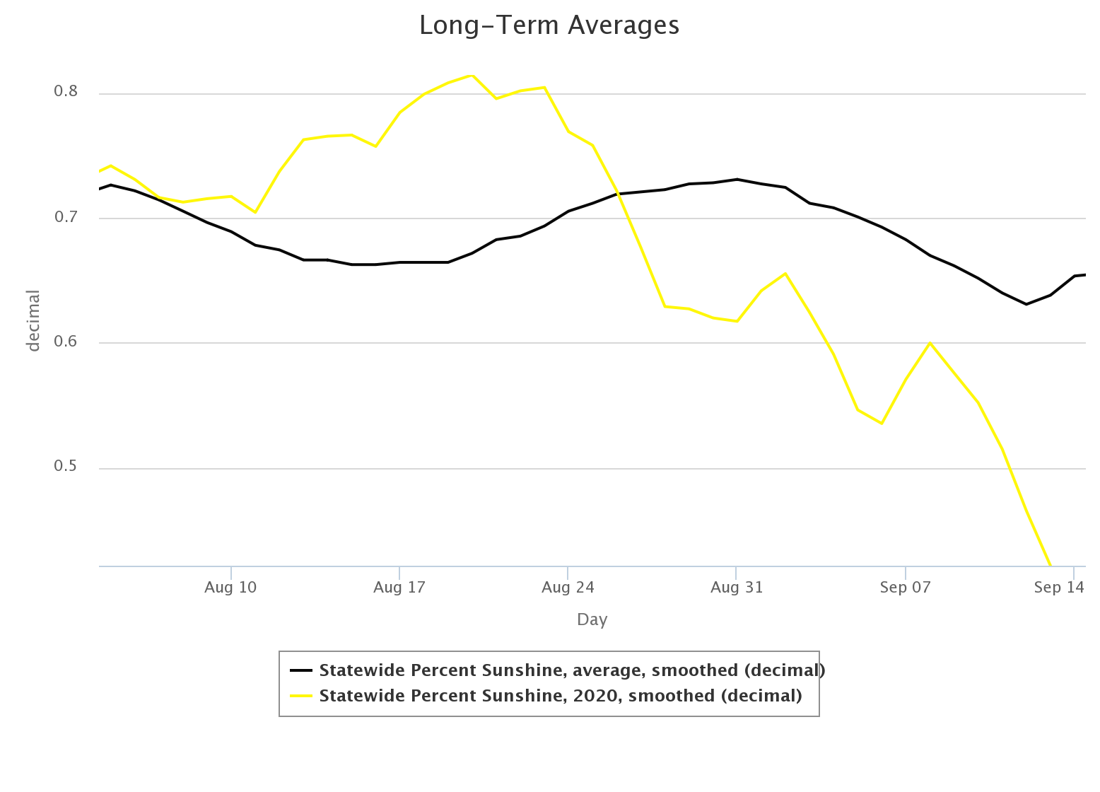
fires out west. We can see that in the departure from average percent possible
sunshine maps from the Mesonet for the last few days. We had a long period there
where we were getting lots of sunshine, then we started to tick down with more
storm systems. The big drop over the last few days, however, was due to the
smoke. This graph shows the statewide average.
http://ticker.mesonet.org/archive/20200914/pct-possible-sunshine.png
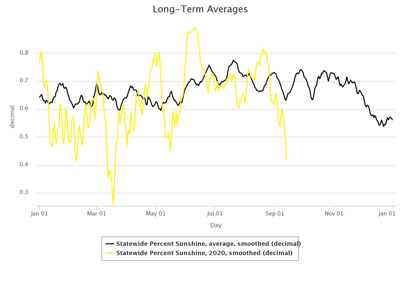
Here's the same graph for the year.
http://ticker.mesonet.org/archive/20200914/pct-possible-sunshine-2020.png
There's that noticeable drop after Thanksgiving when we tend to cloud up, at least
relative to most of the year. Note that this is independent of the length of
the day and solar radiation received. If we COULD get 10 hours of sunshine but
only get 8 hours, then that would be 80%. If we could get 16 hours but only
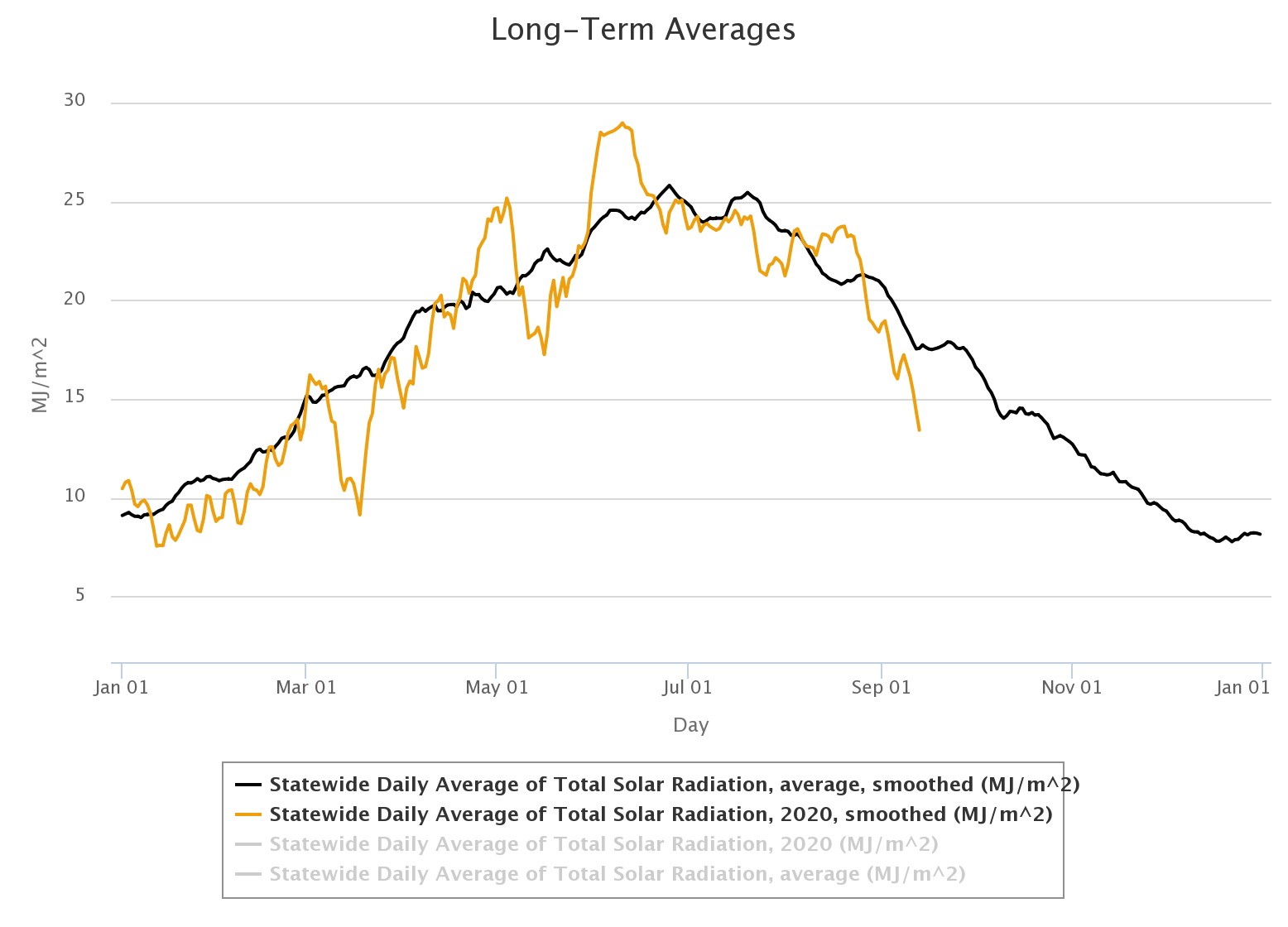
got 12.8 hours, that'd also be 80%. Here is the same graph for 2020, but this
time focusing on total solar radiation received (and the long-term average).
http://ticker.mesonet.org/archive/20200914/total-radiation-2020.png
Obviously, not much risk of getting a tan in December!
The air swept down in the aftermath of last week's cold front, in combination
with the smoke, has managed to keep our temperatures down about 10 degrees
below normal, putting us in October territory (Octember, Septober...take your
pick).
http://ticker.mesonet.org/archive/20200914/Septober.statewide.png
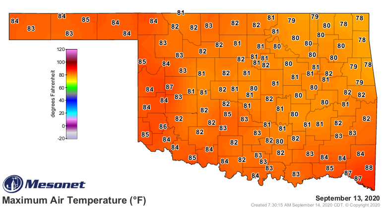
http://ticker.mesonet.org/archive/20200914/yesterday-high-temps.png
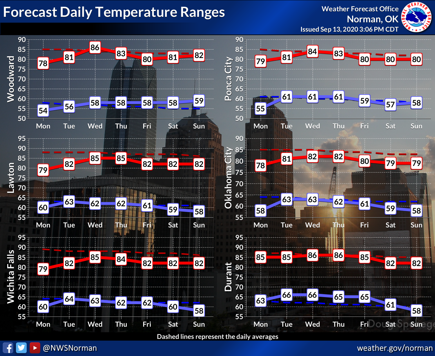
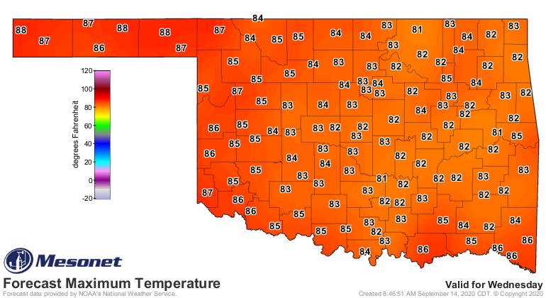
About the same the rest of the week...maybe a bit more sticky as we see some
moisture return to the state. Wednesday looks to be the "hot" day, but still
very pleasant weather for this time of the year.
http://ticker.mesonet.org/archive/20200914/nws-norman-7day-temps.png
http://ticker.mesonet.org/archive/20200914/wednesday-forecast-highs.png
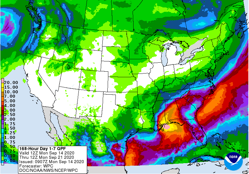
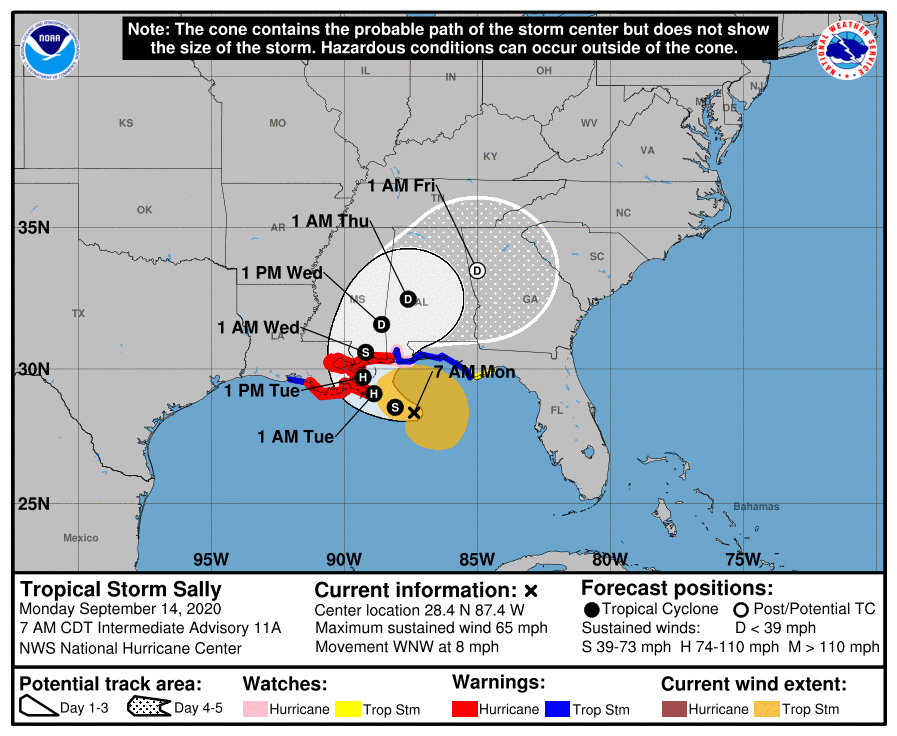
Some rain is possible later this week, but it doesn't look like much. Sally
is another swing and a miss.
http://ticker.mesonet.org/archive/20200914/7day-rain-forecast.gif
http://ticker.mesonet.org/archive/20200914/sally.png
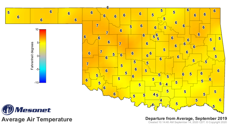
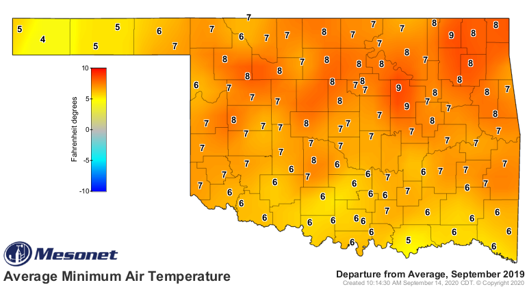
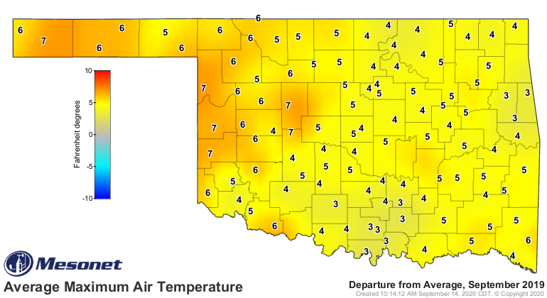
Overall, pretty nice weather. We've certainly had worse Septembers! We go no
further than last year, when September 2019 ended up as the second warmest
on record here in the state, dating back to 1895.
http://ticker.mesonet.org/archive/20200914/sept-2019-depart-normal-avg.png
http://ticker.mesonet.org/archive/20200914/sept-2019-depart-normal-min.png
http://ticker.mesonet.org/archive/20200914/sept-2019-depart-normal-max.png
No worries about that this year, of course. But don't worry...there's still
October (Octember?)!
Gary McManus
State Climatologist
Oklahoma Mesonet
Oklahoma Climatological Survey
(405) 325-2253
gmcmanus@mesonet.org
==================================================
The OCS/Mesonet Ticker
https://ticker.mesonet.org/
To subscribe or unsubscribe from the Ticker
or for questions about the Ticker or its content
Phone or Email the Ticker Manager at OCS
Phone: 405-325-2253 Email: ticker@mesonet.org
---------------------------------------------------
-C- Copyright 2024 Oklahoma Climatological Survey
===================================================
|


 Tweet
Tweet