MESONET TICKER ... MESONET TICKER ... MESONET TICKER ... MESONET TICKER ...
July 14, 2011 July 14, 2011 July 14, 2011 July 14, 2011
Recent rains do little to relieve drought
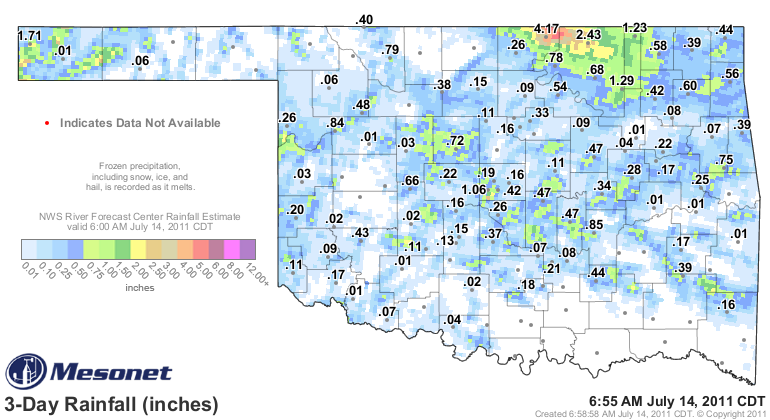
A wandering tropical system has given Oklahoma a brief interlude from the dry
weather over the last couple of days. As seen on this map of rainfall from
the Oklahoma Mesonet, a couple of areas received quite generous totals. Kay and
Osage counties in northern Oklahoma totaled 2-4 inches with localized amounts
of more than 5 inches according to the radar estimates. And the far western
Panhandle received upwards of 2 inches. Not a massive total, but for that area,
it's a huge gulp of water.
http://ticker.mesonet.org/archive/20110714/rainrfc.72hr.png
Will Rogers Airport received 2.91 inches in a downburst on Tuesday that kept
their high temperature below the triple-digit mark at 98 degrees. The trouble
with the rains, however, is that the hefty amounts were very localized. That is
customary for summer storms that are working with little upper-air support. They
form and sit still for the most part, dumping their rain in a hurry before
dissipating. With luck, more storms form along the outflow boundaries that
result, which is what we saw on Tuesday and Wednesday.
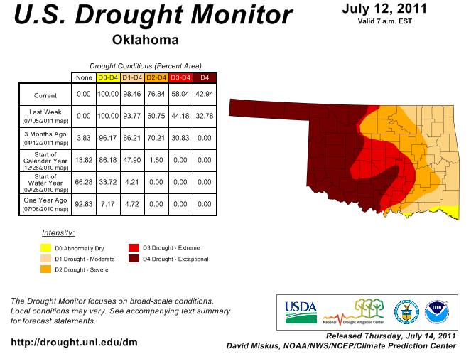
the heat and drought remain untouched for the most part, however, and the latest
U.S. Drought Monitor report reflects that. Exceptional (D4) drought now covers
more than 40 percent of Oklahoma, including the entire western one-third of the
state. Extreme (D3) and Severe (D2) drought continue their eastward march as
well as the heat withers vegetation and dissipates the remaining soil moisture.
Exceptional-to-extreme drought now covers 58 percent of the state, up 14 percent
from last week. Again, a testament to the heat and its ability to hasten the
drought's impacts.
http://ticker.mesonet.org/archive/20110714/ok_dm.png
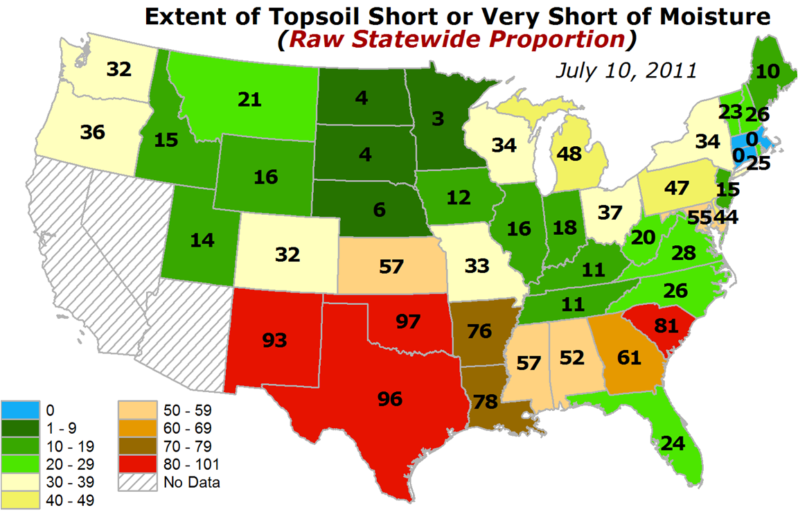
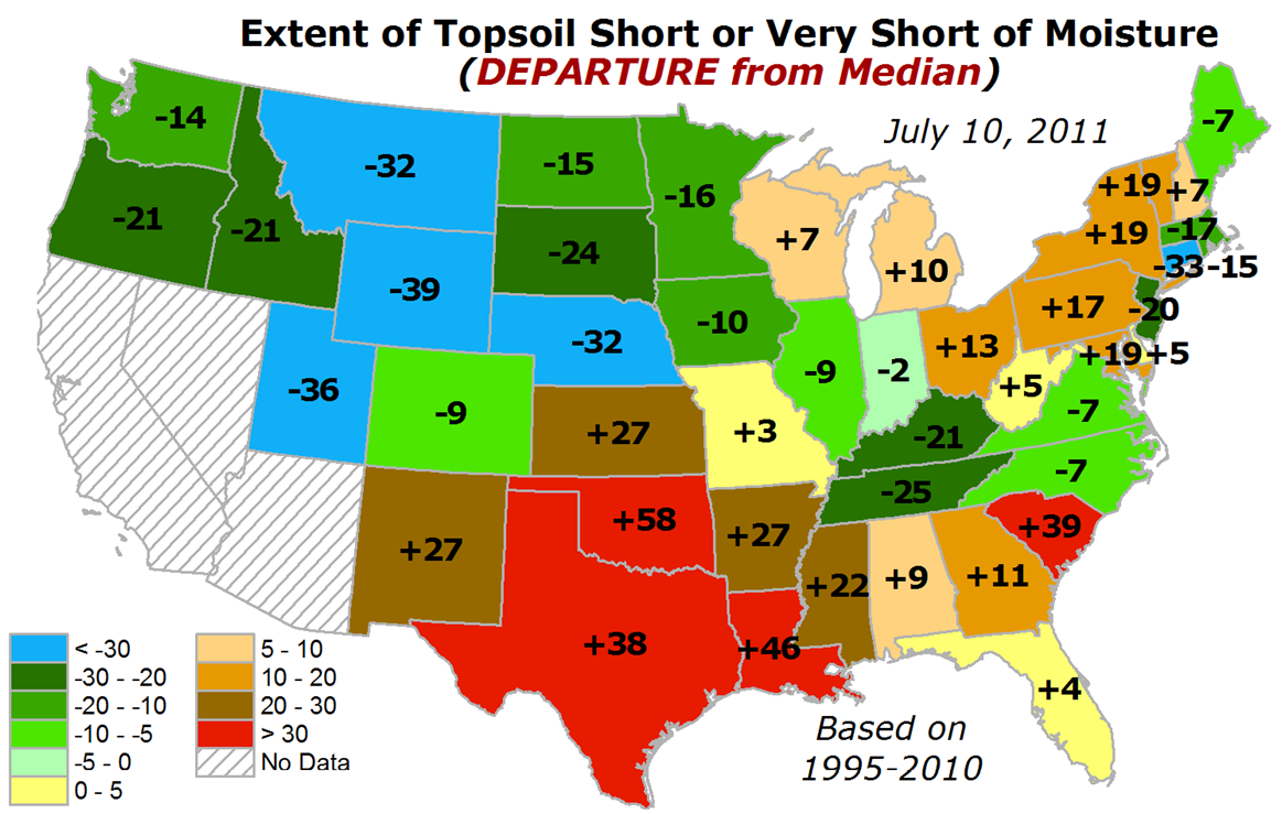
The latest map of the U.S. topsoil conditions indicate that Oklahoma was leading
the country in the percentage of the top 6 inches of soil considered short or
very short of moisture. Being short of soil moisture is not that unexpected for
July in Oklahoma, but the extent of the dryness is noted in the second map, the
departure from median (1995-2010 data) of the same parameter.
http://ticker.mesonet.org/archive/20110714/topsoil.png
http://ticker.mesonet.org/archive/20110714/topsoil_departure.png
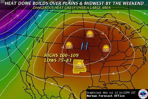
We look to our friends in the NWS for good news, and we're not seeing it just
yet. The NWS offices at Norman and Tulsa both provide graphics bearing bad
news (AHA, blame them!!):
http://ticker.mesonet.org/archive/20110714/fxc_Weekend.jpg
http://ticker.mesonet.org/archive/20110714/tulsa-heat.jpg
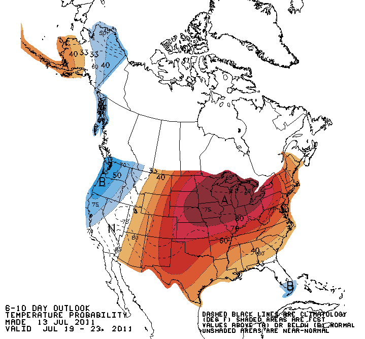
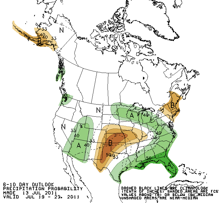
Looking farther out, it should come as no surprise that the Climate Prediction
Center forecasts for later on in July are bleak at best.
July 19-23:
http://ticker.mesonet.org/archive/20110714/610temp.new.gif
http://ticker.mesonet.org/archive/20110714/610prcp.new.gif
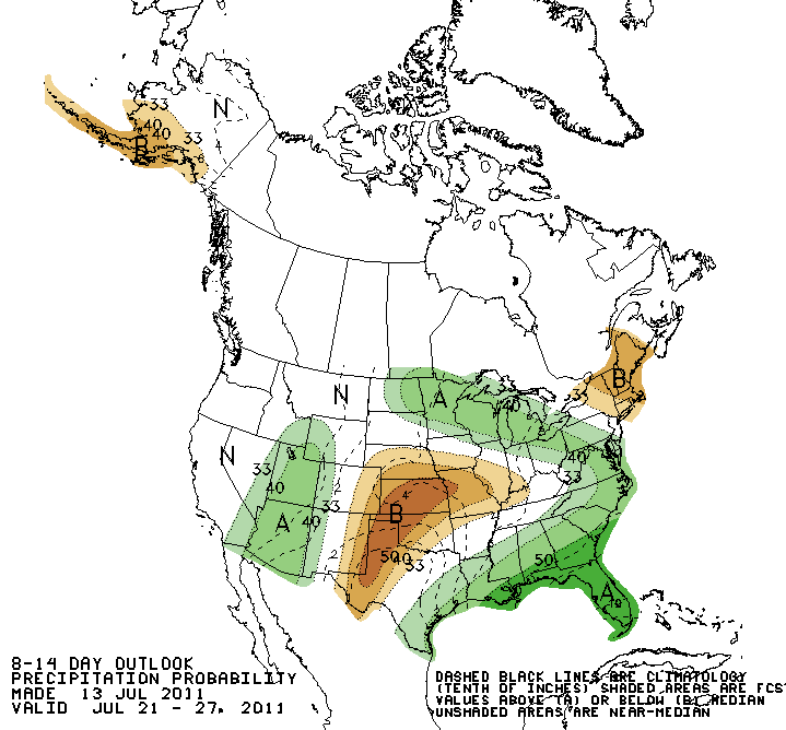
July 21-27:
http://ticker.mesonet.org/archive/20110714/814temp.new.gif
http://ticker.mesonet.org/archive/20110714/814prcp.new.gif
It's a tired refrain, but we'll keep, uhhhhh, refraining it. We need rain and
lots of it to put a dent in this drought. Only then will the heat subside.
That or fall, whichever comes first.
Gary McManus
Associate State Climatologist
Oklahoma Climatological Survey
(405) 325-2253
gmcmanus@mesonet.org
==================================================
The OCS/Mesonet Ticker
https://ticker.mesonet.org/
To subscribe or unsubscribe from the Ticker
or for questions about the Ticker or its content
Phone or Email the Ticker Manager at OCS
Phone: 405-325-2253 Email: ticker@mesonet.org
---------------------------------------------------
-C- Copyright 2024 Oklahoma Climatological Survey
===================================================
|


 Tweet
Tweet