MESONET TICKER ... MESONET TICKER ... MESONET TICKER ... MESONET TICKER ...
September 13, 2012 September 13, 2012 September 13, 2012 September 13, 2012
Here comes the rain (and coolness)!
BOOM! How's this look to ya?
http://radar.weather.gov/Conus/full.php
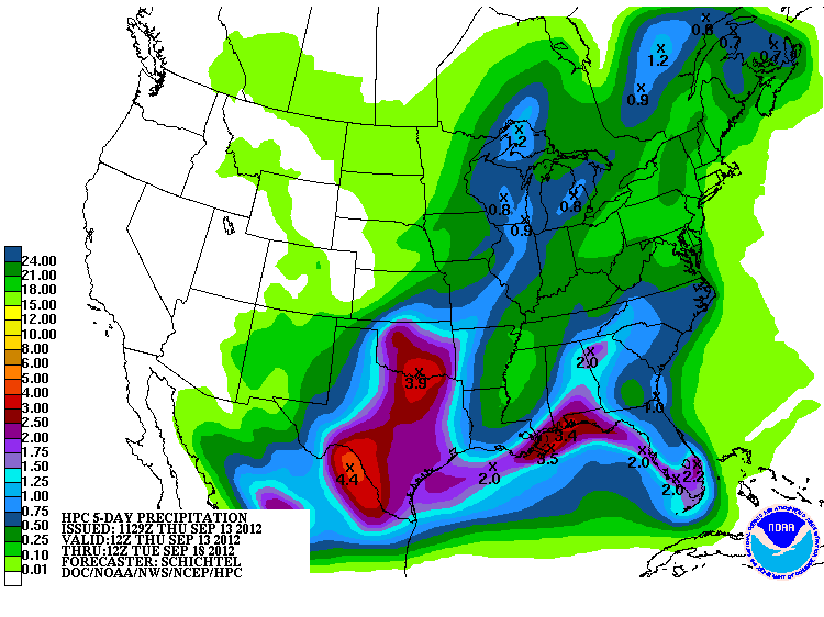
Rain is falling in the state, and more is expected. Lots of it. Another strong
cold front is making its way across the state, dropping temperatures from the 90s
into the 60s and 70s. The latest rainfall forecast from the NWS' HPC sees 1-4
inches in store across the state. While those upper totals might not occur on
a widespread basis, the possibility for a good 2-inch soaker across a large region
is certainly there.
http://ticker.mesonet.org/archive/20120913/5-day-rain.gif
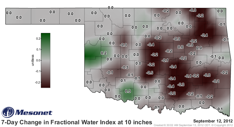
Almost as importantly, it doesn't appear that we will go directly back into 90s
and 100s like after last week's cold front. So this rain will be allowed to soak
in and stay awhile and not be evaporated away. The 7-day change in the 10-inch
soil moisture from the Oklahoma Mesonet shows that diminishing soil moisture
quite well.
http://ticker.mesonet.org/archive/20120913/7day-change-fwi.png
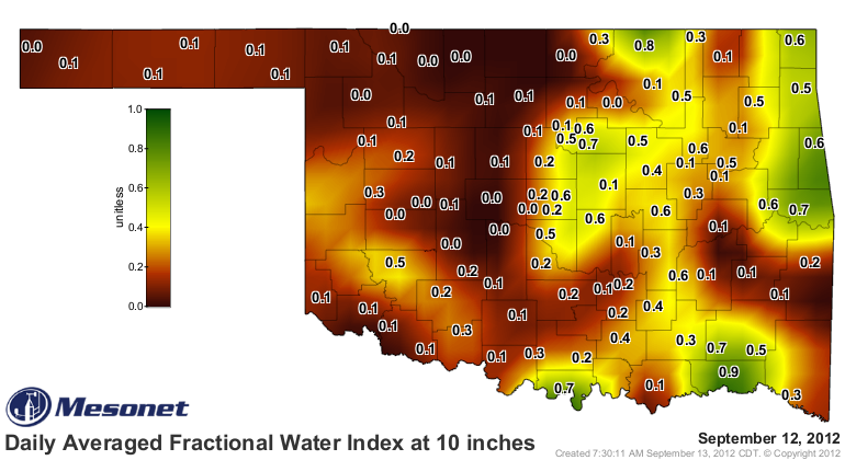
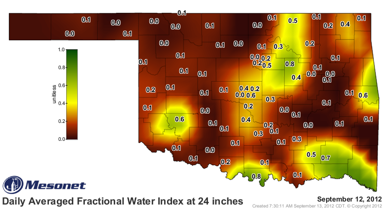
The soil moisture from the lower depths remains nonexistent across much of the
state. Hopefully this rainfall event will begin a long-term change in the other
direction.
http://ticker.mesonet.org/archive/20120913/10-inch-fwi.png
http://ticker.mesonet.org/archive/20120913/24inch-fwi.png
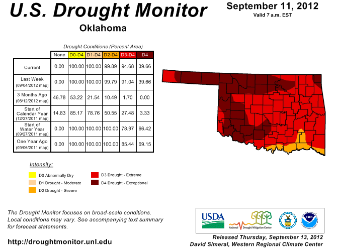
In the meantime, the release of this morning's U.S. Drought Monitor map is
something of a non-event with the rains that are expected. In light of that,
little change was seen since last week's map other than a bit of expansion
in D3 down in southeastern Oklahoma. There is no doubt that drought
intensification was about to rear its ugly head on the map once again, so this
rain is great in its timing.
http://ticker.mesonet.org/archive/20120913/ok_dm.png
Lake levels across much of the state have continued their decline even after the
somewhat spotty recent rains. Here are a few and their current percent of
capacity (conservation pool) as of this morning:
Altus: 18% Foss: 65%
Waurika: 58% Ft. Supply: 71%
Canton: 45% Thunderbird: 71%
Eufaula: 72% Keystone: 74%
Skiatook: 73% Ft. Gibson: 44%
Tenkiller: 73% Broken Bow: 72%
Hugo: 53% Pine Creek: 44%
Those are the major reservoirs, so you could imagine the shape of the smaller
stock/farm ponds. These current rains might not fill everything up, but if they
can saturate those soils, that's a heckuva start.
The outlooks for much of the rest of September continue to look on the cool
side. A large blocking ridge of high pressure is forecast to remain camped off
the coast of Greenland, allowing that colder air from up north to slip right
down across the eastern half of the U.S. You may remember this pattern from
recent hits, such as "Snowmagedden 2009!" and "Snowmagedden 2010!" Luckily we're
in September and not December.
Remember, these outlooks portray probabilities, not actual temperature
anomalies. But the chances for below normal temperatures throughout much of
the rest of the month are greatly increased, at least according to the CPC.
http://ticker.mesonet.org/archive/20120913/sep18-22-temps.gif
http://ticker.mesonet.org/archive/20120913/sep20-26-temps.gif
Now, bring on the rain! I have two soccer practices tonight I need rained out.
Gary McManus
Associate State Climatologist
Oklahoma Climatological Survey
(405) 325-2253
gmcmanus@mesonet.org
==================================================
The OCS/Mesonet Ticker
https://ticker.mesonet.org/
To subscribe or unsubscribe from the Ticker
or for questions about the Ticker or its content
Phone or Email the Ticker Manager at OCS
Phone: 405-325-2253 Email: ticker@mesonet.org
---------------------------------------------------
-C- Copyright 2024 Oklahoma Climatological Survey
===================================================
|


 Tweet
Tweet