Ticker for June 13, 2023
MESONET TICKER ... MESONET TICKER ... MESONET TICKER ... MESONET TICKER ...
June 13, 2023 June 13, 2023 June 13, 2023 June 13, 2023
Ready or not!
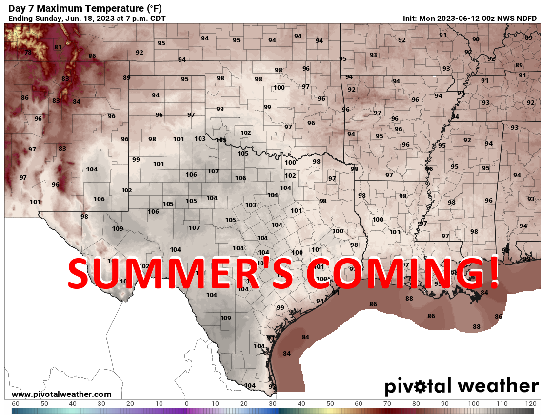
Apparently only me and three other people are excited about this (not my High
School English teacher, after reading that sentence), but yes, summer is indeed
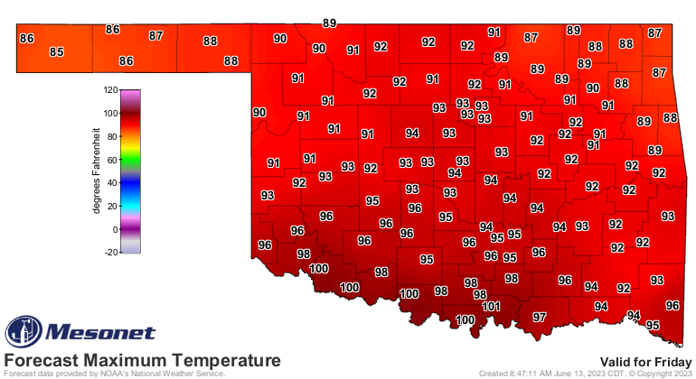
nigh (English to Okie translation: near). And that forecast for Sunday is merely
the hottest day in the next 7, but for SW OK summer comes even earlier in the
week.
Again, MOST of you are probably dreading this. NO! Not the Ticker. Okay, maybe
that too, but I'm talking about the triple-digit heat. Well, quit complaining
because you've had your way for nearly two straight months. Check out the
statewide average highs over the since mid-April or so.
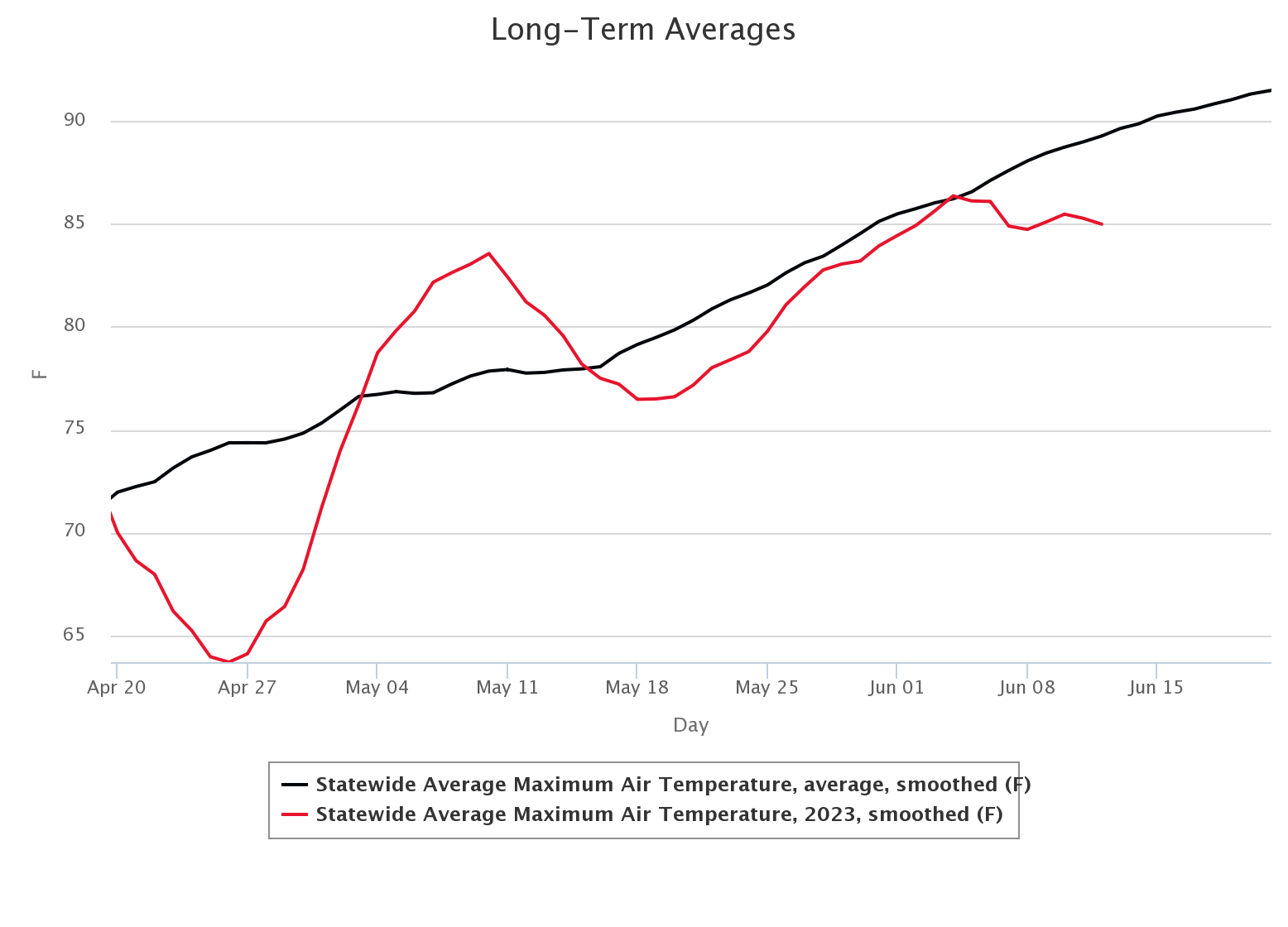
So other than that brief two-week period to begin May, we've been mostly below-
to way below-normal in our high temperatures through that period. I don't think
it's coincidental that that (I said "that" twice...I like "that") mid-May period
was also the only time during the period shown where we had substantial severe
weather (remember the May 11 tornado outbreak?). Also right before that on April
19. So the cool weather has kept severe weather at bay, but it has also kept
summer at bay.
I have no idea if it kept Bey at bay, but she probably wasn't coming to Oklahoma
anyway. You can put that comment in the box to the left.
WAIT A MINUTE! I think I have a thought. No, a sneeze, maybe? Nope, it's
definitely a thought. Let me go check something. Talk amongst yourselves.
Topic: The Super Mario Bros. movie was real life and we're the animation.
Okay, back. Turns out the heat index is going to be even higher than the actual
air temperature, which of course means this will be a sticky heat. I take back
EVERYTHING I said previously, and I'm now hoping for continued cool. And
that's also why you always look through ALL the forecast maps before opening
your big fat keyboard.
Also continued cool...erasing those deficits. The latest round of weather did a
number on the negative numbers in southern Oklahoma with more expected.
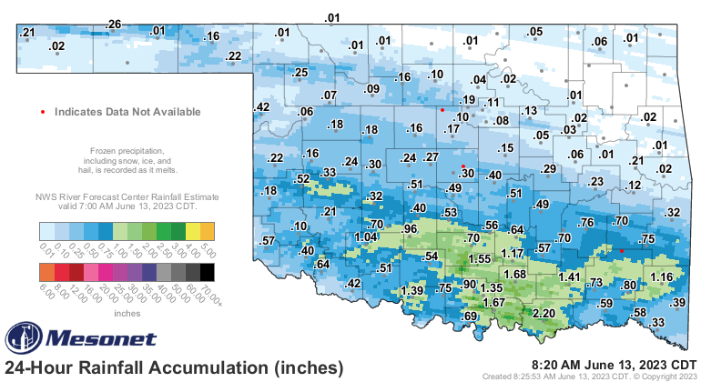
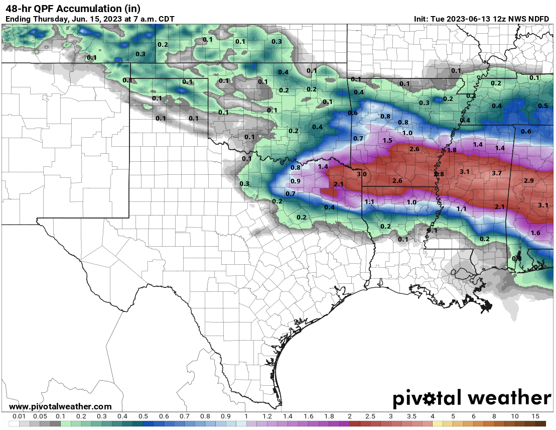
There are still big deficits out there, unfortunately, especially across NE OK.
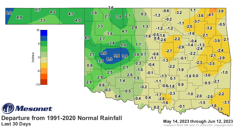
Also unfortunate, our chances to erase them in some areas are starting to
dwindle.
Speaking of dwindling...
Gary McManus
State Climatologist
Oklahoma Mesonet
Oklahoma Climatological Survey
gmcmanus@mesonet.org
June 13 in Mesonet History
| Record | Value | Station | Year |
|---|---|---|---|
| Maximum Temperature | 110°F | BUFF | 2011 |
| Minimum Temperature | 47°F | BOIS | 2005 |
| Maximum Rainfall | 4.15″ | HOBA | 2007 |
Mesonet records begin in 1994.
Search by Date
If you're a bit off, don't worry, because just like horseshoes, “almost” counts on the Ticker website!