Ticker for September 12, 2024
MESONET TICKER ... MESONET TICKER ... MESONET TICKER ... MESONET TICKER ...
September 12, 2024 September 12, 2024 September 12, 2024 September 12, 2024
Full drought ahead!

An AFTERNOON Ticker? Are you kidding me? Something bad must be happening. Well,
I did just get off the road from a drought talk, and let me tell you that's a
really weird place to give a presentation. That asphalt is hot! But so's (wait,
is "so's" a proper contraction? IT IS NOW!) the weather. And it's just gonna
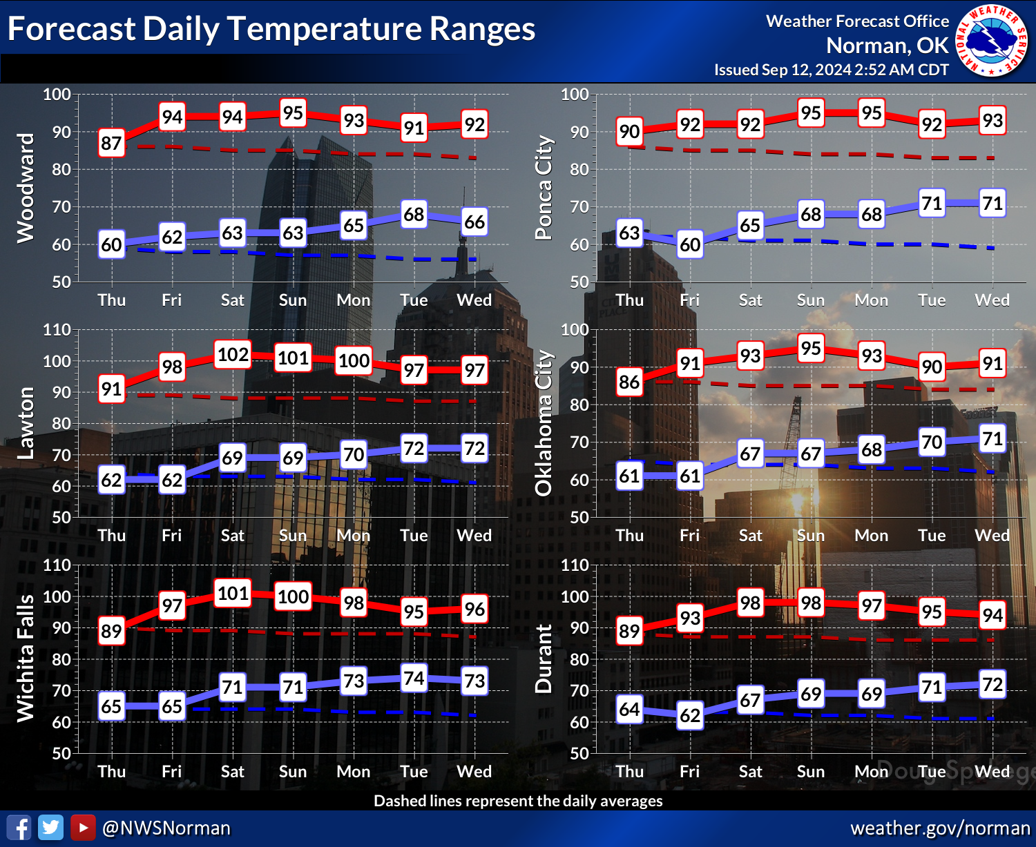
get hotter. In fact (and also opinion), expect a full-on summer weekend.

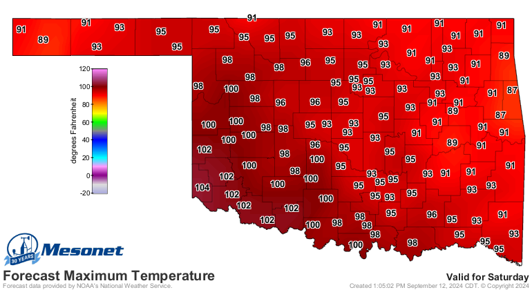
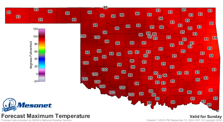
That heat will continue on into next week, and beyond.
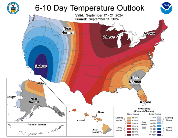
There are hints of a big front about 10 days out, so right after that graphic's
time frame, but at this point, fantasy-cast. Also hints at some rain as well.
You should believe it when you see it, right? Because the next 7 days...nyet!
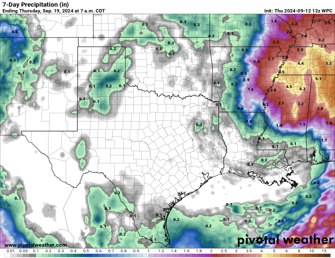
Maybe after that?? No, I'm asking you...heck if I know!
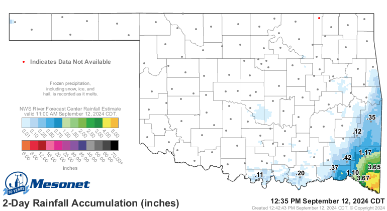
At least those far SE OK got a dose, thanks to Francine.
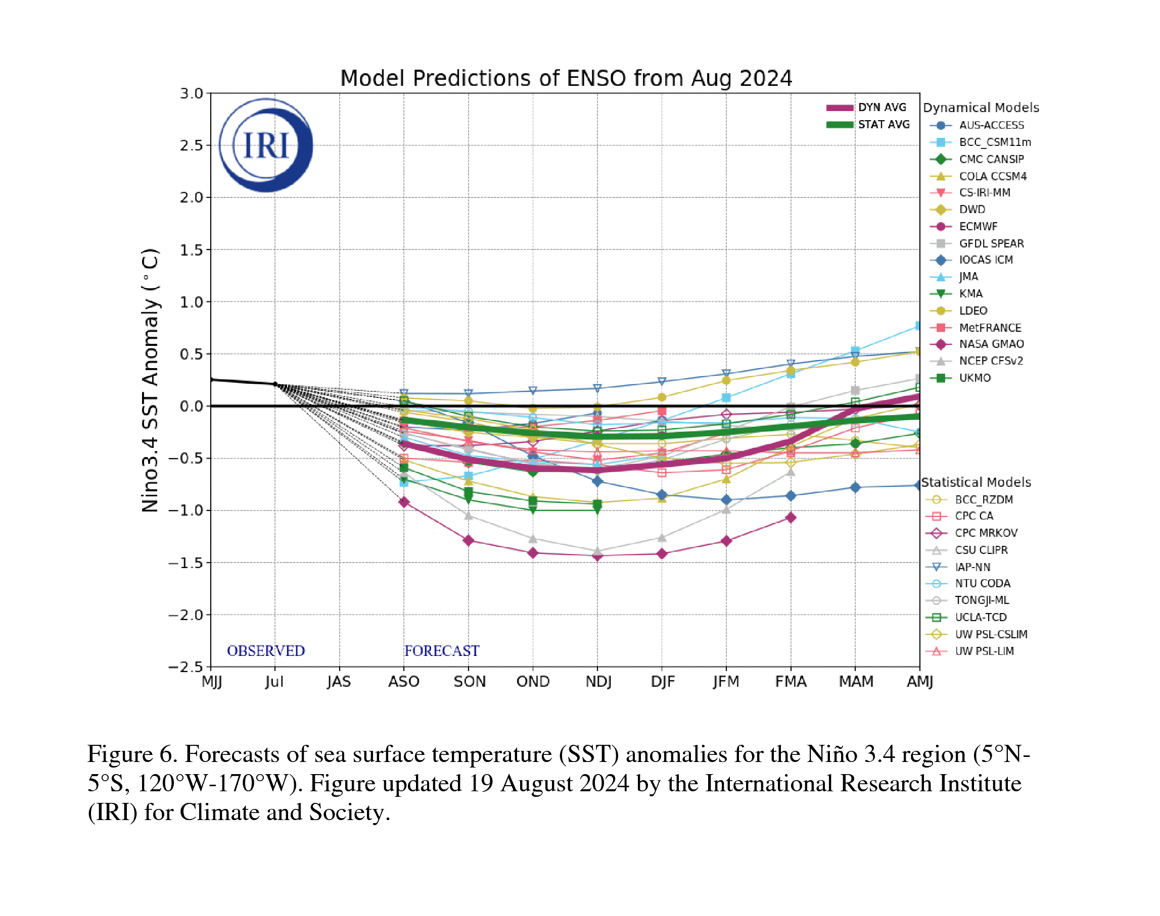
I do think we're getting good news concerning our erstwhile La Nina that we've
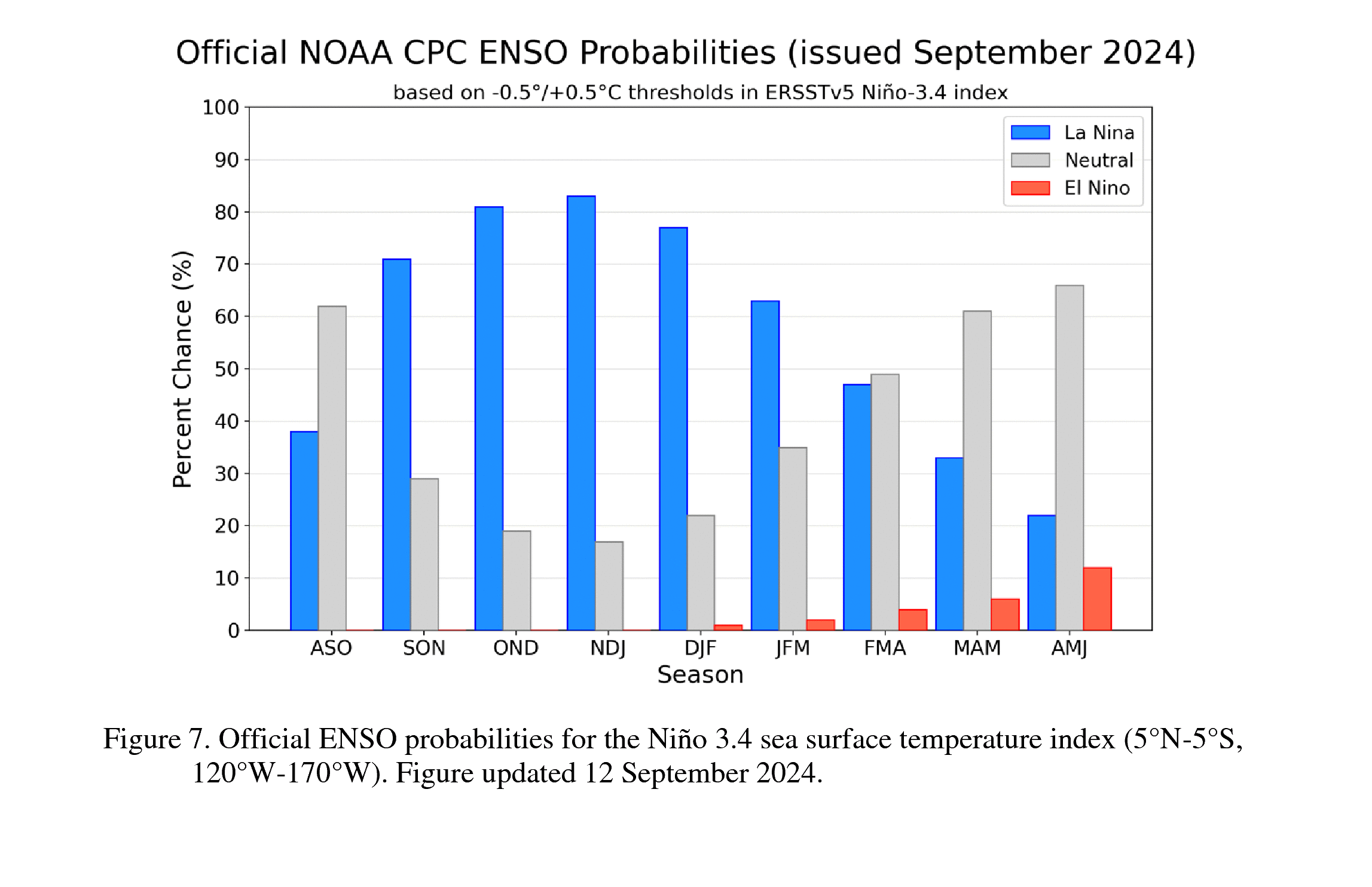
been talking about for 6 months now. The new CPC ENSO Outlook today says "The
IRI plume predicts a weak and a short duration La Niña, as indicated by the
Niño-3.4 index values less than -0.5°C [Fig. 6]. This month, the team relies
more on the latest North American Multi-Model Ensemble (NMME) guidance, which
predicts La Niña to emerge in the next couple of months and continue through
the Northern Hemisphere winter. The continuation of negative subsurface
temperatures and enhanced low-level easterly wind anomalies supports the
formation of a weak La Niña. A weaker La Niña implies that it would be less
likely to result in conventional winter impacts, though predictable signals
could still influence the forecast guidance (e.g., CPC's seasonal outlooks).
In summary, La Niña is favored to emerge in September-November (71% chance) and
is expected to persist through January-March 2025 [Fig. 7]."
Let me remind you that La Nina tends to bring the Southern Tier of the U.S.
warmer and drier than normal conditions during the cool season.
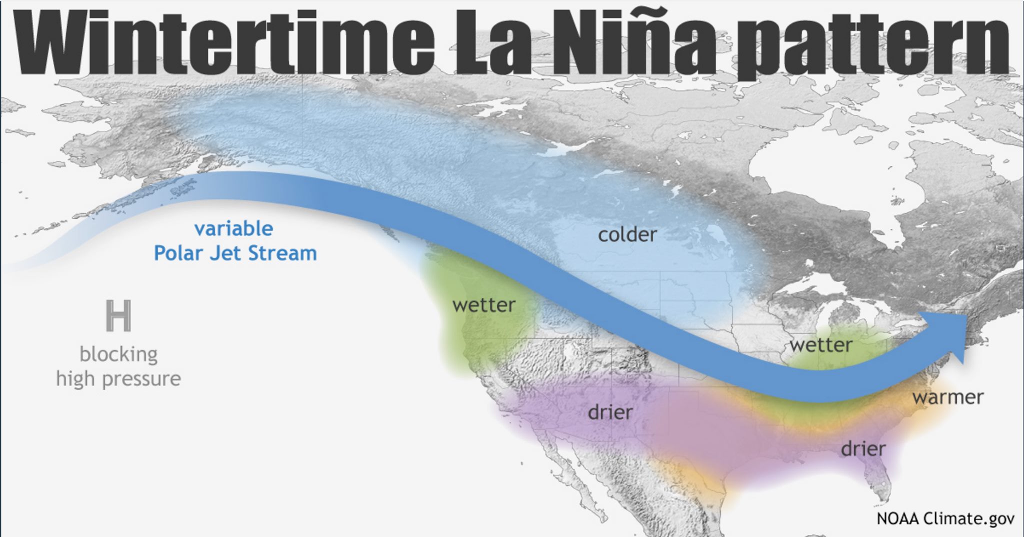
However, the strength of the La Nina CAN matter. Not necessarily in the strength
of the usual impacts, but the likelihood of those impacts occurring. So weaker
strength implies weaker odds of seeing the impacts. Like I say to my mirror
every morning...weak is better.

Mother Nature agrees, I hope.
Gary McManus
State Climatologist
Oklahoma Mesonet
Oklahoma Climate Survey
gmcmanus@ou.edu
September 12 in Mesonet History
| Record | Value | Station | Year |
|---|---|---|---|
| Maximum Temperature | 105°F | ALTU | 2011 |
| Minimum Temperature | 40°F | BOIS | 2014 |
| Maximum Rainfall | 9.13″ | FAIR | 2008 |
Mesonet records begin in 1994.
Search by Date
If you're a bit off, don't worry, because just like horseshoes, “almost” counts on the Ticker website!