MESONET TICKER ... MESONET TICKER ... MESONET TICKER ... MESONET TICKER ...
September 12, 2018 September 12, 2018 September 12, 2018 September 12, 2018
Florence and her Machines
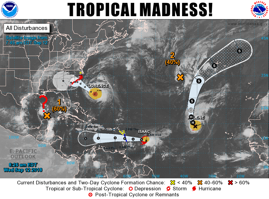
http://ticker.mesonet.org/archive/20180912/tropical-madness.png
Florence? Florence is way too nice of a name for the monster bearing down on the
Carolina's. Florence Nightingale renamed as Florence Nightinmare. With all eyes
glued to that area, we do eventually have to ask if any of those tropical
monstrosities will impact our area. As you remember, we had a somewhat glancing
blow already a couple of weeks back with Gordon, which added just a bit of rain to
far far far eastern Oklahoma. Yes, that far.
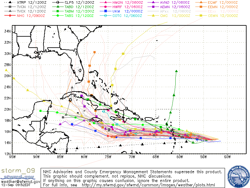
Isaac looks intriguing as he stands in his crisp white uniform serving drinks to
guests on...wait, wrong Isaac! We're talking Tropical Storm Isaac here, churning
due west as it approaches the southern Caribbean. Right now it appears that Isaac
will skirt along south of Puerto Rico and then curve to the northwest towards
Cuba, although a few model runs have it entering the Gulf, and a few other models
have it headed to our south.
http://ticker.mesonet.org/archive/20180912/Isaac-spaghetti-model.gif
The real answer is it's tough to say what it's going to do at this time, other
than head due west for another day or two. So right now, let's say the chances of
it traveling through the Gulf and entering our area as a remnant are quite
small.
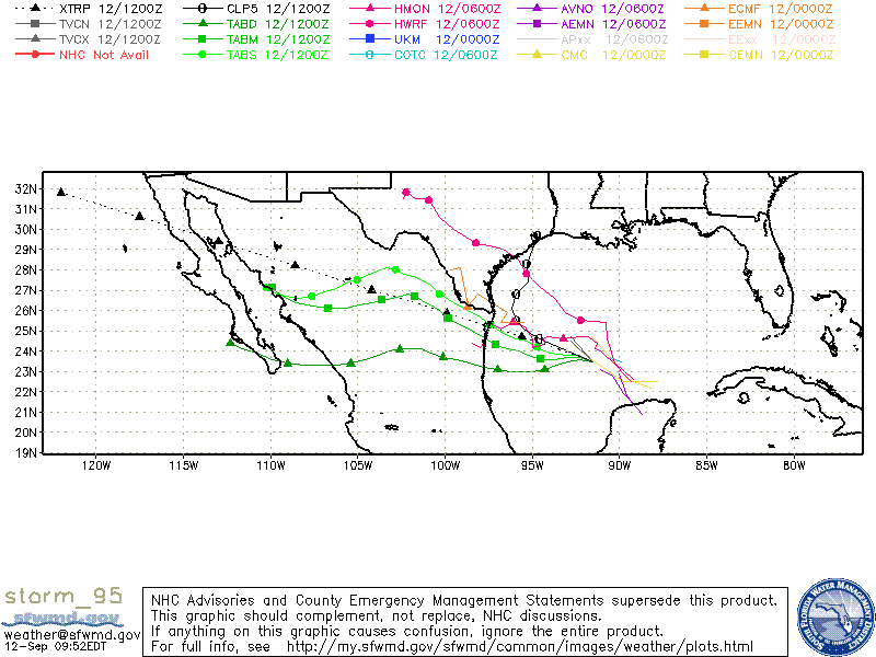
How about Disturbance #1 on the above map, currently given a 60% chance to form
a tropical cyclone within the next 48 hours. That one is a *little* more
intriguing. It will probably reach Tropical Depression at best before it hits
the coast in Texas or Louisiana, so it will be more of a rainmaker than a big
wind event. It does appear that it will continue to our south though, possibly
traversing Mexico, or possibly headed up into West Texas.
http://ticker.mesonet.org/archive/20180912/storm_1.gif
Hard to say what it will do after that, but it is possible that we could see
another glancing blow across far SW OK or maybe the Panhandle? I say that as a
question since it is very questionable, of course (plus, if I'm quoted after
the fact I can deny everything!).
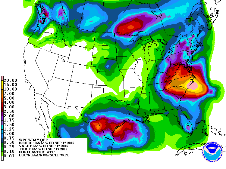
There's just a hint of all this in the 7-day rain forecast. Obviously the greens
over Oklahoma pale in comparison to the colors along the Carolinas.
http://ticker.mesonet.org/archive/20180912/7day-rain-forecast.gif
At any rate, our weather should continue along the boring path -- monumentally
so compared to the East Coast -- for the next few days as we slowly warm up.
Seasonable weather is in the forecast, as well as a few showers here and there.
Sometimes, boring is better. This is one of those times.
Gary McManus
State Climatologist
Oklahoma Mesonet
Oklahoma Climatological Survey
(405) 325-2253
gmcmanus@mesonet.org
==================================================
The OCS/Mesonet Ticker
https://ticker.mesonet.org/
To subscribe or unsubscribe from the Ticker
or for questions about the Ticker or its content
Phone or Email the Ticker Manager at OCS
Phone: 405-325-2253 Email: ticker@mesonet.org
---------------------------------------------------
-C- Copyright 2024 Oklahoma Climatological Survey
===================================================
|


 Tweet
Tweet