Ticker for November 11, 2020
MESONET TICKER ... MESONET TICKER ... MESONET TICKER ... MESONET TICKER ...
November 11, 2020 November 11, 2020 November 11, 2020 November 11, 2020
It's pronounced Autumnsteen
Think back, gentle (I would have said "genteel," but come on) readers, to the
days or yore, when temperatures were in the 70s and 80s...you know, Monday? Okay,
maybe not your days or yore, but they're my days of yore.
I hear ya out there: "say 'days of yore' one more time!" But once the weather
turns to actual November, I start missing those nice temperatures. We had another
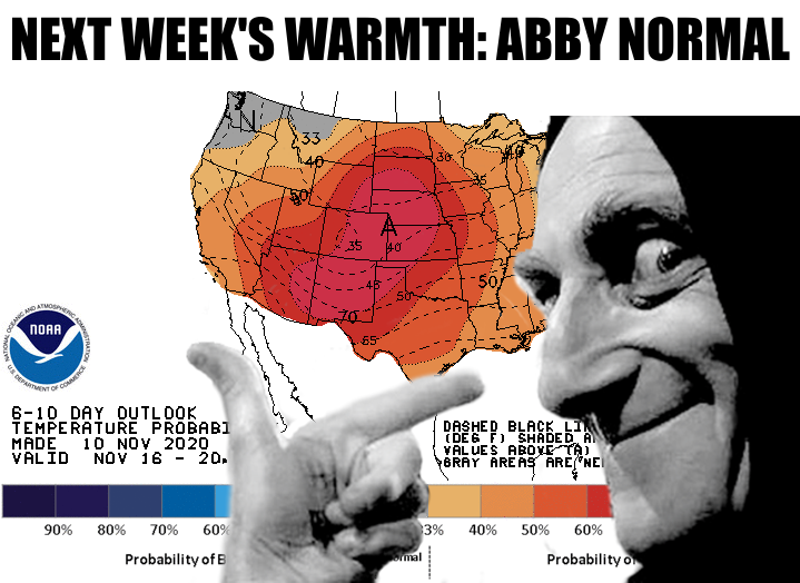
freeze last night, on our way to another "chilly" day in the 50s and 60s.
Nothing too earth shattering there, and that's sort of where we're gonna be for
the next week or so, again with a few ups and down along the way. Saturday should
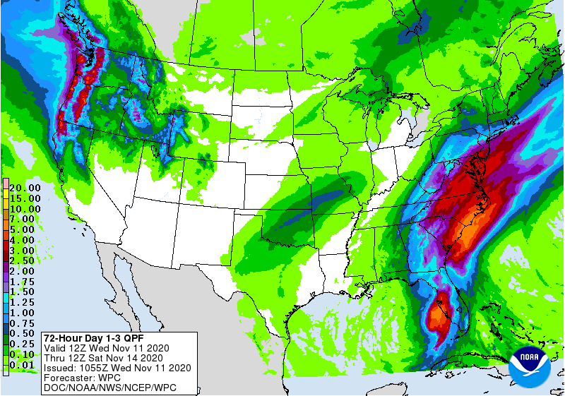
be a windy, warm day ahead of another front on Saturday night, along with some
rain chances. Could be a good dose of moisture, at least for the I-44 corridor.
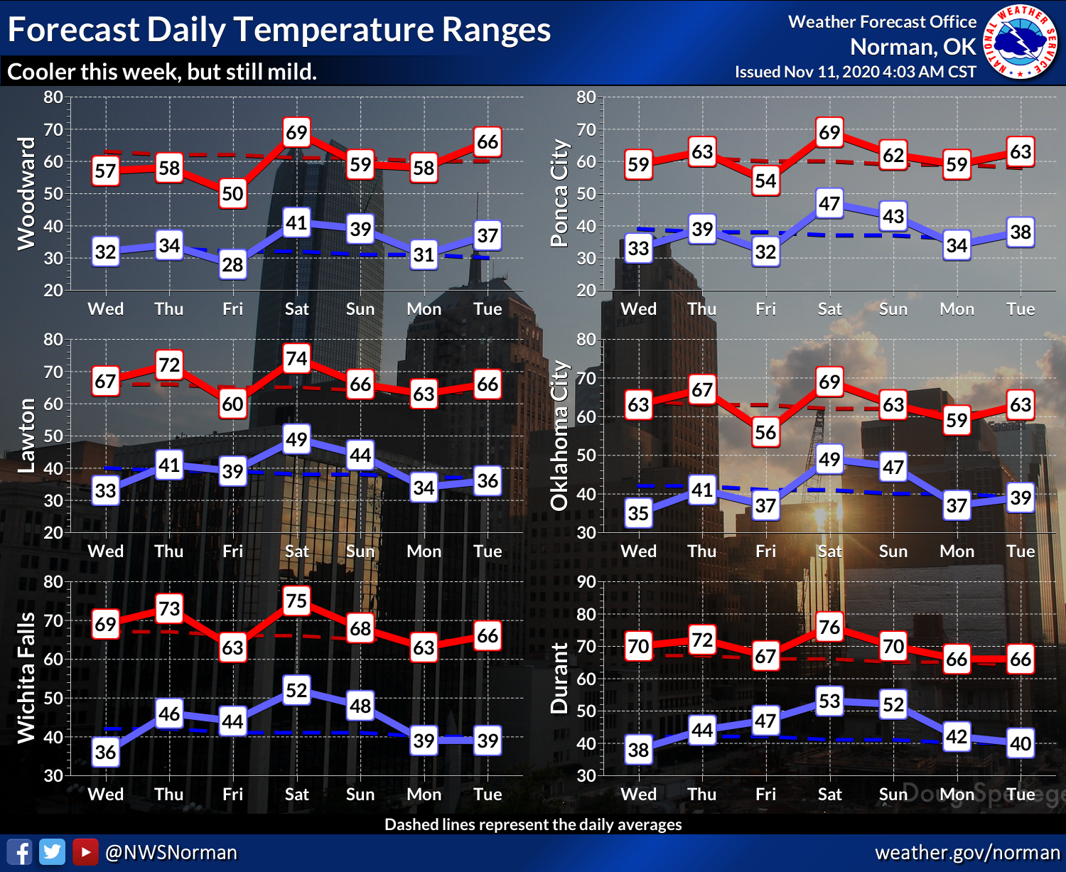
We should see a couple more days with freezing weather in the northwest before
we start to warm things up again, then another bout of the freezies this
weekend, then up the old thermometer again. Still no really frigid weather
showing up, so the southeastern half of the state is still awaiting their first
hard freeze this season. We'll define hard freeze as temperatures at or below
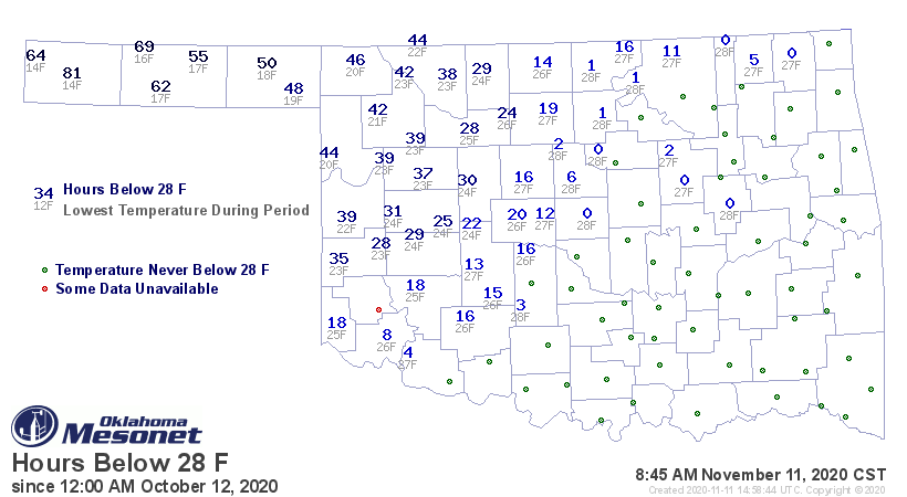
28 degrees. Check out this Mesonet hours below 28 degrees map and you can see
the obvious-but-normal difference in experience with the arctic air between
the two halves of the state separated by I-44.
Again, nothing nasty showing up, unless you consider warm as "nasty" (I know
you're out there, winter fans!). And remember, this time of year, things can
go insane at the drop of the hat. We don't need to go back to 1911 to see this,
we can just look at the end of October 2020.
But how could we forget possibly the most famous cold front in state history
from Nov. 11, 1911!
-------------------------------------------------------------------------------
11/11/11...A Palindrome to Remember!
Oklahomans have grown accustomed to the fickle weather of the Great Plains,
particularly during the transitional months of spring and fall. Many state
residents have left the house dressed for a pleasantly warm autumn day, only to
be caught unawares by the icy chill of an arctic blast. With experience comes
wisdom, however, and most have learned to keep a trained eye on the weather
forecasts. Imagine the surprise of the state?s burgeoning population on
November 11, 1911, when weather forecasts were mostly limited to observations
passed down the telegraph line, as they witnessed one of the most abrupt
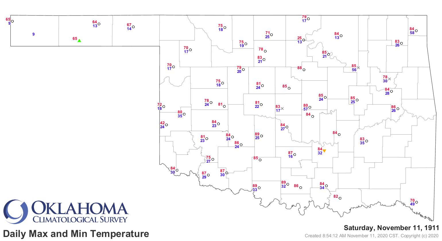
temperature swings in the state?s history. On that afternoon, Oklahoma City
reached a record high temperature of 83 degrees. Soon thereafter, a ?norther?
barreled through the state, dropping temperatures more than 60 degrees in the
span of a few hours. By midnight, the temperature at Oklahoma City had plunged
to a frigid 17 degrees, the record low for that same date. Both records still
stand, marking November 11th, 1911, as the only date in state history in which
the record high and low temperatures were broken on the same day for a single
location.
Gary McManus
State Climatologist
Oklahoma Mesonet
Oklahoma Climatological Survey
(405) 325-2253
gmcmanus@mesonet.org
November 11 in Mesonet History
| Record | Value | Station | Year |
|---|---|---|---|
| Maximum Temperature | 86°F | SLAP | 2005 |
| Minimum Temperature | 1°F | EVAX | 2019 |
| Maximum Rainfall | 1.24″ | COPA | 2012 |
Mesonet records begin in 1994.
Search by Date
If you're a bit off, don't worry, because just like horseshoes, “almost” counts on the Ticker website!