MESONET TICKER ... MESONET TICKER ... MESONET TICKER ... MESONET TICKER ...
October 11, 2023 October 11, 2023 October 11, 2023 October 11, 2023
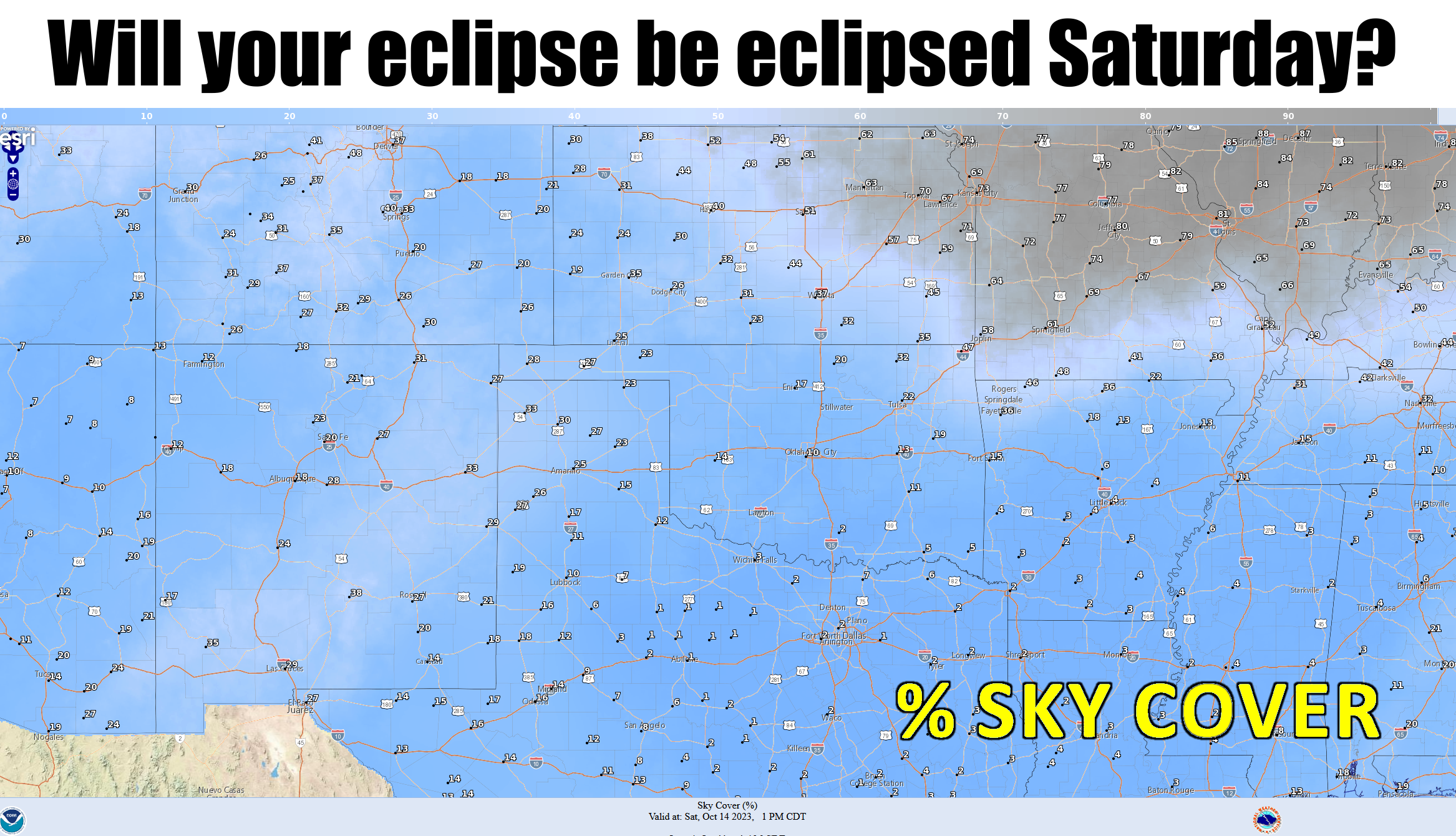
Obscuration
https://ticker.mesonet.org/archive/20231011/saturday-1pm-sky.cover.png
Sorry for no Tick yesterday, I was on the road speaking (which is a really odd
place to give a presentation...you could be hit by a car, and the asphalt is
really hot in the early October sun). And you might ask yourself "But Gary, isn't
there something more exciting than an eclipse to talk about?"
For the umpteenth time, QUIT CALLING YOURSELF GARY! That named is reserved for a
few very important, incredibly handsome, unimaginably intelligent, luxuriously
coifed, yet extraordinarily humble climate dignitaries.
Okay, "luxuriously coifed" was a step too far, right? At any rate, here I am
talking about some magical disappearance of the sun on Saturday, peaking between
11:30 a.m. and noon-ish, although there will be some eclipsing going on between
10:20 a.m. and around 1:20 p.m. Here you can see the peak coverage of the sun
from the fine folks at NASA.
https://ticker.mesonet.org/archive/20231011/saturday-eclipse.png
Okay, that's pretty exciting! And if you notice that top graphic, Oklahoma
should have pretty decent viewing weather with very little cloudiness, although
it will be a bit on the cool, windy side Saturday following a major fall cold
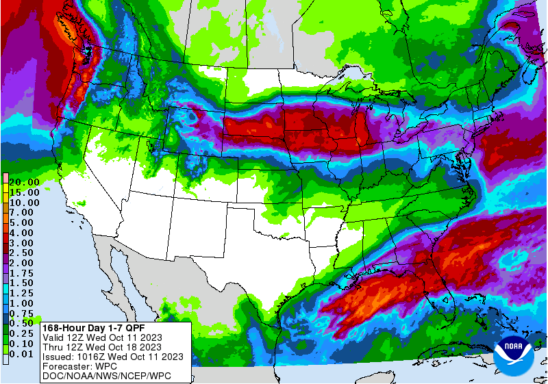
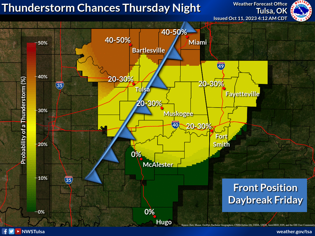
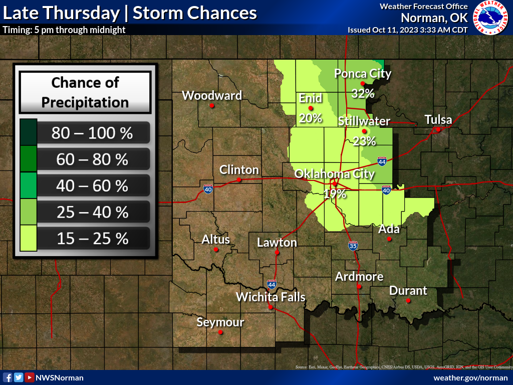
front moving through the state Thursday. That's where the weather gets exciting
for a bit, then really really boring again. So storm chances? Well, they're
there, but not a lot of rain with this front as moisture is very limited, and
that's the ONLY chance of rain on the 7-day forecast.
https://ticker.mesonet.org/archive/20231011/7day-rain-forecast.gif
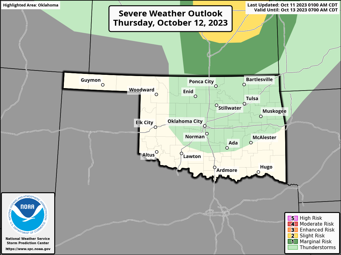
https://ticker.mesonet.org/archive/20231011/nws-tulsa-thursday-storms.png
https://ticker.mesonet.org/archive/20231011/nws-norman-thursday-storms.png
https://ticker.mesonet.org/archive/20231011/OK_swody2.png
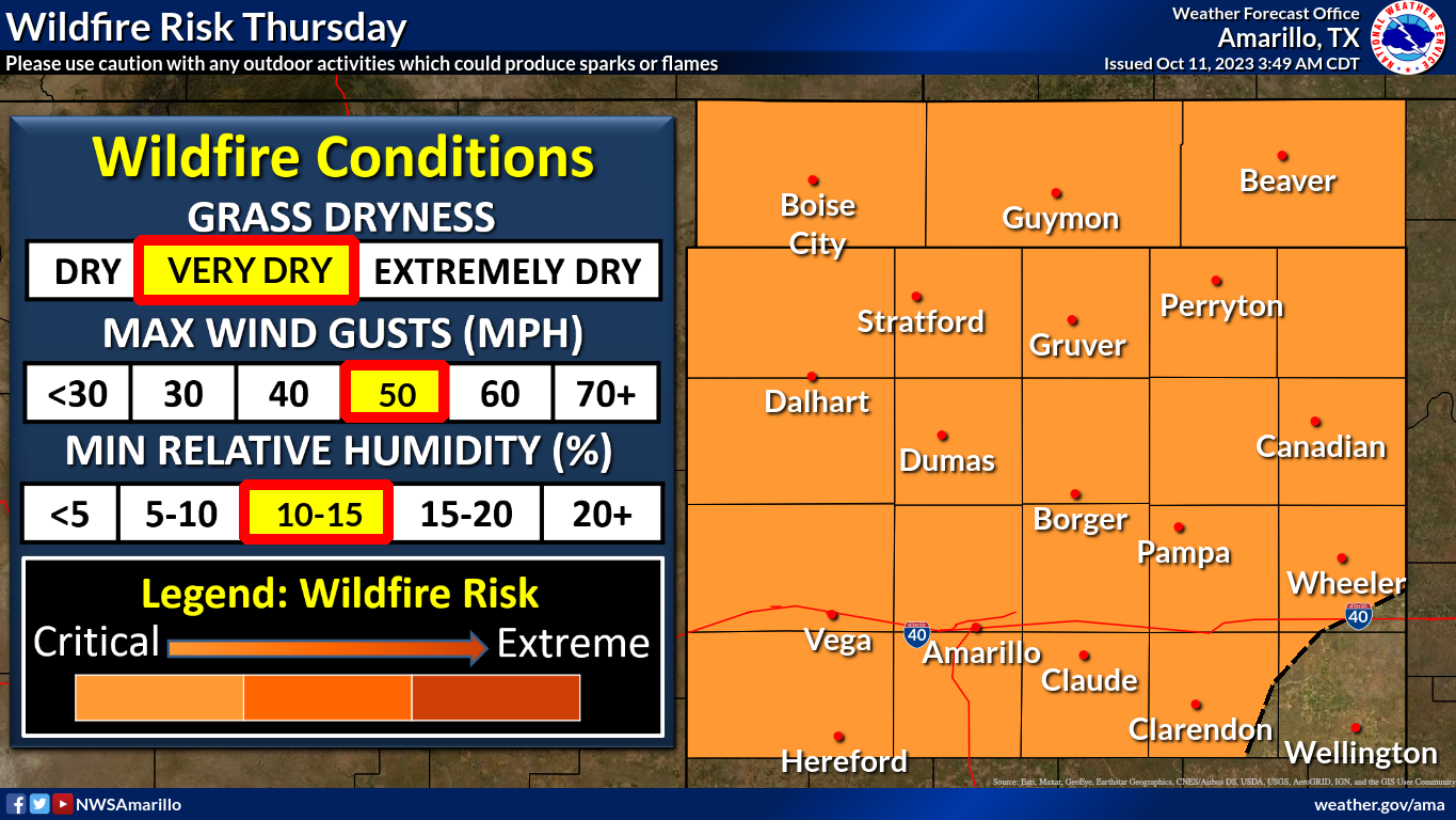
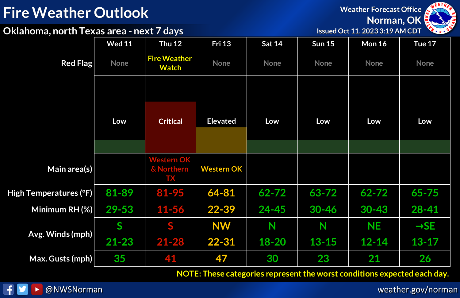
So with a cold front moving in with all this heat in place, fire danger will
also be a concern today but especially tomorrow on Thursday (which is a weirdly
redundant and repetitive way to say that).
https://ticker.mesonet.org/archive/20231011/nws-amarillo-fire.danger.png
https://ticker.mesonet.org/archive/20231011/nws-norman-fire-danger.png
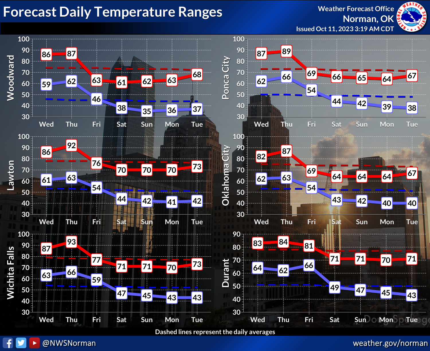
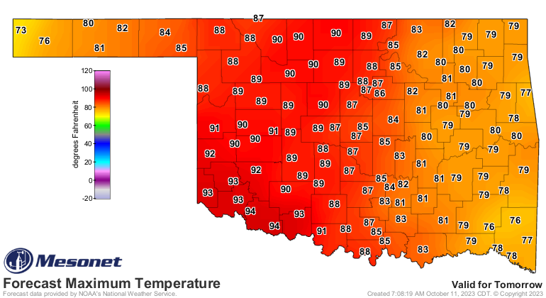
As I said in Monday's Ticker, watch for near record highs on Thursday ahead of
that front. A triple-digit? Probably not, but a person can dream, right?
https://ticker.mesonet.org/archive/20231011/nws-norman-7day-temps.png
https://ticker.mesonet.org/archive/20231011/thursday-forecast-highs.png
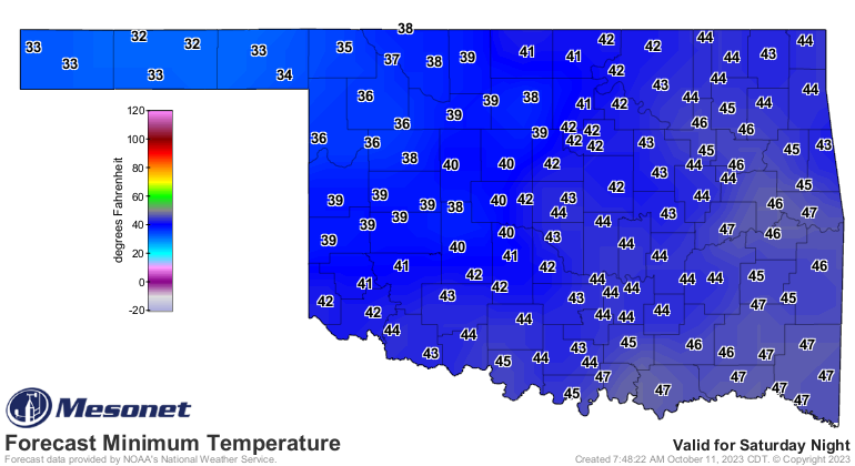
And watch out for more frost and possible freezing weather over the weekend across
northern and western Oklahoma.
https://ticker.mesonet.org/archive/20231011/saturday-lows.png
https://ticker.mesonet.org/archive/20231011/sunday-lows.png
Finally, you can explore more about this eclipse on their website, where you can
learn about things like antumbras, penumbras, and whatnot:
https://science.nasa.gov/eclipses/future-eclipses/eclipse-2023/where-when/
Here you can learn about another celestial marvel, Moon Pies:
https://moonpie.com/
Even more amazing, the Moons Over My Hammy:
https://www.dennys.com/menu/classic-breakfasts/moons-over-my-hammy
This is science at it's best! Told ya...extraordinarily humble.
Gary McManus
State Climatologist
Oklahoma Mesonet
Oklahoma Climatological Survey
gmcmanus@mesonet.org
==================================================
The OCS/Mesonet Ticker
https://ticker.mesonet.org/
To subscribe or unsubscribe from the Ticker
or for questions about the Ticker or its content
Phone or Email the Ticker Manager at OCS
Phone: 405-325-2253 Email: ticker@mesonet.org
---------------------------------------------------
-C- Copyright 2024 Oklahoma Climatological Survey
===================================================
|


 Tweet
Tweet