MESONET TICKER ... MESONET TICKER ... MESONET TICKER ... MESONET TICKER ...
October 11, 2018 October 11, 2018 October 11, 2018 October 11, 2018
So close!
http://ticker.mesonet.org/archive/20181011/20181009_OK_trd.png
Oklahoma hasn't been drought free since Aug. 29, 2017, about 13.5 months ago.
Heck, they've barely been drought free at all for this entire decade! Maybe weeks
at a time, a month here and there at most. I know, I have the Sunday-Wednesday
work hours to prove it. And this graph.
http://ticker.mesonet.org/archive/20181011/drought.monitor-OK-2010-present.png
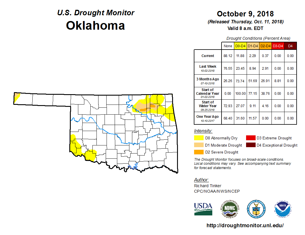
I sorta/kinda promised a drought-free Oklahoma this week as well. Unfortunately,
Mother Nature didn't cooperate. Now I'm not sure why this week's Drought Monitor
author didn't go for taking drought of the NW Panhandle. They received some good
rains during this drought monitor cycle. But that stubborn area up in NE OK
continues to miss out, at least enough to relieve the longer-term drought in the
area.
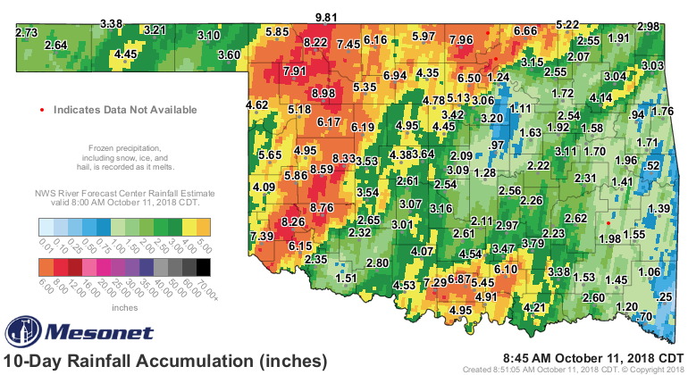
http://ticker.mesonet.org/archive/20181011/10day-rain-totals.png
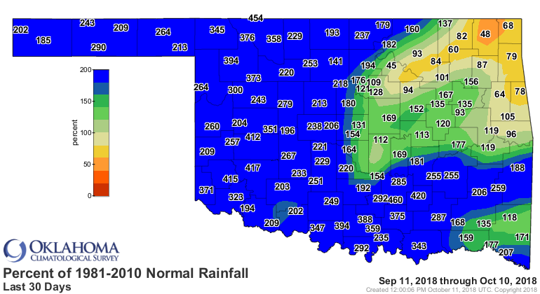
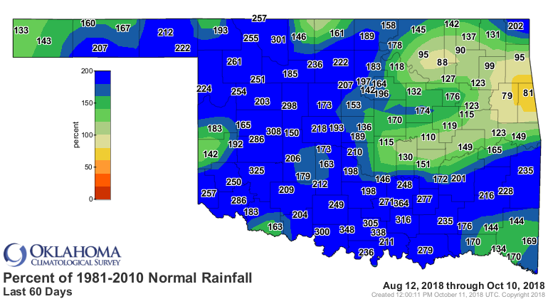
I really don't know how they keep missing! Even going out to 30-60-90 days, where
other parts of the state have received GARGANTUAN totals, that area just keeps
missing.
http://ticker.mesonet.org/archive/20181011/30days.norm_pct.png
http://ticker.mesonet.org/archive/20181011/60days.norm_pct.png
http://ticker.mesonet.org/archive/20181011/90days.norm_pct.png
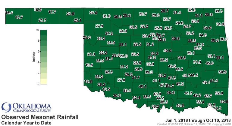
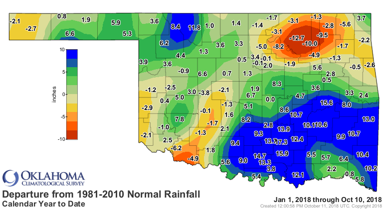
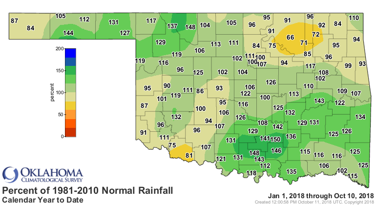
Those misses are made worse by even longer deficits, dating back to the
beginning of the year.
http://ticker.mesonet.org/archive/20181011/year.meso.png
http://ticker.mesonet.org/archive/20181011/year.norm_dep.png
http://ticker.mesonet.org/archive/20181011/year.norm_pct.png
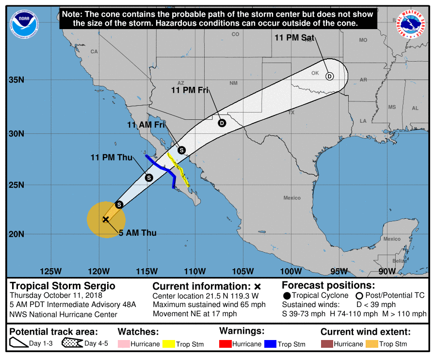
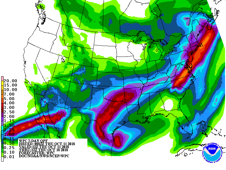
It's bizarre! I had hoped, even though most parts of the state do NOT need a
more rain this soon, that the remnants of Sergio would knock that part of the
state out of drought. But now it appears Sergio is starting to track to the
south, so that part of the state will get the bulk of the rainfall.
http://ticker.mesonet.org/archive/20181011/Sergio-track.png
http://ticker.mesonet.org/archive/20181011/7day-rain-forecast.gif
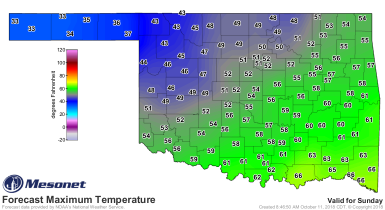
There's still hope! Sergio could track farther north, and the huge/honking
cold front set to arrive on Sunday should also bring some rain, and dare I say
it...snow? Yes, maybe a bit of snow in the NW, with a rain/snow mix possible a
bit farther south and west. The Panhandle could also see a hard freeze, bleeding
into the NW portion of the main body of the state. The Panhandle might struggle
to even reach freezing FOR HIGHS on Sunday!
http://ticker.mesonet.org/archive/20181011/Sunday-forecast-highs.png
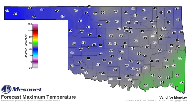
http://ticker.mesonet.org/archive/20181011/Monday-forecast-lows.png
http://ticker.mesonet.org/archive/20181011/Monday-forecast-highs.png
Those will be near-record low maximum temp values if that occurs.
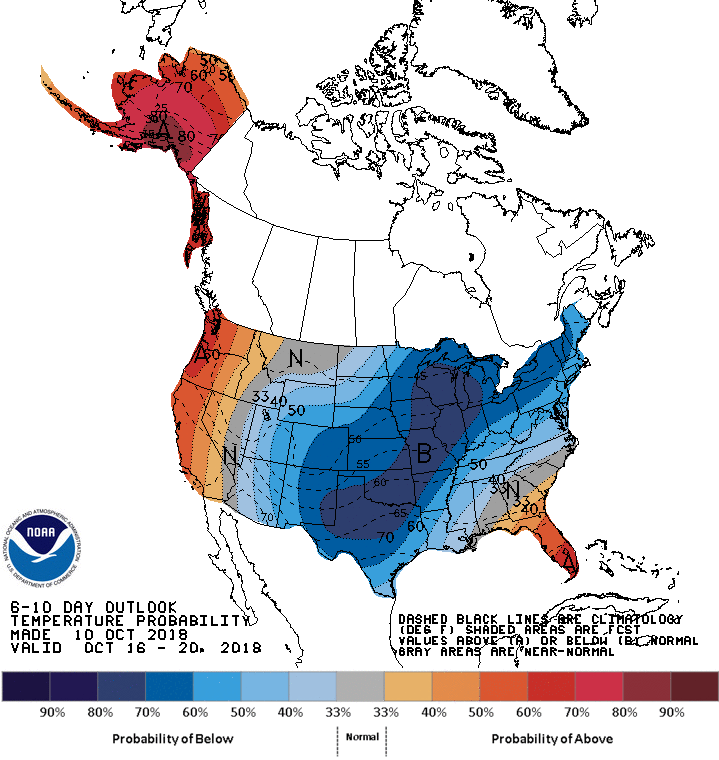
And it will stick around awhile, at least for much of next week. Let the crazy
continue.
http://ticker.mesonet.org/archive/20181011/oct16-20-temp-outlook.gif
Gary McManus
State Climatologist
Oklahoma Mesonet
Oklahoma Climatological Survey
(405) 325-2253
gmcmanus@mesonet.org
==================================================
The OCS/Mesonet Ticker
https://ticker.mesonet.org/
To subscribe or unsubscribe from the Ticker
or for questions about the Ticker or its content
Phone or Email the Ticker Manager at OCS
Phone: 405-325-2253 Email: ticker@mesonet.org
---------------------------------------------------
-C- Copyright 2024 Oklahoma Climatological Survey
===================================================
|


 Tweet
Tweet