Ticker for July 11, 2024
MESONET TICKER ... MESONET TICKER ... MESONET TICKER ... MESONET TICKER ...
July 11, 2024 July 11, 2024 July 11, 2024 July 11, 2024
Boy Named Hot
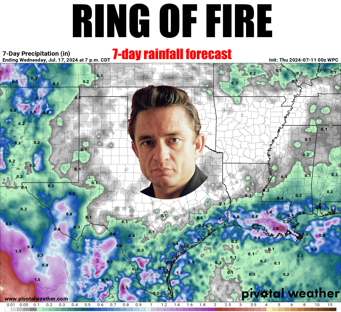
I fell in to a burning ring of drought...is that even a thing? It could be, I
guess. Drought in the summer often brings fire danger. Our fire danger has
diminished thanks to the rains of the past 2 weeks, but some of our OK-FIRE
indicators still say wildfire is a "thing" in Oklahoma.
So it could indeed be a thing. I mean, THIS is a thing, so anything is possible!
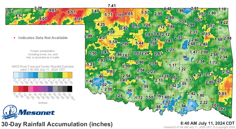
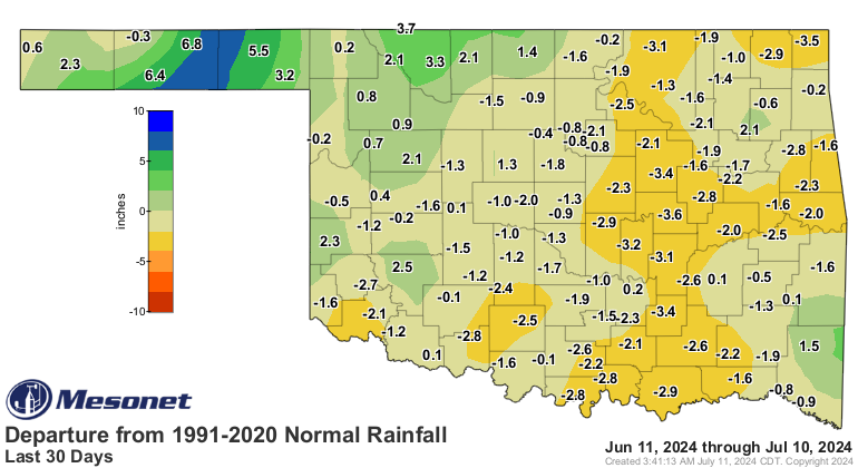
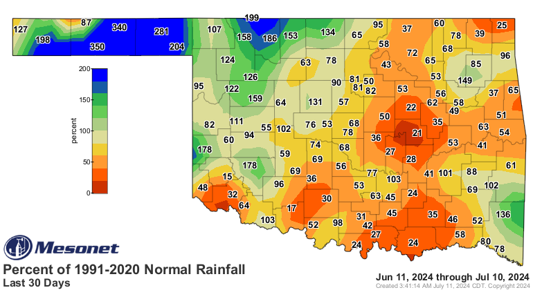
And yes, drought is still a "thing" in Oklahoma, despite the generous rains in
part of the state.
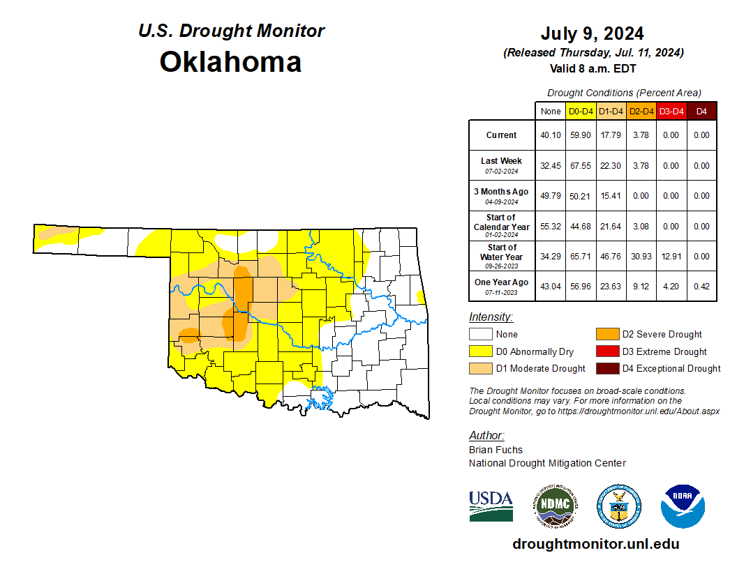
It's not much at just 18% of the state, and even some that yellow D0 area,
signifying Abnormally Dry conditions, means coming OUT of drought, not
necessarily going INTO drought like we've seen over the last couple of months.
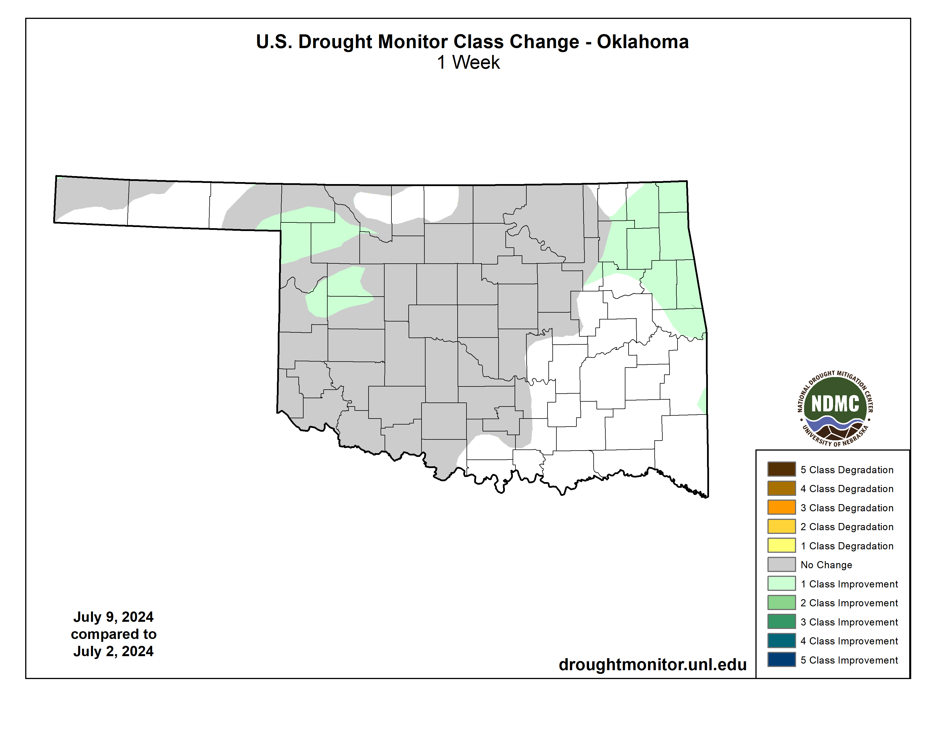
And while there's still that drought in place, with more areas in danger of
going into full-on drought, at least we didn't see any intensification in the
state for the first time in a couple of months as well.
I believe that will probably change going into next week since the rains have
shut off once again and the heat is roaring back. Now after that 7-day period,
we should see chances of rain return...broader areas of rain, at least.
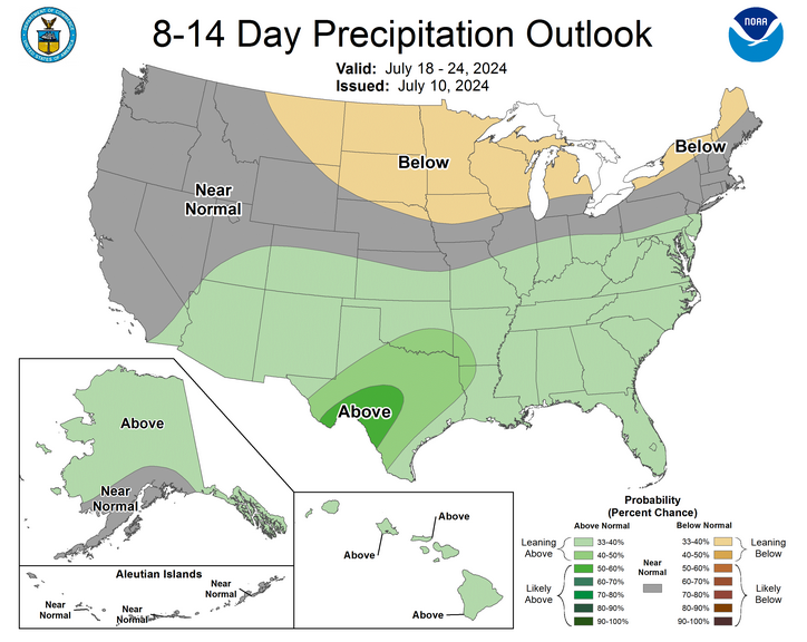
Until then, we're gonna roast before that next cold front in about 8 days.
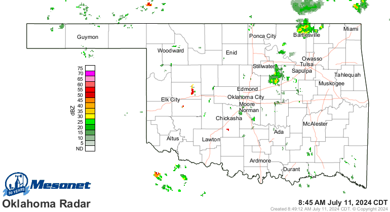
We should continue to see showers here and there. Heck, it's raining right now
for crying out loud!
We just haven't seen enough rain to completely alleviate (English to Okie
translation: get rid of) our moisture deficits.
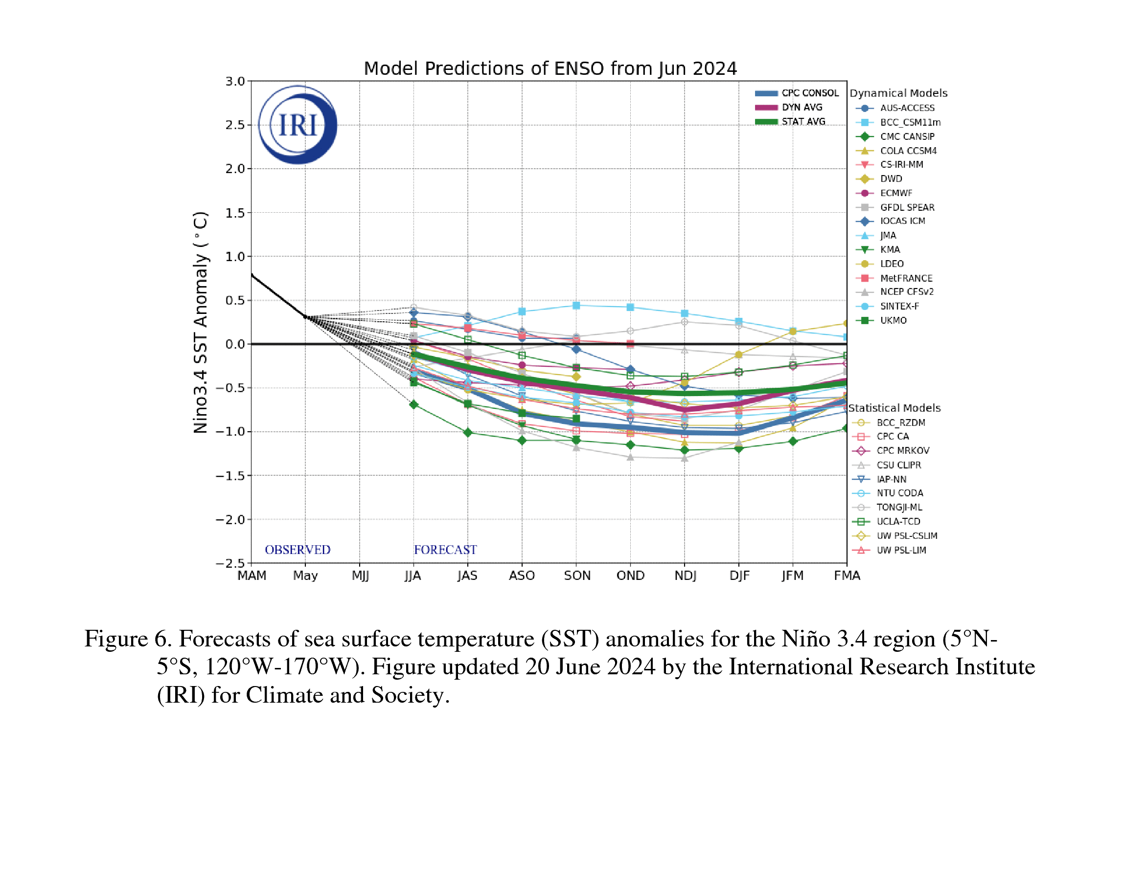
We're still keeping an eye on those ENSO forecasts--ENSO, being the El Nino/
Southern Oscillation representing La Nina, El Nino, and Neutral Conditions
"oscillating" between each other. Think of how your guts react to eating Taco
Bell, and how you go from cramps to bathroom trips then back to normal. Get it?
Well, the CPC folks have delayed the forecast La Nina development by a couple
of months, now seeing greater chances during the August-October period vs. the
previous July-September period.
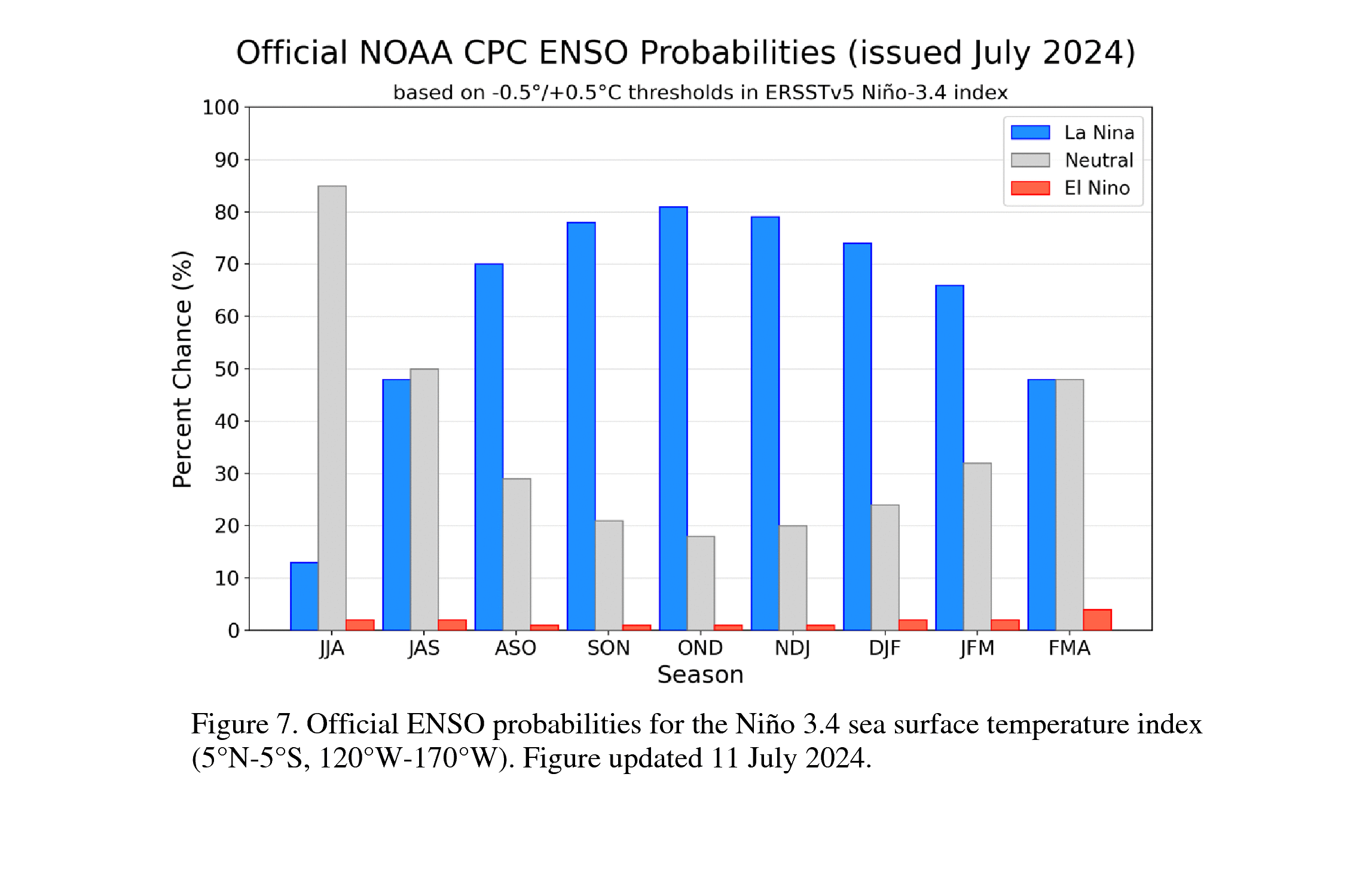
Strength is still borderline moderate.
La Nina, as I've said 738 times, can mean drought development for Oklahoma during
the fall-through-spring period. Or, if drought is already in place, enhancement
or intensification and spread.
Not "WILL"..."CAN." It ain't written in permanent marker, in other words.
Don't be so shocked. THIS is also a thing!
Gary McManus
State Climatologist
Oklahoma Mesonet
Oklahoma Climate Survey
gmcmanus@ou.edu
July 11 in Mesonet History
| Record | Value | Station | Year |
|---|---|---|---|
| Maximum Temperature | 111°F | KIN2 | 2009 |
| Minimum Temperature | 52°F | GOOD | 1999 |
| Maximum Rainfall | 4.62 inches | SULP | 2023 |
Mesonet records begin in 1994.
Search by Date
If you're a bit off, don't worry, because just like horseshoes, “almost” counts on the Ticker website!