Ticker for July 9, 2024
MESONET TICKER ... MESONET TICKER ... MESONET TICKER ... MESONET TICKER ...
July 9, 2024 July 9, 2024 July 9, 2024 July 9, 2024
Summer roars back!
Heck no I've never watched it! Are you kidding me? I only watch monster truck
shows and wrestling. But let me tell you this right now, when Colin put Portia
in here place, that was some great...errrr, wait. IF that actually happened. I
wouldn't know. Ummmmmm, okay, moving on.
Our brush with spring-inside-summer is over (we're about to the point where any
cool downs like that would be fall-inside-summer), but it was glorious, no? Some
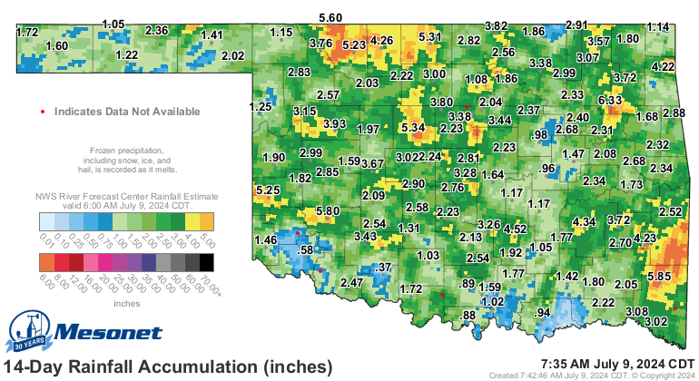
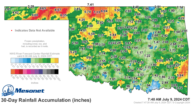
really good rains with that last dose of Beryl down in far SE OK left most of the
state with some good moisture, at least over the last couple of weeks or so.
And gave a major disruption to the heat wave the state was suffering under.
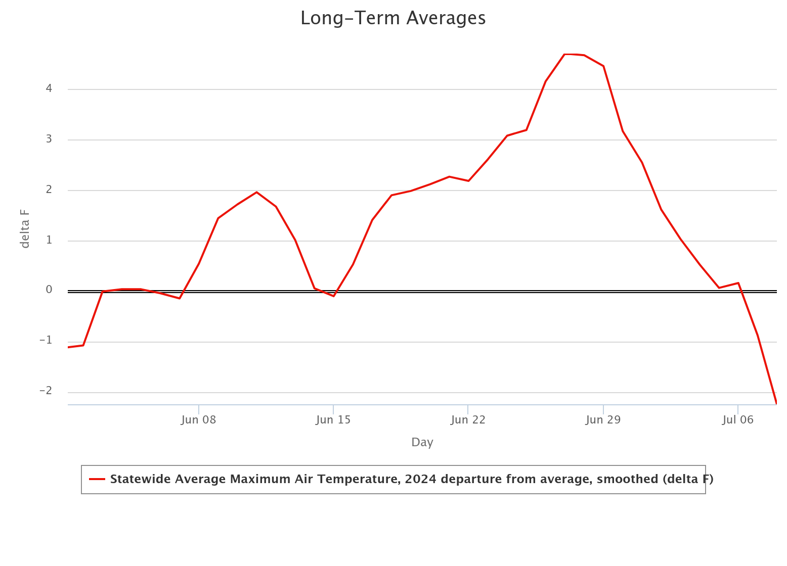
Might have been only 2 or 3 days below normal, but there was a day or two
CLOSE to normal, which is a darned sight better than where we've been. Wait,
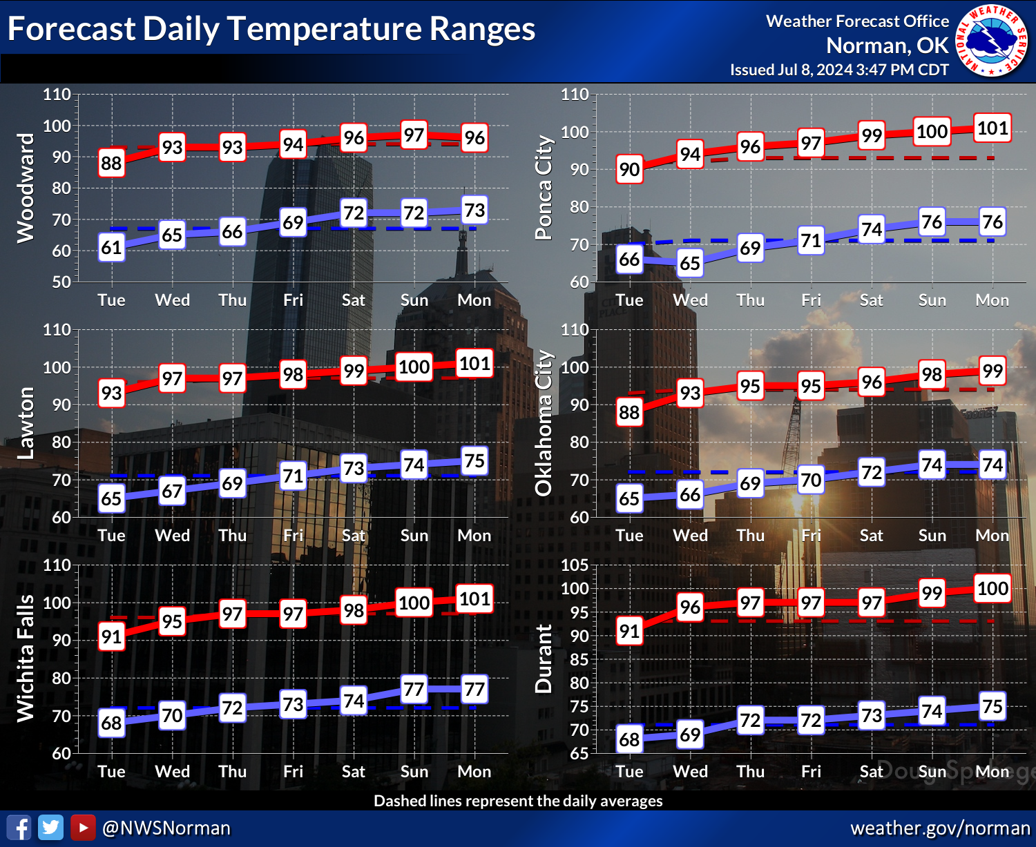
didn't I say that yesterday? Well, might as well get used to it because for the
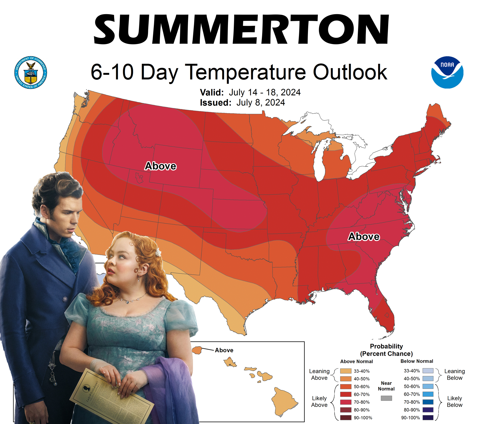
next couple of weeks, it does look like summer is going to take over once again,
with sunny skies and lots of heat.
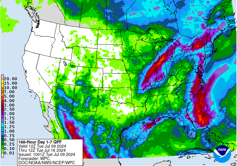
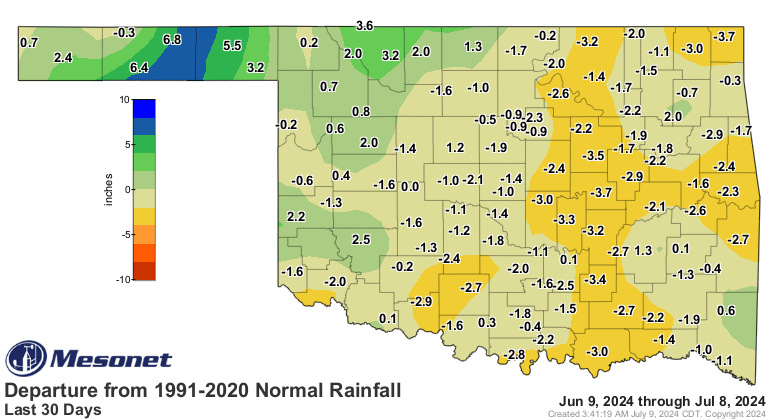
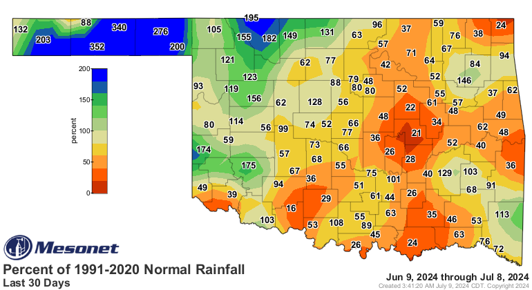
While it's been paused, we must note that flash drought is poised to begin
again without more rainfall, as deficits still rule for much of the state.
Penelope, how could you?! Oops, I mean...think the Niners will go back to the
Super Bowl this year?
Gary McManus
State Climatologist
Oklahoma Mesonet
Oklahoma Climatological Survey
gmcmanus@ou.edu
July 9 in Mesonet History
| Record | Value | Station | Year |
|---|---|---|---|
| Maximum Temperature | 115°F | BUFF | 2009 |
| Minimum Temperature | 55°F | KENT | 2015 |
| Maximum Rainfall | 3.91 inches | OKCE | 2014 |
Mesonet records begin in 1994.
Search by Date
If you're a bit off, don't worry, because just like horseshoes, “almost” counts on the Ticker website!