Ticker for May 11, 2023
MESONET TICKER ... MESONET TICKER ... MESONET TICKER ... MESONET TICKER ...
May 11, 2023 May 11, 2023 May 11, 2023 May 11, 2023
The Suck Zone
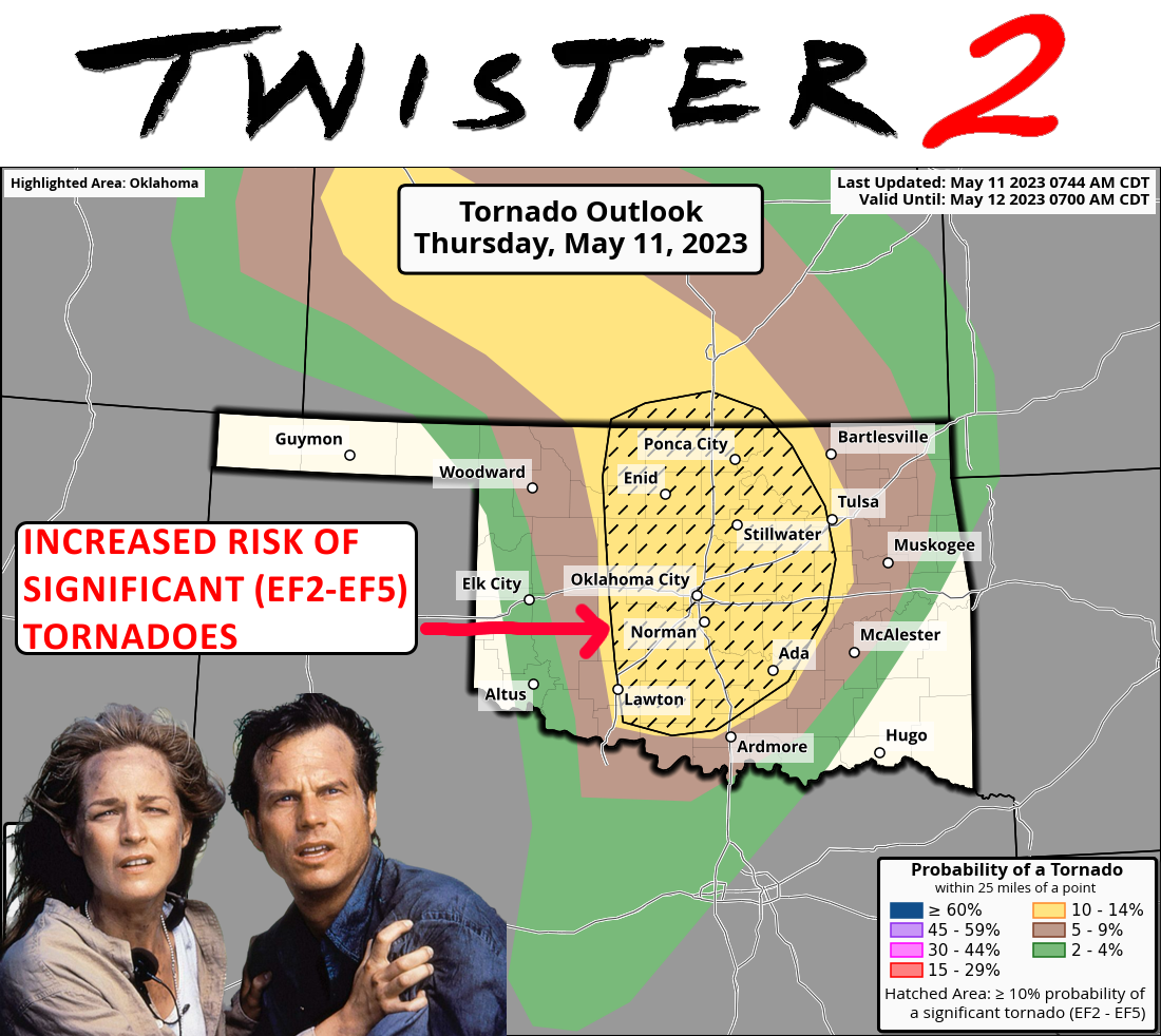
Yes, Ladies and Gentlemen (and most of the rest of you...you know who you are!),
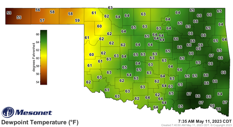
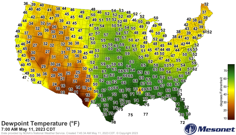
it is indeed one of THOSE days in Oklahoma, when you wake up and step outside
and feel that moist air, knowing that things are gonna go bump in the night AND
the daytime later on. Classic springtime Oklahoma setup for severe weather on the
way today. Lots of moisture streaming up from the Gulf of Mexico. And our
expected afternoon heat in the 80s and 90s later today, mix in some wind that's
mixing itself with height (shear), a good old fashioned dryline out west, and you
have supercelluar soup going in the crockpot to be served later.

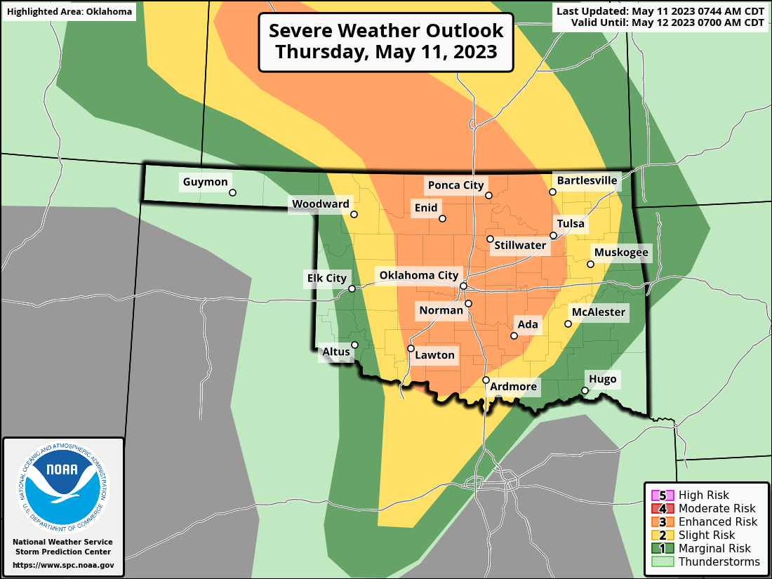
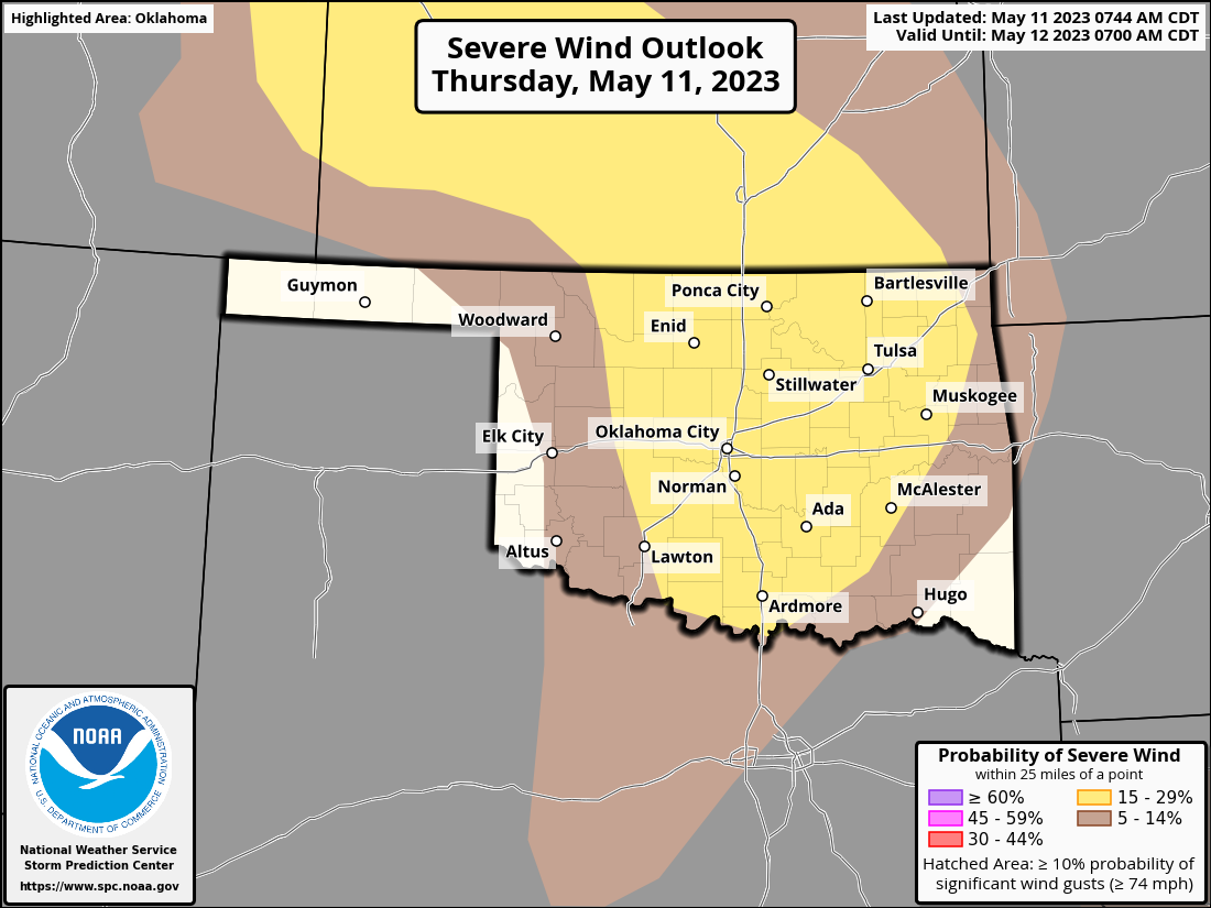
The actual risk for later this afternoon will be winds of 60-80 mph, hail up into
the tennis ball to baseball sizes, and of course tornadoes. Some strong tornadoes
are possible as well.

Tornadoes? Heck, the hail will probably kill ya! It'll put knots on your noggin
faster'n you can rub 'em.
So in order to protect the lives of those you love, and your property, take
the proper precautions NOW. Know where you and your peeps are going to be this
afternoon into evening. Charge your wireless devices (heck, wire your chargeless
devices if you can), put batteries in your NOAA weather radio (or go buy one
if you don't have one), and stay tuned to your favorite local media source as
well as your local NWS office.
And then get ready to do it all again tomorrow.
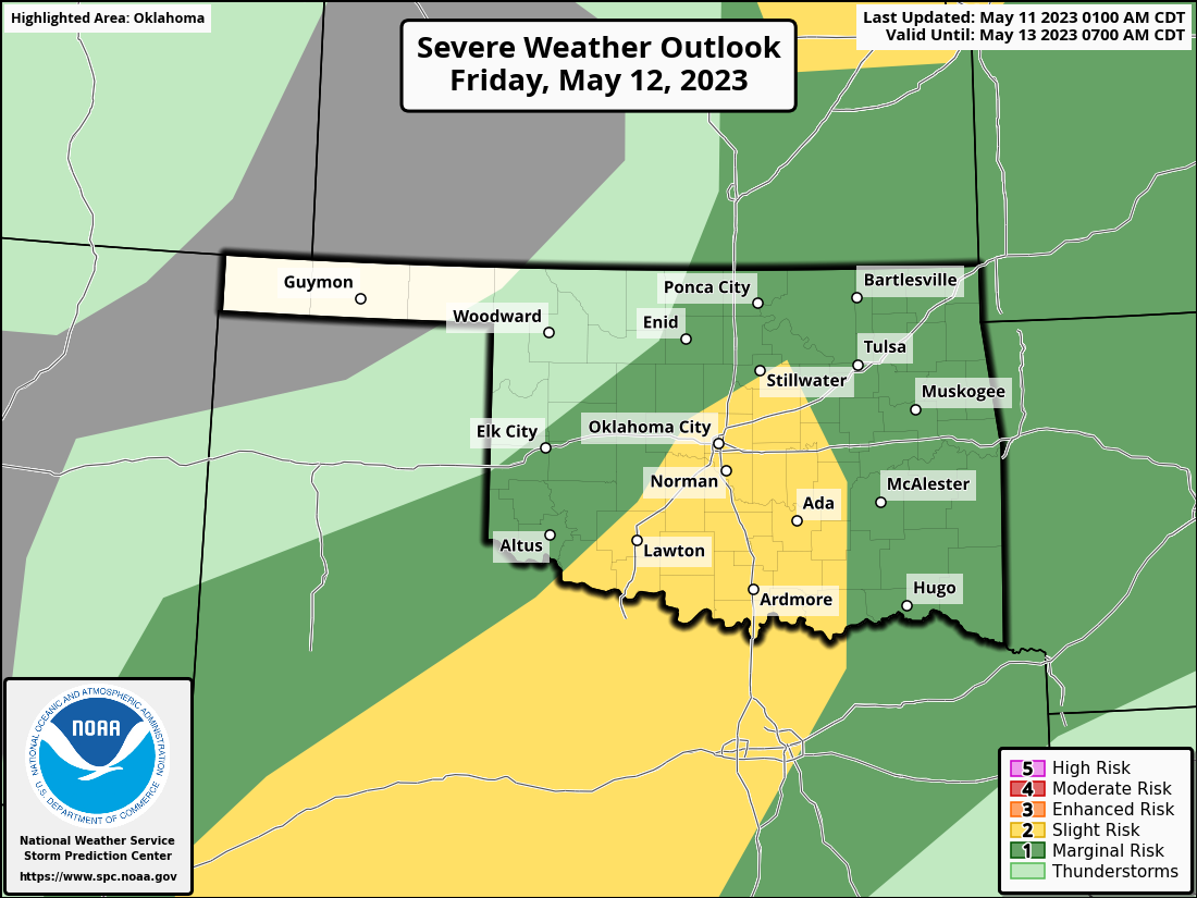
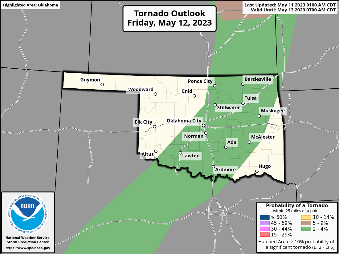
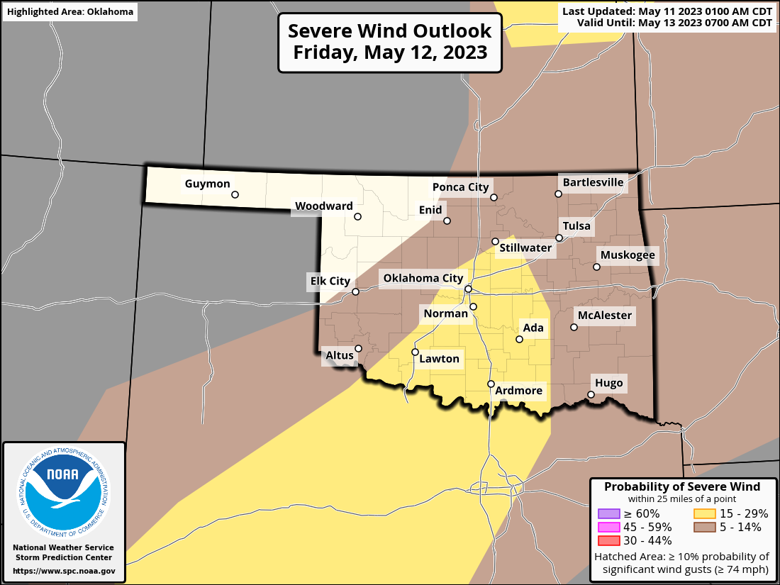
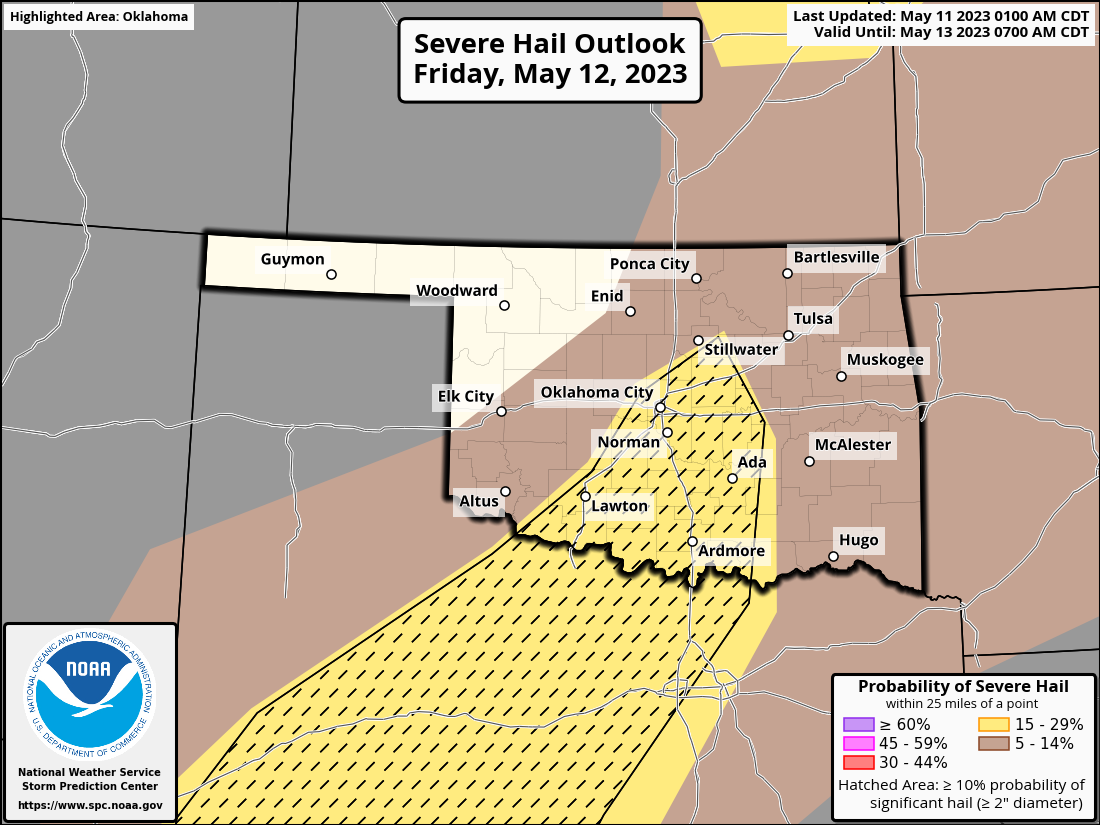
And maybe again on Saturday.
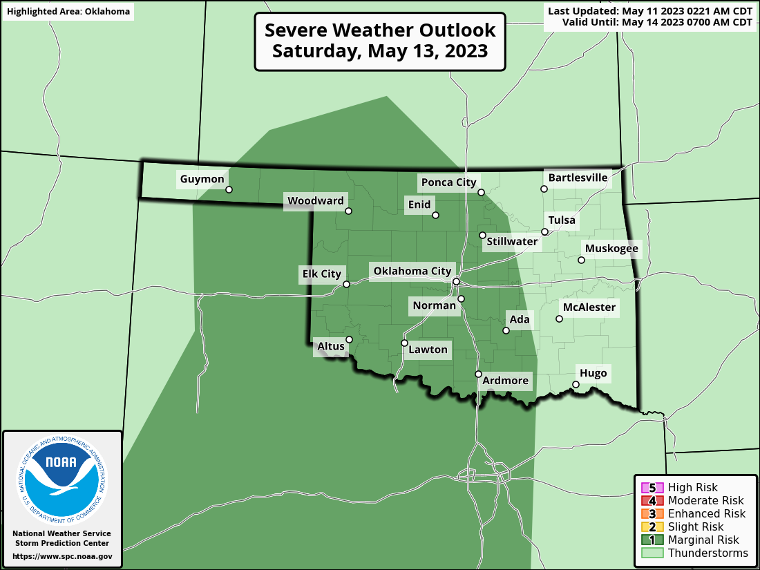
The weather on Friday and Saturday don't look quite as impactful as today's,
but like I said all week, TODAY'S didn't look that impactful a few days out
"but it's May...in Oklahoma."
HINT: It's still May. In Oklahoma.
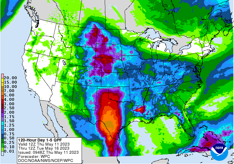
So be prepared today, tomorrow, and again on Saturday, if needed. As we get
closer to the weekend, the rainfall should pick up into more of a flood-risk
type of event, with our 5-day rainfall forecast showing up with 3-4 inches
possible in SW OK.
Oh yeah, rain! We are still in drought, you know.
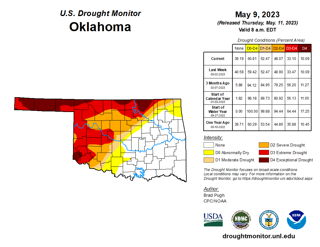
That rainfall will be beneficial, despite any bad stuff it comes with, up until
the point that it causes flash flooding. So know those danger spots, don't drive
into pooled water on roadways, and remember the old saying..."turn around, don't
drown."
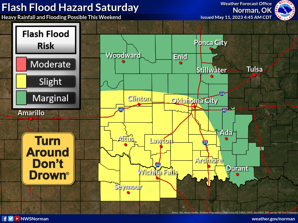
Rain Saturday? Heck, it's raining right now for crying out loud!
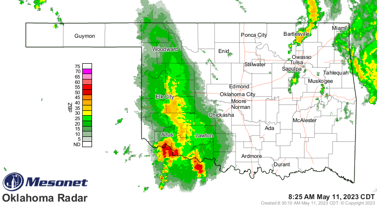
There are things actually working AGAINST our severe weather setup, like the
storms shown in that radar image, some lingering cloudiness, some weak upper-
level flow, etc. But there's enough NOT working against it that should give us
some high-end severe weather today. If it doesn't...great!
Other big news that could impact our weather much farther ahead...the Climate
Prediction Center has issued an "El Nino Watch" for this coming fall. No, it's
not the latest Apple Watch...it's a call for us to sit up and take notice that
El Nino is becoming more likely as we get later into the year.
"El Niño Watch: Issued when conditions are favorable for the development of El
Niño or La Niña conditions within the next six months.
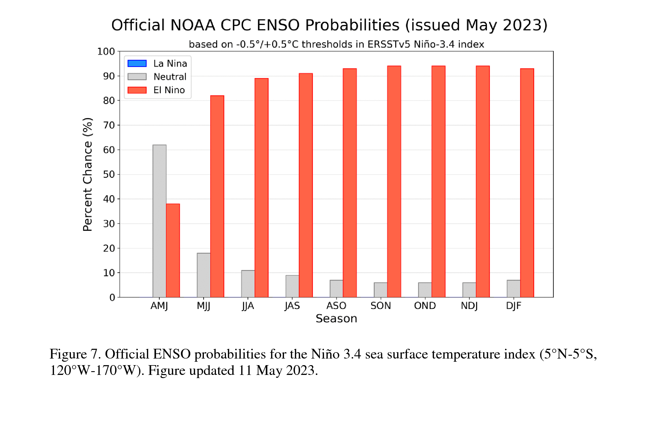
Don't worry too much about what it's doing now...El Nino (and La Nina) mostly
impact our weather as we get into the cool season...so mid-fall, peaking in
winter, and lasting through mid-spring or so.
As we look over the intervening 3-month periods between now and next year at
this time, we see that this El Nino has a chance to get into the strong or
very-strong categories.
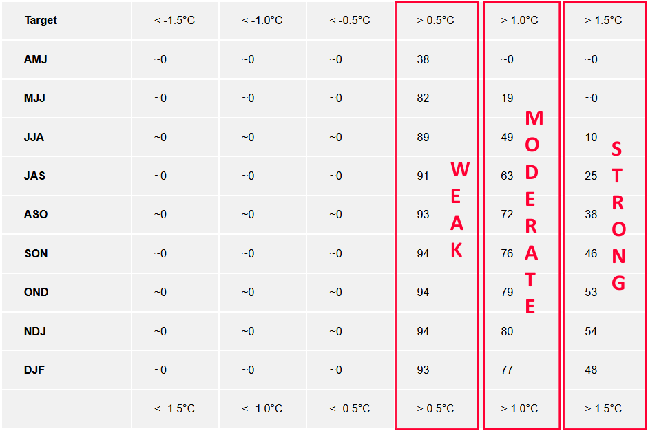
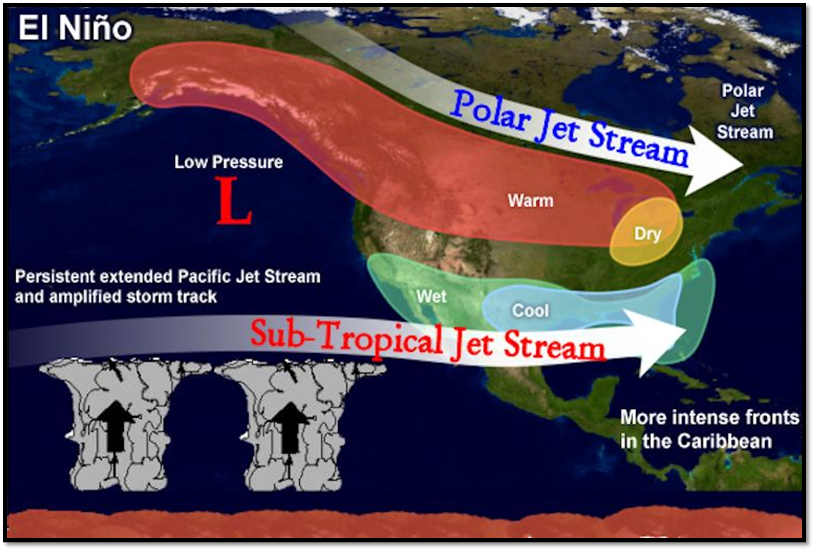
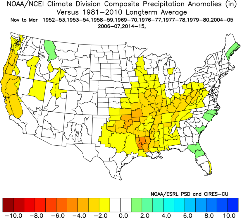
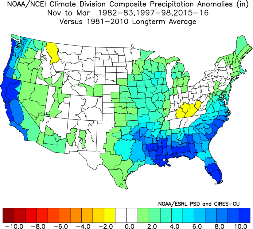
That's important because a weak or moderate El Nino can actually bring us MORE
dry weather, as these November-March precipitation anomaly composites show us.
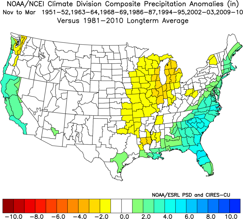
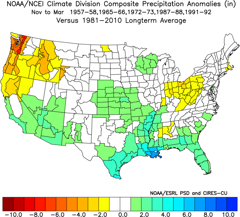
When we get into the strong to very-strong El Nino events, that's when we can
see our better chances for increased precipitation.
Okay, that's a lot to ponder for today. Let's get through our current weather
wackiness before we try and figure out what's going to occur months from now.
Stay safe!
Gary McManus
State Climatologist
Oklahoma Mesonet
Oklahoma Climatological Survey
gmcmanus@mesonet.org
May 11 in Mesonet History
| Record | Value | Station | Year |
|---|---|---|---|
| Maximum Temperature | 106°F | ALTU | 2000 |
| Minimum Temperature | 30°F | BOIS | 2008 |
| Maximum Rainfall | 5.87 inches | HUGO | 1999 |
Mesonet records begin in 1994.
Search by Date
If you're a bit off, don't worry, because just like horseshoes, “almost” counts on the Ticker website!